Category:Eglise St.-Joseph (Rue du Curé Beuret 2, Les Breuleux)
Jump to navigation
Jump to search
| Object location | | View all coordinates using: OpenStreetMap |
|---|
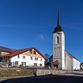
church building in Les Breuleux inthe canton of Jura, Switzerland  | |||||
| Upload media | |||||
| Instance of | |||||
|---|---|---|---|---|---|
| Part of | |||||
| Location | Les Breuleux, Franches-Montagnes District, Jura, Switzerland | ||||
| Street address |
| ||||
| Heritage designation | |||||
 | |||||
Media in category "Eglise St.-Joseph (Rue du Curé Beuret 2, Les Breuleux)"
The following 4 files are in this category, out of 4 total.
-
 2016-Les-Breuleux-Eglise.jpg 1,280 × 1,280; 1.58 MB
-
 2021-05-19 Les Breuleux - clocher de l'église St-Joseph.jpg 5,124 × 3,416; 4.22 MB
-
 Les Breuleux 3266.jpg 3,888 × 2,592; 2.91 MB
-
 Les Breuleux Church 2011.jpg 1,760 × 2,640; 1.19 MB


