Category:Ehemaliges Schulhaus / heute Gemeindeverwaltung (Hauptstrasse 19, Worben)
Jump to navigation
Jump to search
| Object location | | View all coordinates using: OpenStreetMap |
|---|
school building in Worben in the canton of Bern, Switzerland  | |||||
| Upload media | |||||
| Instance of | |||||
|---|---|---|---|---|---|
| Part of | |||||
| Location | Worben, Seeland administrative district, Seeland administrative region, Bern, Switzerland | ||||
| Street address |
| ||||
| Heritage designation |
| ||||
| Inception |
| ||||
 | |||||
Media in category "Ehemaliges Schulhaus / heute Gemeindeverwaltung (Hauptstrasse 19, Worben)"
The following 3 files are in this category, out of 3 total.
-
 2020-Worben-Schulhaus.jpg 1,800 × 1,200; 271 KB
-
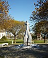 Brunnen Gemeindehaus Worben 2016 04 10.jpg 3,565 × 4,296; 6.07 MB
-
 Gemeindehaus Worben 2016 04 10.jpg 4,932 × 2,951; 3.94 MB

