Category:Election maps of Castile-La Mancha
Jump to navigation
Jump to search
Autonomous communities of Spain: Andalusia · Aragon · Asturias · Balearic Islands · Basque Autonomous Community · Canary Islands · Cantabria · Castile and León · Castilla–La Mancha · Catalonia · Extremadura · Galicia · Community of Madrid · Region of Murcia · Navarre · La Rioja · Valencian Community · Autonomous cities:
Mapas de Castilla-La Mancha. Maps of Castile-La Mancha.
Subcategories
This category has the following 2 subcategories, out of 2 total.
Media in category "Election maps of Castile-La Mancha"
The following 9 files are in this category, out of 9 total.
-
 Castilian-Manchegan regional election, 2015 results by constituency.svg 373 × 476; 192 KB
-
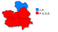
 Castilla-La Mancha 1983.png 265 × 148; 6 KB
-
 Castilla-La Mancha 1987.png 265 × 148; 6 KB
-
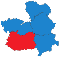
 Castilla-La Mancha 1991.png 265 × 148; 6 KB
-
 Castilla-La Mancha 1995.png 265 × 148; 6 KB
-
 Castilla-La Mancha 2007.png 265 × 148; 6 KB
-
 Castilla-La Mancha 2011.png 265 × 148; 5 KB
-
-


.svg)
