Category:Electoral Units of the United Kingdom
Jump to navigation
Jump to search
The following are electoral divisions and wards in the United Kingdom:
Subcategories
This category has only the following subcategory.
W
Media in category "Electoral Units of the United Kingdom"
The following 99 files are in this category, out of 99 total.
-
Angmering & Findon (electoral division).png 472 × 340; 24 KB
-
Angmering & Findon.svg 776 × 574; 1.46 MB
-
Angmering findon electoral division.svg 476 × 343; 162 KB
-
Arundel & Wick (electoral division).png 472 × 340; 68 KB
-
Bersted (electoral division).png 472 × 340; 68 KB
-
Bewbush & Ifield West (electoral division).png 472 × 340; 24 KB
-
Billingshurst (electoral division).png 472 × 340; 25 KB
-
Bognor Regis East (electoral division).png 472 × 340; 24 KB
-
Bognor Regis West & Aldwick (electoral division).png 472 × 340; 24 KB
-
BoshamChichester2010.svg 424 × 528; 146 KB
-
Bourne (electoral division).png 472 × 340; 24 KB
-
BoxgroveChichester2010.svg 328 × 409; 134 KB
-
Bramber Castle (electoral division).png 472 × 340; 25 KB
-
Broadfield (electoral division).png 472 × 340; 23 KB
-
Broadwater (electoral division).png 472 × 340; 24 KB
-
BuryChichester2010.svg 328 × 409; 133 KB
-
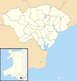
Cardiff UK ward map (blank).svg 1,187 × 1,266; 434 KB
-
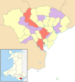
Cardiff UK ward map 2022 - number of councillors.png 800 × 875; 142 KB
-
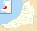
Ceredigion UK ward map (blank).svg 1,425 × 1,192; 1,000 KB
-
Chichester North (electoral division).png 472 × 340; 25 KB
-
Chichester South (electoral division).png 472 × 340; 24 KB
-
Chichester West (electoral division).png 472 × 340; 24 KB
-
ChichesterCentralWard2019.png 4,910 × 6,411; 1.33 MB
-
ChichesterEastChichester2010.svg 328 × 409; 133 KB
-
ChichesterEastWard2019.png 4,910 × 6,411; 1.32 MB
-
ChichesterNorthChichester2010.svg 328 × 409; 133 KB
-
ChichesterNorthWard2019.png 4,910 × 6,411; 1.32 MB
-
ChichesterSouthChichester2010.svg 328 × 409; 133 KB
-
ChichesterSouthWard2019.png 4,910 × 6,411; 1.32 MB
-
ChichesterWestChichester2010.svg 328 × 409; 133 KB
-
ChichesterWestWard2019.png 4,910 × 6,411; 1.32 MB
-
Cuckfield & Lucastes (electoral division).png 472 × 340; 24 KB
-
DonningtonChichester2010.svg 328 × 409; 133 KB
-
EasebourneChichester2010.svg 328 × 409; 133 KB
-
EasebourneWard2019.png 4,910 × 6,411; 1.3 MB
-
East Grinstead Meridian (electoral division).png 472 × 340; 24 KB
-
East Grinstead South (electoral division).png 472 × 340; 24 KB
-
East Preston & Ferring (electoral division).png 472 × 340; 24 KB
-
EastWitteringChichester2010.svg 328 × 409; 133 KB
-
Fernhurst (electoral division).png 472 × 340; 25 KB
-
FernhurstChichester2010.svg 328 × 409; 133 KB
-
FernhurstWard2019.png 4,910 × 6,411; 1.29 MB
-
FishbourneChichester2010.svg 328 × 409; 133 KB
-
FittleworthWard2019.png 4,910 × 6,411; 1.3 MB
-
Fontwell (electoral division).png 472 × 340; 24 KB
-
FuntingtonChichester2010.svg 328 × 409; 133 KB
-
GoodwoodWard2019.png 4,910 × 6,411; 1.33 MB
-
Goring (electoral division).png 472 × 340; 24 KB
-
HarbourVillagesWard2019.png 4,910 × 6,411; 1.3 MB
-
HartingChichester2010.svg 328 × 409; 133 KB
-
HartingWard2019.png 4,910 × 6,411; 1.29 MB
-
Hassocks & Victoria (electoral division).png 472 × 340; 24 KB
-
Haywards Heath East (electoral division).png 472 × 340; 24 KB
-
Henfield (electoral division).png 472 × 340; 25 KB
-
Holbrook (electoral division).png 472 × 340; 24 KB
-
Horsham Hurst (electoral division).png 472 × 340; 24 KB
-
Isle of Anglesey UK ward map (blank).svg 1,425 × 1,255; 1,000 KB
-
Lancing (electoral division).png 472 × 340; 24 KB
-
Langley Green & West Green (electoral division).png 472 × 340; 24 KB
-
LavantChichester2010.svg 328 × 409; 133 KB
-
LavantWard2019.png 4,910 × 6,411; 1.3 MB
-
LoxwoodWard2019.png 4,910 × 6,411; 1.32 MB
-
MidhurstChichester2010.svg 328 × 409; 133 KB
-
MidhurstWard2019.png 4,910 × 6,411; 1.3 MB
-
Northgate & Three Bridges (electoral division).png 472 × 340; 24 KB
-
NorthMundham&TangmereWard2019.png 4,910 × 6,411; 1.31 MB
-
NorthMundhamChichester2010.svg 328 × 409; 133 KB
-
Pembrokeshire UK ward map (blank).svg 1,425 × 1,095; 1.34 MB
-
PetworthChichester2010.svg 328 × 409; 133 KB
-
PetworthWard2019.png 4,910 × 6,411; 1.3 MB
-
PlaistowChichester2010.svg 328 × 409; 134 KB
-
Pulborough (electoral division).png 472 × 340; 25 KB
-
Roffey (electoral division).png 472 × 340; 24 KB
-
RogateChichester2010.svg 328 × 409; 133 KB
-
Rustington (electoral division).png 472 × 340; 24 KB
-
SelseyNorthChichester2010.svg 328 × 409; 133 KB
-
SelseySouthChichester2010.svg 328 × 409; 133 KB
-
SelseySouthWard2019.png 4,910 × 6,411; 1.32 MB
-
SidleshamChichester2010.svg 328 × 409; 133 KB
-
SidleshamwithSelseyNorthWard2019.png 4,910 × 6,411; 1.31 MB
-
SouthbourneChichester2010.svg 328 × 409; 133 KB
-
SouthbourneWard2019.png 4,910 × 6,411; 1.32 MB
-
Southgate & Crawley Central (electoral division).png 472 × 340; 24 KB
-
Southwater & Nuthurst (electoral division).png 472 × 340; 24 KB
-
StedhamChichester2010.svg 328 × 409; 133 KB
-
Storrington (electoral division).png 472 × 340; 25 KB
-
TangmereChichester2010.svg 328 × 409; 133 KB
-
TheWitteringsWard2019.png 4,910 × 6,411; 1.31 MB
-
Tilgate & Furnace Green (electoral division).png 472 × 340; 24 KB
-
Warnham & Rusper (electoral division).png 472 × 340; 25 KB
-
WestbourneChichester2010.svg 328 × 409; 133 KB
-
WestbourneWard2019.png 4,910 × 6,411; 1.32 MB
-
WestWitteringChichester2010.svg 328 × 409; 133 KB
-
WisboroughGreenChichester2010.svg 328 × 409; 133 KB
-
Witterings (electoral division).png 472 × 340; 24 KB
-
Worth Forest (electoral division).png 472 × 340; 25 KB
-
Worthing East (electoral division).png 472 × 340; 24 KB
-
Worthing Pier (electoral division).png 472 × 340; 24 KB
-
Worthing West (electoral division).png 472 × 340; 24 KB


