Category:Electoral districts of Nova Scotia
Jump to navigation
Jump to search
Provinces and territories of Canada: Alberta · British Columbia · Manitoba · New Brunswick · Nova Scotia · Ontario · Prince Edward Island · Quebec · Saskatchewan ·
Media in category "Electoral districts of Nova Scotia"
The following 72 files are in this category, out of 72 total.
-
 2008 NS Fed Elect Map.jpg 1,155 × 850; 48 KB
-
 Annapolis provincial electoral district.svg 512 × 454; 324 KB
-
 Antigonish provincial electoral district.svg 512 × 455; 324 KB
-
 Argyle-Barrington provincial electoral district.svg 512 × 455; 324 KB
-
 Bedford provincial electoral district.svg 512 × 455; 324 KB
-
 By-Elections to the 62nd Nova Scotia House of Assembly (2013 - 2017).svg 2,953 × 2,315; 3.53 MB
-
 Cape Breton Centre provincial electoral district.svg 512 × 455; 324 KB
-
 Cape Breton-Richmond provincial electoral district.svg 512 × 455; 324 KB
-
 Chester-St. Margaret's provincial electoral district.svg 512 × 455; 324 KB
-
 Clare-Digby provincial electoral district.svg 512 × 455; 324 KB
-
 Clayton Park West provincial electoral district.svg 512 × 455; 324 KB
-
 Colchester North provincial electoral district.svg 512 × 455; 324 KB
-
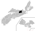
 Colchester-Musquodoboit Valley provincial electoral district.svg 512 × 455; 324 KB
-
 Cole Harbour-Eastern Passage provincial electoral district.svg 512 × 455; 324 KB
-
 Cole Harbour-Eastern Shore provincial electoral district.svg 512 × 455; 324 KB
-
 Cole Harbour-Portland Valley provincial electoral district.svg 512 × 455; 324 KB
-
 Cumberland colchester musquodobit valley map.png 1,064 × 824; 183 KB
-
 Cumberland North provincial electoral district.svg 512 × 455; 324 KB
-
 Cumberland South provincial electoral district.svg 512 × 455; 324 KB
-
 Dartmouth East provincial electoral district.svg 512 × 455; 324 KB
-
 Dartmouth North provincial electoral district.svg 512 × 455; 324 KB
-
 Dartmouth South provincial electoral district.svg 512 × 455; 324 KB
-
 Eastern Shore provincial electoral district.svg 512 × 455; 324 KB
-
 Fairview-Clayton Park provincial electoral district.svg 512 × 455; 324 KB
-
 Glace Bay provincial electoral district.svg 512 × 455; 324 KB
-
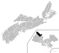
 Guysborough-Sheet Harbour.png 735 × 568; 23 KB
-
 Guysborough–Eastern Shore–Tracadie provincial electoral district.svg 512 × 455; 324 KB
-
 Halifax Armdale provincial electoral district.svg 512 × 455; 324 KB
-
 Halifax Atlantic provincial electoral district.svg 512 × 455; 324 KB
-
 Halifax Chebucto provincial electoral district.svg 512 × 455; 324 KB
-
 Halifax Citadel-Sable Island provincial electoral district.svg 512 × 455; 324 KB
-
 Halifax Clayton Park.png 542 × 504; 18 KB
-
 Halifax electoral district map.png 1,064 × 824; 206 KB
-
 Hammonds Plains-Lucasville provincial electoral district.svg 512 × 455; 324 KB
-
 Hants East provincial electoral district.svg 512 × 455; 324 KB
-
 Hants West provincial electoral district.svg 512 × 455; 324 KB
-
 Inverness provincial electoral district.svg 512 × 455; 324 KB
-
 Kings North provincial electoral district.svg 512 × 455; 324 KB
-
 Kings South provincial electoral district.svg 512 × 455; 324 KB
-
 Kings West provincial electoral district.svg 512 × 455; 324 KB
-
 Kings-Hants.png 372 × 490; 11 KB
-
 Lunenburg provincial electoral district.svg 512 × 455; 324 KB
-
 Lunenburg West provincial electoral district.svg 512 × 455; 324 KB
-
 North Nova.png 372 × 490; 11 KB
-
 Northside-Westmount provincial electoral district.svg 512 × 455; 324 KB
-
 Nova Scotia Provincial Election 2013 - Results By Riding.svg 2,953 × 2,315; 3.45 MB
-
 Nova Scotia Provincial Election 2017 - Results By Riding.svg 2,953 × 2,315; 3.45 MB
-
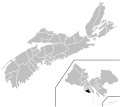
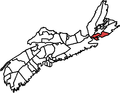
 NovaScotia2021GeneralElections-RichmondRiding.png 590 × 708; 29 KB
-
 NS ElectoralDistricts2009.png 704 × 498; 49 KB
-
 NsFederalDistricts2009.PNG 760 × 688; 28 KB
-
 Pictou Centre provincial electoral district.svg 512 × 455; 324 KB
-
 Pictou East provincial electoral district.svg 512 × 455; 324 KB
-
 Pictou West provincial electoral district.svg 512 × 455; 324 KB
-
 Preston-Dartmouth provincial electoral district.svg 512 × 455; 324 KB
-
 Queens provincial electoral district.svg 512 × 455; 324 KB
-
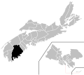
 RichmondNS.png 735 × 568; 23 KB
-
 Sackville-Beaverbank provincial electoral district.svg 512 × 455; 324 KB
-
 Sackville-Cobequid provincial electoral district.svg 512 × 455; 324 KB
-
 Sackville-Eastern Shore.png 372 × 490; 11 KB
-
 Shelburne.png 735 × 568; 23 KB
-
 South Shore—St. Margaret's.png 372 × 490; 11 KB
-
 Southshore stmargarets map.png 1,064 × 824; 184 KB
-
 Sydney River-Mira-Louisbourg provincial electoral district.svg 512 × 455; 324 KB
-
 Sydney-Victoria.png 372 × 490; 11 KB
-
 Sydney-Whitney Pier provincial electoral district.svg 512 × 455; 324 KB
-
 Timberlea-Prospect provincial electoral district.svg 512 × 455; 324 KB
-
 Timberlea—Prospect.png 735 × 568; 23 KB
-

-
 Truro-Bible Hill.png 735 × 568; 23 KB
-
 Victoria-The Lakes provincial electoral district.svg 512 × 455; 324 KB
-
 Waverley-Fall River-Beaver Bank provincial electoral district.svg 512 × 455; 324 KB
-
 Yarmouth provincial electoral district.svg 512 × 455; 324 KB


.svg)


