Category:Electronic nautical charts
Jump to navigation
Jump to search
geographic information system used for nautical navigation that complies with International Maritime Organization (IMO) regulations as an alternative to paper nautical charts  | |||||
| Upload media | |||||
| Instance of | |||||
|---|---|---|---|---|---|
| Has use | |||||
| |||||
Subcategories
This category has the following 2 subcategories, out of 2 total.
N
O
Media in category "Electronic nautical charts"
The following 23 files are in this category, out of 23 total.
-
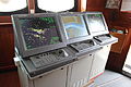 Cap San Diego Brücke Radar ECDIS.jpg 5,184 × 3,456; 5.64 MB
-
 Cartografia SOHMA.jpg 1,280 × 960; 594 KB
-
 ECDISTA.jpg 1,205 × 1,346; 307 KB
-
 Electronic Chart Display.jpg 1,398 × 827; 606 KB
-
 Electronic chart display.xcf 1,392 × 810; 3.17 MB
-
 Electronic nautical chart of Periscal Tresco (01).JPG 4,288 × 2,848; 2.98 MB
-
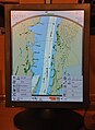
 Electronic nautical chart of Periscal Tresco (02).JPG 3,811 × 2,681; 2.63 MB
-
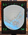
 Electronic nautical chart of Radar Pilot 720º.JPG 2,848 × 3,909; 2.44 MB
-
 Greif (ship, 1946) 2007 by-RaBoe 06.jpg 1,134 × 850; 1.04 MB
-
 Iamsar searchpattern.JPG 2,592 × 1,944; 1.75 MB
-

-
 METS 2009 Periskal Radaroverlay.jpg 2,602 × 3,114; 1.83 MB
-
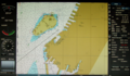
 NOAA chart 25664 1976 detail.png 906 × 759; 1.19 MB
-
 Periskal Inland ECDIS viewer (01).jpg 2,948 × 2,211; 2.35 MB
-
 Port Gdynia.svg 1,820 × 2,350; 84 KB
-
 Rotterdam Ahoy Europort 2011 (23).JPG 1,652 × 2,430; 1.12 MB
-
 Rotterdam Ahoy Europort 2011 (34).JPG 2,136 × 2,672; 1.32 MB
-
 Sail Amsterdam 2010 Sail-in (078).JPG 4,288 × 2,848; 3 MB
-
 Ship Electronic Map.jpg 4,032 × 3,024; 4.46 MB
-
 Sichem Osprey radar and ECDIS.jpg 1,218 × 908; 61 KB
-
 Tresco 3D AIS.JPG 1,280 × 994; 173 KB
-
 Tresco Navigis Inland ECDIS kaart (01).jpg 2,054 × 2,738; 1.51 MB
-
 US NOAA nautical chart of Bering Strait.png 597 × 422; 30 KB


.JPG)
.JPG)

_2007_by-RaBoe_06.jpg)

.jpg)


.jpg)

.JPG)
.JPG)
.JPG)


.jpg)
