Category:Elland
Jump to navigation
Jump to search
market town in Calderdale, in the county of West Yorkshire, England  | |||||
| Upload media | |||||
| Instance of | |||||
|---|---|---|---|---|---|
| Location | Calderdale, West Yorkshire, Yorkshire and the Humber, England | ||||
 | |||||
Cymraeg: Tref farchnad yn Calderdale, Swydd Gorllewin Efrog yw Elland (Cyfeirnod OS: SE106208). Mae gan y dref boblogaeth o bron i 11 mil.
English: Elland is a market town in Calderdale, in the county of West Yorkshire, England, south of Halifax, by the River Calder and the Calder and Hebble Navigation. Its name comes from "ea-land", land near the water. It has a population of 14,554.
Subcategories
This category has the following 19 subcategories, out of 19 total.
A
B
- Binns Wood (7 F)
E
- Elland Park Wood (28 F)
- Elland War Memorial (4 F)
- Elland Wood (2 F)
G
H
O
P
V
- Views of Elland (8 F)
W
Media in category "Elland"
The following 200 files are in this category, out of 201 total.
(previous page) (next page)-
 A Victim of the Railway Juggernaut (16257205872).jpg 3,983 × 2,625; 9.05 MB
-

-
 An overgrown section of Elland FP20 - geograph.org.uk - 4669095.jpg 2,048 × 1,536; 782 KB
-
 Benjamin (9800397126).jpg 3,034 × 2,022; 5.59 MB
-
 Big trees, Tong Royd, Elland - geograph.org.uk - 689322.jpg 480 × 640; 182 KB
-
 Binn's Bottom Mine - geograph.org.uk - 2778636.jpg 1,600 × 1,067; 503 KB
-
 Black Brook - geograph.org.uk - 1387462.jpg 640 × 480; 129 KB
-
-
 Boundary wall of Storth Wood, Elland - geograph.org.uk - 688645.jpg 640 × 415; 143 KB
-
 Boundary wall of Storth Wood, Elland - geograph.org.uk - 703884.jpg 640 × 480; 175 KB
-
 Boundary wall, Elland - geograph.org.uk - 711748.jpg 640 × 465; 124 KB
-

-
 Century Dyeing Company (6276443125).jpg 2,525 × 2,151; 3.35 MB
-
 Children's Centre, Boxhall Road, Elland - geograph.org.uk - 2130695.jpg 2,000 × 1,500; 795 KB
-
 Closed footpath, Elland - geograph.org.uk - 2714954.jpg 2,000 × 1,469; 1.19 MB
-
 Clough, Tong Royd, Elland - geograph.org.uk - 703809.jpg 480 × 640; 148 KB
-
 Concrete pipe stile on Elland Footpath 25 - geograph.org.uk - 4080358.jpg 2,000 × 1,500; 1.64 MB
-
 Cornwall comes to Elland (10559464476).jpg 2,428 × 3,642; 8.25 MB
-
 Derelict mill (2073703621).jpg 996 × 1,496; 553 KB
-
 Derelict mill, by the Calder and Hebble Navigation, Elland (2072090964).jpg 2,560 × 1,920; 1.65 MB
-
 Disused control box, Eastgate - geograph.org.uk - 3342595.jpg 1,766 × 2,000; 1,017 KB
-
 Disused mine adit, Elland - geograph.org.uk - 4159607.jpg 2,000 × 1,544; 766 KB
-
 Disused Mine, Park Nook - geograph.org.uk - 701453.jpg 640 × 427; 94 KB
-
 Don't go bacon my heart... I couldn't if I fried (26683504085).jpg 2,199 × 2,199; 4.28 MB
-
 Doorway of 17C house, Timber Street, Elland - geograph.org.uk - 2048819.jpg 1,464 × 2,000; 746 KB
-
 Drainage of reclaimed spoil tip off Elland Footpath 25 - geograph.org.uk - 4080349.jpg 2,000 × 1,500; 1.86 MB
-

-
 Electricity sub station - geograph.org.uk - 1015076.jpg 640 × 428; 74 KB
-

-

-

-

-
 Elland (12348061213).jpg 2,560 × 1,566; 4.63 MB
-
 Elland (3330968405).jpg 2,560 × 1,706; 3.79 MB
-
 Elland (and Halifax) from Ainley Top (28248316762).jpg 3,670 × 3,000; 9.7 MB
-
 Elland Bridge (14148899796).jpg 3,221 × 3,221; 6.72 MB
-
 Elland Canal Bridge.jpg 800 × 513; 114 KB
-
 Elland Cricket Ground - geograph.org.uk - 1005394.jpg 628 × 470; 145 KB
-
 Elland Footpath 024 - geograph.org.uk - 2029327.jpg 1,500 × 2,000; 1.23 MB
-
 Elland FP19 - geograph.org.uk - 4669047.jpg 2,048 × 1,536; 768 KB
-
 Elland FP19 along a field edge towards Shaw Lane - geograph.org.uk - 4669084.jpg 2,048 × 1,536; 772 KB
-
 Elland FP19 at a field boundary - geograph.org.uk - 4669074.jpg 2,048 × 1,536; 767 KB
-
 Elland FP20 - geograph.org.uk - 4669111.jpg 2,048 × 1,536; 1.12 MB
-
 Elland FP20 - geograph.org.uk - 4669121.jpg 2,048 × 1,536; 748 KB
-
 Elland FP20 in a grassy lane - geograph.org.uk - 4669063.jpg 2,048 × 1,536; 786 KB
-
 Elland FP23 - geograph.org.uk - 4669004.jpg 2,048 × 1,536; 749 KB
-
 Elland FP23 - geograph.org.uk - 4669008.jpg 2,048 × 1,536; 730 KB
-

-
 Elland golf club - geograph.org.uk - 1013742.jpg 640 × 428; 100 KB
-
 Elland Golf Club - geograph.org.uk - 4389467.jpg 640 × 480; 62 KB
-
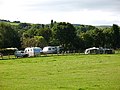 Elland Hall Farm caravan site - geograph.org.uk - 2049256.jpg 640 × 480; 137 KB
-
 Elland Park Wood from Park Nook - geograph.org.uk - 702212.jpg 640 × 426; 63 KB
-
 Elland, from the bridge (2071291537).jpg 2,508 × 1,866; 1.6 MB
-
 Elland.JPG 2,421 × 1,571; 1.93 MB
-
 Entrance to Hullen Edge Hall - geograph.org.uk - 1005380.jpg 640 × 480; 199 KB
-
 Entrance to Park Wood Crematorium - geograph.org.uk - 701322.jpg 640 × 427; 87 KB
-
 Farm Yard at Park Nook - geograph.org.uk - 702270.jpg 640 × 427; 87 KB
-
 Farmers railway carriages. - geograph.org.uk - 1017849.jpg 640 × 428; 64 KB
-
 Fields off Blackley Road, Elland - geograph.org.uk - 2045527.jpg 2,000 × 1,459; 761 KB
-
 Fields off Blackley Road, Elland - geograph.org.uk - 2045538.jpg 2,000 × 1,281; 434 KB
-

-

-
 Footpath down the hillside off Long Wall, Elland - geograph.org.uk - 2470222.jpg 2,000 × 1,500; 1.64 MB
-
 Footpath from Boxhall Road to Coronation Street, Elland - geograph.org.uk - 2228910.jpg 1,500 × 2,000; 761 KB
-

-
 For me a blood-bought free reward (8500340511).jpg 3,163 × 2,014; 6.5 MB
-
 Gate Head Lane - Saddleworth Road - geograph.org.uk - 811494.jpg 640 × 622; 100 KB
-
 Gateposts in Elland Park Wood - geograph.org.uk - 702311.jpg 640 × 427; 129 KB
-
 Glade in the crematorium grounds, Elland - geograph.org.uk - 2239809.jpg 2,000 × 1,500; 814 KB
-
 Hebble, at Elland (14460856085).jpg 3,048 × 3,168; 7.35 MB
-
 Heron (28067946670).jpg 2,432 × 2,432; 3.46 MB
-
 Housing on Ingwood Parade - geograph.org.uk - 1480824.jpg 640 × 480; 54 KB
-
 Hullen Edge 1862. - geograph.org.uk - 1016280.jpg 640 × 428; 92 KB
-
 Inside the underpass - geograph.org.uk - 2049275.jpg 640 × 480; 44 KB
-
 Jagger Green Lane - geograph.org.uk - 1388916.jpg 480 × 640; 98 KB
-
 Lancashire & Yorkshire Bank (6276428149).jpg 2,633 × 3,647; 6.17 MB
-
 Last colours of autumn (2074507840).jpg 2,560 × 1,712; 2.31 MB
-
 Last colours of autumn 2 (2074508444).jpg 1,102 × 912; 564 KB
-
 Lock View - Navigation Close - geograph.org.uk - 1451762.jpg 640 × 480; 252 KB
-
 Memorial garden at Park Wood Crematorium, Elland - geograph.org.uk - 2239814.jpg 2,000 × 1,500; 934 KB
-
 Milestone, Elland Upper Edge.jpg 2,614 × 3,659; 7.76 MB
-
 Mills by the River Calder, Elland (8230956438).jpg 2,922 × 3,780; 5.23 MB
-
 Motorway embankment, Elland - geograph.org.uk - 233350.jpg 640 × 480; 139 KB
-

-
 Mount Pleasant Farm - geograph.org.uk - 1169030.jpg 640 × 480; 59 KB
-
 Narrowboat in the canal, Elland (5195510015).jpg 1,868 × 1,868; 3.26 MB
-
 Narrowboats at Elland (6767598963).jpg 2,063 × 1,780; 2.57 MB
-

-
 New housing - geograph.org.uk - 1451395.jpg 640 × 480; 65 KB
-
 North end of Scar Edge, Elland - geograph.org.uk - 1111458.jpg 640 × 474; 66 KB
-
 Oak trees - geograph.org.uk - 1048803.jpg 640 × 428; 73 KB
-
 Ochre spring, Ainleys, Elland - geograph.org.uk - 2029806.jpg 2,000 × 1,505; 658 KB
-
 Old Cart (12277531014).jpg 2,313 × 1,652; 4.74 MB
-
 Old Earth - Elland Lane - geograph.org.uk - 1451775.jpg 640 × 480; 203 KB
-
 Old gate posts,Scar Edge, Elland - geograph.org.uk - 1111302.jpg 640 × 479; 93 KB
-
 Old Power Way - Lowfields Way - geograph.org.uk - 1451738.jpg 640 × 480; 271 KB
-
 Old Power Way - Savile Way - geograph.org.uk - 1451751.jpg 640 × 480; 263 KB
-
 Old quarry, Tong Royd, Elland - geograph.org.uk - 689420.jpg 640 × 480; 140 KB
-
 Old Road Sign, Elland (5568609375).jpg 3,334 × 2,667; 5.62 MB
-
 Optare Solo in service with Yorkshire Tiger at Elland.jpg 4,608 × 3,456; 2.88 MB
-
 Outfall Bay above Tong Royd, Elland - geograph.org.uk - 703858.jpg 454 × 640; 121 KB
-
 Overgate Hospice - geograph.org.uk - 1048794.jpg 640 × 428; 74 KB
-
 Overhead Power lines, Park Nook - geograph.org.uk - 702230.jpg 640 × 427; 70 KB
-
 Part of Elland Golf Course - geograph.org.uk - 2045147.jpg 2,000 × 1,395; 558 KB
-
 Path across a field, Elland - geograph.org.uk - 4669028.jpg 2,048 × 1,536; 798 KB
-
 Path alongside the M62, Elland - geograph.org.uk - 703818.jpg 640 × 480; 128 KB
-
 Path from new to old road, Elland - geograph.org.uk - 689273.jpg 480 × 640; 134 KB
-
 Pedestrian subway under the A629 - geograph.org.uk - 2049267.jpg 640 × 480; 206 KB
-
 Pinfold Lane, Rastrick - Fixby - geograph.org.uk - 700695.jpg 640 × 470; 56 KB
-
 Plains Lane, Elland - geograph.org.uk - 701415.jpg 427 × 640; 145 KB
-
 Private hospital, Elland - geograph.org.uk - 997406.jpg 640 × 480; 72 KB
-
 Public Footpath in Elland Park Wood - geograph.org.uk - 702306.jpg 640 × 427; 125 KB
-

-
 Pylon off Whitewell Green Lane - geograph.org.uk - 2714990.jpg 1,544 × 2,000; 833 KB
-
 Pylon on Plains Lane, Elland - geograph.org.uk - 701382.jpg 427 × 640; 74 KB
-
 Railway boundary stone, Elland - geograph.org.uk - 1725780.jpg 640 × 480; 195 KB
-

-

-
 Ravenstone Wood - geograph.org.uk - 2231999.jpg 640 × 480; 123 KB
-
 Reanimated then she'll rise (6273081733).jpg 4,000 × 2,650; 7.71 MB
-

-
 Recreation ground, Elland - geograph.org.uk - 2047367.jpg 2,000 × 1,500; 825 KB
-

-
 Rising Sun (6273091171).jpg 2,171 × 3,868; 5.05 MB
-
 Road Bridge - Elland Riorges Link - geograph.org.uk - 1452255.jpg 640 × 480; 219 KB
-

-
 Robert Raikes (5564704515).jpg 3,950 × 3,000; 7.36 MB
-
 Rough pasture, Elland - geograph.org.uk - 711728.jpg 640 × 480; 43 KB
-
 S&S Flickr 17 March 2024.jpg 2,000 × 2,800; 5.29 MB
-
-
 Site of coal mine, Tong Royd, Elland - geograph.org.uk - 689424.jpg 640 × 468; 147 KB
-
 Site of the Spa Field Mills - geograph.org.uk - 1005473.jpg 610 × 458; 168 KB
-
 SL&S Flickr 17 March 2024.jpg 2,707 × 1,934; 4 MB
-
 Slowly Her earthly frame decay'd (6189514277).jpg 3,480 × 3,000; 8.91 MB
-
 Small disused quarry, Storth Wood, Elland - geograph.org.uk - 688638.jpg 640 × 480; 167 KB
-
 Small spoil heap, Ainleys, Elland - geograph.org.uk - 2029751.jpg 1,968 × 1,460; 842 KB
-

-
 South Lane Gardens - South Lane - geograph.org.uk - 1453033.jpg 640 × 480; 238 KB
-
 Southern end of Scar Edge, Elland - geograph.org.uk - 185273.jpg 640 × 480; 95 KB
-
 Spoil heap, Ainleys, Elland - geograph.org.uk - 2029757.jpg 2,000 × 1,465; 814 KB
-
 Steps and path - geograph.org.uk - 1013737.jpg 428 × 640; 56 KB
-
 Stile on Elland FP20 - geograph.org.uk - 4668363.jpg 2,048 × 1,536; 777 KB
-
 Swings and garage site, Park Road, Elland - geograph.org.uk - 2239872.jpg 2,000 × 1,500; 1,011 KB
-
 Tag Lock Headwalls and Spillway - geograph.org.uk - 729834.jpg 640 × 427; 140 KB
-
 Take your seats - geograph.org.uk - 1005422.jpg 640 × 480; 210 KB
-
 Teasel flowers off Elland Footpath 25 - geograph.org.uk - 4080328.jpg 2,048 × 1,536; 1.3 MB
-

-
 The driveway to Park Wood Crematorium, Elland - geograph.org.uk - 2239819.jpg 2,000 × 1,500; 784 KB
-
 The Harold Savage Hall, Elland - geograph.org.uk - 1575301.jpg 640 × 461; 75 KB
-
 The lower reservoir, Tong Royd, Elland - geograph.org.uk - 689303.jpg 640 × 461; 153 KB
-
 The upper reservoir, Tong Royd, Elland - geograph.org.uk - 689319.jpg 640 × 467; 163 KB
-
 Track to Power Station - South Lane - geograph.org.uk - 3870323.jpg 640 × 480; 80 KB
-
 Trees in rows, Tong Royd, Elland - geograph.org.uk - 688509.jpg 480 × 640; 182 KB
-
 Turley Cote Lane - geograph.org.uk - 81665.jpg 640 × 480; 118 KB
-
 Turnpike Street - geograph.org.uk - 1452252.jpg 640 × 480; 201 KB
-
 Twhayte Family Gravestone - geograph.org.uk - 1572989.jpg 480 × 640; 124 KB
-
 Under the Bridge (10408503864).jpg 2,806 × 2,806; 7.8 MB
-
 Under the M62, approaching Elland (3323785444).jpg 2,495 × 1,835; 1.28 MB
-

-
 View from the Bridge (2707068127).jpg 2,509 × 1,882; 4.44 MB
-
 View North from M62 junction 24 - geograph.org.uk - 1393530.jpg 640 × 480; 65 KB
-

-
 Warehouse - geograph.org.uk - 1167452.jpg 640 × 480; 82 KB
-
 Water tanks, Elland - geograph.org.uk - 2714967.jpg 2,000 × 1,479; 1.18 MB
-
 Whoso keepeth the law is wise (6273087251).jpg 3,799 × 2,107; 5.71 MB
-
 Wild Iris, Elland (16094023920).jpg 2,776 × 1,936; 4.49 MB
-
 Wilkinson (5719702597).jpg 3,648 × 2,056; 3.17 MB
-
 Willow tree, Calder and Hebble Navigation (2073713751).jpg 2,460 × 1,641; 1.8 MB
-
 Window (6186043233).jpg 3,000 × 3,442; 6 MB
-
 Wood Nook, Elland - geograph.org.uk - 1980053.jpg 2,000 × 1,500; 879 KB
-
 Wood pasture, Stainland - geograph.org.uk - 692449.jpg 473 × 640; 136 KB
-
 Wood pasture, Stainland - geograph.org.uk - 696162.jpg 474 × 640; 134 KB
-

-

-
 Boundary Stone, Longwood - Elland - geograph.org.uk - 247041.jpg 491 × 640; 133 KB
-
-

-
 Disused quarry in The Rough, Elland - geograph.org.uk - 233357.jpg 640 × 480; 138 KB
-
 Elland Edge Escarpment - geograph.org.uk - 693044.jpg 640 × 427; 73 KB
-
 Elland Park - geograph.org.uk - 91658.jpg 640 × 480; 154 KB
-
 Elland Recreation Ground - geograph.org.uk - 91661.jpg 640 × 474; 78 KB
-
 Footpath 20, Elland - geograph.org.uk - 711740.jpg 640 × 480; 130 KB
-
 Footpath alongside the A629, Elland - geograph.org.uk - 689295.jpg 640 × 480; 82 KB
-
 Footpath at Tong Royd, Elland - geograph.org.uk - 689309.jpg 640 × 480; 177 KB
-
 Gate, Tong Royd, Elland - geograph.org.uk - 689325.jpg 640 × 471; 154 KB
-
 Gog Hill, Elland - geograph.org.uk - 203652.jpg 465 × 640; 118 KB
-

-
 Holme Laithe, Elland - geograph.org.uk - 185250.jpg 640 × 479; 110 KB
-
 Land restoration, Blackley, Elland - geograph.org.uk - 240169.jpg 640 × 480; 105 KB
-

-
 Park, by the riverside, Elland - geograph.org.uk - 251365.jpg 640 × 480; 82 KB
-
 Recreation Ground, Scar Edge, Elland - geograph.org.uk - 185253.jpg 640 × 480; 117 KB
-

-
 Rock strata in The Rough, Elland - geograph.org.uk - 233363.jpg 640 × 480; 163 KB
-
 Scar Edge, Elland - geograph.org.uk - 185251.jpg 640 × 480; 96 KB
-
 Scrub on the Scar Edge escarpment, Elland - geograph.org.uk - 185284.jpg 640 × 480; 148 KB
-
 Shale quarry, Elland - geograph.org.uk - 255711.jpg 640 × 480; 110 KB
-

-

-

.jpg)


.jpg)


.jpg)


.jpg)
.jpg)
.jpg)


.jpg)


.jpg)
.jpg)
_from_Ainley_Top_(28248316762).jpg)
.jpg)


.jpg)


.jpg)


.jpg)
.jpg)


.jpg)
.jpg)
.jpg)


.jpg)


.jpg)
.jpg)


.jpg)


.jpg)


.jpg)


.jpg)


.jpg)


.jpg)


.jpg)
.jpg)

.jpg)


.jpg)
.jpg)
.jpg)
.jpg)
.jpg)


