Category:Elst (Gelderland)
Jump to navigation
Jump to search
village in Overbetuwe, Netherlands _gemeentehuis.JPG)   _welkomstbord.JPG) | |||||
| Upload media | |||||
| Spoken text audio | |||||
|---|---|---|---|---|---|
| Instance of | |||||
| Location |
| ||||
| Population |
| ||||
| Different from | |||||
 | |||||
Subcategories
This category has the following 17 subcategories, out of 17 total.
A
- Ancient Roman temples in Elst (10 F)
B
- Baltussen Konservenfabriek (2 F)
C
E
G
K
M
- Maps of Elst (Gelderland) (3 F)
P
R
S
T
- Taminiau Elst-Overbetuwe (17 F)
Media in category "Elst (Gelderland)"
The following 55 files are in this category, out of 55 total.
-
 Flag of Elst, Gelderland.svg 900 × 600; 408 bytes
-
 Vlag van Elst.gif 326 × 217; 1 KB
-
 Elst wapen randschrift.svg 447 × 431; 131 KB
-
 Elst wapen.svg 150 × 185; 78 KB
-
 Wapen van Elst.gif 187 × 232; 4 KB
-
 20080628 07 Elst.jpg 3,072 × 2,304; 3.5 MB
-
 Achterzijde Kazuifel - Elst - 20069787 - RCE.jpg 932 × 1,200; 319 KB
-
 Achterzijde van Huis de Parck, door Jan de Beijer (1744).jpg 1,758 × 1,326; 545 KB
-
 Asparagus shaped handle. Roman era..jpg 6,036 × 4,020; 1.5 MB
-
De 39ste Vierdaagse afstandsmarsen Weeknummer 55-31 - Open Beelden - 27874.ogv 1 min 29 s, 320 × 240; 7.67 MB
-

-
 Dorpsstr. 8, bokaal - Elst - 20069816 - RCE.jpg 966 × 1,200; 223 KB
-
 Elst (Overbetuwe) bord fietsroutenetwerk.JPG 2,736 × 3,648; 3.62 MB
-
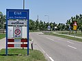 Elst (Overbetuwe) welkomstbord.JPG 3,648 × 2,736; 4.11 MB
-
 Elst, autotunnel onder het spoor foto8 2016-08-31 19.48.jpg 4,352 × 2,520; 6.68 MB
-
 Henkie.jpg 2,592 × 1,944; 2.46 MB
-
 Huizen aan de Solidus in 2021.jpg 385 × 289; 60 KB
-
International Four Days Marches Nijmegen 1955.ogv 1 min 29 s, 352 × 288; 15.03 MB
-
 Kasteel De Parck te Elst, rond 1800, door W. Conrady (1894).jpg 3,368 × 2,204; 2.77 MB
-
 Klimrek Elst.jpg 2,048 × 1,536; 1.45 MB
-

-
 Monstrans - Elst - 20069788 - RCE.jpg 916 × 1,200; 206 KB
-
 Naar het westen - Elst - 20069802 - RCE.jpg 1,200 × 812; 182 KB
-
 NIMH - 2011 - 0128 - Aerial photograph of Elst, The Netherlands - 1920 - 1940.jpg 3,500 × 2,507; 2.32 MB
-
 NIMH - 2011 - 0129 - Aerial photograph of Elst, The Netherlands - 1920 - 1940.jpg 3,500 × 2,520; 2.82 MB
-
 NIMH - 2011 - 5088 - Aerial photograph of Elst, The Netherlands.jpg 4,000 × 2,723; 1.93 MB
-
Nl-Elst (Gelderland)-article.ogg 6 min 56 s; 3.95 MB
-
 Procambarus acutus (Cambaridae), Elst (Gld), the Netherlands - 2.jpg 1,000 × 750; 179 KB
-
 Procambarus acutus (Cambaridae), Elst (Gld), the Netherlands - 3.jpg 1,000 × 750; 236 KB
-
 Procambarus acutus (Cambaridae), Elst (Gld), the Netherlands.jpg 1,000 × 750; 159 KB
-
 Speelplaats aan de Solidus in 2021.jpg 1,216 × 912; 378 KB
-
Spoorwegovergangen Elst in 2021 op de schop.webm 33 s, 1,920 × 1,080; 16.79 MB
-
 Stolperstein für David Abraham Drielsma (Overbetuwe).jpg 2,446 × 2,436; 978 KB
-
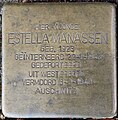 Stolperstein für Estella Manassen (Overbetuwe).jpg 1,816 × 1,845; 578 KB
-
 Stolperstein für Eugenius Rudolph Manassen (Overbetuwe).jpg 1,807 × 1,821; 575 KB
-
 Stolperstein für Felix Abraham Bachrach (Overbetuwe).jpg 1,153 × 1,153; 258 KB
-
 Stolperstein für Helena Bachrach-Cohen (Overbetuwe).jpg 1,143 × 1,153; 236 KB
-
 Stolperstein für Isabella Johanna Bachrach (Overbetuwe).jpg 1,141 × 1,132; 259 KB
-
 Stolperstein für Jacob Nico Bachrach (Overbetuwe).jpg 1,139 × 1,136; 267 KB
-
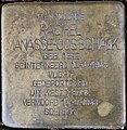 Stolperstein für Rachel Manasse-Gosschalk (Overbetuwe).jpg 1,835 × 1,883; 530 KB
-
 Stolperstein für Roosje Goslininski-Manasse (Overbetuwe).jpg 1,871 × 1,885; 540 KB
-
 Stolperstein für Salomon Manassen (Overbetuwe).jpg 2,598 × 2,587; 1.2 MB
-

-
 The British Army in North-west Europe 1944-45 B12983.jpg 800 × 792; 46 KB
-
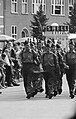 Vierdaagse gestart, doorkomst in Elst, Bestanddeelnr 911-4547.jpg 2,313 × 3,636; 1.96 MB
-
 Vierdaagse gestart, doorkomst in Elst, Bestanddeelnr 911-4548.jpg 2,310 × 3,648; 1.87 MB
-
 Vierdaagse gestart, doorkomst in Elst, Bestanddeelnr 911-4550.jpg 2,442 × 3,678; 1.92 MB
-
 Vierdaagse gestart, doorkomst in Elst, Bestanddeelnr 911-4551.jpg 2,409 × 3,687; 1.73 MB
-
 Vierdaagse gestart, doorkomst in Elst, Bestanddeelnr 911-4552.jpg 3,648 × 2,406; 2 MB
-
 Vierdaagse gestart, doorkomst in Elst, Bestanddeelnr 911-4553.jpg 3,648 × 2,376; 1.95 MB
-
 Vierdaagse gestart, doorkomst in Elst, Bestanddeelnr 911-4554.jpg 3,675 × 2,445; 1.86 MB
-
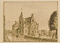 Voorzijde van Huis de Parck, door Jan de Beijer (1744).jpg 1,912 × 1,368; 598 KB
-
 Wandelaars in Elst, Bestanddeelnr 932-6535.jpg 3,689 × 2,408; 1.61 MB
-

-
 Woonhuis.JPG 2,272 × 1,704; 394 KB


.jpg)

_-_Afferdensche_en_Deestsche_Waarden_09_44_33_278000.jpeg)

_bord_fietsroutenetwerk.JPG)


.jpg)


,_Elst_(Gld),_the_Netherlands_-_2.jpg)
,_Elst_(Gld),_the_Netherlands_-_3.jpg)
,_Elst_(Gld),_the_Netherlands.jpg)

.jpg)
.jpg)
.jpg)
.jpg)
.jpg)
.jpg)
.jpg)
.jpg)
.jpg)
.jpg)


.jpg)

.jpg)
