Category:Elysian Park
Zur Navigation springen
Zur Suche springen
English: Elysian Park — a large urban park and its surrounding hillside neighborhood in central Los Angeles, California.
- They are located at the far eastern end of the Santa Monica Mountains in the east Hollywood Hills section .
- The park is the city's oldest park, founded in 1886, and is also the second largest park in Los Angeles at 600 acres (2.4 km²).
- The neighborhood encompasses Chavez Ravine where Dodger Stadium is located.
human settlement in California, United States of America  | |||||
| Medium hochladen | |||||
| Ist ein(e) | |||||
|---|---|---|---|---|---|
| Ort | Los Angeles, Los Angeles County, Kalifornien, Pacific States Region | ||||
 | |||||
Unterkategorien
Es werden 2 von insgesamt 2 Unterkategorien in dieser Kategorie angezeigt:
In Klammern die Anzahl der enthaltenen Kategorien (K), Seiten (S), Dateien (D)
B
- Barlow Respiratory Hospital (4 D)
D
Medien in der Kategorie „Elysian Park“
Folgende 44 Dateien sind in dieser Kategorie, von 44 insgesamt.
-
 02 FallenFruit ElsyianPark.jpg 1.000 × 750; 621 KB
-
 Chavez-ravine-arboretum-sign.jpg 2.816 × 2.112; 1,49 MB
-
 Elysian Waterfall.jpg 4.302 × 5.532; 14,24 MB
-

-
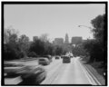
 Arroyo Seco Parkway through Elysian Park.jpg 3.628 × 2.323; 7,1 MB
-
-
 Chavez-ravine-arboretum-view.jpg 2.816 × 2.112; 1,47 MB
-
 CONSULATE OF CATALONIA IN LOS ANGELES 1411 HUSTED ST, 1410 EWING ST 90026 AT PARK DRIVE.jpg 4.000 × 3.000; 4,56 MB
-
 Cypress Park, Los Angeles, CA.jpg 4.032 × 3.024; 3,77 MB
-
 DMHS near Four Level Interchange, 1999.jpg 1.353 × 641; 204 KB
-
 Elysian Park and farmland below, Los Angeles, ca.1898-1900 (CHS-2001).jpg 6.814 × 5.430; 3,67 MB
-
 Elysian Park neighborhood.png 916 × 681; 610 KB
-
 Elysian Park, Los Angeles, Ca.jpg 4.000 × 2.664; 2,65 MB
-
 Elysian park.JPG 2.046 × 1.352; 933 KB
-
 Elysiantown.jpg 1.024 × 768; 257 KB
-
 Entrance to Elysian Park.jpg 4.416 × 3.312; 5,76 MB
-

-
 Four Level Interchange.jpg 4.744 × 3.735; 1,87 MB
-
 Fremont Gate, Elysian Park.jpg 1.097 × 876; 234 KB
-
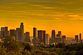
 HDR sunset in Los Angeles1.jpg 5.184 × 3.456; 1,13 MB
-
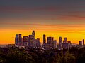
 HDR sunset in Los Angeles2.jpg 5.184 × 3.456; 1,5 MB
-
 HDR sunset in Los Angeles3.jpg 3.456 × 5.184; 1,05 MB
-
 HDR sunset in Los Angeles4.jpg 4.605 × 3.454; 1,05 MB
-
 HDR sunset in Los Angeles5.jpg 5.184 × 3.456; 834 KB
-
 Know Your City No.173 Southbound lanes of Pasadena Freeway.jpg 4.343 × 5.500; 16,03 MB
-
 Know Your City No.82 Abandoned oil well in Elysian Park.jpg 4.290 × 5.469; 15,26 MB
-
 LAPDacademy.jpg 864 × 648; 138 KB
-
 Los Angeles - Historic LAPD Academy - Garden.JPG 3.456 × 2.592; 3,96 MB
-

-

-
 Marker for the First Jewish Site in Los Angeles County.JPG 4.320 × 3.240; 4,11 MB
-
 Montecillo de Leo Politi, Elysian Park, Los Angeles.jpg 1.858 × 1.858; 1,02 MB
-
 North Broadway entrance to Elysian Park, ca.1900 (CHS-163).jpg 5.569 × 4.289; 1,62 MB
-
 Elysian Park, Los Angeles, Calif (NYPL b12647398-74027).tiff 1.569 × 2.384; 10,73 MB
-
 Plant "Shepherdia Argentea", Elysian Park, Los Angeles, California, ca.1920 (CHS-1633).jpg 3.881 × 5.008; 2,48 MB
-

-

-

-
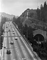
 Southbound SR 110 at tunnels in Elysian Park.jpg 2.560 × 1.920; 1,41 MB
-
 Speed-bump caution sign, Los Angeles.jpg 1.544 × 2.492; 3,69 MB
-
 SR 110 south Academy Road exit from Elysian Park.jpg 2.560 × 1.920; 1,92 MB
-
 View from North Broadway Bridge, Los Angeles River.jpg 8.860 × 1.877; 5,2 MB
-

-


.jpg)


.jpg)


,_Elysian_Park,_Los_Angeles,_ca.1920_(CHS-1616).jpg)


.jpg)
.jpg)
.jpg)


.jpg)
_(14574626197).jpg)