Category:Neighborhoods in Los Angeles
Jump to navigation
Jump to search
district or neighborhood of Los Angeles, California, United States | |||||
| Upload media | |||||
| Instance of | |||||
|---|---|---|---|---|---|
| Subclass of | |||||
| Facet of | |||||
| Location | Los Angeles, Los Angeles County, California, Pacific States Region | ||||
| |||||
Subcategories
This category has the following 122 subcategories, out of 122 total.
- Maps of neighborhoods in Los Angeles (100 F)
*
.
A
B
C
- Castle Heights, Los Angeles (1 F)
- Cheviot Hills, Los Angeles (11 F)
D
E
- Elysian Valley, Los Angeles (3 F)
F
G
- Granada Hills, Los Angeles (25 F)
H
- Hyde Park, Los Angeles (13 F)
J
L
- Larchmont, Los Angeles (10 F)
M
- Mount Olympus, Los Angeles (10 F)
N
- NoHo Arts District, Los Angeles (27 F)
P
R
S
- Saint James Park, Los Angeles (31 F)
- Sonoratown, Los Angeles (2 F)
- South Park, Los Angeles (78 F)
T
- Thai Town, Los Angeles (4 F)
- Toy District, Los Angeles (4 F)
U
V
- Valley Village, Los Angeles (35 F)
- Vermont Square, Los Angeles (1 F)
- Victor Heights, Los Angeles (4 F)
- Victoria Park, Los Angeles (13 F)
W
- Western Heights, Los Angeles (4 F)
- Wilshire Center (13 F)
- Wilshire Park, Los Angeles (11 F)
- Winnetka, Los Angeles (50 F)
Y
- Yucca Corridor (3 F)
Media in category "Neighborhoods in Los Angeles"
The following 91 files are in this category, out of 91 total.
-
 Angeleno Heights Neighborhood Sign.jpg 3,500 × 2,000; 3.02 MB
-
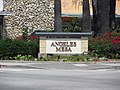
 Angeles Mesa Neighborhood Sign.jpg 3,000 × 1,608; 1.54 MB
-
 Angeles Mesa Street Signage.jpg 4,000 × 3,000; 3.14 MB
-
 Angelus Vista Neighborhood Sign.jpg 3,288 × 1,656; 2.49 MB
-
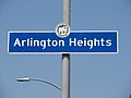 Arlington Heights.jpg 4,000 × 3,000; 1.97 MB
-
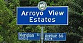 Arroyo View Estates Neighborhood Signage.jpg 4,000 × 2,100; 4.67 MB
-
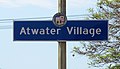 AtwaterVillageSign.jpg 3,500 × 2,000; 3.84 MB
-
 Baird Park neighborhood, Los Angeles, California, US.jpg 4,032 × 2,688; 4.08 MB
-
 Baldwin Hills Crenshaw Plaza and neighborhood signage (close).jpg 4,000 × 3,000; 4.92 MB
-
 Baldwin Hills Crenshaw Plaza and neighborhood signage (wide).jpg 4,000 × 3,000; 3.89 MB
-
 Baldwin Vista.jpg 3,244 × 1,660; 3.04 MB
-
 Benny H. Potter West Adams Avenues Memorial Park.jpg 3,000 × 4,000; 6.85 MB
-
 Bridge the Gap - Flickr - docoverachiever.jpg 1,671 × 2,400; 3.07 MB
-
 Carthay Circle Neighborhood Sign.jpg 4,000 × 2,500; 3.87 MB
-
 Carthay Circle Plaque.jpg 2,677 × 1,874; 3.15 MB
-
 Carthay Circle Signage.jpg 4,000 × 3,000; 5.7 MB
-
 Chesterfield Square Median Marker.jpg 4,000 × 3,000; 3.43 MB
-
 ChesterfieldSquare.jpg 3,960 × 2,880; 3.96 MB
-
 Colegrove Los Angeles California circa 1900.jpg 750 × 954; 260 KB
-
 Del Rey Signage.jpg 4,000 × 3,000; 3.63 MB
-
 EagleRockNeighborhoodSignage.jpg 3,700 × 2,000; 3.54 MB
-
 Eastside Market in Victor Heights, Los Angeles.jpg 3,400 × 1,800; 2.84 MB
-
 Eastside Market Square signage in Victor Heights, Los Angeles (close).jpg 2,000 × 2,000; 2.62 MB
-
 Eastside Market Square signage in Victor Heights, Los Angeles (wide).jpg 4,000 × 3,000; 7.51 MB
-
 ElysianValleySignage.jpg 4,000 × 2,500; 5.45 MB
-
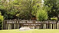 Ernest E Debs Park.jpg 863 × 496; 433 KB
-
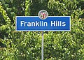 FranklinHills.jpg 3,500 × 2,500; 6.45 MB
-
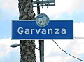 Garvanza Neighborhood Sign.jpg 3,950 × 2,900; 5 MB
-
 GarvanzaPark.jpg 3,900 × 2,700; 6.9 MB
-
 Hancock Park Neighborhood Signage.jpg 2,700 × 1,300; 1.27 MB
-
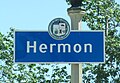
 Hermon Neighborhood Signage.jpg 4,000 × 3,000; 2.58 MB
-
 Hermon neighborhood, Los Angeles, California, US.jpg 3,070 × 2,047; 3.31 MB
-
 Hermon Park Signage.jpg 3,500 × 2,500; 6.33 MB
-
 HermonNeighborhoodSign.jpg 2,900 × 2,000; 3.29 MB
-
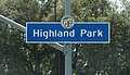 HighlandParkSignage.jpg 3,500 × 2,000; 4.54 MB
-
 Historic Filipinotown Signage Wider.jpg 3,000 × 4,000; 7.75 MB
-
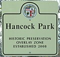 HPOZHancockPark.jpg 1,485 × 1,420; 992 KB
-
 JeffersonPark.jpg 3,960 × 2,700; 3.68 MB
-
 JefParkSign.jpg 3,300 × 2,200; 4.11 MB
-
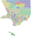
 LA county regions wikivoyage map.png 840 × 984; 180 KB
-
 LA countyregions wikivoyage map.svg 419 × 491; 852 KB
-
 La westside districts proposal.png 2,366 × 928; 256 KB
-
 Little Armenia Neighborhood Sign 2.jpg 4,000 × 3,000; 6.79 MB
-
 Little Armenia Neighborhood Sign.jpg 3,000 × 1,200; 2.06 MB
-
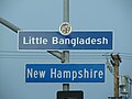 Little Bangladesh sign 1.jpg 4,000 × 3,000; 5.25 MB
-
 Little Bangladesh sign 2.jpg 4,000 × 1,600; 2.87 MB
-
 LittleGreenAcresPark.jpg 4,000 × 3,000; 7.63 MB
-

-
 MagnoliaSquare.jpg 2,000 × 1,200; 1.43 MB
-
 Mandeville Cyn Rd Looking North From Sunset Blvd.jpg 3,991 × 2,661; 1.75 MB
-
 Mandeville Cyn. Rd. looking North from Westridge Rd..jpg 4,001 × 2,667; 1.34 MB
-
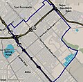 Map of Pacoima neighborhood, Los Angeles, California.jpg 643 × 631; 122 KB
-
 Mapping L.A. neighborhood boundaries.svg 419 × 491; 944 KB
-
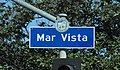 Mar Vista.jpg 3,000 × 1,758; 3.06 MB
-
 Melrose Hill.jpg 3,644 × 2,144; 3.47 MB
-
 Melrose HPOZ.jpg 2,856 × 2,424; 2.83 MB
-
 Miracle Mile District.jpg 4,000 × 3,000; 5.1 MB
-
 Monterey Hills Neighborhood Signage at 5100 Via Marisol.jpg 3,100 × 2,200; 5.27 MB
-
 Monterey Hills neighborhood, Los Angeles, California, US.jpg 4,032 × 2,688; 4.18 MB
-
 MontereyHillsSignage.jpg 3,000 × 2,000; 5.01 MB
-
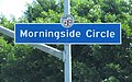 MorningsidCircle.jpg 4,000 × 2,500; 5.28 MB
-
 Nichols Canyon.jpg 317 × 83; 17 KB
-
 Omaha Heights neighborhood, Los Angeles, California, US.jpg 3,935 × 2,623; 2.78 MB
-
 Pickfair Village Signage.jpg 3,000 × 4,000; 3.78 MB
-
 Rose Hill Park neighborhood, Los Angeles, California, US.jpg 3,606 × 2,404; 4.25 MB
-
 Rose Hills Neighborhood Sign.jpg 4,000 × 3,000; 4.76 MB
-
 Rose Hills Neighborhood Signage.jpg 3,000 × 4,000; 3.19 MB
-
 ShermanOaks Neighborhood Signage.jpg 2,742 × 1,194; 1.35 MB
-
 Sycamore Square Neighborhood Sign.jpg 4,000 × 3,000; 7.02 MB
-
 Thai Town.jpg 4,000 × 1,600; 2.73 MB
-
 University-Hills.png 1,536 × 1,024; 1.98 MB
-
 UniversityHillsSignage.jpg 3,500 × 1,350; 1.87 MB
-
 UniversityHillsSignage2.jpg 3,000 × 1,900; 2.87 MB
-
 Valle Vista Tourist Home.jpg 4,000 × 3,000; 6.78 MB
-
 Valley Village Neighborhood Signage.jpg 2,805 × 1,275; 1.48 MB
-
 Van Nuys Neighborhood Signage.jpg 3,294 × 1,926; 3.54 MB
-
 VermontVistaSignage.jpg 4,000 × 2,500; 4.63 MB
-
 Virgil Village Neighborhood Sign.jpg 4,000 × 2,500; 3.78 MB
-
 West Adams Neighborhood Signage.jpg 3,300 × 1,500; 2.31 MB
-
 West Adams Signage Vermont.jpg 2,000 × 1,600; 1.98 MB
-
 West Adams Signage Western.jpg 4,000 × 3,000; 2.01 MB
-
 West Park Terraace Neighborhood Signage.jpg 4,000 × 2,000; 4.43 MB
-
 West Park Terrace Neighborhood Sign.jpg 3,500 × 2,500; 4.53 MB
-
 WestAdamsGatewayMarker.jpg 4,000 × 3,000; 4.61 MB
-
 WestAdamsHeightsEntry.jpg 1,800 × 3,600; 4.02 MB
-
 WestAdamsHeightsSignage.jpg 3,600 × 1,950; 3.28 MB
-
 Westdale Signage.jpg 4,000 × 2,000; 3.83 MB
-
 WesternHeightsSignage copy.jpg 3,800 × 2,700; 6.37 MB
-
 Westside Village.jpg 4,000 × 3,000; 6.23 MB
-
 Wilshire Center.jpg 3,960 × 2,628; 6.98 MB
-
 Wilshire Park Neighborhood Sign.jpg 3,500 × 2,500; 3.89 MB


.jpg)
.jpg)


.jpg)
.jpg)


