Category:Emswehr Bollingerfähr
Jump to navigation
Jump to search
| Object location | | View all coordinates using: OpenStreetMap |
|---|
Media in category "Emswehr Bollingerfähr"
The following 20 files are in this category, out of 20 total.
-
 2013-05-03 Fotoflug Leer Papenburg DSCF6993.jpg 2,500 × 1,673; 2.92 MB
-
 2013-05-03 Fotoflug Leer Papenburg DSCF6994.jpg 2,500 × 1,673; 2.89 MB
-
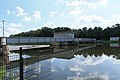
 Heede - Bollingerfähr - Emsweh + Wehrbrücke (Emsbrücke B401) 01 ies.jpg 5,600 × 3,734; 17.61 MB
-
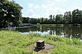
 Heede - Bollingerfähr - Emswehr + Wehrbrücke 01 ies.jpg 5,600 × 3,733; 15 MB
-
 Heede - Bollingerfähr - Emswehr + Wehrbrücke 02 ies.jpg 5,600 × 3,733; 18.79 MB
-
 Heede - Bollingerfähr - Emswehr + Wehrbrücke 03 ies.jpg 5,600 × 3,733; 20.87 MB
-
 Heede - Bollingerfähr - Emswehr + Wehrbrücke 04 ies.jpg 5,600 × 3,733; 23.28 MB
-
 Heede - Bollingerfähr - Emswehr + Wehrbrücke 05 ies.jpg 5,600 × 3,733; 20.32 MB
-
 Heede - Bollingerfähr - Emswehr + Wehrbrücke 06 ies.jpg 5,600 × 3,733; 16.56 MB
-
 Heede - Bollingerfähr - Emswehr + Wehrbrücke 07 ies.jpg 5,600 × 3,735; 20.3 MB
-
 Heede - Bollingerfähr - Emswehr + Wehrbrücke 08 ies.jpg 5,600 × 3,733; 22.51 MB
-
 Heede - Bollingerfähr - Emswehr + Wehrbrücke 09 ies.jpg 5,600 × 3,733; 22.01 MB
-

-

-

-
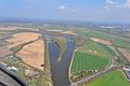
 Luftaufnahmen Nordseekueste 2013 05 by-RaBoe 140.jpg 2,600 × 1,727; 2.56 MB
-
 Luftaufnahmen Nordseekueste 2013 05 by-RaBoe 141.jpg 2,600 × 1,727; 3.28 MB
-
 Luftaufnahmen Nordseekueste 2013 05 by-RaBoe 144.jpg 2,600 × 1,727; 2.51 MB
-
 Luftaufnahmen Nordseekueste 2013 05 by-RaBoe 145.jpg 2,600 × 1,727; 2.64 MB
-
 Luftaufnahmen Nordseekueste 2013 05 by-RaBoe 146.jpg 2,600 × 1,727; 2.48 MB


_01_ies.jpg)


_01_ies.jpg)
_01_ies.jpg)
_02_ies.jpg)


