Category:England photographs taken on 2008-09-21
Appearance
| ← | Sunday 21 September 2008 | → | ||
| ← | September 2008 | → | ||
England photographs taken on 21 September 2008.
Image files should be categorized here automatically using {{taken on}} template. Direct categorization is also possible, if automatic is impossible.
Subcategories
This category has the following 3 subcategories, out of 3 total.
L
Media in category "England photographs taken on 2008-09-21"
The following 200 files are in this category, out of 202 total.
(previous page) (next page)-
"Walkies" at Wall Heath, Staffordshire - geograph.org.uk - 978299.jpg 640 × 432; 119 KB
-
... post office, Driffield, east Yorkshire. (2902607310).jpg 1,280 × 960; 234 KB
-
A typical single-track Devon lane - geograph.org.uk - 974071.jpg 640 × 480; 170 KB
-
A12 Saxmundham Bypass - geograph.org.uk - 972513.jpg 3,072 × 2,304; 1.41 MB
-
A12 Saxmundham Bypass - geograph.org.uk - 972518.jpg 3,072 × 2,304; 1.35 MB
-
A4-A30 roundabout, Hounslow - geograph.org.uk - 973245.jpg 640 × 480; 45 KB
-
A449 north of Prestwood, Staffordshire - geograph.org.uk - 984588.jpg 640 × 480; 129 KB
-
A6089 at Brownshall - geograph.org.uk - 973937.jpg 640 × 480; 92 KB
-
Aircraft set for take off - geograph.org.uk - 1171636.jpg 640 × 426; 102 KB
-
Alder carr, Newton - geograph.org.uk - 978515.jpg 640 × 359; 100 KB
-
All cleaned up - Odiham Castle - geograph.org.uk - 981478.jpg 640 × 480; 86 KB
-
Almer, postbox № DT11 74 - geograph.org.uk - 975171.jpg 480 × 640; 71 KB
-
Angletarn - geograph.org.uk - 983706.jpg 640 × 425; 91 KB
-
Angletarn Beck - geograph.org.uk - 983577.jpg 425 × 640; 120 KB
-
Angletarn from the south-east - geograph.org.uk - 983712.jpg 640 × 425; 84 KB
-
Angletarn Pike - geograph.org.uk - 983697.jpg 514 × 640; 88 KB
-
Animals at Iwade Farm Shop, Iwade, Kent - geograph.org.uk - 973204.jpg 640 × 480; 109 KB
-
Ann Street, Gatehouse of Fleet - geograph.org.uk - 973006.jpg 640 × 480; 64 KB
-
At the entrance to Haveringland Wood - geograph.org.uk - 972652.jpg 480 × 640; 136 KB
-
Ayton Firs - geograph.org.uk - 974267.jpg 640 × 427; 231 KB
-
Bale, south of Lawns Wood, Staffordshire - geograph.org.uk - 979626.jpg 493 × 640; 158 KB
-
Barley stubble at Whiteburn - geograph.org.uk - 973901.jpg 640 × 480; 80 KB
-
Barley stubble near Brownshall - geograph.org.uk - 973934.jpg 640 × 480; 88 KB
-
Barn on Salisbury plain - geograph.org.uk - 974073.jpg 640 × 480; 107 KB
-
Barn, Swanborough Farm - geograph.org.uk - 973972.jpg 640 × 479; 85 KB
-
Basingstoke Canal - from Greywell Tunnel - geograph.org.uk - 988948.jpg 640 × 480; 132 KB
-
Basingstoke Canal - geograph.org.uk - 1014419.jpg 480 × 640; 134 KB
-
Basingstoke Canal - turning point - geograph.org.uk - 988916.jpg 640 × 480; 135 KB
-
Basingstoke canal towpath - geograph.org.uk - 1014458.jpg 480 × 640; 124 KB
-
Bath Green Park - geograph.org.uk - 981527.jpg 640 × 428; 125 KB
-
Bath Green Park - geograph.org.uk - 981531.jpg 640 × 428; 92 KB
-
Baths Island, Windsor - geograph.org.uk - 973505.jpg 640 × 480; 120 KB
-
Bellemoor Road, Shirley - geograph.org.uk - 973358.jpg 640 × 427; 117 KB
-
Benjamin Britten memorial - geograph.org.uk - 993638.jpg 640 × 475; 100 KB
-
Between Altbough Wood and the River Wye - geograph.org.uk - 973855.jpg 640 × 480; 169 KB
-
Big Twitcher, Mill on the Fleet - geograph.org.uk - 972785.jpg 480 × 640; 139 KB
-
Blackwater Estuary - geograph.org.uk - 973638.jpg 640 × 425; 37 KB
-
Boggy Moorland - geograph.org.uk - 973590.jpg 587 × 440; 326 KB
-
Boroughbridge 1st railway station (site), Yorkshire (geograph 4285787).jpg 1,024 × 768; 145 KB
-
Bourne Avenue, Shirley - geograph.org.uk - 974898.jpg 640 × 427; 77 KB
-
Bowdenmoor Reservoir - geograph.org.uk - 974811.jpg 640 × 480; 103 KB
-
Braefoot, near Oxton - geograph.org.uk - 973894.jpg 640 × 480; 72 KB
-
Brambridge Flood Protection Scheme - geograph.org.uk - 1236522.jpg 640 × 427; 156 KB
-
Branksome Avenue street sign - geograph.org.uk - 973322.jpg 640 × 480; 132 KB
-
Branksome Avenue, Shirley - geograph.org.uk - 975249.jpg 640 × 427; 100 KB
-
Briar Cottage, The Street, Rodmell - geograph.org.uk - 973256.jpg 640 × 479; 105 KB
-
Bridge 51 on the Oxford Canal - geograph.org.uk - 1224239.jpg 640 × 480; 89 KB
-
Bridge 51 on the Oxford Canal - geograph.org.uk - 1224242.jpg 640 × 481; 93 KB
-
Bridge near former Ballingham Station - geograph.org.uk - 974430.jpg 640 × 480; 157 KB
-
Bridge over Carey Brook - geograph.org.uk - 974508.jpg 640 × 455; 143 KB
-
Bridge over Hayeswater Gill - geograph.org.uk - 984051.jpg 640 × 425; 116 KB
-
Bridge over Hayeswater Gill - geograph.org.uk - 984119.jpg 640 × 425; 112 KB
-
Bridge over the Goldrill Beck - geograph.org.uk - 983595.jpg 640 × 425; 97 KB
-
Bridge Street, Helmsley - geograph.org.uk - 974933.jpg 640 × 480; 80 KB
-
Bridleway, Shipley - geograph.org.uk - 978242.jpg 640 × 480; 149 KB
-
Brindiwell - geograph.org.uk - 990548.jpg 640 × 480; 161 KB
-
Broughton Bank - geograph.org.uk - 973558.jpg 427 × 640; 253 KB
-
Broughton Beck - geograph.org.uk - 973600.jpg 427 × 640; 263 KB
-
Brunel's "Bowstring Bridge", Windsor - geograph.org.uk - 975441.jpg 640 × 480; 64 KB
-
Canford Magna, postbox No. BH21 73 - geograph.org.uk - 975203.jpg 640 × 480; 144 KB
-
Car Dealer, Ashford Kent - geograph.org.uk - 1012047.jpg 640 × 480; 74 KB
-
Car Park at Motorway Services - geograph.org.uk - 973257.jpg 640 × 427; 78 KB
-
Castle Street, Oswestry - geograph.org.uk - 974624.jpg 640 × 486; 54 KB
-
Castlegate, Helmsley - geograph.org.uk - 974943.jpg 640 × 439; 82 KB
-
Cerne valley - geograph.org.uk - 974806.jpg 640 × 360; 54 KB
-
Channel across the beach, Waterloo - geograph.org.uk - 979514.jpg 640 × 480; 44 KB
-
Chapel Stile - geograph.org.uk - 986904.jpg 640 × 488; 98 KB
-
Cheriton Fitzpaine Cricket Club field - geograph.org.uk - 990567.jpg 640 × 480; 181 KB
-
Chilton Gate crossroads on the A3072 - geograph.org.uk - 974098.jpg 640 × 480; 154 KB
-
China Clay Waste Tip across the Valley - geograph.org.uk - 974249.jpg 640 × 427; 101 KB
-
Church at Bassendean - geograph.org.uk - 974348.jpg 640 × 480; 53 KB
-
Church gate at Stockleigh English - geograph.org.uk - 990598.jpg 640 × 480; 155 KB
-
Church Road, Lasswade - geograph.org.uk - 973832.jpg 640 × 480; 82 KB
-
Class 203 TRB Walthamstow Pump House Museum (1).jpg 1,944 × 1,296; 680 KB
-
Class 203 TRB Walthamstow Pump House Museum.jpg 1,944 × 1,296; 891 KB
-
CO CPStock Walthamstow Pump House Museum.jpg 1,944 × 1,296; 866 KB
-
Coastline at Skilly - geograph.org.uk - 974129.jpg 640 × 480; 74 KB
-
Colebrook Avenue, Shirley - geograph.org.uk - 973366.jpg 640 × 427; 111 KB
-
Colebrook Avenue, Shirley - geograph.org.uk - 974946.jpg 480 × 640; 102 KB
-
Colebrook Avenue, Shirley - geograph.org.uk - 975198.jpg 640 × 427; 101 KB
-
Corsbie Moor from the A6089 - geograph.org.uk - 973922.jpg 640 × 480; 75 KB
-
Cotehele Quay - geograph.org.uk - 984583.jpg 480 × 640; 105 KB
-
Cottage in Hartsop village - geograph.org.uk - 983543.jpg 640 × 450; 100 KB
-
Cottage in Hartsop village - geograph.org.uk - 983559.jpg 640 × 425; 102 KB
-
Cottage of Content - geograph.org.uk - 974547.jpg 640 × 480; 188 KB
-
Cottage with spinning gallery, Hartsop - geograph.org.uk - 983550.jpg 640 × 425; 111 KB
-
Cows and pigs near Cheriton Fitzpaine - geograph.org.uk - 990572.jpg 640 × 480; 165 KB
-
Croscombe, Ashley House - geograph.org.uk - 975696.jpg 640 × 427; 221 KB
-
Crossing the head of Dubhow Beck - geograph.org.uk - 983663.jpg 640 × 425; 116 KB
-
Culvert for Calfgate Gill - geograph.org.uk - 984170.jpg 640 × 425; 110 KB
-
Dead tree, Knodishall Green - geograph.org.uk - 973456.jpg 480 × 640; 94 KB
-
Deep Thatch Cottage, The Street - geograph.org.uk - 973220.jpg 479 × 640; 148 KB
-
Deptford Lane - geograph.org.uk - 1014400.jpg 640 × 474; 63 KB
-
Deptford Lane - geograph.org.uk - 1014425.jpg 640 × 477; 89 KB
-
Deptford Lane - geograph.org.uk - 988952.jpg 640 × 480; 90 KB
-
Detached houses, Howard's Grove - geograph.org.uk - 972157.jpg 640 × 480; 105 KB
-
Detail at Hawick High School - geograph.org.uk - 988235.jpg 445 × 640; 115 KB
-
Discharge pipe into Hayeswater Gill - geograph.org.uk - 984163.jpg 459 × 640; 115 KB
-
Disused China Clay Works - geograph.org.uk - 974027.jpg 640 × 427; 136 KB
-
Disused track to Haveringland Hall Park - geograph.org.uk - 972892.jpg 640 × 480; 158 KB
-
Ditch meets footpath at Newton Moor - geograph.org.uk - 972273.jpg 640 × 480; 118 KB
-
Downstream towards Hoarwithy - geograph.org.uk - 973976.jpg 640 × 480; 115 KB
-
Dry gill on slopes of Brock Crags - geograph.org.uk - 983652.jpg 430 × 640; 112 KB
-
Dubhow Beck - geograph.org.uk - 983669.jpg 425 × 640; 111 KB
-
Dubhow Beck and the Hartsop bridleway - geograph.org.uk - 983583.jpg 640 × 425; 132 KB
-
East Anglian Galvanising Ltd - geograph.org.uk - 982623.jpg 640 × 480; 84 KB
-
Edgefield Industrial Estate - geograph.org.uk - 973813.jpg 640 × 480; 67 KB
-
Eton College - geograph.org.uk - 973716.jpg 640 × 480; 78 KB
-
Evercreech, churchyard - geograph.org.uk - 975877.jpg 640 × 427; 210 KB
-
Exwick and Exeter - geograph.org.uk - 1007204.jpg 640 × 455; 55 KB
-
Fallen Tree - Basingstoke Canal - geograph.org.uk - 1014444.jpg 640 × 476; 134 KB
-
Fantail, Shipley Windmill - geograph.org.uk - 978287.jpg 480 × 640; 61 KB
-
Farm Land on Salisbury plain - geograph.org.uk - 974080.jpg 640 × 480; 86 KB
-
Farmland and Lawns Wood, Staffordshire - geograph.org.uk - 984188.jpg 640 × 459; 133 KB
-
Farmland at Lawnswood, Staffordshire - geograph.org.uk - 984659.jpg 640 × 450; 137 KB
-
Farmland at Lawnswood, Staffordshire - geograph.org.uk - 984666.jpg 640 × 439; 153 KB
-
Farmland at Lawnswood, Staffordshire - geograph.org.uk - 984675.jpg 640 × 480; 138 KB
-
Farmland by Lawnswood, Staffordshire - geograph.org.uk - 984796.jpg 640 × 426; 119 KB
-
Farmland near Corsbie Moor - geograph.org.uk - 974555.jpg 640 × 480; 55 KB
-
Farmland near Lawns Wood, Staffordshire - geograph.org.uk - 980274.jpg 640 × 439; 139 KB
-
Farmland towards Lawnswood, Staffordshire - geograph.org.uk - 980270.jpg 640 × 441; 150 KB
-
Farmland, Piddington - geograph.org.uk - 988515.jpg 640 × 480; 144 KB
-
Farmland, Piddington - geograph.org.uk - 988518.jpg 640 × 480; 140 KB
-
Farmland, West Wycombe - geograph.org.uk - 988506.jpg 640 × 480; 157 KB
-
Filter house, Hayeswater Gill - geograph.org.uk - 984154.jpg 640 × 396; 83 KB
-
Flat fields, Saxmundham area - geograph.org.uk - 973520.jpg 640 × 480; 120 KB
-
Flats, Shirley - geograph.org.uk - 972395.jpg 480 × 640; 102 KB
-
Fleet Canal Swing Bridge Site - geograph.org.uk - 972694.jpg 640 × 480; 162 KB
-
Footpath across Newton Moor - geograph.org.uk - 972279.jpg 640 × 480; 105 KB
-
Footpath along Monk's Dale - geograph.org.uk - 1013888.jpg 640 × 480; 374 KB
-
Footpath to Iford - geograph.org.uk - 973385.jpg 640 × 479; 126 KB
-
Footpath to Lawnswood, Staffordshire - geograph.org.uk - 984746.jpg 480 × 640; 121 KB
-
Footpath towards Wordesley, West Midlands - geograph.org.uk - 979570.jpg 640 × 429; 126 KB
-
Footpath towards Wordesley, West Midlands - geograph.org.uk - 979597.jpg 640 × 453; 135 KB
-
Footpath towards Wordesley, West Midlands - geograph.org.uk - 980917.jpg 640 × 480; 131 KB
-
Footpath towards Wordesley, West Midlands - geograph.org.uk - 980920.jpg 480 × 640; 135 KB
-
Footpath, Shipley - geograph.org.uk - 978332.jpg 480 × 640; 120 KB
-
Forestry road in Cawston, Norfolk- geograph.org.uk - 973013.jpg 640 × 455; 126 KB
-
Former Callowland School, Watford.jpg 640 × 480; 76 KB
-
Former Post Office, Elterwater - geograph.org.uk - 986894.jpg 640 × 491; 103 KB
-
Fox and Goose (Dog and Bone) - geograph.org.uk - 1014405.jpg 484 × 640; 57 KB
-
Fox and Goose car park - geograph.org.uk - 989325.jpg 640 × 473; 83 KB
-
Fox and Goose car park - geograph.org.uk - 989340.jpg 640 × 474; 86 KB
-
Fox and Goose carpark entrance - geograph.org.uk - 1014423.jpg 640 × 479; 58 KB
-
Free-range chickens prefer the shade - geograph.org.uk - 990588.jpg 640 × 480; 179 KB
-
Gate to Rye Field - geograph.org.uk - 972647.jpg 640 × 480; 137 KB
-
Gatehouse of Fleet Parish Church - geograph.org.uk - 973096.jpg 480 × 640; 77 KB
-
Grain silos at Edgefield - geograph.org.uk - 973814.jpg 640 × 480; 74 KB
-
Granary at Edgefield - geograph.org.uk - 973817.jpg 640 × 480; 69 KB
-
Grass bales at Bear Mead - geograph.org.uk - 1187359.jpg 640 × 480; 69 KB
-
Grass field near Prestwood, Staffordshire - geograph.org.uk - 979494.jpg 640 × 640; 169 KB
-
Grass field near Prestwood, Staffordshire - geograph.org.uk - 979556.jpg 640 × 416; 115 KB
-
Grassy field above Mitcheldean - geograph.org.uk - 978301.jpg 640 × 480; 124 KB
-
Great Broughton Methodist Church - geograph.org.uk - 973632.jpg 640 × 427; 219 KB
-
GreensplatRoadCornwallUK.jpg 1,200 × 800; 219 KB
-
Grosmont Castle - geograph.org.uk - 972826.jpg 640 × 426; 91 KB
-
Gweek, Cornwall - geograph.org.uk - 997948.jpg 427 × 640; 80 KB
-
Harbour Inn, Porthleven - geograph.org.uk - 992764.jpg 640 × 427; 100 KB
-
Harvest time in Grosmont - geograph.org.uk - 972859.jpg 640 × 426; 87 KB
-
Highcliffe, UK - panoramio - Sławomir Hutryk.jpg 2,304 × 1,728; 870 KB
-
Highcliffe, UK - panoramio.jpg 2,304 × 1,728; 708 KB
-
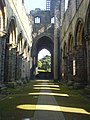
Kirkstall Abbey - panoramio.jpg 1,224 × 1,632; 427 KB
-
Kirkstall Abbey Cloister - panoramio.jpg 1,632 × 1,224; 432 KB
-
Morish Cotley - geograph.org.uk - 972820.jpg 640 × 480; 87 KB
-
Azzam Tamimi.JPG 3,648 × 2,736; 2.43 MB
-
Ruined Corn Mill, Hartsop - geograph.org.uk - 983634.jpg 640 × 420; 99 KB
-
Stockdale Lane - geograph.org.uk - 4706635.jpg 1,600 × 1,200; 368 KB
-
Sunderland Minister Church - panoramio.jpg 1,600 × 989; 854 KB
-
The Bridge Shopping Center - panoramio.jpg 1,600 × 1,071; 463 KB
-
The Lake, Leeds Castle - panoramio.jpg 2,816 × 2,112; 2.95 MB
-
The view from The Engine House, 9017 heads north - geograph.org.uk - 6726637.jpg 1,024 × 684; 207 KB
-
Under the Bridge - panoramio.jpg 1,600 × 1,071; 647 KB
