Category:Environs of Gimingham
Jump to navigation
Jump to search

Media in category "Environs of Gimingham"
The following 39 files are in this category, out of 39 total.
-
 -2018-08-15 Pond next to Paston Way Footpath in the parish of Gimingham.JPG 5,152 × 3,864; 7.95 MB
-
 -2018-08-15 Quiet country lane in the parish of Gimingham (1).JPG 3,864 × 5,152; 5.46 MB
-
 -2018-08-15 Quiet country lane in the parish of Gimingham (2).JPG 3,864 × 5,152; 7.69 MB
-
 -2018-08-15 Sugar beet feild next to Paston Way Footpath in the parish of Gimingham.JPG 5,152 × 3,864; 7.1 MB
-
 -2018-08-19 Footbridge over the River Mun west of Gimingham (1).JPG 5,152 × 3,864; 6.9 MB
-
 -2018-08-19 River Mun west of Gimingham (1).JPG 5,152 × 3,864; 6.54 MB
-
 -2018-08-19 River Mun west of Gimingham (2).JPG 5,152 × 3,864; 7.43 MB
-
 -2019-08-29 Countryside in the parish of Gimingham, Norfolk.jpg 5,152 × 3,864; 2.93 MB
-
 -2021-01-05 Houses on Mill Street in the village of Gimingham, Norfolk.JPG 5,152 × 3,864; 3.74 MB
-
 -2021-01-05 Houses on Trimingham Road in the village of Gimingham, Norfolk.JPG 5,152 × 3,864; 3.84 MB
-
 -2021-12-05 A derelict brick and flint Barn, Heath Road, Gimingham (1).JPG 5,152 × 3,864; 3.83 MB
-
 -2021-12-05 A derelict brick and flint Barn, Heath Road, Gimingham (2).JPG 5,152 × 3,864; 3.48 MB
-
 -2022-03-20 Trimingham, Norfolk.JPG 5,152 × 3,864; 5.95 MB
-
 -2022-03-21 Frog and toad spawn, Grove farm pond, Gimingham, Norfolk (1).JPG 5,152 × 3,864; 5.89 MB
-
 -2022-03-21 Frog spawn, Grove farm pond, Gimingham, Norfolk (2).JPG 5,152 × 3,864; 5.53 MB
-
 -2022-03-21 Toad, Grove farm pond, Gimingham, Norfolk.JPG 5,152 × 3,864; 6.61 MB
-
 -2022-05-21 Hall farm, Gimingham, Norfolk.JPG 5,152 × 3,864; 4.9 MB
-
 2018-07-13 A derelict brick and flint Barn, Heath Road, Gimingham.jpg 1,600 × 1,067; 361 KB
-
 2018-08-19 Coutryside east of Paston way footpath, Gimingham.JPG 5,152 × 3,864; 5.13 MB
-
 2018-08-19 Footbridge over the River Mun west of Gimingham (2).JPG 3,864 × 5,152; 6.68 MB
-
 2018-08-19 Footbridge over the River Mun west of Gimingham (3).JPG 3,864 × 5,152; 4.9 MB
-
 2018-08-19 Footbridge over the River Mun west of Gimingham (4).JPG 3,864 × 5,152; 7.67 MB
-
 2018-08-19 Looking towards RAF Trimingham from Paston way footpath, Gimingham.JPG 3,864 × 5,152; 5.92 MB
-
 2018-08-19 River Mun west of Gimingham (3).JPG 3,864 × 5,152; 6.27 MB
-
 2018-08-19 View of Gimingham from Paston way footpath.JPG 5,152 × 3,864; 4.85 MB
-
 2018-08-24 Sugar beet feild south of The Grove farm, Gimingham.JPG 3,864 × 5,152; 8.23 MB
-
 A field-woodland boundary - geograph.org.uk - 1215897.jpg 640 × 480; 102 KB
-
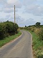
 A serpentine lane - geograph.org.uk - 1215372.jpg 600 × 513; 103 KB
-
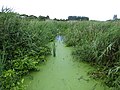
 An overgrown drain - geograph.org.uk - 1216045.jpg 480 × 640; 107 KB
-
 Dilapidated barn on Heath Lane - geograph.org.uk - 527321.jpg 640 × 480; 64 KB
-
 Farm track along reservoir - geograph.org.uk - 1215994.jpg 640 × 480; 101 KB
-
 Farm track to Heath Lane - geograph.org.uk - 1215989.jpg 640 × 480; 76 KB
-
 Farmland near Southrepps Road - geograph.org.uk - 535090.jpg 640 × 480; 127 KB
-
 Frog spawn in drainage ditch - geograph.org.uk - 1216339.jpg 640 × 480; 136 KB
-
 Glimpsing through the hedge - geograph.org.uk - 1215916.jpg 480 × 640; 121 KB
-
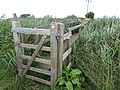
 Ivy-clad gate post - geograph.org.uk - 1216419.jpg 480 × 640; 158 KB
-
 Pasture beside drain - geograph.org.uk - 1216348.jpg 480 × 640; 129 KB
-
 View north across cultivated field - geograph.org.uk - 1215966.jpg 620 × 549; 101 KB
-
 Waiting patiently - geograph.org.uk - 1216069.jpg 480 × 640; 118 KB

.JPG)
.JPG)

.JPG)
.JPG)
.JPG)


.JPG)
.JPG)

.JPG)
.JPG)


.JPG)
.JPG)
.JPG)

.JPG)


