Category:Erehof Barchem
Jump to navigation
Jump to search
| Object location | | View all coordinates using: OpenStreetMap |
|---|
 | |||||
| Upload media | |||||
| Instance of | |||||
|---|---|---|---|---|---|
| Location | Barchem, Lochem, Gelderland, Netherlands | ||||
 | |||||
English: Location Information: The town of Barchem is situated to the south-east of Apeldoorn off the N346. From the motorway A1 turn off at Lochem onto the N332, direction of Lochem. Follow the N332 to the junction with the N346 and at the T junction turn left onto the N346 in the direction of Lochem. Follow the main road into the town and take the first major road to the right called Barchemseweg in the direction of Barchem. On entering the village turn right into Vandamstraat and the cemetery is along here on the right.
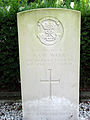
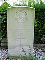
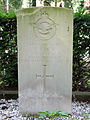
Historical Information: The British plot, which faces the cemetery entrance, contains the graves of soldiers from the United Kingdom who were killed in the battle which took place in the neighbourhood of Barchem.
Nederlands: Het erehof Barchem ligt op de algemene begraafplaats in Barchem. Er liggen 25 graven van zowel militairen die gesneuveld zijn bij de bevrijding van Barchem als luchtmachtpersoneel wat is omgekomen bij crashes in de omgeving.
Media in category "Erehof Barchem"
The following 25 files are in this category, out of 25 total.
-
 Barchem A. O'Pray.jpg 1,920 × 2,560; 1.71 MB
-
 Barchem A.C.A. Veeck.jpg 1,920 × 2,560; 1.66 MB
-
 Barchem A.S.W. Warr.jpg 1,920 × 2,560; 1.99 MB
-
 Barchem C.L.Pearce.jpg 1,920 × 2,560; 1.55 MB
-
 Barchem D.Evans-1.jpg 1,920 × 2,560; 1.63 MB
-
 Barchem D.Evans.jpg 1,920 × 2,560; 1.37 MB
-
 Barchem E.R.Culff.jpg 1,920 × 2,560; 1.43 MB
-
 Barchem G.Graham.jpg 1,920 × 2,560; 1.46 MB
-
 Barchem G.H.Butler Williams.jpg 1,920 × 2,560; 1.55 MB
-
 Barchem G.Simpson.jpg 1,441 × 2,165; 1.04 MB
-
 Barchem GFHurworth.jpg 1,305 × 1,961; 917 KB
-
 Barchem H.R. Wilmore.jpg 1,920 × 2,560; 1.63 MB
-
 Barchem I.C.Dunn.jpg 1,920 × 2,560; 1.7 MB
-
 Barchem J.Potts.jpg 1,490 × 2,239; 1.11 MB
-
 Barchem L.D.MC Allister.JPG 1,920 × 2,560; 1.31 MB
-
 Barchem L.MC Cracken.JPG 1,920 × 2,560; 1.89 MB
-
 Barchem M.J.Duke.JPG 1,920 × 2,560; 1.81 MB
-
 Barchem P.F.J.Copp.JPG 1,920 × 2,560; 1.64 MB
-
 Barchem P.M.Smith.JPG 1,386 × 2,080; 1,018 KB
-
 Barchem R.Collins.JPG 1,920 × 2,560; 2.64 MB
-
 Barchem T.A.Dew.JPG 1,920 × 2,560; 2.34 MB
-
 Barchem T.H. Swarbrick.JPG 1,920 × 2,560; 1.75 MB
-
 Barchem-27.jpg 2,560 × 1,920; 2.26 MB
-
 Barchem-28.jpg 2,560 × 1,920; 2.24 MB
-
 Barchem.jpg 2,560 × 1,920; 2.29 MB


