Category:Erosion in England
Jump to navigation
Jump to search
Subcategories
This category has the following 7 subcategories, out of 7 total.
Media in category "Erosion in England"
The following 36 files are in this category, out of 36 total.
-
 Anyone can shape the landscape - geograph.org.uk - 1147605.jpg 480 × 640; 77 KB
-
 Chine forming on soft cliffs at Compton, Isle of Wight.JPG 3,264 × 2,448; 4 MB
-
 Cows Head Rock - geograph.org.uk - 425556.jpg 640 × 480; 61 KB
-
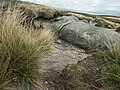
 Denuded peat, Bleaklow - geograph.org.uk - 329341.jpg 640 × 426; 81 KB
-
 East Cliff, West Bay, Dorset-geograph-5653988.jpg 427 × 640; 41 KB
-
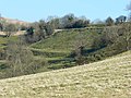
 Eroded hillside near Oliver's Castle - geograph.org.uk - 870366.jpg 640 × 449; 72 KB
-
 Eroded stream bank. Walter Clough Valley, Hove Edge - geograph.org.uk - 6520194.jpg 2,000 × 1,500; 1.72 MB
-
 Eroding cliff - geograph.org.uk - 782446.jpg 640 × 480; 144 KB
-
 Eroding shale, Post Hill - geograph.org.uk - 5645152.jpg 1,024 × 768; 254 KB
-

-
 Erosion at Rocking Stone - geograph.org.uk - 33777.jpg 640 × 427; 108 KB
-
 Erosion at Rocking Stone - geograph.org.uk - 33786.jpg 640 × 427; 75 KB
-
 Erosion at the top of Pin Hill Lane - geograph.org.uk - 4242844.jpg 2,000 × 1,500; 1.46 MB
-
 Erosion damage on the banks of the Stour - geograph.org.uk - 843472.jpg 427 × 640; 125 KB
-
 Erosion of Boulder Clay in Filey Bay.JPG 3,872 × 2,592; 7.95 MB
-
 Erosion of track, Stainland - geograph.org.uk - 696166.jpg 480 × 640; 148 KB
-
 Erosion on Pudsey Beck at Troydale - geograph.org.uk - 5645164.jpg 1,024 × 768; 226 KB
-
 Escarpment, Edburton Hill - geograph.org.uk - 495658.jpg 640 × 441; 142 KB
-
 Former Lead Workings at Bleaberry Gill - geograph.org.uk - 839201.jpg 640 × 427; 326 KB
-
 Hollows on Split Boulder. - geograph.org.uk - 502524.jpg 427 × 640; 264 KB
-
 Hunmanby Gap Cliff Erosion - geograph.org.uk - 217363.jpg 480 × 640; 70 KB
-
 Hunmanby Gap Cliff Erosion - geograph.org.uk - 217366.jpg 640 × 480; 104 KB
-
 Kinder Low - geograph.org.uk - 2970016.jpg 3,648 × 2,736; 4.02 MB
-
 Moorland, Kinder Scout - geograph.org.uk - 222514.jpg 640 × 480; 349 KB
-
 Peat erosion - geograph.org.uk - 209481.jpg 640 × 480; 95 KB
-
 Raven Scar from the B6255 at Dale House - geograph.org.uk - 1811521.jpg 2,048 × 1,536; 1.99 MB
-
 Sand-covered groyne - geograph.org.uk - 1119255.jpg 640 × 480; 134 KB
-
 Slumped Arch - geograph.org.uk - 778211.jpg 640 × 427; 82 KB
-
-
 Soil erosion, Wigborough, Somerset - geograph.org.uk - 133839.jpg 640 × 480; 380 KB
-
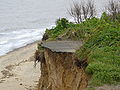 The road to nowhere (Covehithe).JPG 3,072 × 2,304; 3.25 MB
-
 Water erosion, Judy Woods - geograph.org.uk - 2531967.jpg 1,024 × 768; 205 KB
-
 Water forming a narrow channel - geograph.org.uk - 1700307.jpg 640 × 448; 111 KB
-
 Erosion of the river bank - geograph.org.uk - 694305.jpg 640 × 480; 154 KB
-
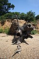
 Exposed tree roots - geograph.org.uk - 1748881.jpg 640 × 505; 149 KB
-
 Worn steps on Symonds Yat - geograph.org.uk - 335349.jpg 640 × 478; 105 KB


.JPG)


