Category:Evie and Rendall
Jump to navigation
Jump to search
parish on Mainland, Orkney Islands, Scotland, UK  | |||||
| Upload media | |||||
| Instance of | |||||
|---|---|---|---|---|---|
| Named after | |||||
| Location |
| ||||
| Population |
| ||||
| Area |
| ||||
 | |||||
Media in category "Evie and Rendall"
The following 200 files are in this category, out of 238 total.
(previous page) (next page)-
 A gem of a cottage - geograph.org.uk - 5402323.jpg 2,560 × 1,920; 3.22 MB
-
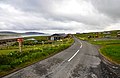
 A966 - geograph.org.uk - 3473816.jpg 640 × 424; 82 KB
-
 A966 by Burgar House - geograph.org.uk - 3473753.jpg 640 × 424; 91 KB
-
 A966 coast road - geograph.org.uk - 3474161.jpg 640 × 424; 76 KB
-
 A966 coastal road - geograph.org.uk - 3473755.jpg 640 × 424; 84 KB
-
 A966 Muckle Pow - geograph.org.uk - 4057707.jpg 4,128 × 2,752; 2.05 MB
-
 A966 through Rendall - geograph.org.uk - 3473193.jpg 640 × 424; 99 KB
-
 Abandoned Croft and Sheep Skerry - geograph.org.uk - 3473838.jpg 640 × 424; 89 KB
-
 Aeoleanite - c10,000 years old - geograph.org.uk - 2633463.jpg 4,000 × 3,000; 4.58 MB
-
 Akerness farm - geograph.org.uk - 5402339.jpg 2,560 × 1,920; 3.25 MB
-
 Bay of Hinderayre - geograph.org.uk - 5402268.jpg 2,560 × 1,920; 3.16 MB
-
 Betty's Reading Room - geograph.org.uk - 4375787.jpg 2,560 × 1,920; 2.19 MB
-
 Betty's Reading Room Tingwall - geograph.org.uk - 3508431.jpg 2,177 × 1,864; 1.28 MB
-
 Birsay Moors - geograph.org.uk - 6282951.jpg 6,000 × 4,000; 5.01 MB
-
 Birsay Moors Nature Reserve - geograph.org.uk - 4486405.jpg 640 × 480; 424 KB
-
 Bluebells by the Burn of Woodwick - geograph.org.uk - 3410913.jpg 1,024 × 719; 350 KB
-
 Boathouse Bay of Hilderayre - geograph.org.uk - 3231901.jpg 3,872 × 2,592; 3.25 MB
-
 Boggy track - geograph.org.uk - 5402581.jpg 2,560 × 1,920; 3.25 MB
-
 Breck of Rendall farm - geograph.org.uk - 5402279.jpg 2,560 × 1,920; 789 KB
-
 Broad Taing - geograph.org.uk - 2706842.jpg 4,000 × 3,000; 4.71 MB
-
 Broad Taing Crookness - geograph.org.uk - 2706763.jpg 3,911 × 2,864; 3.82 MB
-
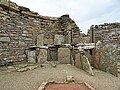
 Broch of Gurness - geograph.org.uk - 2125685.jpg 800 × 531; 118 KB
-
 Broch of Gurness - geograph.org.uk - 3112662.jpg 1,024 × 768; 297 KB
-
 Broch of Gurness - geograph.org.uk - 3225309.jpg 1,600 × 1,025; 281 KB
-
 Broch of Gurness - geograph.org.uk - 3349408.jpg 1,600 × 1,066; 354 KB
-
 Broch of Gurness - geograph.org.uk - 3773461.jpg 1,536 × 864; 425 KB
-
 Broch of Gurness - geograph.org.uk - 3912299.jpg 1,600 × 1,063; 486 KB
-
 Broch of Gurness - geograph.org.uk - 3912301.jpg 1,600 × 1,063; 338 KB
-
 Broch of Gurness - geograph.org.uk - 5402357.jpg 2,560 × 1,920; 3.31 MB
-
 Broch of Gurness - geograph.org.uk - 5827720.jpg 640 × 427; 364 KB
-
 Broch of Gurness - geograph.org.uk - 5839668.jpg 1,024 × 316; 339 KB
-
 Broch of Gurness - geograph.org.uk - 5839700.jpg 1,280 × 309; 540 KB
-
 Broch of Gurness - geograph.org.uk - 6281542.jpg 6,000 × 4,000; 4.23 MB
-
 Broch of Gurness visitor centre and foreshore - geograph.org.uk - 3773513.jpg 1,536 × 864; 469 KB
-
 Buildings round the Broch - geograph.org.uk - 5839689.jpg 640 × 449; 382 KB
-
 Bull above Aiker Ness - geograph.org.uk - 6282861.jpg 6,000 × 4,000; 5.23 MB
-
 Burgar - geograph.org.uk - 3473820.jpg 640 × 424; 93 KB
-
 Burgar Farm - geograph.org.uk - 3473823.jpg 640 × 424; 82 KB
-
 Burgar Hill - geograph.org.uk - 4174317.jpg 838 × 457; 140 KB
-
 Burgar Hill from Breeran - geograph.org.uk - 6202459.jpg 1,600 × 1,066; 436 KB
-
 Burgar, postbox № KW17 70 - geograph.org.uk - 2631292.jpg 480 × 640; 102 KB
-
 Burn of Sweenalay - geograph.org.uk - 3473046.jpg 640 × 424; 173 KB
-
 Burn of Woo - geograph.org.uk - 3473674.jpg 640 × 409; 74 KB
-
 Burness Point - geograph.org.uk - 5007665.jpg 2,592 × 1,944; 1.13 MB
-
 Burnt Mound - geograph.org.uk - 2294324.jpg 3,200 × 2,400; 4.89 MB
-
 Cattle and wind turbines, Burgar Hill - geograph.org.uk - 6202633.jpg 1,600 × 1,065; 310 KB
-
 Cattle near Midgarth - geograph.org.uk - 6281075.jpg 6,000 × 4,000; 7.38 MB
-
 Cemetery gates - geograph.org.uk - 5402259.jpg 2,560 × 1,920; 3.31 MB
-
 Cliffs of the Islands - geograph.org.uk - 3473832.jpg 640 × 424; 85 KB
-
 Coast north of Redha - geograph.org.uk - 3473857.jpg 640 × 424; 80 KB
-
 Coast Track - geograph.org.uk - 3473669.jpg 424 × 640; 115 KB
-
 Coastal fields - geograph.org.uk - 5402294.jpg 2,560 × 1,920; 3.19 MB
-
 Collapsing roof - geograph.org.uk - 2325962.jpg 3,648 × 2,736; 3.52 MB
-
 Costa Head Thrift - geograph.org.uk - 1928337.jpg 1,501 × 997; 1.06 MB
-
 Costa Hill - geograph.org.uk - 4099789.jpg 2,560 × 1,920; 3.03 MB
-
 Costa Primary School - geograph.org.uk - 3473825.jpg 640 × 424; 92 KB
-

-
 Costa, postbox № KW17 58 - geograph.org.uk - 2585080.jpg 640 × 480; 76 KB
-
 Couldn't resist - geograph.org.uk - 2322846.jpg 2,132 × 1,799; 2.28 MB
-
 Crismo House - geograph.org.uk - 3474224.jpg 640 × 424; 67 KB
-
 Dale Farm, Rendall - geograph.org.uk - 2072811.jpg 2,048 × 1,536; 675 KB
-
 Date on a Gateway - geograph.org.uk - 2322813.jpg 3,648 × 2,736; 5.89 MB
-
 Dereliction at Tingwall - geograph.org.uk - 5923032.jpg 5,202 × 3,465; 3.34 MB
-
 Disused Quarry At Vishall Hill - geograph.org.uk - 4099705.jpg 2,560 × 1,920; 2.15 MB
-
 Doocot at Hall of Rendall - geograph.org.uk - 5402286.jpg 2,560 × 1,920; 3.33 MB
-
 Entrance path to the Broch of Gurness - geograph.org.uk - 5402351.jpg 2,560 × 1,920; 3.29 MB
-
 Entrance to the Broch of Gurness - geograph.org.uk - 5822123.jpg 640 × 427; 341 KB
-
 Eolianite in Aikerness - geograph.org.uk - 2325924.jpg 3,472 × 2,528; 3.79 MB
-
 Evie Cemetery and Eynhallow Sound - geograph.org.uk - 5680508.jpg 1,600 × 1,066; 307 KB
-
 Evie Hostel - geograph.org.uk - 3473642.jpg 424 × 640; 78 KB
-

-
 Evie, Mistra Shop - geograph.org.uk - 2585076.jpg 640 × 480; 59 KB
-
 Evie, postbox № KW17 77 - geograph.org.uk - 2585078.jpg 640 × 480; 89 KB
-
 Evie, view eastwards towards Evie Sands - geograph.org.uk - 3178746.jpg 1,600 × 1,066; 392 KB
-
 Evie, view northwards over Eynhallow Sound to Rousay - geograph.org.uk - 3178582.jpg 1,600 × 1,066; 229 KB
-
 Eynhallow and Rousay - geograph.org.uk - 3473829.jpg 640 × 424; 88 KB
-
 Eynhallow Sound - geograph.org.uk - 3687055.jpg 3,802 × 2,534; 3.92 MB
-
 Eynhallow Sound - geograph.org.uk - 6281504.jpg 6,000 × 4,000; 3.95 MB
-

-
 Eynhallow Sound at the Broch of Gurness - geograph.org.uk - 2523978.jpg 1,600 × 1,200; 296 KB
-
 Farm track opposite Midgarth - geograph.org.uk - 6281045.jpg 6,000 × 4,000; 6.72 MB
-
 Fence on Baillie Hill - geograph.org.uk - 3742710.jpg 3,872 × 2,592; 5.48 MB
-
 Fence, Costa Hill, Orkney - geograph.org.uk - 3049647.jpg 3,648 × 2,736; 912 KB
-
 Ferry terminal, Tingwall - geograph.org.uk - 3186289.jpg 1,600 × 1,066; 191 KB
-
 Fields above Aiker Ness - geograph.org.uk - 6282881.jpg 6,000 × 4,000; 5.75 MB
-
 Fields in Costa - geograph.org.uk - 3474201.jpg 640 × 424; 86 KB
-
 Flaws - geograph.org.uk - 3473636.jpg 640 × 424; 76 KB
-
 Flaws Cottage - geograph.org.uk - 3473631.jpg 640 × 424; 92 KB
-
 Footpath leading to the Broch of Gurness - geograph.org.uk - 4486410.jpg 640 × 480; 379 KB
-
 Foreshore at the Broch of Gurness - geograph.org.uk - 5808421.jpg 1,024 × 513; 131 KB
-
 Gate on the side of Baillie Hill - geograph.org.uk - 3742718.jpg 3,872 × 2,592; 5.53 MB
-
 Georth - geograph.org.uk - 3473741.jpg 640 × 424; 72 KB
-
 Georth Farm - geograph.org.uk - 3473696.jpg 640 × 424; 70 KB
-
 Good grazing at Queenamuckle - geograph.org.uk - 2094545.jpg 3,888 × 2,592; 3.18 MB
-
 Gorseness Road - geograph.org.uk - 3472958.jpg 640 × 424; 65 KB
-
 Gorseness, the telephone box - geograph.org.uk - 2631302.jpg 640 × 480; 66 KB
-
 Graveyard on shore of Hinderayre bay - geograph.org.uk - 3235430.jpg 1,168 × 1,760; 675 KB
-
 Hackland Church - geograph.org.uk - 4378786.jpg 2,560 × 1,920; 2.21 MB
-
 Hall of Rendall - geograph.org.uk - 2094323.jpg 3,888 × 2,592; 4.37 MB
-

-
 Hen of Gairsay - geograph.org.uk - 3710882.jpg 3,462 × 2,308; 972 KB
-
 Hen of Gairsay - geograph.org.uk - 4098950.jpg 2,560 × 1,920; 2.58 MB
-
 Herding sheep with a Toyota near Aikerness - geograph.org.uk - 4067071.jpg 3,098 × 4,647; 7.08 MB
-
 Houses beside the Broch - geograph.org.uk - 5839705.jpg 640 × 427; 332 KB
-
 Howe - geograph.org.uk - 3473668.jpg 640 × 416; 129 KB
-
 Inquisitive audience - geograph.org.uk - 2322787.jpg 1,950 × 1,373; 1.53 MB
-
 Inside Betty's Reading Room - geograph.org.uk - 5402327.jpg 2,560 × 1,920; 3.39 MB
-
 Inside Betty's Reading Room Tingwall - geograph.org.uk - 3508439.jpg 3,648 × 2,736; 4.17 MB
-
 Inside the Broch - geograph.org.uk - 5839681.jpg 640 × 480; 419 KB
-
 Interior of the Broch of Gurness - geograph.org.uk - 2670982.jpg 640 × 435; 100 KB
-
 Jetty At Millburn Bay, Gairsay - geograph.org.uk - 4098957.jpg 2,488 × 1,820; 1.8 MB
-
 Layburn - geograph.org.uk - 3473170.jpg 640 × 424; 83 KB
-
 Lichen on headstone - geograph.org.uk - 2322832.jpg 3,648 × 2,736; 7.38 MB
-
 Little Hut - geograph.org.uk - 2698399.jpg 4,000 × 3,000; 4.3 MB
-
 Little Hut - geograph.org.uk - 2698437.jpg 4,000 × 3,000; 4.65 MB
-
 Loch of Swanney - geograph.org.uk - 3474234.jpg 640 × 424; 106 KB
-
 Looking down to Evie from Breeran - geograph.org.uk - 3186832.jpg 1,600 × 1,066; 266 KB
-
 Looking down to Evie from Burgar Hill - geograph.org.uk - 3181770.jpg 1,600 × 1,066; 226 KB
-
 Looking towards the Point of Hellia - geograph.org.uk - 4486408.jpg 640 × 480; 380 KB
-
 Lower Cottascarth, near Settiscarth - geograph.org.uk - 6202479.jpg 1,600 × 1,065; 369 KB
-

-
 Lowrie's Water, Burgar Hill - geograph.org.uk - 6202450.jpg 1,600 × 1,065; 589 KB
-
 Mid Hill Trig - geograph.org.uk - 4099767.jpg 2,560 × 1,920; 1.7 MB
-
 Mid Tooin trig point - geograph.org.uk - 2104119.jpg 3,264 × 2,448; 3.87 MB
-
 Mid Tower Trig Near Milldoe - Mid Tooin TUMP - geograph.org.uk - 4378835.jpg 2,560 × 1,920; 2.23 MB
-
 Millfield - geograph.org.uk - 3474146.jpg 640 × 424; 116 KB
-

-
 Mist-shrouded fields near Tingwall - geograph.org.uk - 6281136.jpg 6,000 × 4,000; 4.35 MB
-
 Moorland, Ernie Tooin - geograph.org.uk - 4308878.jpg 800 × 526; 79 KB
-
 Moors by Durrisdale - geograph.org.uk - 3473585.jpg 640 × 424; 102 KB
-
 Moss of Hatamo - geograph.org.uk - 3473228.jpg 424 × 640; 72 KB
-
 Moss of Hatamo - geograph.org.uk - 3473241.jpg 640 × 424; 79 KB
-
 Muckle Pow - geograph.org.uk - 3474193.jpg 640 × 418; 79 KB
-
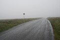 Narrow road with passing places - geograph.org.uk - 6282976.jpg 6,000 × 4,000; 5.22 MB
-
 Norseman - geograph.org.uk - 3472963.jpg 640 × 424; 95 KB
-
 North Head, Gairsay - geograph.org.uk - 4005100.jpg 2,560 × 1,920; 2.41 MB
-
 North-east from Burgar Hill - geograph.org.uk - 6202456.jpg 1,600 × 1,065; 695 KB
-
 Old and New at Brookfield - geograph.org.uk - 3473029.jpg 640 × 424; 79 KB
-

-

-
 Old peat workings - geograph.org.uk - 2325737.jpg 4,000 × 3,000; 4.96 MB
-
 Old pier at Eynhallow Sound - geograph.org.uk - 3067839.jpg 600 × 397; 255 KB
-
 Old track new track - geograph.org.uk - 2104205.jpg 3,264 × 2,448; 4.09 MB
-
 Orquil - geograph.org.uk - 2325938.jpg 3,648 × 2,736; 4.73 MB
-
 Outbuildings at the Broch of Gurness - geograph.org.uk - 3687094.jpg 3,872 × 2,592; 4.75 MB
-
 Passing through Costa - geograph.org.uk - 3474209.jpg 640 × 424; 72 KB
-
 Passing through Crismo - geograph.org.uk - 3474240.jpg 640 × 424; 93 KB
-
 Path towards the sea, near Costa - geograph.org.uk - 5923028.jpg 5,202 × 3,465; 3.41 MB
-
 Picnic table on Birsay Moors - geograph.org.uk - 6283028.jpg 6,000 × 4,000; 4.65 MB
-
 Queenamuckle Farm - geograph.org.uk - 2094293.jpg 3,888 × 2,592; 3.45 MB
-
 Rainy day near Norseman village - geograph.org.uk - 5402248.jpg 2,560 × 1,920; 855 KB
-
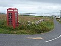
 Red telephone box, Gorseness road, Rendal - geograph.org.uk - 3041434.jpg 3,872 × 2,592; 2.01 MB
-
 Rendall doocot - geograph.org.uk - 3762949.jpg 1,600 × 1,200; 250 KB
-
 Rendall doocot - geograph.org.uk - 3771080.jpg 1,178 × 858; 471 KB
-
 Rendall Doocot - geograph.org.uk - 5837423.jpg 1,024 × 686; 150 KB
-
 Rendall Doocot Interior - geograph.org.uk - 5837431.jpg 1,024 × 688; 172 KB
-
 Rendall Doocot, Hall of Rendall, Mainland - geograph.org.uk - 3348828.jpg 1,066 × 1,600; 333 KB
-
 Road to Evie - geograph.org.uk - 6283019.jpg 6,000 × 4,000; 7.2 MB
-
 Road to Jubidee - geograph.org.uk - 3473575.jpg 640 × 424; 79 KB
-
 Road to the coast - geograph.org.uk - 5402570.jpg 2,560 × 1,920; 3.27 MB
-
 Road to Woodwick - geograph.org.uk - 6281127.jpg 6,000 × 4,000; 7.5 MB
-
 Rocky Coast - geograph.org.uk - 3112658.jpg 1,024 × 768; 249 KB
-
 Rocky shore below the visitors centre - geograph.org.uk - 3487963.jpg 1,440 × 964; 406 KB
-
 Rocky shore of Eynhallow Sound - geograph.org.uk - 6281418.jpg 6,000 × 4,000; 3.98 MB
-
 Rough grazing near Midgarth - geograph.org.uk - 6281030.jpg 6,000 × 4,000; 4.47 MB
-
 Rough pasture at Castlehill - geograph.org.uk - 5808448.jpg 1,024 × 571; 135 KB
-
 RSPB Burgar Hill Hide - geograph.org.uk - 3473725.jpg 640 × 424; 79 KB
-
 Rudimentary track on Baillie Hill - geograph.org.uk - 3742713.jpg 3,872 × 2,592; 2.25 MB
-
 Ruins near Graemshall - geograph.org.uk - 2104131.jpg 3,264 × 2,448; 2.77 MB
-
 Sands of Evie - geograph.org.uk - 4486407.jpg 640 × 480; 401 KB
-
 Sands of Evie - geograph.org.uk - 5402556.jpg 2,227 × 1,441; 589 KB
-
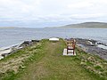 Seaside bench by the Broch of Gurness - geograph.org.uk - 4469593.jpg 640 × 480; 405 KB
-
 Sheep by Midland Farm - geograph.org.uk - 6281067.jpg 6,000 × 4,000; 3.39 MB
-
 Shoreline east of Tingwall pier - geograph.org.uk - 6263738.jpg 3,648 × 2,736; 2.19 MB
-
 Shoreline Graffiti - Broad Taing - geograph.org.uk - 2706785.jpg 4,000 × 3,000; 4.12 MB
-
 Shoreline Graffiti - Crookness - geograph.org.uk - 2706812.jpg 4,000 × 3,000; 3.93 MB
-
 Shoreline rocks at Buckquoy - geograph.org.uk - 2561599.jpg 800 × 600; 136 KB
-
 Silage store near Tingwall - geograph.org.uk - 6281111.jpg 6,000 × 4,000; 4.52 MB
-
 Skea Looking East - geograph.org.uk - 1928258.jpg 640 × 425; 68 KB
-
 Skea Looking West - geograph.org.uk - 1928246.jpg 640 × 425; 60 KB
-
 Skiddy - geograph.org.uk - 3473217.jpg 640 × 424; 74 KB
-
 Small Lochan - geograph.org.uk - 4380485.jpg 2,560 × 1,920; 2.2 MB
-

-
 Stone Carving - geograph.org.uk - 3473054.jpg 640 × 424; 107 KB
-
 Summit, Milldoe - geograph.org.uk - 4307182.jpg 800 × 489; 59 KB
-
 Sunset at Evie Sands - geograph.org.uk - 3188321.jpg 1,600 × 1,066; 245 KB
-
 Taing of Midgarth - geograph.org.uk - 5402315.jpg 2,560 × 1,920; 3.3 MB
-
 Telecommunications mast on Fibla Fiold - geograph.org.uk - 2104126.jpg 2,448 × 3,264; 2.36 MB
-
 The A966 At Georth in Orkney - geograph.org.uk - 4219452.jpg 640 × 427; 75 KB
-
 The Birsay Moors - geograph.org.uk - 5807966.jpg 1,024 × 575; 154 KB
-
 The Broch of Gurness - geograph.org.uk - 3687075.jpg 3,872 × 2,592; 2.25 MB
-
 The Broch of Gurness - geograph.org.uk - 5317650.jpg 2,000 × 1,333; 539 KB
-
 The Broch of Gurness in Orkney - geograph.org.uk - 4212812.jpg 2,464 × 1,632; 1.98 MB
-

-
 The Burn of Desso reaching the sea - geograph.org.uk - 3687346.jpg 3,872 × 2,592; 2.02 MB
-
 The Doorway into the Broch - geograph.org.uk - 5839672.jpg 461 × 640; 415 KB
-
 The Entrance Passageway - geograph.org.uk - 5839685.jpg 480 × 640; 403 KB
-
 The north side of Vishall Hill - geograph.org.uk - 6282851.jpg 6,000 × 4,000; 7.34 MB
-
 The phone at the farm - geograph.org.uk - 2698449.jpg 4,000 × 3,000; 4.26 MB
-
 The RSPB hide at Cottascarth - geograph.org.uk - 6202478.jpg 1,600 × 1,065; 601 KB


