Category:Fair Isle
Jump to navigation
Jump to search
| Object location | | View all coordinates using: OpenStreetMap |
|---|
island at the south of the Shetland Islands, Scotland, UK   | |||||
| Upload media | |||||
| Instance of | |||||
|---|---|---|---|---|---|
| Part of | |||||
| Located in protected area |
| ||||
| Location |
| ||||
| Located in or next to body of water | |||||
| Owned by |
| ||||
| Operator | |||||
| Has part(s) |
| ||||
| Width |
| ||||
| Length |
| ||||
| Population |
| ||||
| Area |
| ||||
| Elevation above sea level |
| ||||
| official website | |||||
 | |||||
Subcategories
This category has the following 6 subcategories, out of 6 total.
F
- Fair Isle Airport (5 F)
- Fair Isle North Lighthouse (17 F)
- Fair Isle South Lighthouse (21 F)
S
- Stonybreck (3 F)
Media in category "Fair Isle"
The following 200 files are in this category, out of 326 total.
(previous page) (next page)-

-
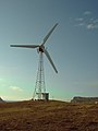
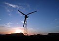 100kW Aerogenerator, Fair Isle - geograph.org.uk - 9129.jpg 640 × 451; 64 KB
-
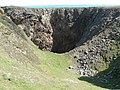 A Blowhole - geograph.org.uk - 3079994.jpg 600 × 450; 146 KB
-

-
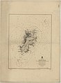
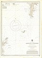 Admiralty Chart No 1119 Lerwick to Stronsay, Published 1956.jpg 8,190 × 11,216; 14.28 MB
-
 Admiralty Chart No 1942 Fair Isle to Wick, Published 1972.jpg 16,322 × 11,181; 36.23 MB
-
 Admiralty Chart No 2622 Fair Isle, Published 1858.jpg 5,373 × 5,362; 5.53 MB
-
 Admiralty Chart No 2622 Fair Isle, Published 1883.jpg 8,052 × 10,912; 14.41 MB
-
 Aerial view of North Haven, Fair Isle - geograph.org.uk - 17893.jpg 640 × 480; 120 KB
-
 Aerogenerator and angelica - geograph.org.uk - 3152035.jpg 640 × 427; 103 KB
-
 An unaggressive Bonxie - geograph.org.uk - 5016617.jpg 2,592 × 1,944; 1.19 MB
-
 Antwerp Flyer IMG 1579 (19552071182).jpg 3,324 × 1,830; 1.59 MB
-
 Bale wrapping, Fair Isle 2001 - a.jpg 1,800 × 1,200; 448 KB
-
 Bale wrapping, Fair Isle 2001 - b.jpg 1,800 × 1,200; 452 KB
-
 Bale wrapping, Fair Isle 2001 - c.jpg 1,077 × 768; 126 KB
-
 Barkland, Field and Sheep Rock - geograph.org.uk - 344952.jpg 640 × 410; 31 KB
-
-

-
 Buness from Goorn, Fair Isle - geograph.org.uk - 2380894.jpg 800 × 548; 75 KB
-
 Burgaroo, Fair Isle - geograph.org.uk - 2386426.jpg 800 × 534; 84 KB
-
 Burkle, Fair Isle - geograph.org.uk - 3151098.jpg 640 × 427; 81 KB
-
 Burn of Gilsetter in spate, Fair Isle - geograph.org.uk - 2380461.jpg 533 × 800; 153 KB
-
 Burn of Gilsetter, Fair Isle - geograph.org.uk - 2380495.jpg 542 × 800; 149 KB
-
 Burrashield Hill - geograph.org.uk - 5016625.jpg 2,592 × 1,944; 1.4 MB
-
 Burrashield Summit - geograph.org.uk - 3555485.jpg 2,560 × 1,920; 3.22 MB
-
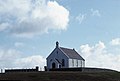
 Church of Scotland, Fair Isle - geograph.org.uk - 3557611.jpg 2,560 × 1,918; 2.16 MB
-
 Cliff edge of Meo Ness - geograph.org.uk - 1992703.jpg 1,024 × 768; 277 KB
-
 Cliff ridge bordering Geo Claver - geograph.org.uk - 1999555.jpg 1,024 × 768; 297 KB
-
 Cliff top path - geograph.org.uk - 3079987.jpg 450 × 600; 138 KB
-
 Cliffs at Hoini, Fair Isle - geograph.org.uk - 4999436.jpg 2,592 × 1,944; 1.28 MB
-
 Cliffs at Vaasetter and Sheep Rock - geograph.org.uk - 4311576.jpg 1,024 × 751; 185 KB
-
 Cliffs below Ward Hill from Dronger - geograph.org.uk - 1999568.jpg 1,024 × 768; 275 KB
-

-
 Coastline from Malcolm's Head - geograph.org.uk - 1999666.jpg 1,024 × 768; 182 KB
-
 Coastline near Malcolm's Head - geograph.org.uk - 871114.jpg 640 × 410; 73 KB
-
-

-
 Contented sheep on Fair Isle - geograph.org.uk - 4506940.jpg 640 × 480; 306 KB
-
-
 Cristal Kame, Fair Isle - geograph.org.uk - 2386489.jpg 540 × 800; 143 KB
-
 Cro Stack in South Harbour - geograph.org.uk - 3557619.jpg 2,560 × 1,920; 2.9 MB
-
 Croft houses, Fair Isle - geograph.org.uk - 9206.jpg 640 × 302; 77 KB
-
 Crofting land of Fair Isle 1974 - geograph.org.uk - 873218.jpg 640 × 418; 90 KB
-
 Da Sherriff - geograph.org.uk - 344962.jpg 424 × 640; 43 KB
-
 Distant Sunbeams IMG 6603 (24485779755).jpg 4,237 × 2,156; 2.86 MB
-
 Double Heligoland Trap - geograph.org.uk - 2001534.jpg 1,024 × 768; 206 KB
-
 Easter Lother - geograph.org.uk - 345040.jpg 417 × 640; 66 KB
-
 Easter Lother and the North Light - geograph.org.uk - 345074.jpg 640 × 416; 45 KB
-
 Easter Lother, Fair Isle - geograph.org.uk - 2386398.jpg 800 × 555; 108 KB
-
 Evening at North Haven, Fair Isle - geograph.org.uk - 5511927.jpg 800 × 512; 113 KB
-
 Fair Isle - Croft houses.jpg 618 × 255; 47 KB
-
 Fair Isle 01.jpg 20,363 × 3,409; 6 MB
-
 Fair Isle 02.jpg 16,839 × 3,681; 5.4 MB
-
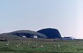
 Fair Isle airfield terminal building - geograph.org.uk - 4506007.jpg 640 × 480; 176 KB
-
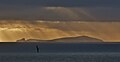
 Fair Isle at sunset - geograph.org.uk - 3490919.jpg 640 × 480; 44 KB
-
 Fair Isle banner View from a ferry.JPG 3,500 × 500; 838 KB
-
 Fair Isle Bird Observatory in 1982 - geograph.org.uk - 3830582.jpg 640 × 424; 100 KB
-
 Fair Isle Bird Observatory in 1986 - geograph.org.uk - 2379524.jpg 563 × 800; 101 KB
-
 Fair Isle Bird Observatory reopened June 2010 - geograph.org.uk - 1999001.jpg 1,024 × 768; 292 KB
-
 Fair Isle Bird Observatory, 1974 - geograph.org.uk - 6029154.jpg 1,600 × 900; 703 KB
-
 Fair Isle coastline at Port Saider - geograph.org.uk - 1990842.jpg 1,024 × 768; 273 KB
-
 Fair Isle crofts - geograph.org.uk - 344994.jpg 640 × 382; 47 KB
-
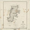
 Fair Isle crop of Ordnance Survey One-Inch Sheet 4 Shetland, Published 1961.jpg 1,732 × 1,715; 289 KB
-
 Fair Isle dry stone wall - geograph.org.uk - 4505985.jpg 640 × 480; 218 KB
-
 Fair Isle Electricity Company Ltd. - geograph.org.uk - 3152150.jpg 480 × 640; 41 KB
-
 Fair Isle fire station - geograph.org.uk - 4505979.jpg 640 × 480; 159 KB
-
 Fair Isle Flurry IMG 7121 (23813912643).jpg 4,263 × 2,291; 2.06 MB
-
 Fair Isle from Good Shepherd IV ferry.jpg 1,800 × 1,200; 445 KB
-
 Fair Isle from Malcolm's Head - geograph.org.uk - 2381080.jpg 800 × 532; 88 KB
-
 Fair Isle from Sumburgh Head - geograph.org.uk - 2796022.jpg 1,418 × 1,000; 1.6 MB
-
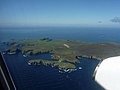
 Fair Isle from the air - geograph.org.uk - 1850546.jpg 640 × 427; 44 KB
-
 Fair Isle from the air - geograph.org.uk - 4470033.jpg 1,024 × 494; 78 KB
-
 Fair Isle from the air - geograph.org.uk - 5295292.jpg 1,024 × 682; 118 KB
-
-
 Fair Isle from the north - geograph.org.uk - 1126760.jpg 640 × 406; 64 KB
-

-
 Fair Isle from Utra - geograph.org.uk - 2381001.jpg 800 × 558; 73 KB
-
 Fair Isle gap IMG 3622 (11841914103).jpg 4,259 × 2,209; 2.87 MB
-
 Fair Isle gap IMG 3631 (11841605935).jpg 4,246 × 2,284; 2.24 MB
-
 Fair Isle Gap IMG 5511 (15336157274).jpg 4,272 × 2,329; 2.95 MB
-
 Fair Isle IMG 5507 (15773968769).jpg 4,237 × 2,276; 2.61 MB
-
 Fair Isle IMG 6201 (12641994483).jpg 4,217 × 2,277; 2.99 MB
-
 Fair Isle IMG 7629 (30360794234).jpg 4,194 × 2,405; 2.35 MB
-
 Fair Isle Kirk - geograph.org.uk - 2381123.jpg 800 × 539; 65 KB
-
 Fair Isle Kirk from the Rippack - geograph.org.uk - 2380906.jpg 800 × 548; 95 KB
-
 Fair Isle Kirk interior - geograph.org.uk - 893323.jpg 480 × 640; 68 KB
-
 Fair Isle Kirk, late in the evening - geograph.org.uk - 893314.jpg 640 × 480; 32 KB
-
 Fair Isle Kirk, summer evening. - geograph.org.uk - 8521.jpg 640 × 470; 68 KB
-
 Fair Isle landing strip - geograph.org.uk - 4506016.jpg 640 × 480; 156 KB
-
 Fair Isle life-line IMG 8733 (14099386824).jpg 4,220 × 2,376; 1.82 MB
-
 Fair Isle Methodist Church interior - geograph.org.uk - 893300.jpg 640 × 480; 65 KB
-
 Fair Isle North Lighthouse - geograph.org.uk - 5511989.jpg 800 × 385; 75 KB
-
 Fair Isle Reflections IMG 5778 (23641363721).jpg 4,208 × 2,313; 3 MB
-
 Fair Isle Scotland.JPG 4,976 × 1,360; 2.65 MB
-
 Fair Isle South light - geograph.org.uk - 4311540.jpg 1,024 × 617; 56 KB
-
 Fair Isle South Lighthouse (Skaddan) - geograph.org.uk - 3505438.jpg 2,560 × 1,920; 2.5 MB
-
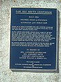 Fair Isle South, memorial plaque - geograph.org.uk - 3151539.jpg 480 × 640; 120 KB
-
 Fair isle station.jpg 1,731 × 1,040; 217 KB
-
 Fair Isle Surgery - geograph.org.uk - 4505973.jpg 640 × 480; 210 KB
-
 Fair Isle tie-down - geograph.org.uk - 3102488.jpg 640 × 480; 60 KB
-
 Fair Isle water mills - geograph.org.uk - 3809871.jpg 709 × 1,024; 201 KB
-

-
 Fair Isle, aerial 2007 - geograph.org.uk - 3150250.jpg 640 × 427; 44 KB
-
 Fair Isle, North Haven.jpg 640 × 364; 109 KB
-
 Fair Isle, sunset around Ward Hill - geograph.org.uk - 2555001.jpg 640 × 480; 39 KB
-

-
 Fairisle.jpg 2,048 × 1,536; 573 KB
-
 FIBO in 1986 - geograph.org.uk - 344928.jpg 640 × 417; 45 KB
-
 Golden Island IMG 6609 (24118021999).jpg 4,212 × 2,161; 2.62 MB
-
 Good Shepherd III arrival at Fair Isle - geograph.org.uk - 6032010.jpg 1,600 × 1,067; 829 KB
-
 Good Shepherd III, Fair Isle - geograph.org.uk - 2379551.jpg 800 × 542; 121 KB
-
 Good Shepherd IV and harbour at Fair Isle from ferry.jpg 1,800 × 1,200; 440 KB
-
 Good Shepherd IV at Fair Isle.jpg 1,800 × 1,200; 442 KB
-
 Good Shepherd IV between Fair Isle and Lerwick - geograph.org.uk - 6029316.jpg 1,600 × 1,200; 508 KB
-
 Good Shepherd IV docked at Fair Isle.jpg 1,800 × 1,200; 440 KB
-
-
 GoodshepherdIV.jpg 1,800 × 1,200; 481 KB
-
 Greater spotting orange birders - geograph.org.uk - 4497405.jpg 4,896 × 3,672; 6.37 MB
-
-
 GSI IMG 7240 (14815781436).jpg 3,552 × 2,113; 2.34 MB
-
 Gunglesund Rock Pool - geograph.org.uk - 1995927.jpg 1,024 × 768; 233 KB
-
 Gunnawark and Konnis, Fair Isle - geograph.org.uk - 2384706.jpg 800 × 553; 118 KB
-
 Half Way Home IMG 8141 (31334359272).jpg 4,256 × 2,101; 1.86 MB
-
-
 Hay baling, Ford 4000, Wolvo R500, Fair Isle 2001 - a.jpg 1,800 × 1,200; 469 KB
-
 Hay baling, Ford 4000, Wolvo R500, Fair Isle 2001 - b.jpg 1,800 × 1,200; 465 KB
-
 Head of North Felsigeo, Fair Isle - geograph.org.uk - 2386143.jpg 533 × 800; 181 KB
-
 Heili Stack, Fair Isle - geograph.org.uk - 2380983.jpg 558 × 800; 118 KB
-
 Heligoland Trap - geograph.org.uk - 3080014.jpg 600 × 450; 139 KB
-
 Hjukni Geo and the Reevas, Fair Isle - geograph.org.uk - 2382614.jpg 800 × 536; 104 KB
-
 Hjukni Geo, Fair Isle - geograph.org.uk - 344992.jpg 640 × 417; 28 KB
-
 Hoiliff and western cliffs of Fair Isle - geograph.org.uk - 1997511.jpg 1,024 × 759; 226 KB
-

-
 Hole of Klaver - geograph.org.uk - 344968.jpg 402 × 640; 34 KB
-
-
 Inner Stack - geograph.org.uk - 345629.jpg 418 × 640; 59 KB
-
 Kame of Furse and Yessness, Fair Isle - geograph.org.uk - 2386506.jpg 800 × 519; 101 KB
-
 Kirk on Fair Isle - geograph.org.uk - 4505962.jpg 640 × 480; 173 KB
-
 Kirk Stack (or Stacks of Skroo), Fair Isle - geograph.org.uk - 17895.jpg 640 × 480; 122 KB
-
 Kirk Stack - geograph.org.uk - 908549.jpg 640 × 426; 26 KB
-
 Kirk Stack from the end of Dronger - geograph.org.uk - 1992404.jpg 1,024 × 765; 260 KB
-
 Kirk Stack, Fair Isle, from the sea - geograph.org.uk - 4134158.jpg 1,024 × 680; 159 KB
-
 Kirk Stack, Fair Isle, from the sea - geograph.org.uk - 5060401.jpg 1,024 × 684; 88 KB
-
 Kirn o' Scroo - geograph.org.uk - 345043.jpg 430 × 640; 55 KB
-
-
 Landing on Fair Isle - geograph.org.uk - 4506024.jpg 640 × 480; 182 KB
-
 Landing on Fair Isle, aerial 2007 - geograph.org.uk - 3150267.jpg 640 × 480; 34 KB
-
 Last sunset 2013 IMG 3342 (11667933714).jpg 4,260 × 2,003; 1.9 MB
-
 Looking Over The Edge At Kista - geograph.org.uk - 3558316.jpg 2,560 × 1,920; 3.54 MB
-
 Looking to Ward Hill, Fair Isle - geograph.org.uk - 5016588.jpg 2,592 × 1,944; 1.56 MB
-
 Looking towards Ward Hill - geograph.org.uk - 2385928.jpg 800 × 538; 112 KB
-
 Malcolm's Head - geograph.org.uk - 345652.jpg 640 × 426; 53 KB
-
 Malcolm's Head - geograph.org.uk - 3505421.jpg 2,560 × 1,920; 3.31 MB
-
 Malcolm's Head - geograph.org.uk - 5016686.jpg 2,592 × 1,944; 1.18 MB
-
 Malcolm's Head from the west - geograph.org.uk - 531235.jpg 640 × 208; 13 KB
-
 Malcolm's Head, Fair Isle, from the sea - geograph.org.uk - 4134193.jpg 1,024 × 681; 106 KB
-
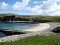
 Mavers Geo, South Haven, Fair Isle - geograph.org.uk - 5511939.jpg 800 × 600; 129 KB
-
 Methodist Church, Fair Isle - geograph.org.uk - 3197818.jpg 640 × 432; 40 KB
-
 Methodist Church, stained glass - geograph.org.uk - 3152170.jpg 480 × 640; 138 KB
-
 Moored in North Haven, Fair Isle - geograph.org.uk - 4506085.jpg 640 × 480; 191 KB
-
 MV Filla in North Haven, Fair Isle - geograph.org.uk - 2379599.jpg 800 × 551; 136 KB
-
 Mystic Island IMG 7081 (24138706820).jpg 4,248 × 2,204; 3.08 MB
-
 Natural arch - geograph.org.uk - 3079977.jpg 600 × 450; 148 KB
-
 Natural arch - geograph.org.uk - 3081810.jpg 600 × 450; 144 KB
-

-
 Natural arch, Funniequoy, Fair Isle - geograph.org.uk - 2380449.jpg 800 × 533; 143 KB
-

-
 Natural Arches - geograph.org.uk - 3080002.jpg 600 × 450; 158 KB
-
 Nesting birds on the Fair Isle Coast - geograph.org.uk - 1999562.jpg 1,024 × 768; 229 KB
-
-
 North coast of Fair Isle - geograph.org.uk - 871074.jpg 640 × 444; 120 KB
-
-
 North Felsigeo - geograph.org.uk - 345630.jpg 640 × 415; 80 KB
-
 North Felsigeo, Fair Isle - geograph.org.uk - 2379603.jpg 542 × 800; 75 KB
-
 North Felsigeo, Fair Isle - geograph.org.uk - 2386165.jpg 532 × 800; 70 KB
-
 North Haven seat - geograph.org.uk - 3083768.jpg 600 × 450; 142 KB
-
 North Haven, a ferry and a seal - geograph.org.uk - 3151198.jpg 640 × 427; 95 KB
-
 North Haven, Fair Isle - geograph.org.uk - 2379542.jpg 800 × 563; 85 KB
-
 North Haven, Fair Isle - geograph.org.uk - 6029341.jpg 1,600 × 1,073; 513 KB
-
 North Haven, Fair Isle 1974 - geograph.org.uk - 871058.jpg 1,600 × 1,067; 749 KB
-
 North Light, Fair Isle, from the sea - geograph.org.uk - 4134144.jpg 1,024 × 682; 113 KB
-
 North Naaversgill, Fair Isle, from the sea - geograph.org.uk - 5059014.jpg 1,024 × 682; 142 KB
-
 North Reeva - geograph.org.uk - 345008.jpg 434 × 640; 35 KB
-
 North Reeva, Fair Isle - geograph.org.uk - 2382675.jpg 542 × 800; 146 KB
-
 North ^ South Haven from Bu Ness - geograph.org.uk - 6391503.jpg 1,600 × 1,303; 446 KB
-
 Old bird "Obs" and North Haven, 2007 - geograph.org.uk - 3152004.jpg 640 × 427; 64 KB
-
 Old peat road, Fair Isle - geograph.org.uk - 9213.jpg 640 × 404; 114 KB
-
 On a ranger-led walk to Malcolm's Head - geograph.org.uk - 1999224.jpg 1,024 × 768; 237 KB
-
 On Goorn peninsula - geograph.org.uk - 6392253.jpg 1,600 × 1,105; 266 KB
-
 Ordnance Survey 1-250000 - HZ.jpg 4,000 × 4,000; 547 KB
-
 Ordnance Survey One-Inch Sheet 4 Shetland, Published 1961.jpg 8,249 × 9,870; 6.6 MB
-
 Outbound IMG 5415 (22589543624).jpg 4,254 × 2,117; 2.15 MB
-
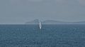
 Passing Fair Isle - geograph.org.uk - 4511612.jpg 640 × 480; 96 KB
-
 Puffins on the cliffs by The Holms - geograph.org.uk - 1994285.jpg 1,024 × 765; 234 KB
-

-
 Pund, Fair Isle - geograph.org.uk - 344983.jpg 640 × 426; 34 KB
-
 Remains of a square stone wall - geograph.org.uk - 3077538.jpg 600 × 450; 133 KB
-
 Road to the south of Fair Isle - geograph.org.uk - 4505969.jpg 640 × 480; 208 KB
-
 Rock outcrops above the cliffs of Bu Ness - geograph.org.uk - 1992545.jpg 1,024 × 768; 340 KB
-
 Rocky coastline near the South Light - geograph.org.uk - 893167.jpg 640 × 480; 105 KB


.jpg)


.jpg)


.jpg)


.jpg)
.jpg)
.jpg)
.jpg)
.jpg)
.jpg)


.jpg)


.jpg)

_-_geograph.org.uk_-_3505438.jpg)


.jpg)


_pup,_Easter_Lother,_Fair_Isle_-_geograph.org.uk_-_1119968.jpg)
.jpg)


.jpg)


,_Fair_Isle_-_geograph.org.uk_-_17895.jpg)


,_Dog_Geo,_Fair_Isle_-_geograph.org.uk_-_1072605.jpg)


.jpg)


.jpg)


.jpg)


