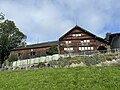
Category:Farmhouse in Urnäsch, Letz 731
Jump to navigation
Jump to search
| Object location | | View all coordinates using: OpenStreetMap |
|---|
 | |||||
| Upload media | |||||
| Instance of | |||||
|---|---|---|---|---|---|
| Part of | |||||
| Location |
| ||||
| Street address |
| ||||
| Heritage designation | |||||
 | |||||
Media in category "Farmhouse in Urnäsch, Letz 731"
The following 2 files are in this category, out of 2 total.
-
 Bauernhaus Letz 731.jpg 4,032 × 3,024; 5.79 MB
-
 Letz 731 Urnäsch.jpg 4,608 × 3,456; 3.29 MB
