Category:Farmhouses in Monmouthshire
Jump to navigation
Jump to search

Subcategories
This category has the following 3 subcategories, out of 3 total.
C
- Castle Farmhouse, Raglan (14 F)
- Church Farmhouse, Llanarth (1 F)
L
- Llwyn-celyn Farmhouse (5 F)
Media in category "Farmhouses in Monmouthshire"
The following 38 files are in this category, out of 38 total.
-
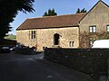
 Blaengavenny Farmouse, Llanvihangel Crucorney.jpg 4,032 × 3,024; 6.01 MB
-
 Church Farm farmhouse (geograph 6906725).jpg 5,179 × 3,451; 4.14 MB
-
 Church Farm Llandenny.jpg 4,522 × 2,975; 2.53 MB
-
 Cwm Farmhouse, Llangattock Lingoed.jpg 4,000 × 3,000; 5.26 MB
-
 Farmhouse at Norton - geograph.org.uk - 2108701.jpg 640 × 480; 86 KB
-
 Little Llwygy Farmhouse - 3374691 - geograph.org.uk.jpg 640 × 480; 61 KB
-
 Little Pool Hall - geograph.org.uk - 168323.jpg 640 × 480; 88 KB
-
 Little Pool Hall.jpg 4,000 × 3,000; 1.48 MB
-
 Lower Treseny Farm, Grosmont - geograph.org.uk - 214218.jpg 640 × 480; 106 KB
-
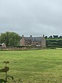
 Manor Farm, Crick.jpg 3,264 × 2,448; 2.49 MB
-
 Newton Court Farm.JPG 4,320 × 3,240; 4.5 MB
-
 Old Trecastle Farm, Pen-Y-Clawdd.jpg 3,264 × 2,448; 944 KB
-
 Pant-glas Farmhouse, Trellech, Monmouthshire (cropped).jpg 1,172 × 878; 213 KB
-
 Pant-glas Farmhouse, Trellech, Monmouthshire.jpg 1,936 × 2,592; 782 KB
-
 Pen-y-Clawdd Farm, Raglan.jpg 3,264 × 2,448; 1.1 MB
-
 Penrhos Farmhouse.jpg 4,000 × 3,000; 1.44 MB
-
 Pentre Farm House - geograph.org.uk - 299361.jpg 640 × 427; 82 KB
-
 Pilstone Farmhouse.jpg 4,000 × 3,000; 1.47 MB
-
 St Fraeds - Skenfrith - geograph.org.uk - 139710.jpg 640 × 480; 166 KB
-
 Tresenny Farmhouse - 3220428 - geograph.org.uk.jpg 640 × 460; 72 KB
-
 Trivor Farmhouse, St Maughans.jpg 4,032 × 3,024; 6.5 MB
-
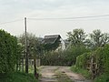
 Ty Draw Caravan site near Usk - geograph.org.uk - 968323.jpg 640 × 480; 87 KB
-
 Ty Uchaf Farmhouse, Llanelly.jpg 3,968 × 2,388; 1.48 MB
-
 Ty-hwnt-y-bwlch, Cwmyoy - 3121849 - geograph.jpg 640 × 480; 90 KB
-
 Upper Clawdd Farmhouse - geograph.org.uk - 364456.jpg 640 × 480; 90 KB
-
 Upper Green, Llantilio Crossenny.jpg 3,024 × 4,032; 5.51 MB
-
 Caerlwyn Mawr Farm - geograph.org.uk - 429503.jpg 640 × 480; 75 KB
-
 Church Farm in festive mode - geograph.org.uk - 300243.jpg 640 × 427; 59 KB
-
 Dyffryn Isaf - geograph.org.uk - 372495.jpg 640 × 480; 76 KB
-
 Farmhouse on Rudry Road - geograph.org.uk - 372535.jpg 640 × 458; 63 KB
-
 Glyn Rhymney - geograph.org.uk - 372496.jpg 640 × 480; 97 KB
-
 Graddfa - geograph.org.uk - 736620.jpg 638 × 475; 75 KB
-
 Lanpil farm house - geograph.org.uk - 345066.jpg 640 × 480; 94 KB
-
 Nant-yr-ych - geograph.org.uk - 212252.jpg 640 × 480; 152 KB
-
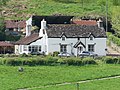
 Ninewells Farm House - geograph.org.uk - 299327.jpg 640 × 427; 95 KB
-
 Pennar Farm, Ton-y-pistyll - geograph.org.uk - 429511.jpg 640 × 455; 53 KB
-
 Pennywan farmhouse - geograph.org.uk - 422224.jpg 640 × 480; 92 KB
-
 Ty Capten Farm - geograph.org.uk - 610828.jpg 640 × 480; 132 KB

.jpg)


.jpg)


