Category:Farms in Wheldrake CP
Jump to navigation
Jump to search
English: Farms in Wheldrake civil parish.
Subcategories
This category has the following 7 subcategories, out of 7 total.
B
- Blackwood Farm, Wheldrake (2 F)
D
- Dodsworth Farm, Wheldrake (5 F)
G
- Gothic House Farm, Wheldrake (6 F)
L
- Low Well Farm, Wheldrake (5 F)
M
W
- Warren House Farm, Wheldrake (5 F)
- Wheldrake Grange (5 F)
Media in category "Farms in Wheldrake CP"
The following 18 files are in this category, out of 18 total.
-
 Brick Farm - geograph.org.uk - 1920833.jpg 640 × 480; 146 KB
-
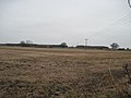
 Broad Highway - geograph.org.uk - 2373927.jpg 3,264 × 2,448; 1.49 MB
-
 Entrance to Link Hall Farm - geograph.org.uk - 4098229.jpg 1,600 × 1,064; 648 KB
-
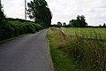
 Farm buildings near Wheldrake - geograph.org.uk - 371432.jpg 640 × 480; 84 KB
-
 Farm entrance near Wheldrake - geograph.org.uk - 6236473.jpg 1,024 × 768; 167 KB
-
 Farm track at Millfield Farm - geograph.org.uk - 5267197.jpg 1,024 × 768; 78 KB
-
 Hardmoor Farm - geograph.org.uk - 2375365.jpg 640 × 427; 256 KB
-
 Link Hall - geograph.org.uk - 2375103.jpg 640 × 427; 280 KB
-
 Orchard Farm near sunset - geograph.org.uk - 5267219.jpg 1,024 × 768; 134 KB
-
 Over fields to Sparrow Hall Farm - geograph.org.uk - 2374028.jpg 3,264 × 2,448; 1.96 MB
-
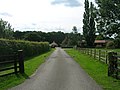
 Road leading to Wigman Hall - geograph.org.uk - 4098238.jpg 1,600 × 1,064; 745 KB
-
 Sign for Wigman Hall on Wheldrake Lane - geograph.org.uk - 4098240.jpg 1,600 × 1,064; 860 KB
-
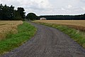
 Track to Haggwood Farm (footpath) - geograph.org.uk - 2561470.jpg 1,600 × 1,200; 520 KB
-
 Track to Noah's Ark Farm - geograph.org.uk - 5314180.jpg 1,024 × 768; 151 KB
-
 Track to Noahs Ark Farm - geograph.org.uk - 100517.jpg 640 × 427; 78 KB
-
 Track to Wheldrake Hall - geograph.org.uk - 1551280.jpg 640 × 480; 39 KB
-
 View towards Orchard Farm - geograph.org.uk - 5267531.jpg 1,024 × 768; 154 KB
-
 Wilberforce Way - geograph.org.uk - 6136663.jpg 1,024 × 683; 455 KB


_-_geograph.org.uk_-_2561470.jpg)


