Category:Farnborough, Hampshire
Jump to navigation
Jump to search
town in Hampshire, England  | |||||
| Upload media | |||||
| Instance of | |||||
|---|---|---|---|---|---|
| Location | Rushmoor, Hampshire, South East England, England | ||||
| Population |
| ||||
| Elevation above sea level |
| ||||
| Different from | |||||
 | |||||
Subcategories
This category has the following 21 subcategories, out of 21 total.
B
- Bus stops in Farnborough (3 F)
C
F
- Farnborough Hill (4 F)
- Farnborough Street (4 F)
- Farnborough Town Hall (2 F)
M
- Maps of Farnborough (6 F)
P
S
Media in category "Farnborough, Hampshire"
The following 89 files are in this category, out of 89 total.
-

-
 Approaching Eelmoor Hill East - geograph.org.uk - 1743151.jpg 2,560 × 1,920; 1.8 MB
-

-
 AutosoloCourses-AM-1&2.pdf 1,754 × 1,239; 37 KB
-
 AutosoloCourses-AM-1&2.svg 781 × 562; 178 KB
-
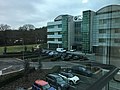 BMW UK campus.jpg 4,032 × 3,024; 2.54 MB
-
 Bridge over A331, to east of Farnborough North train station 01.jpg 4,000 × 3,000; 4.99 MB
-
 Bridge over A331, to east of Farnborough North train station 02.jpg 4,000 × 3,000; 3.72 MB
-
 Bridge over A331, to east of Farnborough North train station 03.jpg 4,000 × 3,000; 4.7 MB
-
 Bridge to Cross Street, Farnborough - geograph.org.uk - 2047423.jpg 480 × 640; 112 KB
-
 Car Park Entrance, Farnborough - geograph.org.uk - 1983066.jpg 1,024 × 681; 270 KB
-
 Car Park, Queen's Parade, Farnborough - geograph.org.uk - 1983064.jpg 1,024 × 681; 184 KB
-
 Car Park, Queen's Parade, Farnborough - geograph.org.uk - 1983074.jpg 1,024 × 681; 151 KB
-
 Car Park, Queen's Parade, Farnborough - geograph.org.uk - 1983080.jpg 1,024 × 681; 140 KB
-
 Car Park, Queen's Parade, Farnborough - geograph.org.uk - 1983084.jpg 1,024 × 681; 155 KB
-
 Car Park, Queen's Parade, Farnborough - geograph.org.uk - 1983087.jpg 1,024 × 681; 153 KB
-
 Car Park, Queen's Parade, Farnborough - geograph.org.uk - 1983090.jpg 1,024 × 681; 164 KB
-
 Claycart Bridge, Basingstoke Canal - geograph.org.uk - 584845.jpg 640 × 524; 165 KB
-
 CMAC;RAMC 838, Keogh Barracks, Ash Vale, nr. Wellcome L0031735.jpg 1,605 × 1,228; 789 KB
-

-
 Collingwood - panoramio.jpg 1,936 × 2,592; 2.12 MB
-
 Cove Brook near West Heath - geograph.org.uk - 576692.jpg 640 × 480; 141 KB
-
 Cross Street, Farnborough - geograph.org.uk - 2045677.jpg 640 × 480; 62 KB
-
 Cross Street, Farnborough - geograph.org.uk - 2045698.jpg 640 × 480; 68 KB
-

-
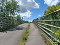
 Cycle path, Farnborough - geograph.org.uk - 2047409.jpg 640 × 480; 143 KB
-
 Eelmoor Bridge, Basingstoke Canal - geograph.org.uk - 584852.jpg 640 × 528; 124 KB
-
 FAC HertfordHouse1.jpg 756 × 504; 137 KB
-
 FAC HertfordHouse2.jpg 756 × 504; 111 KB
-
 FAC HertfordHouse3.jpg 756 × 504; 124 KB
-
 Farnborough Abbey - geograph.org.uk - 759442.jpg 640 × 428; 60 KB
-
 Farnborough Airshow 1952 crash memorial.jpg 2,080 × 4,624; 4.38 MB
-
 Farnborough Gasworks - geograph.org.uk - 2771294.jpg 640 × 430; 52 KB
-
 Farnborough Hill Veterinary Centre - geograph.org.uk - 2761138.jpg 640 × 430; 39 KB
-
 Farnborough Hill, Farnborough - geograph.org.uk - 3380531.jpg 640 × 420; 158 KB
-
 Farnborough Sorting Office - geograph.org.uk - 1895787.jpg 1,925 × 1,441; 982 KB
-
 Farnborough Street, Ornate railings - geograph.org.uk - 1389846.jpg 640 × 480; 100 KB
-
 Farnborough street.jpg 700 × 525; 364 KB
-
 Farnborough swimming pool.jpg 700 × 525; 321 KB
-
 Farnborough weekly market - geograph.org.uk - 799729.jpg 640 × 512; 84 KB
-
 Farnborough, Concept - geograph.org.uk - 1391074.jpg 640 × 480; 95 KB
-
 BP Petrol Station on the southbound A325 - geograph.org.uk - 525753.jpg 446 × 640; 133 KB
-
 Farnborough, Southwood Pavilion - geograph.org.uk - 1392688.jpg 640 × 480; 70 KB
-
 Farnborough, St Michael's Abbey - geograph.org.uk - 1391348.jpg 640 × 480; 84 KB
-
 Farnborough, UK - panoramio.jpg 3,906 × 2,602; 7.82 MB
-
 FarnboroughAerospaceCentre panorama.jpg 1,106 × 458; 388 KB
-
 FarnboroughAerospaceCentre1.jpg 756 × 504; 161 KB
-
 FarnboroughAerospaceCentre2.jpg 756 × 504; 173 KB
-
 FAST Cody Pavilion.JPG 3,726 × 2,603; 4.37 MB
-
 Fernand Cabrol 1903.jpg 1,547 × 1,961; 306 KB
-
 Flats in Farnborough - geograph.org.uk - 101541.jpg 640 × 480; 107 KB
-
 Guildford Road West, Farnborough - geograph.org.uk - 2047416.jpg 640 × 480; 63 KB
-
 Ham and Blackbird roundabout - geograph.org.uk - 3330637.jpg 640 × 427; 161 KB
-

-
 Ham ^ Blackbird - side view - geograph.org.uk - 3693436.jpg 640 × 483; 81 KB
-
 Historic temporary balloon shed frames - geograph.org.uk - 1554333.jpg 640 × 587; 143 KB
-
 Holiday Inn Farnborough.jpg 4,032 × 3,024; 4.7 MB
-
 Kingsmead 2.jpg 700 × 525; 395 KB
-
 Kingsmeadfarn.jpg 700 × 525; 309 KB
-
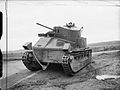
 Medium Tank A7E1.jpg 928 × 664; 118 KB
-
 Mobile homes - geograph.org.uk - 524792.jpg 640 × 412; 105 KB
-

-
 OYBike 2.jpg 2,048 × 1,536; 1.04 MB
-
 Princes Mead Biplane (front).jpg 4,031 × 2,535; 2.95 MB
-
 Princes Mead Biplane (rear).jpg 4,032 × 3,024; 3.72 MB
-
 Princes Mead Shopping Mall, Farnborough - geograph.org.uk - 1232786.jpg 640 × 480; 105 KB
-
 Queen Elizabeth Park - geograph.org.uk - 760209.jpg 640 × 529; 160 KB
-
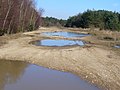
 Ravine Head - geograph.org.uk - 1743127.jpg 2,560 × 1,920; 1.76 MB
-
 Ravine Head, Eelmoor - geograph.org.uk - 1743140.jpg 2,560 × 1,920; 1.77 MB
-
 Reading Road, Farnborough - geograph.org.uk - 2047391.jpg 640 × 480; 126 KB
-
 Reading Road, Farnborough - geograph.org.uk - 2047400.jpg 640 × 480; 100 KB
-
 Rushmoor fire station - geograph.org.uk - 279907.jpg 640 × 427; 190 KB
-
 Stagecoach Hants & Surrey Goldline launch 2.JPG 3,328 × 1,872; 2.07 MB
-
 Stagecoach Hants & Surrey Goldline launch 3.JPG 3,328 × 1,872; 1.67 MB
-
 Stagecoach Hants & Surrey Goldline launch.JPG 3,328 × 1,872; 1.98 MB
-
 The British Army in the United Kingdom 1939-45 H10006.jpg 800 × 800; 58 KB
-
 The British Army in the United Kingdom 1939-45 H1138.jpg 800 × 600; 87 KB
-
 The British Army in the United Kingdom 1939-45 H1141.jpg 800 × 598; 70 KB
-
 The British Army in the United Kingdom 1939-45 H1148.jpg 800 × 601; 63 KB
-
 The British Army in the United Kingdom 1939-45 H1149.jpg 800 × 601; 73 KB
-

-

-
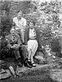 The Grubb Family (9618237215).jpg 1,519 × 2,000; 2.01 MB
-
 Third Round. First knockdown for 'The Boy.' NYIN 1860.jpg 868 × 396; 163 KB
-
 Woburn Avenue, Farnborough - geograph.org.uk - 3596508.jpg 2,006 × 1,504; 1.07 MB
-
 Cromwell Way - geograph.org.uk - 554594.jpg 640 × 631; 212 KB
-
 Farnborough - geograph.org.uk - 3841.jpg 640 × 427; 37 KB
-
 Farnborough Gate Retail Park - geograph.org.uk - 510906.jpg 640 × 544; 159 KB
-
 Farnborough Gate Retail Park - geograph.org.uk - 637204.jpg 492 × 640; 84 KB


,_281_Farnborough_Road,_Farnborough_-_geograph.org.uk_-_2017113.jpg)


.jpg)

.jpg)
.jpg)


.jpg)


