Category:Farumruten
Jump to navigation
Jump to search
bicycle highway from Farum to Kongens Nytorv in Denmark  | |||||
| Upload media | |||||
| Instance of | |||||
|---|---|---|---|---|---|
| Part of | |||||
| Named after | |||||
| Location | |||||
| Inception |
| ||||
| Length |
| ||||
| Terminus | |||||
| official website | |||||
| |||||
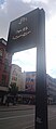
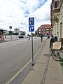
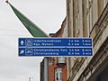
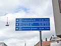
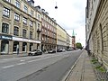
C95 Farumruten is a super bikeway between Farum and Kongens Nytorv in Copenhagen. The first part between Farum and Bellahøj was opened in April 2013 and the rest in May 2017.
Media in category "Farumruten"
The following 34 files are in this category, out of 34 total.
-
 Biɕcycle information system Copenhagen 01.jpg 877 × 2,000; 621 KB
-
 Biɕcycle information system Copenhagen 02.jpg 1,550 × 2,000; 912 KB
-
 Biɕcycle information system Copenhagen 03.jpg 1,005 × 2,000; 500 KB
-
 C95 Farumruten at Bellahøj.jpg 1,944 × 2,592; 2.62 MB
-
 C95 Farumruten on Gothersgade.jpg 2,560 × 1,920; 2.13 MB
-
 C97 Frederikssundruten at Bellahøj 02.jpg 2,592 × 1,944; 2.82 MB
-
 Directional road sign for cyclists on Gothersgade 01.jpg 2,560 × 1,920; 2.01 MB
-
 Directional road sign for cyclists on Gothersgade 02.jpg 2,560 × 1,920; 1.71 MB
-
 Directional road signs for cyclists at Bellahøj 01.jpg 1,944 × 2,592; 2.63 MB
-
 Directional road signs for cyclists at Bellahøj 02.jpg 2,592 × 1,944; 2.3 MB
-
 Directional road signs for cyclists at Bellahøj 03.jpg 1,944 × 2,592; 2.31 MB
-
 Directional road signs for cyclists at Bellahøj 04.jpg 2,592 × 1,944; 1.79 MB
-
 Directional road signs for cyclists at Nørrebros Runddel 01.jpg 1,944 × 2,592; 2.21 MB
-
 Directional road signs for cyclists at Nørrebros Runddel 02.jpg 2,592 × 1,944; 1,014 KB
-
 Directional road signs for cyclists at Nørrebros Runddel 05.jpg 1,944 × 2,592; 2.21 MB
-
 Directional road signs for cyclists at Nørrebros Runddel 06.jpg 2,592 × 1,944; 1.71 MB
-
 Directional road signs for cyclists at Søtorvet 01.jpg 1,944 × 2,592; 2.27 MB
-
 Directional road signs for cyclists at Søtorvet 02.jpg 2,592 × 1,944; 1.64 MB
-
 Directional road signs for cyclists at Søtorvet 03.jpg 1,868 × 2,536; 2.11 MB
-
 Directional road signs for cyclists at Søtorvet 04.jpg 2,592 × 1,944; 1.72 MB
-
 Directional road signs for cyclists at Søtorvet 07.jpg 1,870 × 2,538; 2.46 MB
-
 Directional road signs for cyclists at Søtorvet 08.jpg 2,592 × 1,944; 2.69 MB
-
 Directional road signs for cyclists at Søtorvet 09.jpg 1,944 × 2,592; 2.66 MB
-
 Directional road signs for cyclists at Søtorvet 10.jpg 2,592 × 1,944; 2.15 MB
-
 Directional road signs for cyclists on Nørrebrogade 01.jpg 1,944 × 2,592; 2.3 MB
-
 Directional road signs for cyclists on Nørrebrogade 02.jpg 2,592 × 1,944; 1.39 MB
-
 Farumruten Supercykelsti.jpg 3,454 × 1,939; 682 KB
-
 Gothersgade 01.jpg 2,592 × 1,944; 2.42 MB
-
 Gothersgade Copenhagen.jpg 6,000 × 4,000; 2.28 MB
-
 Gothersgade ved Adelgade.jpg 6,000 × 4,000; 3.45 MB
-
 Movia bus line 350S on Dronning Louises Bro.jpg 2,560 × 1,920; 2.68 MB
-
 Movia bus line 350S on Nørrebrogade 01.jpg 2,560 × 1,920; 2.97 MB
-
 Movia bus line 5C on Nørrebrogade.jpg 2,560 × 1,920; 2.87 MB
-
 Nørrebro street.jpg 3,020 × 4,027; 2.05 MB


