Category:February 2006 in County Antrim
Jump to navigation
Jump to search
English: Images taken in County Antrim, Northern Ireland in this month of 2006 (not the date of the upload).
| Jan | Feb | Mar | Apr | May | Jun | Jul | Aug | Sep | Oct | Nov | Dec | ||
| ← | 38 | 48 | 10 | 35 | 37 | 24 | 53 | 216 | 56 | 18 | 18 | 25 | → |
|---|
Media in category "February 2006 in County Antrim"
The following 48 files are in this category, out of 48 total.
-
 Abandoned Cottage - geograph.org.uk - 126929.jpg 640 × 480; 105 KB
-
 Abandoned Farm - geograph.org.uk - 118739.jpg 640 × 480; 90 KB
-
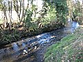 Ballinderry River - geograph.org.uk - 125589.jpg 640 × 480; 167 KB
-
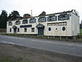
 Ballyhill Orange Hall - geograph.org.uk - 118783.jpg 640 × 480; 69 KB
-
 Ballyminymore Road - geograph.org.uk - 116073.jpg 640 × 480; 67 KB
-
 Ballyminymore Road - geograph.org.uk - 116075.jpg 640 × 480; 144 KB
-
 Beechers - geograph.org.uk - 115763.jpg 640 × 480; 90 KB
-
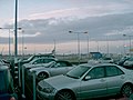
 Belfast Airport - geograph.org.uk - 119151.jpg 640 × 480; 37 KB
-
 Belfast International Airport - geograph.org.uk - 119152.jpg 640 × 480; 35 KB
-
 Belfast International Airport - geograph.org.uk - 119464.jpg 640 × 480; 89 KB
-
 Belfast International Airport - geograph.org.uk - 119473.jpg 640 × 480; 100 KB
-
 Black Mountain Transmitter Mast. - geograph.org.uk - 228410.jpg 640 × 480; 26 KB
-
 Brookhall Historical Farm (detail) - geograph.org.uk - 125576.jpg 640 × 480; 85 KB
-
 Bungalow with Conifers - geograph.org.uk - 118834.jpg 640 × 480; 83 KB
-
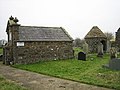 Carmavy Graveyard - geograph.org.uk - 115759.jpg 640 × 480; 96 KB
-
 Cottage - geograph.org.uk - 118837.jpg 640 × 480; 90 KB
-
 Countryside near Glenavy - geograph.org.uk - 119368.jpg 640 × 480; 33 KB
-
 Crumlin River - geograph.org.uk - 118854.jpg 640 × 480; 162 KB
-
 Crumlin River - geograph.org.uk - 126898.jpg 640 × 480; 146 KB
-
 Derelict Cottage - geograph.org.uk - 129070.jpg 640 × 480; 139 KB
-
 Diamond Orange Hall - geograph.org.uk - 126909.jpg 640 × 480; 104 KB
-
 Disused Outbuilding - geograph.org.uk - 125510.jpg 640 × 480; 120 KB
-
 Farmhouse and outbuildings - geograph.org.uk - 126912.jpg 640 × 480; 48 KB
-
 Farmstead - geograph.org.uk - 125718.jpg 640 × 480; 112 KB
-
 Fields near the airport - geograph.org.uk - 119384.jpg 640 × 480; 38 KB
-
 Flatfield House - geograph.org.uk - 122821.jpg 640 × 480; 68 KB
-
 Gate - geograph.org.uk - 125615.jpg 640 × 480; 93 KB
-
 Gateway - geograph.org.uk - 115754.jpg 640 × 480; 95 KB
-
 Houses near A26 - geograph.org.uk - 119366.jpg 640 × 480; 43 KB
-
 Keeping an eye on the livestock - geograph.org.uk - 116074.jpg 640 × 480; 108 KB
-
 Killead Presbyterian Church - geograph.org.uk - 115749.jpg 640 × 480; 94 KB
-
 Kilmore Orange Hall - geograph.org.uk - 129068.jpg 640 × 480; 96 KB
-
 Knockmore Junction to Antrim Railway Line - geograph.org.uk - 125584.jpg 640 × 480; 137 KB
-
 Lough Neagh - geograph.org.uk - 126920.jpg 640 × 480; 106 KB
-
 Newtownabbey.jpg 2,048 × 1,536; 852 KB
-
 NGW Complex - Divis Mountain - geograph.org.uk - 231765.jpg 640 × 480; 43 KB
-
 Outbuilding with Bell - geograph.org.uk - 126905.jpg 640 × 480; 65 KB
-
 Outbuildings - geograph.org.uk - 126932.jpg 640 × 480; 84 KB
-
 Railway Bridge - geograph.org.uk - 122811.jpg 640 × 480; 112 KB
-
 Rural Stream - geograph.org.uk - 129084.jpg 640 × 480; 148 KB
-
 Sand Extraction - geograph.org.uk - 126971.jpg 640 × 480; 58 KB
-
-
 St Joseph's Magheragall - geograph.org.uk - 125504.jpg 640 × 480; 75 KB
-
 St Patrick's Church, Aghagallon - geograph.org.uk - 125695.jpg 480 × 640; 68 KB
-
 Sylvan Scene - geograph.org.uk - 116070.jpg 640 × 480; 165 KB
-
 The "Katie Hannan" at Portrush - geograph.org.uk - 1058131.jpg 640 × 383; 82 KB
-
 The Coast Road - geograph.org.uk - 357189.jpg 640 × 426; 95 KB
-
 The Dublin Line - geograph.org.uk - 129058.jpg 640 × 480; 71 KB


_-_geograph.org.uk_-_125576.jpg)


_Killead_-_geograph.org.uk_-_115746.jpg)


