Category:February 2006 in Kent
Jump to navigation
Jump to search
Ceremonial counties of England: Berkshire · Buckinghamshire · Cambridgeshire · Cheshire · Cornwall · Cumbria · Derbyshire · Devon · Dorset · Durham · East Riding of Yorkshire · East Sussex · Essex · Gloucestershire · Greater London · Greater Manchester · Hampshire · Herefordshire · Hertfordshire · Isle of Wight · Kent · Lancashire · Leicestershire · Lincolnshire · Merseyside · Norfolk · North Yorkshire · Northamptonshire · Northumberland · Nottinghamshire · Oxfordshire · Rutland · Shropshire · Somerset · South Yorkshire · Staffordshire · Suffolk · Surrey · Tyne and Wear · Warwickshire · West Midlands · West Sussex · West Yorkshire · Wiltshire · Worcestershire
City-counties: Bristol ·
Former historic counties:
Other former counties:
City-counties: Bristol ·
Former historic counties:
Other former counties:
Deutsch: Bilder, die im Februar 2006 in Kent aufgenommen worden sind. Bitte beachten Sie, dass dies weder das Datum des Uploads noch das Datum des Scannens eines Fotos ist.
English: Images/pictures taken in Kent during February 2006. Note this is not the date of the upload, nor the date a photo was scanned.
Español: Fotografías o imágenes tomadas en Kent durante febrero 2006. No es la fecha de subida ni escaneo, sino la fecha en que las fotografías o imágenes se crearon.
Esperanto: Bildoj faritaj en Kent en februaro 2006. Tio ne estas la dato, kiam la bildoj estis alŝutitaj aŭ skanitaj.
Français : Photographies ou images prises en Kent durant février 2006. Ce n'est pas la date du téléchargement ou du scan.
Galego: Fotografías ou imaxes tomadas en Kent durante febreiro 2006. Non é a data de subida nin escaneamento, senón a data na que se crearon as fotografías ou imaxes.
Italiano: Fotografie o immagini scattate a Kent nel febbraio 2006. Nota bene: la data non si riferisce né a quella di upload né a quella in cui la foto è stata digitalizzata.
Norsk bokmål: Bilder tatt i Kent i løpet av februar 2006. Merk at dette ikke er datoen for opplasting, eller når et bilde har blitt skannet.
Norsk nynorsk: Bilete teke i Kent i løpet av februar 2006. Merk at dette ikkje er datoen for opplasting, eller når eit bilete har vorte skanna.
Русский: Изображения, сделанные в Kent в течение февраль 2006 (не дата загрузки изображения).
Українська: Зображення, зроблені в Kent протягом лютий 2006. Зауважте, що це не дата завантаження чи дата сканування фотографії.
| February 2005 | ← | February 2006 | → | February 2007 | |||||||
| Jan | Feb | Mar | Apr | May | Jun | Jul | Aug | Sep | Oct | Nov | Dec |
| 39 | 30 | 25 | 49 | 28 | 70 | 103 | 44 | 32 | 43 | 12 | 17 |
|---|---|---|---|---|---|---|---|---|---|---|---|
Media in category "February 2006 in Kent"
The following 30 files are in this category, out of 30 total.
-
 Agricultural Equipment, Lower Hartlip - geograph.org.uk - 122836.jpg 640 × 480; 97 KB
-
 Beltring Road, near Beltring Station - geograph.org.uk - 123415.jpg 640 × 480; 180 KB
-
 Carving on newel post, Eastwell Manor - geograph.org.uk - 129104.jpg 497 × 640; 108 KB
-
 Claremont Primary School - geograph.org.uk - 121131.jpg 640 × 480; 165 KB
-
 Cleared plot on Lower Hartlip Road - geograph.org.uk - 122845.jpg 640 × 480; 157 KB
-
 Cricket nets, Upchurch - geograph.org.uk - 122868.jpg 640 × 480; 117 KB
-
 Duck pond at the Garden Centre - geograph.org.uk - 122663.jpg 640 × 480; 111 KB
-
 Footpath at Scotts Hill, Lower Hartlip - geograph.org.uk - 122831.jpg 480 × 640; 159 KB
-
 Holcombe2.png 1,280 × 960; 1.81 MB
-
 Housing on Lower Hartlip Road - geograph.org.uk - 122850.jpg 640 × 480; 114 KB
-
 Little Budds Farm - geograph.org.uk - 123416.jpg 640 × 480; 121 KB
-
 M2 motorway between Stockbury and Hartlip - geograph.org.uk - 122829.jpg 640 × 480; 110 KB
-
 M2 viaduct over Mount Lane, Hartlip - geograph.org.uk - 122841.jpg 640 × 464; 119 KB
-
 Margate beach - geograph.org.uk - 138237.jpg 640 × 480; 90 KB
-
 PaddockWoodRailwayStation.jpg 640 × 480; 169 KB
-
 Paradise Farm, Lower Hartlip - geograph.org.uk - 122660.jpg 640 × 480; 115 KB
-
 Pembury Hospital (part of) - geograph.org.uk - 123866.jpg 640 × 480; 114 KB
-
 Railway line through the woods - geograph.org.uk - 123891.jpg 640 × 480; 206 KB
-
 Railway near Martin - geograph.org.uk - 124450.jpg 640 × 480; 94 KB
-
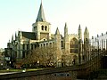 Rochester Cathedral, Kent - geograph.org.uk - 119940.jpg 640 × 480; 80 KB
-
 Southfields, School playing fields - geograph.org.uk - 121917.jpg 640 × 480; 163 KB
-
 St John's Recreation Ground - geograph.org.uk - 1518363.jpg 406 × 640; 68 KB
-
 St Mary Church, Laddingford - geograph.org.uk - 123426.jpg 640 × 480; 167 KB
-
 Sweepstakes Farm, Hartlip - geograph.org.uk - 122274.jpg 640 × 480; 116 KB
-
 The Rose and Crown, Lower Hartlip - geograph.org.uk - 122842.jpg 640 × 480; 104 KB
-
 The Tuck Inn - geograph.org.uk - 122852.jpg 640 × 480; 108 KB
-

-
 West Pikefish Farm - geograph.org.uk - 123424.jpg 640 × 480; 130 KB
-
 Callows House near Ham Green - geograph.org.uk - 122684.jpg 640 × 480; 93 KB
-
 Village Green, East Langdon - geograph.org.uk - 124443.jpg 640 × 387; 53 KB


_-_geograph.org.uk_-_123866.jpg)


