Category:February 2010 in Scotland
Jump to navigation
Jump to search
Deutsch: Bilder, die im Februar 2010 in Scotland aufgenommen worden sind. Bitte beachten Sie, dass dies weder das Datum des Uploads noch das Datum des Scannens eines Fotos ist.
English: Images/pictures taken in Scotland during February 2010. Note this is not the date of the upload, nor the date a photo was scanned.
Español: Fotografías o imágenes tomadas en Scotland durante febrero 2010. No es la fecha de subida ni escaneo, sino la fecha en que las fotografías o imágenes se crearon.
Esperanto: Bildoj faritaj en Scotland en februaro 2010. Tio ne estas la dato, kiam la bildoj estis alŝutitaj aŭ skanitaj.
Français : Photographies ou images prises en Scotland durant février 2010. Ce n'est pas la date du téléchargement ou du scan.
Galego: Fotografías ou imaxes tomadas en Scotland durante febreiro 2010. Non é a data de subida nin escaneamento, senón a data na que se crearon as fotografías ou imaxes.
Italiano: Fotografie o immagini scattate a Scotland nel febbraio 2010. Nota bene: la data non si riferisce né a quella di upload né a quella in cui la foto è stata digitalizzata.
Norsk bokmål: Bilder tatt i Scotland i løpet av februar 2010. Merk at dette ikke er datoen for opplasting, eller når et bilde har blitt skannet.
Norsk nynorsk: Bilete teke i Scotland i løpet av februar 2010. Merk at dette ikkje er datoen for opplasting, eller når eit bilete har vorte skanna.
Русский: Изображения, сделанные в Scotland в течение февраль 2010 (не дата загрузки изображения).
Українська: Зображення, зроблені в Scotland протягом лютий 2010. Зауважте, що це не дата завантаження чи дата сканування фотографії.
| February 2009 | ← | February 2010 | → | February 2011 | |||||||
| Jan | Feb | Mar | Apr | May | Jun | Jul | Aug | Sep | Oct | Nov | Dec |
| 22 | 69 | 28 | 67 | 40 | 63 | 45 | 42 | 25 | 16 | 74 | 25 |
|---|---|---|---|---|---|---|---|---|---|---|---|
Subcategories
This category has the following 4 subcategories, out of 4 total.
Media in category "February 2010 in Scotland"
The following 65 files are in this category, out of 65 total.
-
 A dead elm tree on Skelston Moor - geograph.org.uk - 1725919.jpg 427 × 640; 153 KB
-
 A Rather Sodden Market Muir, Forfar - geograph.org.uk - 1728133.jpg 640 × 426; 52 KB
-
 Along the bay - geograph.org.uk - 1721536.jpg 640 × 428; 54 KB
-
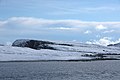
 Balta from Swinna Ness - geograph.org.uk - 1723369.jpg 800 × 533; 87 KB
-
 Balta from the end of Swinna Ness - geograph.org.uk - 1723629.jpg 800 × 533; 74 KB
-
 Barn near Newton - geograph.org.uk - 1722927.jpg 640 × 427; 219 KB
-
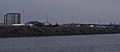 Boats by the Clyde - geograph.org.uk - 1706720.jpg 640 × 277; 65 KB
-
 Boats by the Clyde - geograph.org.uk - 1706727.jpg 640 × 318; 82 KB
-

-
 Chicken jambalaya - 2010.jpg 3,264 × 2,448; 3.8 MB
-
 Christmas Tree Nursery - geograph.org.uk - 1719460.jpg 640 × 427; 258 KB
-
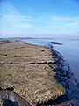
 Coastline at Cumlewick Ness - geograph.org.uk - 1702551.jpg 800 × 534; 157 KB
-
 Colvend Copper Mine - geograph.org.uk - 1716665.jpg 768 × 1,024; 345 KB
-
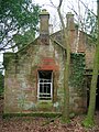
 Cottages near East Mains - geograph.org.uk - 1718136.jpg 640 × 427; 264 KB
-
 Craigengar - geograph.org.uk - 1691824.jpg 640 × 480; 105 KB
-
 Crosswood Burn - geograph.org.uk - 1691829.jpg 640 × 359; 78 KB
-
 Crosswood Burn - geograph.org.uk - 1713117.jpg 640 × 480; 100 KB
-
 Crosswood Burn - geograph.org.uk - 1713162.jpg 640 × 359; 98 KB
-
 Dalmore House, kitchens and servants areas, Stair.JPG 2,288 × 1,712; 1.4 MB
-
 Dead Trees, Glasgow Airport - geograph.org.uk - 1701616.jpg 3,478 × 2,214; 2.17 MB
-
 Defunct post boxes, Crosswoodburn - geograph.org.uk - 1714563.jpg 640 × 480; 102 KB
-

-
 East High Street, Forfar - geograph.org.uk - 1728108.jpg 640 × 426; 60 KB
-

-

-
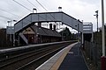
 Footbridge of Old Kilpatrick Station - geograph.org.uk - 1701528.jpg 640 × 480; 150 KB
-
 Footbridge over the Cowie Water - geograph.org.uk - 1724621.jpg 665 × 378; 113 KB
-
 Former railway bridge - geograph.org.uk - 1707138.jpg 640 × 429; 199 KB
-
 Fort Matilda railway station - geograph.org.uk - 1702445.jpg 640 × 429; 129 KB
-
 Herring Gull (Larus argentatus), Lerwick - geograph.org.uk - 1705310.jpg 800 × 533; 129 KB
-
 Kidsneuk old railway bridge, Irvine.JPG 2,288 × 1,712; 1.15 MB
-

-
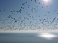 Large flock of Barnacle Geese off Colvend Coast - geograph.org.uk - 1716892.jpg 1,024 × 768; 121 KB
-
 Linlithgow Loch cold and bleak - geograph.org.uk - 1706159.jpg 640 × 449; 43 KB
-
 Little Causeway, Forfar - geograph.org.uk - 1702213.jpg 640 × 428; 60 KB
-
 Loch Ionadagro Dam - geograph.org.uk - 1717084.jpg 640 × 480; 223 KB
-
 Millbrae, Baltasound, in the snow - geograph.org.uk - 1691712.jpg 800 × 533; 115 KB
-
 North Street, Forfar - geograph.org.uk - 1728114.jpg 640 × 427; 52 KB
-
 Old railway cutting - geograph.org.uk - 1702379.jpg 1,024 × 768; 847 KB
-
 Old railway embankment - geograph.org.uk - 1707104.jpg 640 × 429; 132 KB
-
 Patchwork at Glensaugh Research Station - geograph.org.uk - 1704061.jpg 640 × 425; 120 KB
-
 Pig Farming at Lower Broadrashes - geograph.org.uk - 1721522.jpg 640 × 427; 255 KB
-
 Post Box in Station Road, Forfar - geograph.org.uk - 1725488.jpg 640 × 428; 85 KB
-
 Prior Road, Forfar - geograph.org.uk - 1725379.jpg 640 × 427; 53 KB
-

-
 Queen Street, Forfar - geograph.org.uk - 1725357.jpg 640 × 427; 54 KB
-
 Railway Bridge near Carmyle (geograph 1697931).jpg 1,024 × 768; 248 KB
-

-
 River Spean - geograph.org.uk - 1703181.jpg 640 × 480; 93 KB
-
 Saltmarsh On South Bank Of Forth - geograph.org.uk - 1717119.jpg 480 × 640; 73 KB
-
 Servants quarters, Dalmore House, Stair.JPG 1,712 × 2,288; 1.31 MB
-
 Smiley face at Banchory - geograph.org.uk - 1730306.jpg 1,024 × 768; 106 KB
-

-

-
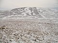
 Summit of Mealowther - geograph.org.uk - 1691810.jpg 640 × 359; 69 KB
-
 Summit of Mealowther - geograph.org.uk - 1691815.jpg 640 × 359; 68 KB
-
 The Burnett Arms Hotel - geograph.org.uk - 1730303.jpg 1,024 × 768; 103 KB
-
 The Douglas Arms, Banchory - geograph.org.uk - 1730300.jpg 1,024 × 768; 116 KB
-
 The Howgate - geograph.org.uk - 1723864.jpg 640 × 480; 129 KB
-
 The Howgate - geograph.org.uk - 1723866.jpg 640 × 480; 105 KB
-
 The source of the Water of Leith - geograph.org.uk - 1691796.jpg 640 × 359; 43 KB
-
 View of Osnaburg Street, Forfar - geograph.org.uk - 1702189.jpg 640 × 427; 55 KB
-
 West High Street, Forfar - geograph.org.uk - 1728101.jpg 640 × 427; 70 KB
-
 Wreck "Dunoon" - geograph.org.uk - 1742855.jpg 640 × 639; 114 KB
-
 Wyllie Street, Forfar - geograph.org.uk - 1725387.jpg 640 × 427; 62 KB


,_Lerwick_-_geograph.org.uk_-_1705310.jpg)


.jpg)


