Category:February 2022 in York
Jump to navigation
Jump to search
Deutsch: Bilder, die im Februar 2022 in York aufgenommen worden sind. Bitte beachten Sie, dass dies weder das Datum des Uploads noch das Datum des Scannens eines Fotos ist.
English: Images/pictures taken in York during February 2022. Note this is not the date of the upload, nor the date a photo was scanned.
Español: Fotografías o imágenes tomadas en York durante febrero 2022. No es la fecha de subida ni escaneo, sino la fecha en que las fotografías o imágenes se crearon.
Esperanto: Bildoj faritaj en York en februaro 2022. Tio ne estas la dato, kiam la bildoj estis alŝutitaj aŭ skanitaj.
Français : Photographies ou images prises en York durant février 2022. Ce n'est pas la date du téléchargement ou du scan.
Galego: Fotografías ou imaxes tomadas en York durante febreiro 2022. Non é a data de subida nin escaneamento, senón a data na que se crearon as fotografías ou imaxes.
Italiano: Fotografie o immagini scattate a York nel febbraio 2022. Nota bene: la data non si riferisce né a quella di upload né a quella in cui la foto è stata digitalizzata.
Norsk bokmål: Bilder tatt i York i løpet av februar 2022. Merk at dette ikke er datoen for opplasting, eller når et bilde har blitt skannet.
Norsk nynorsk: Bilete teke i York i løpet av februar 2022. Merk at dette ikkje er datoen for opplasting, eller når eit bilete har vorte skanna.
Русский: Изображения, сделанные в York в течение февраль 2022 (не дата загрузки изображения).
Українська: Зображення, зроблені в York протягом лютий 2022. Зауважте, що це не дата завантаження чи дата сканування фотографії.
| February 2021 | ← | February 2022 | → | February 2023 | |||||||
| Jan | Feb | Mar | Apr | May | Jun | Jul | Aug | Sep | Oct | Nov | Dec |
| 94 | 43 | 68 | 41 | 75 | 36 | 127 | 22 | 16 | 31 | 11 | 15 |
|---|---|---|---|---|---|---|---|---|---|---|---|
Subcategories
This category has only the following subcategory.
F
- February 2022 floods in York (17 F)
Media in category "February 2022 in York"
The following 42 files are in this category, out of 42 total.
-
 1 3 & 5 Piccadilly York.jpg 3,319 × 2,489; 2.43 MB
-
 1 to 5 South Esplanade York 01.jpg 4,354 × 3,264; 4.67 MB
-
 10 Pavement York 01.jpg 3,212 × 4,284; 3.14 MB
-
 10 Pavement York 02.jpg 2,873 × 3,830; 2.58 MB
-
 10 Pavement York 03.jpg 3,275 × 4,368; 2.75 MB
-
 2-10 Clifford Street York 01.jpg 4,608 × 3,456; 5.52 MB
-
 2-10 Clifford Street York 02.jpg 4,356 × 3,267; 3.1 MB
-
 2-10 Clifford Street York 03.jpg 4,345 × 3,259; 4.44 MB
-
 2-10 Clifford Street York.jpg 4,124 × 3,093; 3.62 MB
-
 24 Pavement York Feb 22.jpg 3,456 × 4,608; 4.48 MB
-
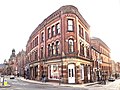
 26 and 27 High Ousegate York 01.jpg 4,608 × 3,455; 4.06 MB
-
 26 and 27 High Ousegate York 02.jpg 2,592 × 3,456; 2.42 MB
-
 26 and 27 High Ousegate York 03.jpg 2,586 × 3,448; 2.42 MB
-
 26 and 28 Pavement York Feb 22.jpg 4,608 × 3,456; 3.87 MB
-
 Baile Hill York 01.jpg 4,608 × 3,456; 9.63 MB
-
 Chungking Hotpot York.jpg 4,608 × 3,456; 5.46 MB
-
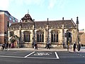
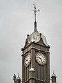 Clock tower York Magistrates Court.jpg 3,286 × 4,382; 1.85 MB
-
 Cumberland House York 10 Feb 22.jpg 4,070 × 3,052; 3.56 MB
-
 Cumberland House York 10 Feb 23.jpg 3,846 × 2,885; 3.83 MB
-
 Farewell to the Rt Revd Alison White (51904621330).jpg 3,456 × 2,304; 1.71 MB
-
 Former Trinity Chapel Peckitt Street York 01.jpg 4,173 × 3,130; 4.29 MB
-
 Former Trinity Chapel Peckitt Street York 02.jpg 4,608 × 3,456; 5.76 MB
-
 Former Trinity Chapel Peckitt Street York 03.jpg 2,445 × 3,260; 2.4 MB
-
 Former Trinity Chapel Peckitt Street York 04.jpg 3,217 × 2,413; 2.44 MB
-
 Former Trinity Chapel Peckitt Street York 05.jpg 4,064 × 3,048; 3.57 MB
-
 Friargate House Castlegate York 04.jpg 3,288 × 3,288; 3.48 MB
-
 Friargate House Castlegate York 05.jpg 4,608 × 3,456; 5.83 MB
-
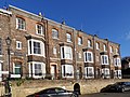
 Friars Terrace York.jpg 4,338 × 3,254; 4.56 MB
-
 Front entrance York Magistrates Court 02.jpg 3,456 × 4,608; 6.06 MB
-
 Gable apex at 12 Clifford Street York.jpg 4,608 × 3,456; 3.28 MB
-
 Grand Opera House, York Feb 2022 01.jpg 4,608 × 3,456; 9.32 MB
-
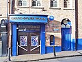 Grand Opera House, York Feb 2022 02.jpg 4,417 × 3,312; 3.81 MB
-
 Magistrates Court York 01.jpg 4,608 × 3,456; 3.16 MB
-
 Magistrates Court York 02.jpg 4,608 × 3,456; 3.13 MB
-
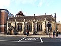 St John's Church Micklegate York 01.jpg 4,288 × 3,216; 3.64 MB
-
 St John's Church Micklegate York 02.jpg 4,256 × 3,192; 3.82 MB
-
 Terrace houses in Peckitt Street York 01.jpg 4,608 × 3,456; 5.25 MB
-
 Terrace houses in Peckitt Street York 02.jpg 4,608 × 3,456; 4.64 MB
-
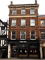
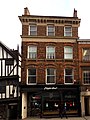
 Weird Fish Stonegate York.jpg 2,532 × 1,899; 1.16 MB
-
 York Dungeon entrance.jpg 1,664 × 2,219; 1.28 MB
-
 York Gin shop Pavement York 01.jpg 4,608 × 3,456; 4.43 MB
-
 York St. John from the walls (geograph 7106770).jpg 1,024 × 683; 360 KB


.jpg)


.jpg)