Category:Feniscowles
Jump to navigation
Jump to search
English: Feniscowles is a village in the unitary authority of Blackburn with Darwen, Lancashire, England. It is situated approximately west of Blackburn. Part of the village is in the civil parish of Livesey. (→Feniscowles)
Polski: Feniscowles – wieś w Anglii, w hrabstwie ceremonialnym Lancashire, w dystrykcie (unitary authority) Blackburn with Darwen. Leży 36 km na północny zachód od miasta Manchester i 296 km na północny zachód od Londynu. (→Feniscowles)
village in the United Kingdom .jpg) | |||||
| Upload media | |||||
| Instance of | |||||
|---|---|---|---|---|---|
| Location | Livesey, Blackburn with Darwen, Lancashire, North West England, England | ||||
 | |||||
Subcategories
This category has the following 2 subcategories, out of 2 total.
I
Media in category "Feniscowles"
The following 30 files are in this category, out of 30 total.
-
 Eileen's Corner Shop - geograph.org.uk - 399613.jpg 640 × 416; 277 KB
-
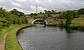
 Feniscowles Bridge - geograph.org.uk - 399514.jpg 640 × 426; 348 KB
-
 Feniscowles Cricket Club - Clubhouse (geograph 2473262).jpg 1,600 × 1,200; 306 KB
-
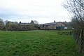
 Hordens, Livesey Branch Road, Blackburn - geograph.org.uk - 990745.jpg 602 × 450; 142 KB
-
 Leeds And Liverpool Canal - geograph.org.uk - 158196.jpg 640 × 480; 130 KB
-
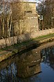
 Livesey Hall Bridge - geograph.org.uk - 399603.jpg 640 × 426; 387 KB
-
 Lower Stockclough - geograph.org.uk - 162976.jpg 640 × 427; 119 KB
-
 M65 crossing Stanworth Valley - geograph.org.uk - 399503.jpg 640 × 372; 343 KB
-
 Millfield Bridge - geograph.org.uk - 484166.jpg 640 × 383; 270 KB
-
 Nature takes over - geograph.org.uk - 484198.jpg 426 × 640; 476 KB
-
 Not so new now - geograph.org.uk - 399545.jpg 640 × 499; 448 KB
-
 The Sun's down, but the Star still shines - geograph.org.uk - 399575.jpg 640 × 487; 347 KB
-
 Under Repair - geograph.org.uk - 1161787.jpg 640 × 480; 100 KB
-
 Water column - geograph.org.uk - 399513.jpg 424 × 640; 330 KB
-
 An uneasy ride - geograph.org.uk - 484164.jpg 640 × 386; 262 KB
-
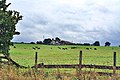
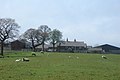 Bradley Farm - geograph.org.uk - 163211.jpg 640 × 427; 67 KB
-
 Canal Scene - geograph.org.uk - 1442822.jpg 640 × 480; 89 KB
-
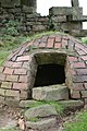
 Conduit - geograph.org.uk - 487039.jpg 640 × 480; 239 KB
-
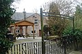
 Entrance to Feniscowles New Hall - geograph.org.uk - 638369.jpg 640 × 480; 133 KB
-
 Evening mist - geograph.org.uk - 612681.jpg 640 × 426; 320 KB
-
 Field by the Leeds Liverpool canal - geograph.org.uk - 484171.jpg 640 × 426; 313 KB
-
-

-
 Lower Whitehalgh Farm - geograph.org.uk - 162983.jpg 640 × 427; 78 KB
-
 Old Toll Bar - geograph.org.uk - 158850.jpg 640 × 480; 69 KB
-
 River Darwen, Feniscowles - geograph.org.uk - 638368.jpg 640 × 480; 199 KB
-
 Shaws Farm - geograph.org.uk - 163212.jpg 640 × 427; 109 KB
-
 Well - geograph.org.uk - 349337.jpg 425 × 640; 280 KB
-
 Witton Weavers Aqueduct - geograph.org.uk - 42597.jpg 640 × 480; 62 KB
-
 Wood along Sheep Bridge Brook - geograph.org.uk - 163214.jpg 640 × 427; 136 KB


.jpg)


