Category:Fernwood, Nottinghamshire
Jump to navigation
Jump to search
English: Fernwood is a village and civil parish in the Newark and Sherwood district of Nottinghamshire, England. The parish, which then included Balderton, had a population of 10,298 as of 2001. It is a suburb of Newark-on-Trent.
village and civil parish in Nottinghamshire, UK | |||||
| Upload media | |||||
| Instance of | |||||
|---|---|---|---|---|---|
| Location | Newark and Sherwood, Nottinghamshire, East Midlands, England | ||||
 | |||||
Media in category "Fernwood, Nottinghamshire"
The following 83 files are in this category, out of 83 total.
-
 A1 - a look into Nottinghamshire - geograph.org.uk - 2645149.jpg 640 × 428; 85 KB
-
 A1 - B6326 exit 1-2 mile - geograph.org.uk - 2645154.jpg 640 × 428; 68 KB
-
 A1 - Cross Lane bridge - geograph.org.uk - 2645161.jpg 640 × 428; 85 KB
-
 A1 at Balderton - geograph.org.uk - 3450306.jpg 1,647 × 1,036; 978 KB
-
 A1 northbound - geograph.org.uk - 3614837.jpg 2,253 × 1,353; 975 KB
-
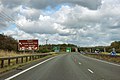 A1 signs for B6326 exit - geograph.org.uk - 2645165.jpg 640 × 428; 79 KB
-
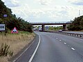
 A326 overbridge, A1 - geograph.org.uk - 2513254.jpg 640 × 378; 32 KB
-
 Alongside the gypsum quarry - geograph.org.uk - 2285142.jpg 1,024 × 768; 131 KB
-
 Ambulance on the A1 - geograph.org.uk - 3633295.jpg 2,247 × 1,350; 942 KB
-
 Amenity planting near Staple Lane - geograph.org.uk - 2285113.jpg 1,024 × 768; 177 KB
-
-
 B6326 approaching the A1 - geograph.org.uk - 2827510.jpg 640 × 480; 50 KB
-
 B6326 bridge over the A1 - geograph.org.uk - 2624781.jpg 640 × 422; 52 KB
-
 B6326 Crossing the A1 near Balderton - geograph.org.uk - 4215918.jpg 640 × 480; 248 KB
-
 B6326 towards the A1 - geograph.org.uk - 2827379.jpg 640 × 480; 65 KB
-
 Balderton Hall - geograph.org.uk - 2539959.jpg 1,024 × 768; 204 KB
-

-
 Bridge over A1 at Balderton - geograph.org.uk - 3450331.jpg 1,713 × 1,069; 950 KB
-
 Bridge over cycle path - geograph.org.uk - 2827334.jpg 640 × 480; 74 KB
-
 Cotham Thorns - geograph.org.uk - 2927831.jpg 480 × 640; 98 KB
-
 Cross Lane Overbridge, A1 - geograph.org.uk - 2513240.jpg 640 × 430; 38 KB
-
 Cycle path on disused railway - geograph.org.uk - 2827341.jpg 640 × 480; 41 KB
-
 Decorated hedge - geograph.org.uk - 2336165.jpg 1,024 × 768; 163 KB
-
 Dry Grass and A1 - geograph.org.uk - 213301.jpg 640 × 480; 109 KB
-
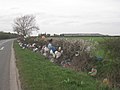
 Farm track off Shire Lane - geograph.org.uk - 2827518.jpg 640 × 480; 49 KB
-
 Farmland near Balderton - geograph.org.uk - 793763.jpg 640 × 396; 31 KB
-
 Farmland off the B6326 - geograph.org.uk - 2827494.jpg 640 × 480; 42 KB
-
 Farmland off the B6326 - geograph.org.uk - 2827507.jpg 640 × 480; 71 KB
-
 Farmland west of Grange Lane - geograph.org.uk - 2927812.jpg 640 × 480; 69 KB
-
 Farmland, Balderfield - geograph.org.uk - 2827513.jpg 640 × 480; 58 KB
-
 Farmland, Balderton - geograph.org.uk - 4230967.jpg 640 × 430; 44 KB
-
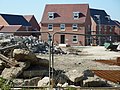 Fernwood - geograph.org.uk - 2629504.jpg 640 × 480; 139 KB
-
 Fernwood Business Park - geograph.org.uk - 831323.jpg 640 × 427; 48 KB
-
 Fernwood Day Nursery - geograph.org.uk - 2539960.jpg 1,024 × 768; 141 KB
-
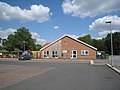
 Fernwood Village Hall - geograph.org.uk - 2539957.jpg 1,024 × 768; 179 KB
-
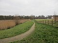 Footpath by a retention pond - geograph.org.uk - 5652389.jpg 1,024 × 768; 136 KB
-
 Footpath by the A1 - geograph.org.uk - 5652388.jpg 1,024 × 768; 155 KB
-
 Footpath to Claypole off Spring Lane - geograph.org.uk - 1944607.jpg 800 × 600; 145 KB
-
 Goldstraw Lane, Fernwood Village - geograph.org.uk - 3089620.jpg 800 × 600; 199 KB
-
 Grange Lane - geograph.org.uk - 4983269.jpg 3,696 × 2,448; 2.41 MB
-
 Grange Lane heading south - geograph.org.uk - 2927815.jpg 640 × 480; 50 KB
-
 Grange Lane heading south - geograph.org.uk - 2927826.jpg 640 × 480; 45 KB
-
 Grange Lane looking north - geograph.org.uk - 5133950.jpg 640 × 481; 35 KB
-
 Grange Lane towards Balderton - geograph.org.uk - 4983272.jpg 1,600 × 1,060; 262 KB
-
 Grazing, Balderton Grange - geograph.org.uk - 2927822.jpg 640 × 480; 57 KB
-
 Great North Road (B6326) - geograph.org.uk - 2827496.jpg 640 × 480; 70 KB
-
 Great North Road - geograph.org.uk - 2629542.jpg 640 × 480; 82 KB
-
 Great North Road - geograph.org.uk - 2629583.jpg 640 × 480; 78 KB
-
 Gypsum quarry - geograph.org.uk - 634371.jpg 640 × 480; 52 KB
-
 Harrowing - geograph.org.uk - 2629485.jpg 640 × 480; 132 KB
-
-
 Jericho Works - geograph.org.uk - 2285025.jpg 1,024 × 768; 174 KB
-
 Junction of ditches alongside Staple Lane - geograph.org.uk - 2285101.jpg 1,024 × 768; 269 KB
-
 Nottinghamshire pylons - geograph.org.uk - 4230975.jpg 640 × 430; 51 KB
-
 Oakwood Mews - geograph.org.uk - 831391.jpg 640 × 427; 78 KB
-
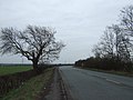
 Old route of the Great North Road - geograph.org.uk - 6077132.jpg 1,024 × 768; 174 KB
-
 One (and only) Stop - geograph.org.uk - 2539962.jpg 1,024 × 768; 160 KB
-
 Ploughed fields by Balderton - geograph.org.uk - 3672998.jpg 640 × 480; 175 KB
-
 Pylons stride across Nottinghamshire - geograph.org.uk - 4001700.jpg 1,600 × 1,200; 159 KB
-
 Route 64 - geograph.org.uk - 2966283.jpg 640 × 427; 72 KB
-
 Route 64 - geograph.org.uk - 936743.jpg 640 × 427; 93 KB
-
 Rubys Walk - geograph.org.uk - 2539954.jpg 1,024 × 768; 195 KB
-
 Shire Dyke - geograph.org.uk - 2827523.jpg 640 × 480; 68 KB
-
 Southbound A1 near Balderton - geograph.org.uk - 4215576.jpg 640 × 480; 217 KB
-
 Southbound A1, Cross Lane Bridge - geograph.org.uk - 4215920.jpg 640 × 480; 241 KB
-
 Spoil Heap near Grange Lane - geograph.org.uk - 2285119.jpg 1,024 × 768; 187 KB
-
 Spring Lane - geograph.org.uk - 2629498.jpg 640 × 480; 137 KB
-
 Staple Lane heading to Balderton - geograph.org.uk - 5133966.jpg 640 × 480; 32 KB
-
 Teasel - geograph.org.uk - 936732.jpg 427 × 640; 86 KB
-
 Telecommunications mast by the A1 - geograph.org.uk - 2624779.jpg 640 × 366; 32 KB
-
 The Great North Road junction with Shire Lane - geograph.org.uk - 3127961.jpg 1,024 × 768; 152 KB
-
 The raw material - geograph.org.uk - 2285093.jpg 1,024 × 768; 126 KB
-
 The Tawny Owl - geograph.org.uk - 2827375.jpg 640 × 377; 37 KB
-
 Track to Balderton Grange - geograph.org.uk - 2927817.jpg 640 × 480; 101 KB
-
 Urban art - geograph.org.uk - 2966281.jpg 640 × 427; 126 KB
-
 View at Balderfield - geograph.org.uk - 2527986.jpg 1,024 × 768; 166 KB
-
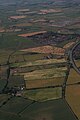
 View into Nottinghamshire - geograph.org.uk - 6074944.jpg 1,024 × 768; 131 KB
-
 View towards Hawton from near Balderton Grange - geograph.org.uk - 2285134.jpg 1,024 × 768; 189 KB
-
 Water Tower - geograph.org.uk - 831388.jpg 427 × 640; 47 KB
-
 You have been warned - geograph.org.uk - 2629472.jpg 480 × 640; 121 KB
-
 Approach to the gypsum quarry - geograph.org.uk - 634450.jpg 640 × 480; 40 KB
-
 Farmer's field - geograph.org.uk - 634373.jpg 640 × 480; 55 KB
-
 Recreation area - geograph.org.uk - 213617.jpg 640 × 480; 67 KB


_-_geograph.org.uk_-_2827496.jpg)


_Stop_-_geograph.org.uk_-_2539962.jpg)


