Category:Feuerwehr- und Gemeindehaus, Zuberbach
Jump to navigation
Jump to search
| Object location | | View all coordinates using: OpenStreetMap |
|---|
.jpg) | |||||
| Upload media | |||||
| Instance of | |||||
|---|---|---|---|---|---|
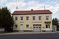
| Location | Weiden bei Rechnitz, Oberwart District, Burgenland, Austria | ||||
 | |||||
Media in category "Feuerwehr- und Gemeindehaus, Zuberbach"
The following 3 files are in this category, out of 3 total.
-
 20210820 WTSB Zuberbach 4968.jpg 4,363 × 2,909; 7.21 MB
-
 Weiden bei Rechnitz - Zuberbach, Feuerwehr- und Gemeindehaus (01).jpg 3,000 × 2,000; 1,011 KB
-
 Zuberbach - Feuerwehr- und Gemeindehaus.jpg 4,865 × 3,243; 8.96 MB

