Category:Fields in Acaster Malbis CP
Jump to navigation
Jump to search
English: Fields in Acaster Malbis civil parish, York.
Media in category "Fields in Acaster Malbis CP"
The following 24 files are in this category, out of 24 total.
-
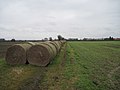
 Bales along a track - geograph.org.uk - 3754910.jpg 640 × 427; 96 KB
-
 Between Bishopthorpe and Acaster Malbis - geograph.org.uk - 1305503.jpg 640 × 478; 164 KB
-
 Church Ings, Acaster Malbis - geograph.org.uk - 2730222.jpg 3,190 × 2,346; 1.59 MB
-
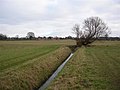
 Ditch off Appleton Road - geograph.org.uk - 6226630.jpg 5,184 × 3,456; 6.6 MB
-
 Embankment and field by the River Ouse - geograph.org.uk - 6246314.jpg 1,024 × 768; 199 KB
-
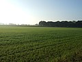
 Farmland near Acaster Malbis - geograph.org.uk - 2648602.jpg 1,600 × 1,200; 315 KB
-
 Farmland off Acaster Lane - geograph.org.uk - 5369769.jpg 640 × 427; 52 KB
-
 Farmland, Acaster Malbis Moor - geograph.org.uk - 2648635.jpg 1,600 × 1,200; 450 KB
-
 Farmland, Woodside Farm - geograph.org.uk - 2648639.jpg 1,600 × 1,200; 356 KB
-
 Field Edge Footpath between Bishopthorpe and Acaster Malbis - geograph.org.uk - 3383652.jpg 4,000 × 3,000; 3.01 MB
-
 Field on the Edge of Disused Acaster Malbis Airfield - geograph.org.uk - 6224876.jpg 5,184 × 3,456; 6.63 MB
-
 Frozen airfield - geograph.org.uk - 1305697.jpg 640 × 478; 188 KB
-
 Grass Patch by Stonebridge Farm - geograph.org.uk - 6225394.jpg 5,184 × 3,456; 6.34 MB
-
 Nova Scotia - geograph.org.uk - 3754907.jpg 640 × 427; 71 KB
-
 Poplar Grove Farm - geograph.org.uk - 1305594.jpg 640 × 478; 191 KB
-
 Riverside towards South Ings - geograph.org.uk - 4105588.jpg 1,600 × 1,064; 578 KB
-
 Straw Bales between Fields - geograph.org.uk - 3381342.jpg 4,000 × 3,000; 2.87 MB
-
 Stub Wood - geograph.org.uk - 2648776.jpg 1,600 × 1,200; 696 KB
-
 Stub Wood from the River Ouse flood bank - geograph.org.uk - 3383548.jpg 4,000 × 3,000; 2.67 MB
-
 The Riverside path at South Ings - geograph.org.uk - 4105627.jpg 1,600 × 1,064; 496 KB
-
 Top of the airfield - geograph.org.uk - 1305637.jpg 640 × 478; 164 KB
-
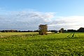
 Towards Acaster Malbis - geograph.org.uk - 113995.jpg 640 × 479; 48 KB
-
 Towards Woodside Farm - geograph.org.uk - 2776085.jpg 640 × 480; 92 KB
-
 Track near Stonebridge Farm - geograph.org.uk - 2776115.jpg 640 × 480; 85 KB


