Category:Fields in County Sligo
Jump to navigation
Jump to search
Media in category "Fields in County Sligo"
The following 70 files are in this category, out of 70 total.
-
 A Sligo Donkey - panoramio.jpg 4,000 × 3,000; 4.29 MB
-
 Barroe South - geograph.org.uk - 1611167.jpg 640 × 480; 94 KB
-
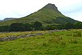 Benwiskin - geograph.org.uk - 1150937.jpg 639 × 426; 191 KB
-
 Bunduff Townland - geograph.org.uk - 1482202.jpg 640 × 479; 78 KB
-
 Bunduff Townland - geograph.org.uk - 1482205.jpg 640 × 479; 73 KB
-
 Bunduff Townland - geograph.org.uk - 1482209.jpg 640 × 479; 72 KB
-
 Bunduff Townland - geograph.org.uk - 825776.jpg 640 × 479; 82 KB
-
 Bunduff Townland - geograph.org.uk - 825780.jpg 640 × 479; 78 KB
-
 Carrownaleck - geograph.org.uk - 3070963.jpg 640 × 480; 307 KB
-
 Carrowneden - geograph.org.uk - 3070849.jpg 640 × 480; 330 KB
-

-
 Cattle, Carrowneden - geograph.org.uk - 3070844.jpg 640 × 480; 254 KB
-
 Cattle, Knockadoo - geograph.org.uk - 3070562.jpg 640 × 480; 264 KB
-
 Clear felled area - geograph.org.uk - 3072462.jpg 640 × 480; 251 KB
-
 Cropped field with Benwiskin - geograph.org.uk - 2539994.jpg 640 × 480; 100 KB
-
 Endless grassland south of Inishcrone - geograph.org.uk - 2523731.jpg 640 × 480; 118 KB
-
 Farmland at Coolnageer - geograph.org.uk - 964054.jpg 640 × 427; 211 KB
-

-
 Farmland, Kilross - geograph.org.uk - 3062375.jpg 640 × 480; 269 KB
-
 Field and earthbank - geograph.org.uk - 3070952.jpg 640 × 480; 275 KB
-
 Field at Cloghmine - geograph.org.uk - 799507.jpg 640 × 480; 70 KB
-
 Field at Lough Gill - geograph.org.uk - 826384.jpg 640 × 480; 81 KB
-
 Field bank and fence, Clooncose 2000 - geograph.org.uk - 3189265.jpg 423 × 640; 75 KB
-
 Field below Carrownadargny - geograph.org.uk - 799566.jpg 640 × 480; 76 KB
-
 Field near Ballintougher - geograph.org.uk - 3062329.jpg 640 × 480; 291 KB
-
 Field near Ballintougher - geograph.org.uk - 3062333.jpg 640 × 480; 253 KB
-
 Field near Ballintougher - geograph.org.uk - 3062366.jpg 640 × 480; 261 KB
-
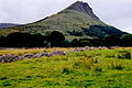
 Field near Benwisken - geograph.org.uk - 1149307.jpg 639 × 426; 338 KB
-
 Field near Coolaney - geograph.org.uk - 3070251.jpg 640 × 480; 271 KB
-
 Field with Benbulbin - geograph.org.uk - 2533064.jpg 640 × 480; 92 KB
-

-
 Field, Cloonacool - geograph.org.uk - 3267947.jpg 640 × 465; 302 KB
-
 Fields at Carrownadargny - geograph.org.uk - 1630750.jpg 640 × 480; 83 KB
-
 Fields with Benbulbin - geograph.org.uk - 2531459.jpg 640 × 480; 100 KB
-
 Gated hay field - geograph.org.uk - 2537806.jpg 640 × 480; 100 KB
-
 Grassland beside the Moy - geograph.org.uk - 3072003.jpg 640 × 480; 263 KB
-
 Grassland, Ballygawley - geograph.org.uk - 3062533.jpg 640 × 480; 252 KB
-

-
 Hay bales - geograph.org.uk - 2540752.jpg 640 × 480; 91 KB
-
 Hay meadow, Shancough - geograph.org.uk - 3070470.jpg 640 × 480; 292 KB
-

-
 Hill country near Collooney - geograph.org.uk - 3062625.jpg 640 × 480; 277 KB
-
 Lisnalurg Sligo - geograph.org.uk - 824268.jpg 640 × 479; 72 KB
-
 Loug Anelteen - panoramio.jpg 4,000 × 3,000; 4.41 MB
-
 Lough Anelteen from the north - panoramio.jpg 4,000 × 3,000; 4.25 MB
-
 Lough Anelteen Sligo - panoramio.jpg 3,264 × 2,448; 2.15 MB
-
 Lough Gill Sligo - panoramio (1).jpg 3,264 × 2,448; 1.9 MB
-
 Lough Gill Sligo - panoramio.jpg 3,264 × 2,448; 2.18 MB
-
 Meadow with flowers - geograph.org.uk - 2540771.jpg 640 × 480; 93 KB
-
 Meadowsweet - geograph.org.uk - 3062633.jpg 640 × 480; 302 KB
-
 Near Strandhill - geograph.org.uk - 824412.jpg 640 × 479; 51 KB
-
 Pasture at Bellaburke - geograph.org.uk - 969444.jpg 640 × 427; 205 KB
-
 Pasture at Bunrawer - geograph.org.uk - 967682.jpg 640 × 427; 168 KB
-
 Pasture at Caltragh - geograph.org.uk - 964040.jpg 640 × 426; 163 KB
-
 Pasture at Cam - geograph.org.uk - 963636.jpg 640 × 427; 155 KB
-
 Pasture at Cam - geograph.org.uk - 963638.jpg 640 × 427; 153 KB
-
 Pasture at Cam - geograph.org.uk - 963641.jpg 640 × 427; 166 KB
-
 Pasture at Cam - geograph.org.uk - 963644.jpg 640 × 427; 165 KB
-
 Pasture at Cam - geograph.org.uk - 964014.jpg 640 × 427; 208 KB
-
 Pasture at Cappacharnaun - geograph.org.uk - 969428.jpg 640 × 427; 178 KB
-
 Pasture at Cappacharnaun - geograph.org.uk - 969438.jpg 640 × 427; 180 KB
-
 Pasture at Coolgarry - geograph.org.uk - 964029.jpg 640 × 427; 184 KB
-
 Pasture at Curry - geograph.org.uk - 964017.jpg 640 × 427; 179 KB
-
 Pasture at Curry - geograph.org.uk - 964021.jpg 640 × 427; 188 KB
-
 Pasture at Curry - geograph.org.uk - 964025.jpg 640 × 427; 168 KB
-
 Pasture at Newtown - geograph.org.uk - 964034.jpg 640 × 427; 189 KB
-
-
 Rough grazing near Tully - geograph.org.uk - 798227.jpg 640 × 480; 70 KB
-
 Sheep grazing at Corradoo West - geograph.org.uk - 798274.jpg 640 × 480; 83 KB
-


.jpg)


