Category:Fifield, Oxfordshire
Jump to navigation
Jump to search
village and civil parish in West Oxfordshire, Oxfordshire, England  | |||||
| Upload media | |||||
| Instance of | |||||
|---|---|---|---|---|---|
| Location | West Oxfordshire, Oxfordshire, South East England, England | ||||
| Different from | |||||
| Said to be the same as | Fifield (Wikimedia duplicated page, civil parish) | ||||
 | |||||
Subcategories
This category has the following 3 subcategories, out of 3 total.
F
- Merrymouth Inn (5 F)
T
Media in category "Fifield, Oxfordshire"
The following 166 files are in this category, out of 166 total.
-
 A424 at The Merrymouth Inn - geograph.org.uk - 2651788.jpg 640 × 480; 53 KB
-
 A424 at The Merrymouth Inn - geograph.org.uk - 3131957.jpg 640 × 480; 32 KB
-
 A424, Fifield - geograph.org.uk - 6349006.jpg 1,884 × 1,224; 947 KB
-
 Abandoned helicopter at Rissington Airfield - geograph.org.uk - 5373963.jpg 2,832 × 3,552; 1.78 MB
-
 Abandoned helicopter cockpit - geograph.org.uk - 5373971.jpg 3,552 × 2,832; 3.65 MB
-
 Across the drive - geograph.org.uk - 2400234.jpg 4,288 × 3,216; 3.24 MB
-
 Across the field - geograph.org.uk - 2401920.jpg 4,288 × 3,216; 1.68 MB
-
 Across the track - geograph.org.uk - 1933625.jpg 4,000 × 3,000; 4.58 MB
-
 Airfield view - geograph.org.uk - 2789353.jpg 4,320 × 3,240; 4.3 MB
-
 Along the field edge - geograph.org.uk - 2400680.jpg 4,288 × 3,216; 2.45 MB
-

-
 Bend in the track - geograph.org.uk - 2400409.jpg 4,288 × 3,216; 3.91 MB
-
 Between the hedges - geograph.org.uk - 2789377.jpg 4,320 × 3,240; 5.26 MB
-
 Bridge over a stream - geograph.org.uk - 3206632.jpg 640 × 427; 252 KB
-
 Bridge over the stream - geograph.org.uk - 2395763.jpg 4,288 × 3,216; 2.64 MB
-
 Bridleway crossroads - geograph.org.uk - 2401922.jpg 4,288 × 3,216; 4.04 MB
-
 Bridleway leaves the road - geograph.org.uk - 4222336.jpg 4,320 × 3,240; 4.9 MB
-
 Bridleway leaves track - geograph.org.uk - 2402231.jpg 4,288 × 3,216; 2.12 MB
-
 Bridleway near Warren Farm - geograph.org.uk - 3201780.jpg 640 × 426; 199 KB
-
 Bridleway to Bruern Wood - geograph.org.uk - 2400366.jpg 4,288 × 3,216; 3.37 MB
-
 Bridleway to byway - geograph.org.uk - 4223955.jpg 4,320 × 3,240; 4.93 MB
-

-
 Bridleways crossroads (2) - geograph.org.uk - 2401923.jpg 4,288 × 3,216; 2.98 MB
-
 Building at Little Rissington Airfield - geograph.org.uk - 4223806.jpg 4,320 × 3,240; 4.6 MB
-
 Byway leaves the lane - geograph.org.uk - 2792947.jpg 4,320 × 3,240; 4.87 MB
-
 Cadet class kart at Little Rissington - geograph.org.uk - 5028609.jpg 3,937 × 2,413; 1.02 MB
-
 Cadet class karts at Little Rissington - geograph.org.uk - 5028789.jpg 1,671 × 1,345; 504 KB
-
 Cattle grid on bridleway - geograph.org.uk - 2400676.jpg 3,629 × 3,163; 2.54 MB
-
 Change of angle - geograph.org.uk - 1933329.jpg 4,000 × 3,000; 1.88 MB
-
 Church Street - geograph.org.uk - 3206551.jpg 640 × 427; 224 KB
-
 Church Street or High Street - geograph.org.uk - 3206556.jpg 640 × 427; 201 KB
-
 Coming into Fifield - geograph.org.uk - 1216106.jpg 640 × 427; 97 KB
-
 Concrete pillbox - geograph.org.uk - 2789345.jpg 4,320 × 3,240; 4.81 MB
-
 Contrast at Limekiln Plantation - geograph.org.uk - 3201793.jpg 640 × 428; 172 KB
-
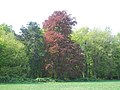 Copper Beech - geograph.org.uk - 2400360.jpg 4,288 × 3,216; 3.89 MB
-
 Covered reservoir - geograph.org.uk - 2400417.jpg 4,288 × 3,216; 3.04 MB
-
 Crop field next to A424 near Fifield - geograph.org.uk - 2505414.jpg 640 × 480; 101 KB
-
 D'Arcy Dalton Way - geograph.org.uk - 4756955.jpg 640 × 480; 90 KB
-
 Enclosed path - geograph.org.uk - 4224790.jpg 3,240 × 4,320; 4.3 MB
-
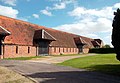 Field Barns, Fifield Manor - geograph.org.uk - 2599207.jpg 3,584 × 2,484; 1.84 MB
-
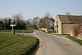 Crossroads in Fifield - geograph.org.uk - 1216120.jpg 640 × 427; 63 KB
-
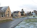
 Hill Farm Barn - geograph.org.uk - 309079.jpg 640 × 480; 73 KB
-
 Fifield - geograph.org.uk - 131247.jpg 640 × 480; 89 KB
-
 Fifield Heath (1) - geograph.org.uk - 2400235.jpg 4,288 × 3,216; 2.19 MB
-
 Fifield Heath (2) - geograph.org.uk - 2400236.jpg 4,288 × 3,216; 3.91 MB
-
 Fifield village.jpg 640 × 480; 120 KB
-
 First class travel - geograph.org.uk - 5373990.jpg 2,832 × 3,552; 4.21 MB
-
 Flat field - geograph.org.uk - 2395749.jpg 4,288 × 3,216; 2.47 MB
-
 Flora's Cottage - geograph.org.uk - 309083.jpg 640 × 480; 90 KB
-
 Footpath heading to Fifield - geograph.org.uk - 2681339.jpg 640 × 480; 88 KB
-
 Footpath to the church - geograph.org.uk - 4224787.jpg 4,320 × 3,240; 4.67 MB
-
 Footpath towards A424 - geograph.org.uk - 3206530.jpg 430 × 640; 204 KB
-
 Footpath towards Idbury - geograph.org.uk - 3206609.jpg 640 × 427; 212 KB
-
 Footpath towards Idbury - geograph.org.uk - 3206621.jpg 640 × 427; 211 KB
-
 Four ways to go (1) - geograph.org.uk - 4223942.jpg 4,320 × 3,240; 4.97 MB
-
 Four ways to go (2) - geograph.org.uk - 4223946.jpg 4,320 × 3,240; 4.97 MB
-
 Four ways to go (3) - geograph.org.uk - 4223949.jpg 4,320 × 3,240; 4.98 MB
-
 Four ways to go (4) - geograph.org.uk - 4223951.jpg 4,320 × 3,240; 5.1 MB
-
 Gate near Workman Farm - geograph.org.uk - 3201776.jpg 640 × 427; 190 KB
-
 Gently flows the stream - geograph.org.uk - 4223977.jpg 4,320 × 3,240; 4.96 MB
-
 Green lane - geograph.org.uk - 2789359.jpg 4,320 × 3,240; 4.9 MB
-
 Harveys Barn - geograph.org.uk - 2793020.jpg 4,320 × 3,240; 4.81 MB
-
 Heading towards Fifield. - geograph.org.uk - 1226257.jpg 640 × 427; 44 KB
-
 Herbert's Heath woodland - geograph.org.uk - 1933372.jpg 4,000 × 3,000; 4.79 MB
-
 Hillside House - geograph.org.uk - 2793030.jpg 4,320 × 3,240; 5.3 MB
-
 Horse at Workham Farm - geograph.org.uk - 3201736.jpg 640 × 397; 232 KB
-
 Horse jumps - geograph.org.uk - 2789389.jpg 4,320 × 3,240; 5.26 MB
-
 Horse jumps - geograph.org.uk - 4223960.jpg 4,320 × 3,240; 5.12 MB
-
 House in Fifield - geograph.org.uk - 3206534.jpg 640 × 427; 224 KB
-
 Into open fields - geograph.org.uk - 2395650.jpg 4,288 × 3,216; 2.14 MB
-
 Into the valley - geograph.org.uk - 2792895.jpg 4,320 × 3,240; 4.88 MB
-
 Junior TKM class karts at Rissington - geograph.org.uk - 5028625.jpg 2,979 × 1,982; 926 KB
-
 Junior X30 karts at Rissington - geograph.org.uk - 5028620.jpg 3,108 × 2,072; 1.02 MB
-
 Karts at Rissington Kart Club - geograph.org.uk - 5028322.jpg 4,256 × 2,832; 3.48 MB
-
 Karts at Rissington Kart Club - geograph.org.uk - 5028328.jpg 4,118 × 1,506; 919 KB
-
 Leaky barn - geograph.org.uk - 2394471.jpg 4,288 × 3,216; 2.77 MB
-
 Little Rissington Airfield (1) - geograph.org.uk - 4223810.jpg 4,320 × 3,240; 4.72 MB
-
 Little Rissington Airfield (2) - geograph.org.uk - 4223812.jpg 4,320 × 3,240; 4.8 MB
-
 Little Rissington Airfield - geograph.org.uk - 2789325.jpg 4,320 × 3,240; 4.49 MB
-
 Little Rissington airfield - geograph.org.uk - 3201801.jpg 640 × 409; 219 KB
-
 Llamas in the field - geograph.org.uk - 2793038.jpg 4,320 × 3,240; 4.49 MB
-
 Llamas near Fifield - geograph.org.uk - 3206628.jpg 640 × 399; 173 KB
-
 Mown bridleway - geograph.org.uk - 2402229.jpg 4,288 × 3,216; 5.54 MB
-
 Newly planted - geograph.org.uk - 2400690.jpg 4,288 × 3,216; 3.32 MB
-
 No way through - geograph.org.uk - 2789351.jpg 4,320 × 3,240; 4.72 MB
-
 One wall of a house - geograph.org.uk - 2394164.jpg 4,288 × 3,216; 3.23 MB
-
 Over the brook - geograph.org.uk - 2792891.jpg 4,320 × 3,240; 4.81 MB
-
 Oxfordshire countryside - geograph.org.uk - 1933340.jpg 4,000 × 3,000; 2.09 MB
-
 Oxfordshire farmland - geograph.org.uk - 1933635.jpg 4,000 × 3,000; 2.71 MB
-
 Part of Choake's Brake - geograph.org.uk - 4223820.jpg 4,320 × 3,240; 4.84 MB
-
 Path and bridleway (1) - geograph.org.uk - 2401930.jpg 4,288 × 3,216; 2.76 MB
-
 Path and bridleway (2) - geograph.org.uk - 2401932.jpg 4,288 × 3,216; 3.5 MB
-
 Path and bridleway leave the road - geograph.org.uk - 4222338.jpg 4,320 × 3,240; 4.83 MB
-
 Path crosses bridleway - geograph.org.uk - 1933360.jpg 4,000 × 3,000; 3.55 MB
-
 Path junction - geograph.org.uk - 4223937.jpg 4,320 × 3,240; 5.06 MB
-
 Path to Bruern Abbey - geograph.org.uk - 6393242.jpg 800 × 450; 169 KB
-
 Playing fields - geograph.org.uk - 2681358.jpg 640 × 480; 80 KB
-
 Recreation field - geograph.org.uk - 2395648.jpg 4,288 × 3,216; 2.25 MB
-
 Repairs in progress - geograph.org.uk - 2789398.jpg 4,320 × 3,240; 4.73 MB
-
 Restricted byway at Workham Farm - geograph.org.uk - 3201755.jpg 640 × 427; 260 KB
-
 Restricted byway near Workham Farm - geograph.org.uk - 3201761.jpg 640 × 427; 280 KB
-
 Restricted byway near Workham Farm - geograph.org.uk - 3201767.jpg 640 × 427; 280 KB
-
 Restricted byway near Workham Farm - geograph.org.uk - 3201770.jpg 640 × 429; 197 KB
-
 Seven Shires Way - geograph.org.uk - 2679351.jpg 640 × 480; 78 KB
-
 Seven Shires Way - geograph.org.uk - 2681373.jpg 640 × 480; 58 KB
-
 Sheds and quarry - geograph.org.uk - 2792995.jpg 4,320 × 3,240; 4.6 MB
-
 Signpost on the bridleway - geograph.org.uk - 3201832.jpg 616 × 640; 351 KB
-
 St John the Baptist, Fifield - East end - geograph.org.uk - 6363553.jpg 900 × 661; 532 KB
-
 St John the Baptist, Fifield - Font - geograph.org.uk - 6363560.jpg 537 × 900; 384 KB
-

-

-

-

-
 St John the Baptist, Fifield - West end - geograph.org.uk - 6363556.jpg 900 × 666; 487 KB
-
 Start of bridleway - geograph.org.uk - 2402238.jpg 4,288 × 3,216; 3.4 MB
-
 Start of path - geograph.org.uk - 2394479.jpg 4,288 × 3,216; 4.36 MB
-
 Starveall Wood - geograph.org.uk - 1933382.jpg 4,000 × 3,000; 4.33 MB
-
 Surfaced lane - geograph.org.uk - 2789355.jpg 4,320 × 3,240; 5.23 MB
-
 The Old Rectory - geograph.org.uk - 4224793.jpg 4,320 × 3,240; 5.3 MB
-
 There's a lot of it about - geograph.org.uk - 4223817.jpg 4,320 × 3,240; 4.72 MB
-
 Through the copse - geograph.org.uk - 2400231.jpg 4,288 × 3,216; 4.24 MB
-
 Through the gate - geograph.org.uk - 2395769.jpg 4,288 × 3,216; 2.54 MB
-
 Towards Fifield (1) - geograph.org.uk - 2401926.jpg 4,288 × 3,216; 2.86 MB
-
 Towards Fifield (2) - geograph.org.uk - 2401929.jpg 4,288 × 3,216; 2.42 MB
-
 Towards the clump - geograph.org.uk - 2400374.jpg 4,288 × 3,216; 4.45 MB
-
 Towards the heath - geograph.org.uk - 2400232.jpg 4,288 × 3,216; 2.36 MB
-
 Towards the road - geograph.org.uk - 4224760.jpg 4,320 × 3,240; 5.16 MB
-
 Track to the farm - geograph.org.uk - 2400698.jpg 4,288 × 3,216; 6.16 MB
-
 Two ways to go - geograph.org.uk - 1933387.jpg 4,000 × 3,000; 4.81 MB
-
 Village crossroads - geograph.org.uk - 2793010.jpg 4,320 × 3,240; 4.31 MB
-
 Warren Farm - geograph.org.uk - 4223932.jpg 4,320 × 3,240; 4.87 MB
-
 Water works (1) - geograph.org.uk - 2395732.jpg 4,288 × 3,216; 3.98 MB
-
 Water works (2) - geograph.org.uk - 2395741.jpg 4,288 × 3,216; 2.47 MB
-
 Woodland edge - geograph.org.uk - 2400233.jpg 4,288 × 3,216; 2.53 MB
-
 Workham Farm (1) - geograph.org.uk - 2792881.jpg 4,320 × 3,240; 4.6 MB
-
 Workham Farm (2) - geograph.org.uk - 2792932.jpg 4,320 × 3,240; 5.25 MB
-
 Workham Farm (3) - geograph.org.uk - 2792937.jpg 4,320 × 3,240; 4.9 MB
-
 Workham Farm (4) - geograph.org.uk - 2792940.jpg 4,320 × 3,240; 5.19 MB
-
 Workham Farm (5) - geograph.org.uk - 2792943.jpg 4,320 × 3,240; 5.13 MB
-
 Workham Farm - geograph.org.uk - 4223963.jpg 4,320 × 3,240; 4.81 MB
-
 Workham Farm - geograph.org.uk - 781434.jpg 640 × 417; 369 KB
-
 Workham Lane - geograph.org.uk - 2792965.jpg 4,320 × 3,240; 4.82 MB
-
 A424 a driver's road - geograph.org.uk - 783198.jpg 482 × 640; 268 KB
-
 Approaching Tangley Hall - geograph.org.uk - 382315.jpg 640 × 480; 108 KB
-
 Blackheath Bungalow - geograph.org.uk - 272595.jpg 640 × 480; 133 KB
-
 Blackheath Clump - geograph.org.uk - 272517.jpg 640 × 480; 196 KB
-
 Bridge over Coombe Brooke - geograph.org.uk - 383406.jpg 640 × 480; 170 KB
-
 Coombe Brook - geograph.org.uk - 382317.jpg 640 × 480; 161 KB
-
 Footpath at Lower Farm - geograph.org.uk - 309098.jpg 640 × 480; 100 KB
-
 Hill Barn Farm - geograph.org.uk - 272521.jpg 640 × 480; 112 KB
-
 Hill Farm and the road to Bruern - geograph.org.uk - 272501.jpg 640 × 480; 97 KB
-
 Horse pasture by Manor Farm - geograph.org.uk - 309101.jpg 640 × 480; 90 KB
-
 Lane down to Tangley Farm - geograph.org.uk - 309090.jpg 640 × 480; 63 KB
-
 Lane in the rain - geograph.org.uk - 309103.jpg 640 × 480; 58 KB
-
 Old and new grass - geograph.org.uk - 272507.jpg 640 × 480; 128 KB
-
 Plank Quarry Plantation - geograph.org.uk - 272526.jpg 640 × 480; 152 KB
-
 Road junction and High Lodge Farm - geograph.org.uk - 272503.jpg 640 × 480; 99 KB
-
 Springhill Farm - geograph.org.uk - 272504.jpg 640 × 480; 139 KB
-
 Tangley Hall and Farm - geograph.org.uk - 382316.jpg 640 × 480; 130 KB
-
 Tangley Woods - geograph.org.uk - 272494.jpg 640 × 480; 136 KB
-
 Towards Tangley Wood - geograph.org.uk - 382319.jpg 640 × 480; 120 KB
-
 Track over Habber Gallows Hill - geograph.org.uk - 272603.jpg 480 × 640; 135 KB
-
 Trig point in the hedge - geograph.org.uk - 272508.jpg 640 × 427; 140 KB
-
 Trig. point detail - geograph.org.uk - 272511.jpg 480 × 640; 159 KB
-
 Workham Bottom - geograph.org.uk - 383403.jpg 640 × 427; 107 KB
-
 Workham Bottom - geograph.org.uk - 383404.jpg 640 × 480; 123 KB


_-_geograph.org.uk_-_2401923.jpg)


_-_geograph.org.uk_-_2400235.jpg)
_-_geograph.org.uk_-_2400236.jpg)


_-_geograph.org.uk_-_4223942.jpg)
_-_geograph.org.uk_-_4223946.jpg)
_-_geograph.org.uk_-_4223949.jpg)
_-_geograph.org.uk_-_4223951.jpg)


_-_geograph.org.uk_-_4223810.jpg)
_-_geograph.org.uk_-_4223812.jpg)


_-_geograph.org.uk_-_2401930.jpg)
_-_geograph.org.uk_-_2401932.jpg)


_-_geograph.org.uk_-_2401926.jpg)
_-_geograph.org.uk_-_2401929.jpg)


_-_geograph.org.uk_-_2395732.jpg)
_-_geograph.org.uk_-_2395741.jpg)

_-_geograph.org.uk_-_2792881.jpg)
_-_geograph.org.uk_-_2792932.jpg)
_-_geograph.org.uk_-_2792937.jpg)
_-_geograph.org.uk_-_2792940.jpg)
_-_geograph.org.uk_-_2792943.jpg)


