Category:Fivehead
Jump to navigation
Jump to search
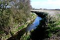
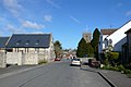
English: Fivehead is a village and parish in Somerset, England, situated on the Fivehead River, miles east of Taunton in the South Somerset district. In 2002, the village had a population of 643.
village in the United Kingdom  | |||||
| Upload media | |||||
| Instance of | |||||
|---|---|---|---|---|---|
| Location | South Somerset, Somerset, South West England, England | ||||
| Population |
| ||||
| Said to be the same as | Fivehead (Wikimedia duplicated page, civil parish) | ||||
 | |||||
Subcategories
This category has the following 3 subcategories, out of 3 total.
M
- St Martin's Church, Fivehead (4 F)
S
Media in category "Fivehead"
The following 173 files are in this category, out of 173 total.
-
 A378 ascends Swell Hill - geograph.org.uk - 4010462.jpg 3,648 × 2,736; 1.65 MB
-
 A378 junction with Gange's Hill - geograph.org.uk - 4010441.jpg 3,648 × 2,736; 1.46 MB
-
 A378 on Swell Hill - geograph.org.uk - 5363688.jpg 1,600 × 1,200; 694 KB
-
 A378 south of Chilly Copse - geograph.org.uk - 4008787.jpg 3,648 × 2,736; 1.43 MB
-
 Arable land, Higher Swell - geograph.org.uk - 3664444.jpg 1,024 × 768; 242 KB
-
 Barn at Eastwood Farm - geograph.org.uk - 4942495.jpg 1,024 × 768; 215 KB
-
 Bluebells appearing in Swell Wood - geograph.org.uk - 5365087.jpg 1,600 × 1,200; 849 KB
-
 Bluebells in Swell Wood - geograph.org.uk - 5353451.jpg 1,600 × 1,200; 783 KB
-
 Bluebells in Swell Wood - geograph.org.uk - 5363639.jpg 1,200 × 1,600; 828 KB
-
 Bluebells in Swell Wood - geograph.org.uk - 5365081.jpg 1,200 × 1,600; 816 KB
-
 Briar Cottage, Fivehead - geograph.org.uk - 2789565.jpg 3,888 × 2,592; 5.19 MB
-
 Burton Pynsent from Underhill Farm - geograph.org.uk - 2789539.jpg 3,888 × 2,592; 5.26 MB
-
 Butcher's Hill, Fivehead - geograph.org.uk - 3664493.jpg 1,024 × 768; 238 KB
-
 Car park for RSPB Swell Wood nature reserve - geograph.org.uk - 5365096.jpg 1,600 × 1,200; 805 KB
-
 Cars for sale at Fivehead Garage - geograph.org.uk - 5363552.jpg 1,600 × 1,201; 817 KB
-
 Cattle at Swell Drove - geograph.org.uk - 2789545.jpg 3,888 × 2,592; 4.28 MB
-
 Chapel at Fivehead - geograph.org.uk - 2789586.jpg 3,888 × 2,592; 6.86 MB
-
 Cottage at Cathanger Wood - geograph.org.uk - 3138250.jpg 640 × 480; 88 KB
-
 Cottages, Upper Fivehead - geograph.org.uk - 3664498.jpg 1,024 × 768; 191 KB
-
 Cowslips - geograph.org.uk - 4937850.jpg 1,024 × 768; 364 KB
-
 Crossham Lane - geograph.org.uk - 2241926.jpg 640 × 480; 96 KB
-
 Currymead Lane - geograph.org.uk - 4956142.jpg 1,024 × 768; 215 KB
-

-
 Direction Sign - Signpost on Butcher's Hill in Fivehead - geograph.org.uk - 6072574.jpg 1,715 × 1,192; 186 KB
-
 Drain on West Sedge Moor - geograph.org.uk - 4938596.jpg 1,024 × 768; 256 KB
-
 Ducks at Swell Drove - geograph.org.uk - 2789541.jpg 3,888 × 2,592; 3.59 MB
-
 Eastwood Farm - geograph.org.uk - 4936635.jpg 1,024 × 768; 222 KB
-
 Eastwood Farmhouse - geograph.org.uk - 4937835.jpg 1,024 × 761; 140 KB
-
 Entrance drive, Langford - geograph.org.uk - 4956104.jpg 1,024 × 768; 230 KB
-
 Entrance driveway, Moortown Farm - geograph.org.uk - 4956139.jpg 1,024 × 827; 249 KB
-
 Fallen tree by the nature trail in Swell Wood - geograph.org.uk - 5363643.jpg 1,200 × 1,600; 804 KB
-
 Field below Burton Wood - geograph.org.uk - 4942530.jpg 1,024 × 768; 255 KB
-
 Field of stubble, off Stowey Lane - geograph.org.uk - 4607037.jpg 1,024 × 768; 208 KB
-
 Fields near Eastwood Farm - geograph.org.uk - 4942516.jpg 1,024 × 768; 289 KB
-
 Fields north of Swell Wood on Somerset Levels - geograph.org.uk - 5363651.jpg 1,600 × 1,200; 945 KB
-
 Fivehead Baptist Church - geograph.org.uk - 4814041.jpg 1,024 × 768; 177 KB
-
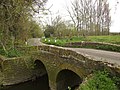
 Fivehead Bridge - geograph.org.uk - 4814079.jpg 1,024 × 768; 208 KB
-
 Fivehead Drove - geograph.org.uk - 4937880.jpg 1,024 × 768; 370 KB
-
 Fivehead Drove - geograph.org.uk - 4937888.jpg 1,024 × 768; 253 KB
-
 Fivehead River - and lush vegetation - geograph.org.uk - 450044.jpg 640 × 480; 184 KB
-
 Fivehead River.jpg 640 × 428; 122 KB
-
 Fivehead Village - geograph.org.uk - 1221404.jpg 640 × 428; 58 KB
-
 Fivehead Village Hall - geograph.org.uk - 2984501.jpg 800 × 541; 132 KB
-
 Fivehead Village Hall - geograph.org.uk - 3141221.jpg 640 × 480; 71 KB
-
 Fivehead Wood - geograph.org.uk - 4937842.jpg 1,024 × 768; 263 KB
-
 Fivehead, by Swell Court Farm - geograph.org.uk - 1282696.jpg 640 × 427; 418 KB
-
 Fivehead, field below Swell Hill - geograph.org.uk - 3077785.jpg 640 × 427; 410 KB
-
 Fivehead, Swell Hill - geograph.org.uk - 3077808.jpg 640 × 427; 391 KB
-
 Fivehead, The Crown Inn - geograph.org.uk - 1282702.jpg 640 × 427; 377 KB
-
 Fivehead, towards Swell Court Farm - geograph.org.uk - 3077805.jpg 640 × 427; 437 KB
-
 Fivehead, towards Swell Wood - geograph.org.uk - 3077789.jpg 640 × 427; 419 KB
-

-
 Fivehead, wheatfield by Swell Hill - geograph.org.uk - 3077792.jpg 640 × 427; 470 KB
-
 Fivehead. The road to Swell - geograph.org.uk - 2791423.jpg 1,600 × 1,067; 606 KB
-
 Footpath in Fivehead - geograph.org.uk - 3145555.jpg 640 × 480; 117 KB
-
 Footpath to Swell Drove - geograph.org.uk - 4956110.jpg 1,024 × 768; 201 KB
-
 Footpath, Fivehead - geograph.org.uk - 1904005.jpg 640 × 480; 162 KB
-
 Ganges Hill , Fivehead - geograph.org.uk - 2789570.jpg 2,592 × 3,888; 5.94 MB
-
 Gate, St Martin's Church - geograph.org.uk - 1903994.jpg 480 × 640; 163 KB
-
 Green-Winged Orchids - geograph.org.uk - 4937855.jpg 1,024 × 768; 381 KB
-
 Greenshutters Nurseries, Fivehead - geograph.org.uk - 3665443.jpg 1,024 × 768; 168 KB
-
 Hatch Drove - geograph.org.uk - 4942536.jpg 1,024 × 768; 237 KB
-
 Heron on its nest in Swell Wood - geograph.org.uk - 5363695.jpg 1,600 × 1,200; 994 KB
-
 Heronry hide, Swell Wood - geograph.org.uk - 5353447.jpg 1,600 × 1,200; 653 KB
-
 Higher Swell from the main road at Swell Wood - geograph.org.uk - 2789613.jpg 3,888 × 2,592; 5.27 MB
-
 House at Stowey Farm - geograph.org.uk - 3141199.jpg 640 × 480; 82 KB
-
 Inside St Catherine's Church, Swell - geograph.org.uk - 5365136.jpg 1,200 × 1,600; 814 KB
-
 Isle Brewers Bridge - geograph.org.uk - 3470778.jpg 640 × 480; 103 KB
-
 Isle Brewers Bridge - geograph.org.uk - 3470786.jpg 640 × 480; 112 KB
-
 Isle Brewers, Road over the bridge - geograph.org.uk - 1846981.jpg 800 × 486; 462 KB
-
 Isle Moor - geograph.org.uk - 3151430.jpg 640 × 480; 58 KB
-
 Islemoor Drove - geograph.org.uk - 4814118.jpg 1,024 × 768; 348 KB
-
 Isolated cottage on the A378 - geograph.org.uk - 3665453.jpg 1,024 × 769; 178 KB
-
 Isolated tree near Underhill Farm - geograph.org.uk - 4936628.jpg 1,024 × 768; 230 KB
-
 Isolated trees on West Sedge Moor - geograph.org.uk - 4939214.jpg 1,024 × 768; 233 KB
-
 Lane heading east - geograph.org.uk - 1871048.jpg 640 × 480; 157 KB
-
 Lane heading east, south of Fivehead - geograph.org.uk - 1871054.jpg 640 × 480; 216 KB
-
 Lane heading south - geograph.org.uk - 1871047.jpg 640 × 480; 131 KB
-
 Lane junction south of Fivehead - geograph.org.uk - 1871051.jpg 640 × 480; 210 KB
-
 Langford Lane - geograph.org.uk - 3664483.jpg 1,024 × 749; 245 KB
-
 Lower Listock Farm - geograph.org.uk - 1807044.jpg 640 × 446; 83 KB
-
 Lower Listock Farm - geograph.org.uk - 2791420.jpg 1,600 × 1,067; 294 KB
-
 Lower Swell - geograph.org.uk - 2789605.jpg 3,888 × 2,592; 5.82 MB
-
 Meadows below Swell Wood - geograph.org.uk - 4936622.jpg 1,024 × 768; 272 KB
-
 Middle Drove - geograph.org.uk - 4944154.jpg 1,024 × 768; 188 KB
-
 Mute Swan at Middle Drove - geograph.org.uk - 4939253.jpg 1,024 × 768; 248 KB
-
 Nature trail in Swell Wood - geograph.org.uk - 5363634.jpg 1,600 × 1,200; 813 KB
-
 Nature trail in Swell Wood - geograph.org.uk - 5365092.jpg 1,200 × 1,600; 815 KB
-
 New development at New House Farm - geograph.org.uk - 4606913.jpg 1,024 × 768; 135 KB
-
 Nursery and garden centre entrance - geograph.org.uk - 5363548.jpg 1,600 × 798; 574 KB
-

-
 Pasture, alongside the Fivehead River - geograph.org.uk - 4814104.jpg 1,024 × 768; 213 KB
-
 Path and bluebells in Swell Wood - geograph.org.uk - 5353453.jpg 1,600 × 1,200; 707 KB
-
 Path in Swell Wood - geograph.org.uk - 5353423.jpg 1,600 × 1,200; 764 KB
-
 Path in Swell Wood - geograph.org.uk - 5353433.jpg 1,600 × 1,200; 696 KB
-
 Ploughed field on Stowey Lane - geograph.org.uk - 556336.jpg 640 × 480; 138 KB
-
 Red Post House, Fivehead - geograph.org.uk - 3664490.jpg 1,024 × 768; 211 KB
-
 Remains of farm bridge, Middle Drove - geograph.org.uk - 4938612.jpg 1,024 × 768; 235 KB
-
 Remains of Ledgenham Farm - geograph.org.uk - 4942524.jpg 1,024 × 768; 269 KB
-
 Scarp slope and Burton Wood - geograph.org.uk - 5363658.jpg 1,600 × 1,200; 851 KB
-
 Seat by nature trail in Swell Wood - geograph.org.uk - 5365078.jpg 1,200 × 1,600; 852 KB
-
 Side drain, Fivehead Drove - geograph.org.uk - 4938567.jpg 1,024 × 768; 254 KB
-
 Smith's Farm, Fivehead - geograph.org.uk - 2789560.jpg 3,888 × 2,592; 4.69 MB
-
 South Drove - geograph.org.uk - 4937866.jpg 1,024 × 768; 308 KB
-
 South Drove and Smiths Farm - geograph.org.uk - 1807623.jpg 640 × 480; 63 KB
-
 St Martin's Church, Fivehead - geograph.org.uk - 4814046.jpg 1,024 × 768; 249 KB
-

-
 Stillbrook Lane - geograph.org.uk - 4606889.jpg 1,024 × 768; 206 KB
-
 Swell church and churchyard - geograph.org.uk - 5365131.jpg 1,600 × 1,200; 924 KB
-
 Swell Court Farm - geograph.org.uk - 2789619.jpg 3,888 × 2,592; 6.95 MB
-
 Swell Court Farm from churchyard - geograph.org.uk - 2789628.jpg 3,888 × 2,592; 4.5 MB
-
 Swell Drove - geograph.org.uk - 4936612.jpg 1,024 × 768; 169 KB
-
 Swell Lane - geograph.org.uk - 5365143.jpg 1,600 × 1,277; 766 KB
-
 Swell Wood - geograph.org.uk - 3470691.jpg 640 × 480; 116 KB
-
 Swell Wood - geograph.org.uk - 5353428.jpg 1,600 × 1,257; 828 KB
-
 Swell Wood car park - geograph.org.uk - 5353457.jpg 1,600 × 1,200; 661 KB
-
 Swell Wood heronry seen from the RSPB hide - geograph.org.uk - 5363569.jpg 1,200 × 1,600; 924 KB
-
 Swell, St. Catherine's Church, "The Church in the Farmyard" - geograph.org.uk - 4961469.jpg 4,895 × 3,053; 7.39 MB
-
 Swell, St. Catherine's Church, "The Church in the Farmyard" - geograph.org.uk - 4961479.jpg 4,542 × 2,830; 7.66 MB
-
 Swell, St. Catherine's Church, The Norman south doorway arch - geograph.org.uk - 4961494.jpg 5,224 × 3,162; 7.08 MB
-
 Swell, The route to St. Catherine's Church - geograph.org.uk - 4961461.jpg 3,678 × 2,456; 3.93 MB
-
 The bird hide at Swell Wood - geograph.org.uk - 2791418.jpg 3,888 × 2,592; 3.95 MB
-
 The Crown Inn, Fivehead - geograph.org.uk - 4814065.jpg 1,024 × 810; 175 KB
-
 The heronry hide, Swell Wood nature reserve - geograph.org.uk - 5363562.jpg 1,200 × 1,600; 978 KB
-
 The Norman south door, St Catherine's Church, Swell - geograph.org.uk - 5365137.jpg 1,200 × 1,600; 780 KB
-
 The south garden wall of Swell Court Farm - geograph.org.uk - 5365107.jpg 1,600 × 1,200; 808 KB
-
 Tilting Weir on Middle Drove - geograph.org.uk - 4939231.jpg 1,024 × 768; 303 KB
-
 Tilting Weir on Middle Drove - geograph.org.uk - 4939243.jpg 1,024 × 768; 174 KB
-
 Track and barn, Underhill Farm - geograph.org.uk - 3470738.jpg 640 × 480; 99 KB
-
 Track and footpath in Swell Wood - geograph.org.uk - 5363626.jpg 1,600 × 1,200; 840 KB
-
 Tree breaking into leaf by Somerset Levels - geograph.org.uk - 5363661.jpg 1,600 × 1,200; 729 KB
-
 Trees at the road junction near Cathanger - geograph.org.uk - 5363541.jpg 1,600 × 1,280; 790 KB
-
 Turning for Swell - geograph.org.uk - 3664436.jpg 1,024 × 768; 192 KB
-
 Turning for Swell Woods RSPB nature reserve - geograph.org.uk - 3664449.jpg 1,024 × 768; 251 KB
-
 Underhill Farm - geograph.org.uk - 2789553.jpg 3,888 × 2,592; 7.52 MB
-
 Underhill Farm - geograph.org.uk - 4936604.jpg 1,024 × 809; 268 KB
-
 Underhill Farm and the moors, Fivehead - geograph.org.uk - 2789534.jpg 3,888 × 2,592; 3.88 MB
-
 Underhill Farm from Swell Wood - geograph.org.uk - 5363701.jpg 1,600 × 1,200; 907 KB
-
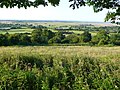
 View of Somerset Levels from Swell Wood - geograph.org.uk - 5363654.jpg 1,600 × 1,200; 810 KB
-
 View over West Sedgemoor - geograph.org.uk - 3138263.jpg 640 × 480; 140 KB
-
 View towards South Drove - geograph.org.uk - 2791421.jpg 1,600 × 1,067; 480 KB
-
 Wall beside A378 at Tanyard Farm - geograph.org.uk - 5363556.jpg 1,600 × 1,200; 790 KB
-
 War memorial, Fivehead - geograph.org.uk - 1903948.jpg 640 × 480; 151 KB
-
 War Memorial, Fivehead - geograph.org.uk - 2789578.jpg 2,592 × 3,888; 6.54 MB
-
 West Sedge Moor - geograph.org.uk - 1807051.jpg 640 × 413; 68 KB
-
 West Sedge Moor - geograph.org.uk - 4944160.jpg 1,024 × 768; 156 KB
-
 West Sedgemoor - geograph.org.uk - 1807627.jpg 640 × 392; 55 KB
-
 West Sedgemoor - geograph.org.uk - 1807632.jpg 640 × 446; 51 KB
-
 Western Farm - geograph.org.uk - 4956116.jpg 1,024 × 768; 175 KB
-
 Wheelchair access at Swell Wood - geograph.org.uk - 2791426.jpg 2,592 × 3,888; 6.17 MB
-
 Bales and willow on West Sedge Moor - geograph.org.uk - 557571.jpg 640 × 341; 77 KB
-
 Bridge over Fivehead River - geograph.org.uk - 450038.jpg 640 × 480; 157 KB
-
 Bridge over the River Isle, Isle Brewers - geograph.org.uk - 450019.jpg 640 × 480; 140 KB
-
 Broadway Drove - geograph.org.uk - 557539.jpg 640 × 480; 137 KB
-
 Drain on West Sedge Moor - geograph.org.uk - 556416.jpg 640 × 480; 141 KB
-
 Drain on West Sedge Moor - geograph.org.uk - 557587.jpg 485 × 640; 112 KB
-
 Drain on West Sedge Moor - geograph.org.uk - 558026.jpg 640 × 480; 135 KB
-
 Drain on West Sedge Moor - geograph.org.uk - 558036.jpg 640 × 480; 143 KB
-
 Field beside A378 - geograph.org.uk - 438612.jpg 640 × 480; 142 KB
-
 Field beside Stowey Road - geograph.org.uk - 556390.jpg 640 × 447; 110 KB
-
 Field by South Drove - geograph.org.uk - 558041.jpg 480 × 640; 97 KB
-
 Hatch Drove - geograph.org.uk - 558732.jpg 640 × 480; 106 KB
-
 Langford Lane - geograph.org.uk - 438616.jpg 480 × 640; 104 KB
-
 Lower Listock Farm - geograph.org.uk - 481592.jpg 640 × 480; 118 KB
-
 Moortown Farm - geograph.org.uk - 635571.jpg 640 × 480; 75 KB
-
 On Broadway Drove - geograph.org.uk - 557606.jpg 640 × 480; 152 KB
-
 Signpost near Two Bridges - geograph.org.uk - 557081.jpg 640 × 480; 164 KB
-
 Smith's Farm and Chilly Copse - geograph.org.uk - 481598.jpg 640 × 480; 110 KB
-
 South Drove - geograph.org.uk - 481594.jpg 640 × 480; 121 KB
-
 Swell Drove, West Sedgemoor, Somerset - geograph.org.uk - 50540.jpg 640 × 418; 165 KB
-
 Thorn Hill - geograph.org.uk - 381331.jpg 640 × 480; 64 KB
-
 View west at Mattock's Tree Green - geograph.org.uk - 381326.jpg 640 × 480; 97 KB
-
 Western Farm - geograph.org.uk - 438619.jpg 640 × 480; 110 KB


