Category:Fleetwood
Jump to navigation
Jump to search
town in Lancashire, England  | |||||
| Upload media | |||||
| Instance of | |||||
|---|---|---|---|---|---|
| Location | Wyre, Lancashire, North West England, England | ||||
| Said to be the same as | Fleetwood (Wikimedia duplicated page, civil parish) | ||||
 | |||||
Fleetwood is a coastal town in Lancashire, England, at the northwest corner of the Fylde, with a population of 25,939 at the United Kingdom Census 2011 census.
Subcategories
This category has the following 14 subcategories, out of 14 total.
A
B
C
E
F
- Fisherman's Friend (28 F)
- Fleetwood Boating Lake (19 F)
- Fleetwood Wrecks (2 F)
G
H
M
P
- Port of Fleetwood (25 F)
S
T
Media in category "Fleetwood"
The following 200 files are in this category, out of 1,058 total.
(previous page) (next page)-

-
 "Cafe Marina" 65 North Albert Street, Fleetwood, FY7 6AR - geograph.org.uk - 1961715.jpg 1,632 × 1,224; 547 KB
-
 "Welcome Home" - geograph.org.uk - 3718706.jpg 3,239 × 2,451; 1.57 MB
-
 "Wyre Rose" ferry approaching Fleetwood - geograph.org.uk - 2426688.jpg 1,024 × 654; 140 KB
-
 "Wyre Rose" ferry at Fleetwood - geograph.org.uk - 2426676.jpg 1,024 × 680; 170 KB
-
 2006 Morecambe Bay Helicopter Accident Memorial Detail - geograph.org.uk - 4207335.jpg 1,000 × 1,000; 1.18 MB
-

-
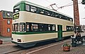
 A Blackpool bound tram - geograph.org.uk - 5820586.jpg 4,106 × 2,732; 7.09 MB
-
 A fence across the Lancashire Coastal Way - geograph.org.uk - 5749285.jpg 2,700 × 2,011; 340 KB
-
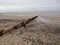 A Groyne on Fleetwood Beach - geograph.org.uk - 5973341.jpg 640 × 480; 71 KB
-
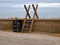 A ladder stile over the sea wall near Fleetwood - geograph.org.uk - 5749281.jpg 2,700 × 2,025; 378 KB
-
 A memorial bench by the Lancashire Coastal Way - geograph.org.uk - 5749266.jpg 2,700 × 1,944; 507 KB
-

-

-
 A stormy day on Rossall Beach - geograph.org.uk - 3164553.jpg 800 × 533; 233 KB
-
 A view of the Wyre Estuary. - geograph.org.uk - 1026985.jpg 640 × 480; 52 KB
-

-

-
 Abigail H awaiting low tide - geograph.org.uk - 1030811.jpg 640 × 480; 100 KB
-
 Aboard Wyre Rose - geograph.org.uk - 5100334.jpg 1,000 × 750; 579 KB
-
 Access to the beach by Rossall Scar - geograph.org.uk - 5749273.jpg 2,700 × 2,025; 496 KB
-
 Across the Wyre - geograph.org.uk - 5100410.jpg 1,000 × 750; 450 KB
-
-
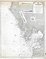
 Admiralty Chart No 2010 Morecambe Bay, Published 1873.jpg 12,195 × 8,415; 10.59 MB
-
 Al fresco cafe UK style - geograph.org.uk - 3187247.jpg 640 × 481; 55 KB
-
 Albert Square, Fleetwood - geograph.org.uk - 3487565.jpg 640 × 404; 134 KB
-
 Albert Street - geograph.org.uk - 3043495.jpg 640 × 481; 540 KB
-
 Aldi in Fleetwood - geograph.org.uk - 3012691.jpg 2,021 × 1,500; 266 KB
-
 Amounderness Way (A585) - geograph.org.uk - 3043830.jpg 640 × 480; 432 KB
-
 Amounderness Way (A585) - geograph.org.uk - 3827934.jpg 640 × 480; 60 KB
-
 Amounderness Way - geograph.org.uk - 5190971.jpg 1,000 × 750; 650 KB
-
 Amounderness Way and Fisherman's Friend Factory - geograph.org.uk - 2765617.jpg 2,193 × 1,554; 1 MB
-
 Amounderness Way looking south - geograph.org.uk - 3292529.jpg 640 × 480; 50 KB
-
 Amusement arcade, Fleetwood - geograph.org.uk - 3827031.jpg 640 × 480; 67 KB
-
 An industrial estate - geograph.org.uk - 5820520.jpg 4,305 × 2,795; 7.84 MB
-
 An overview of the cut off quay - geograph.org.uk - 5826454.jpg 4,542 × 3,023; 6.39 MB
-
 Anchor at Fisherman's Walk - geograph.org.uk - 3737323.jpg 1,000 × 669; 289 KB
-
 Anchors in Euston Gardens - geograph.org.uk - 6298905.jpg 1,280 × 1,098; 1.01 MB
-
 Ardent WK55 at Freeport - geograph.org.uk - 3279255.jpg 640 × 478; 151 KB
-
 Associated British Ports, Fleetwood - geograph.org.uk - 5826977.jpg 4,461 × 2,969; 5.74 MB
-
 Balmoral Terrace, Fleetwood - geograph.org.uk - 5960310.jpg 640 × 480; 64 KB
-
 Bart Simpson in Fleetwood - geograph.org.uk - 3043501.jpg 640 × 480; 482 KB
-
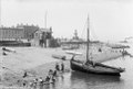 Beach and customs watch house, Fleetwood, Lancashire RMG G02624.tiff 6,545 × 4,453; 83.38 MB
-
 Beach and Groyne, Fleetwood - geograph.org.uk - 3826945.jpg 640 × 480; 94 KB
-
 Beach and Groyne, Rossall Scar - geograph.org.uk - 3826940.jpg 640 × 480; 79 KB
-
 Beach and holidaymakers, Fleetwood, Lancashire RMG G03256.tiff 6,496 × 4,488; 83.41 MB
-
 Beach at Fleetwood - geograph.org.uk - 5047524.jpg 640 × 481; 451 KB
-
 Beach at Rossall - geograph.org.uk - 3044087.jpg 640 × 480; 466 KB
-
 Beach fishing, Fleetwood - geograph.org.uk - 3826980.jpg 640 × 480; 62 KB
-
 Beach fishing, Rossall Scar - geograph.org.uk - 3826939.jpg 640 × 511; 64 KB
-
 Beach Lighthouse (1) - geograph.org.uk - 5113784.jpg 3,864 × 5,152; 6.12 MB
-
 Beach Lighthouse (2) - geograph.org.uk - 5113792.jpg 3,864 × 5,152; 5.93 MB
-
 Beach Lighthouse (Fleetwood).jpg 1,152 × 2,048; 289 KB
-
 Beach Lighthouse and radar station - geograph.org.uk - 6162267.jpg 3,640 × 2,730; 880 KB
-
 Beach Lighthouse, Fleetwood - geograph.org.uk - 3189602.jpg 2,736 × 3,648; 3.22 MB
-

-
 Beach near Rossall Point - geograph.org.uk - 4660051.jpg 640 × 517; 150 KB
-
 Beach Road, Fleetwood - geograph.org.uk - 3720464.jpg 4,488 × 3,290; 1.82 MB
-
 Beach Road-Broadway - geograph.org.uk - 3043862.jpg 640 × 481; 501 KB
-
 Beach, Fleetwood - geograph.org.uk - 3826948.jpg 640 × 480; 63 KB
-
 Beach, Rossall Point - geograph.org.uk - 3826944.jpg 640 × 480; 63 KB
-
 Blackpool and Fleetwood Tramway - geograph.org.uk - 3826924.jpg 640 × 480; 54 KB
-
 Blackpool and Fleetwood Tramway - geograph.org.uk - 3827915.jpg 640 × 480; 96 KB
-
 Blackpool and Fleetwood Tramway - geograph.org.uk - 3827918.jpg 640 × 480; 98 KB
-

-

-

-

-

-
-

-
-
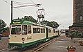
 Blackpool tram by North Euston Garden - geograph.org.uk - 4156515.jpg 1,500 × 999; 201 KB
-

-

-
 Boarded up houses on Dock Street - geograph.org.uk - 3126170.jpg 1,500 × 959; 108 KB
-

-
 Boardwalk to the coastal path - geograph.org.uk - 5666522.jpg 2,700 × 2,025; 549 KB
-
 Boat Graveyard,Fleetwood Marsh - geograph.org.uk - 2765577.jpg 2,560 × 1,920; 2.72 MB
-
 Boating Lake - geograph.org.uk - 3941860.jpg 2,560 × 1,920; 2.5 MB
-
 Boating Pool, Fleetwood - geograph.org.uk - 2765751.jpg 1,600 × 1,200; 217 KB
-
 Boating pool, Fleetwood - geograph.org.uk - 3826977.jpg 640 × 480; 47 KB
-
 Boating Pool, Fleetwood - geograph.org.uk - 5555071.jpg 640 × 480; 57 KB
-
 Boating Pool, Marine Gardens - geograph.org.uk - 3720334.jpg 4,608 × 3,456; 5.83 MB
-
 Boating Pool, Marine Gardens - geograph.org.uk - 3720338.jpg 4,608 × 3,456; 6.06 MB
-
 Boats (3332229367).jpg 4,086 × 2,886; 7.27 MB
-
 Boats at low tide, outside Wyre Dock, Fleetwood - geograph.org.uk - 5463249.jpg 1,024 × 768; 137 KB
-
 Boats on the river taking advantage of the flooding tide - geograph.org.uk - 5923413.jpg 4,484 × 2,984; 6.88 MB
-
 Bold Street-Hesketh Place, Fleetwood, Lancashire - geograph.org.uk - 1961758.jpg 1,630 × 1,063; 505 KB
-
 Bombardier Flexity 2, Lord Street - geograph.org.uk - 3043685.jpg 640 × 480; 474 KB
-
 Bowling greens - geograph.org.uk - 1343988.jpg 640 × 457; 352 KB
-
 Bridge at Marine Gardens Boating lake - geograph.org.uk - 3043966.jpg 640 × 480; 554 KB
-
 Bridge over the Boating Lake - geograph.org.uk - 3043967.jpg 640 × 480; 484 KB
-
 Bridleway by the sea wall - geograph.org.uk - 5749303.jpg 2,700 × 2,025; 454 KB
-
 Bridleway by the sea wall - geograph.org.uk - 5749306.jpg 2,700 × 2,019; 545 KB
-
 Britain in Bloom - geograph.org.uk - 6298544.jpg 1,280 × 1,112; 1.18 MB
-
 Broadway (A587) - geograph.org.uk - 3826925.jpg 640 × 480; 44 KB
-
 Bunkers - geograph.org.uk - 3043926.jpg 640 × 481; 434 KB
-
 Buoy 16 - geograph.org.uk - 6299390.jpg 1,280 × 960; 1.01 MB
-
 Buoy 23, Wyre estuary, Fleetwood - geograph.org.uk - 5463027.jpg 1,024 × 768; 130 KB
-
 Buoy 23A, Wyre estuary, Fleetwood - geograph.org.uk - 5463020.jpg 1,024 × 768; 106 KB
-
 Buoy and plaque - geograph.org.uk - 42940.jpg 640 × 479; 132 KB
-
 Buoys at Fleetwood - geograph.org.uk - 1252401.jpg 640 × 387; 56 KB
-
 Buses, trams and ferry. - geograph.org.uk - 533150.jpg 640 × 480; 86 KB
-
 Butterflies and Bumble Bees at Euston Gardens - geograph.org.uk - 6297759.jpg 1,280 × 968; 976 KB
-
 Canshe Hole, 80 minutes before low tide - geograph.org.uk - 5452525.jpg 1,024 × 768; 109 KB
-
 Car centre on Radcliffe Road - geograph.org.uk - 3827917.jpg 640 × 480; 53 KB
-
 Car park at Freeport - geograph.org.uk - 2960762.jpg 640 × 480; 118 KB
-
 Carousel in St Peter's Place - geograph.org.uk - 3043524.jpg 640 × 481; 645 KB
-
 Causeway, Fleetwood Marsh Nature Park - geograph.org.uk - 2765509.jpg 2,560 × 1,920; 3.04 MB
-
 Centenary class car at Fleetwood Ash Street - geograph.org.uk - 2101466.jpg 3,456 × 2,304; 4.16 MB
-
 Centenary class car at Fleetwood Ash Street - geograph.org.uk - 2101714.jpg 3,456 × 2,304; 3.76 MB
-
 Channel out to sea - geograph.org.uk - 2730363.jpg 1,500 × 988; 167 KB
-
 Channel to the sea - geograph.org.uk - 4156536.jpg 1,500 × 989; 195 KB
-
 Chapel at Rossall School, Fleetwood - geograph.org.uk - 6081209.jpg 1,600 × 1,065; 508 KB
-
 Chapel Of St.John The Baptist, Rossall School - geograph.org.uk - 3941088.jpg 2,232 × 1,254; 1.65 MB
-

-
 Charabanc on Upper Lune Street - geograph.org.uk - 5047506.jpg 640 × 481; 383 KB
-
 Chatsworth Avenue, Fleetwood - geograph.org.uk - 3043874.jpg 640 × 481; 459 KB
-
 Cherub drinking fountain - geograph.org.uk - 6298910.jpg 1,280 × 960; 903 KB
-
 Cherub drinking fountain - geograph.org.uk - 6299325.jpg 1,280 × 1,707; 1.36 MB
-

-

-
 Clock at Fisherman's Walk - geograph.org.uk - 1584688.jpg 640 × 479; 83 KB
-
 Clock Tower at Fisherman's Walk - geograph.org.uk - 3942786.jpg 1,000 × 1,000; 308 KB
-
 Clock tower memorial, Fleetwood - geograph.org.uk - 3827913.jpg 640 × 537; 69 KB
-
 Clock Tower on Lord Street - geograph.org.uk - 3043628.jpg 480 × 640; 477 KB
-
 Clock Tower, Fleetwood - DSC06627.JPG 2,736 × 3,648; 3.63 MB
-
 Clocktower Junction - geograph.org.uk - 4143333.jpg 5,472 × 3,648; 6.02 MB
-
 Close-up - geograph.org.uk - 1934378.jpg 640 × 480; 88 KB
-
 Closed units at Freeport - geograph.org.uk - 5188794.jpg 1,000 × 717; 574 KB
-
 Coastal changes - geograph.org.uk - 5908918.jpg 4,744 × 3,162; 3.24 MB
-
 Coastal Defence Project Rossall Beach - geograph.org.uk - 4711379.jpg 1,600 × 1,200; 523 KB
-
 Coastal Promenade S of Larkholme, Fleetwood - geograph.org.uk - 6010708.jpg 2,920 × 5,184; 3.54 MB
-
 Cobbled wall, The Mount - geograph.org.uk - 3486007.jpg 640 × 425; 201 KB
-
 Colourwashed houses, Mount Street, Fleetwood - geograph.org.uk - 5463273.jpg 1,024 × 768; 110 KB
-
 Commemorative Buoy - geograph.org.uk - 833141.jpg 640 × 481; 127 KB
-
 Communal bath - geograph.org.uk - 3720364.jpg 3,831 × 2,330; 2.4 MB
-

-

-
 Construction work on the sea wall at Larkholme - geograph.org.uk - 5749295.jpg 2,700 × 2,025; 381 KB
-
 Copse Road - geograph.org.uk - 5190474.jpg 1,000 × 750; 556 KB
-
 Coral encrusted pebbles on Rossall Beach - geograph.org.uk - 3672872.jpg 1,500 × 999; 252 KB
-

-
 Course of old dock road, now just a path - geograph.org.uk - 2765571.jpg 2,560 × 1,920; 2.69 MB
-

-
 Cycle track at Larkholme - geograph.org.uk - 1593237.jpg 640 × 422; 68 KB
-
 Cycleway Signpost - geograph.org.uk - 1961741.jpg 1,220 × 1,226; 316 KB
-
 Denham Way approaching roundabout - geograph.org.uk - 3292528.jpg 640 × 481; 40 KB
-
 Departure of Queen Victoria, Prince Albert and their children.jpg 602 × 470; 58 KB
-
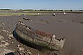 Derelict and aground at low water - geograph.org.uk - 5826256.jpg 4,420 × 2,942; 7.1 MB
-
 Derwent Avenue, Fleetwood - geograph.org.uk - 3720556.jpg 4,608 × 3,456; 2.4 MB
-
 Deserted beach, Fleetwood - geograph.org.uk - 3826949.jpg 640 × 480; 64 KB
-
 Deserted quay, Fleetwood - geograph.org.uk - 3827911.jpg 640 × 480; 37 KB
-
 Diner on Dock Street, Fleetwood - geograph.org.uk - 3827908.jpg 640 × 480; 74 KB
-
 Distant View Towards Rossal School - geograph.org.uk - 3941060.jpg 2,325 × 1,305; 1.96 MB
-
 Disused docks, Fleetwood - geograph.org.uk - 5349003.jpg 1,600 × 1,200; 396 KB
-
 Disused Railway - geograph.org.uk - 1157446.jpg 640 × 426; 144 KB
-
 Dock at Fleetwood - geograph.org.uk - 2329799.jpg 4,320 × 3,240; 4.18 MB
-
 Dock Street, Fleetwood - geograph.org.uk - 3827906.jpg 640 × 480; 52 KB
-
 Dock Street, Fleetwood - geograph.org.uk - 3827909.jpg 640 × 480; 59 KB
-
 Dock Street-Adelaide Street - geograph.org.uk - 3043471.jpg 640 × 427; 437 KB
-
 Dog walkers on the beach - geograph.org.uk - 5666526.jpg 2,700 × 2,025; 416 KB
-
 Dolphin Chippie - geograph.org.uk - 2928944.jpg 640 × 480; 120 KB
-
 Drainage Channel - geograph.org.uk - 3941046.jpg 2,560 × 1,920; 2.82 MB
-
 Drainage channel at Larkholme - geograph.org.uk - 2176180.jpg 1,500 × 1,000; 145 KB
-
 Drainage channel in the sea defence - geograph.org.uk - 2176126.jpg 1,500 × 1,000; 130 KB
-
 Dredger off Knott End on Sea - geograph.org.uk - 5728912.jpg 1,280 × 960; 858 KB
-
 Ebbing tide at Rossall Point - geograph.org.uk - 4064374.jpg 4,000 × 3,000; 3.47 MB
-
 Edward VII postbox (FY7 10) - geograph.org.uk - 5873471.jpg 1,280 × 1,707; 1.69 MB
-
 EIIR Postbox (FY7 44) - geograph.org.uk - 5189694.jpg 1,000 × 1,000; 718 KB
-
 EIIR postbox (FY7 7) - geograph.org.uk - 5188655.jpg 1,000 × 1,247; 817 KB
-

-
 End of the Pier, before the end of the pier - geograph.org.uk - 3794531.jpg 2,080 × 1,368; 445 KB
-

-
 Entrance to a landing stage at Fleetwood - geograph.org.uk - 5452483.jpg 1,024 × 768; 168 KB
-
 Entrance to caravan park - geograph.org.uk - 3827938.jpg 640 × 480; 54 KB
-
 Entrance to Fleetwood Dock - geograph.org.uk - 5190842.jpg 1,000 × 750; 580 KB
-
 Entrance to Freeport - geograph.org.uk - 2960836.jpg 640 × 506; 160 KB
-
 Entrance to holiday park - geograph.org.uk - 3827942.jpg 640 × 480; 50 KB
-

-
-
 Entrance to The Cala Gran Holiday Park - geograph.org.uk - 1962198.jpg 640 × 426; 230 KB
-
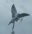 Eros at Fleetwood - geograph.org.uk - 5730792.jpg 1,280 × 1,368; 890 KB
-
 Estuary Shore at Fleetwood - geograph.org.uk - 5047531.jpg 640 × 481; 468 KB
-
 European Pioneer at Fleetwood - geograph.org.uk - 765940.jpg 640 × 447; 298 KB
-
 Fairway in Larkholme - geograph.org.uk - 1593227.jpg 640 × 409; 46 KB
-
 Fairway looking north - geograph.org.uk - 3292521.jpg 640 × 480; 47 KB
-
 Fairway, Larkholme, Fleetwood - geograph.org.uk - 6081234.jpg 1,600 × 1,065; 454 KB
-
 Fairway, Rossall View - geograph.org.uk - 3044001.jpg 640 × 481; 455 KB
-
 Farmer Parrs Animal World - geograph.org.uk - 5826200.jpg 4,534 × 2,275; 5.11 MB
-
 Feeling hungry in Fleetwood - geograph.org.uk - 1508142.jpg 640 × 522; 72 KB
-
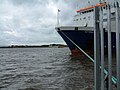 Ferry for Ireland - geograph.org.uk - 833128.jpg 640 × 481; 109 KB
-
 Ferry mooring rope - geograph.org.uk - 4318727.jpg 1,000 × 1,000; 700 KB
-
 Ferry pier - geograph.org.uk - 1344258.jpg 640 × 457; 291 KB
-
 Ferry Terminal, Fleetwood - geograph.org.uk - 2765657.jpg 1,920 × 2,560; 2.08 MB
-
 Ferry to Knott End - geograph.org.uk - 5100267.jpg 1,000 × 750; 580 KB
-
 Field of hay bales, Fleetwood - DSC06538.JPG 3,648 × 2,736; 3.64 MB
-
 Fisherman's Friend - geograph.org.uk - 3043848.jpg 640 × 480; 489 KB
-

_55_Bold_Street,_Fleetwood_FY7_6HL_-_geograph.org.uk_-_1961762.jpg)


_-_geograph.org.uk_-_3043830.jpg)
_-_geograph.org.uk_-_3827934.jpg)


_-_geograph.org.uk_-_5113784.jpg)
_-_geograph.org.uk_-_5113792.jpg)
.jpg)


.jpg)


_-_geograph.org.uk_-_3826925.jpg)


,_Fleetwood_-_geograph.org.uk_-_2426597.jpg)
,_Fleetwood_-_geograph.org.uk_-_2426624.jpg)


_-_geograph.org.uk_-_5873471.jpg)
_-_geograph.org.uk_-_5189694.jpg)
_-_geograph.org.uk_-_5188655.jpg)


