Category:Flempton
Jump to navigation
Jump to search
English: Flempton is a village in the St Edmundsbury district of Suffolk, England. It is on the A1101 road from Bury St Edmunds.
village in the United Kingdom  | |||||
| Upload media | |||||
| Instance of | |||||
|---|---|---|---|---|---|
| Location | St Edmundsbury, Suffolk, East of England, England | ||||
| Said to be the same as | Flempton (Wikimedia duplicated page, civil parish) | ||||
 | |||||
Subcategories
This category has the following 2 subcategories, out of 2 total.
C
G
- The Greyhound, Flempton (4 F)
Media in category "Flempton"
The following 43 files are in this category, out of 43 total.
-
 Brakey Pin Hall Farm - geograph.org.uk - 2865087.jpg 3,264 × 2,448; 1.46 MB
-
 Clough Staunch, River Lark - geograph.org.uk - 639747.jpg 640 × 427; 110 KB
-
 Cottages And Green - geograph.org.uk - 2758180.jpg 1,024 × 768; 221 KB
-
 Derelict lock, West Stow - geograph.org.uk - 5447849.jpg 640 × 480; 187 KB
-
 Drive and gateway to Brakey Pin Hall Farm - geograph.org.uk - 4747465.jpg 5,184 × 3,456; 4.06 MB
-
 Drive For Brakey Pin Hall Farm - geograph.org.uk - 5176528.jpg 1,024 × 769; 261 KB
-
 Driveway to Brakey Pin Hall Farm - geograph.org.uk - 1129568.jpg 640 × 427; 102 KB
-
 Entering Flempton - geograph.org.uk - 4703139.jpg 640 × 480; 61 KB
-
 Farmland near Flempton - geograph.org.uk - 4703136.jpg 640 × 480; 53 KB
-
 Field Boundary - geograph.org.uk - 5176546.jpg 1,024 × 768; 254 KB
-
 Field of barley - geograph.org.uk - 5447816.jpg 640 × 480; 114 KB
-
 Flat farmland near Flempton - geograph.org.uk - 4709462.jpg 640 × 480; 64 KB
-
 Flempton House - geograph.org.uk - 1129560.jpg 640 × 427; 82 KB
-
 Flempton Lock, River Lark - geograph.org.uk - 639745.jpg 427 × 640; 92 KB
-
 Heading east into Flempton - geograph.org.uk - 4709464.jpg 640 × 480; 53 KB
-
 Headstone of 2nd Lt John Marcon Floyd (RAF) - geograph.org.uk - 4914000.jpg 1,996 × 1,996; 1.41 MB
-
 Lackford landfill site - geograph.org.uk - 31369.jpg 640 × 427; 74 KB
-
 Ordnance Survey Flush Bracket 10731 - geograph.org.uk - 4273136.jpg 4,000 × 3,000; 4.34 MB
-
 Plover Lake - geograph.org.uk - 4428247.jpg 5,184 × 3,888; 2.23 MB
-
 River Lark, West Stow - geograph.org.uk - 2743313.jpg 1,280 × 856; 181 KB
-
 River Lark, West Stow - geograph.org.uk - 2743485.jpg 1,280 × 856; 251 KB
-
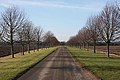
 Road from Risby to Flempton - geograph.org.uk - 5447809.jpg 640 × 428; 83 KB
-
 Round Bus Shelter - geograph.org.uk - 2758170.jpg 768 × 1,024; 210 KB
-
 School Warning Sign - geograph.org.uk - 5176513.jpg 1,024 × 768; 223 KB
-
 Thatched cottages, Flempton - geograph.org.uk - 4709465.jpg 640 × 439; 56 KB
-
 The Greyhound, Flempton (closed) - geograph.org.uk - 5447831.jpg 640 × 428; 106 KB
-
 Village green at Flempton - geograph.org.uk - 1148041.jpg 640 × 480; 78 KB
-
 Wheat field in Flempton - geograph.org.uk - 31220.jpg 640 × 427; 72 KB
-
 Wide Field Margin - geograph.org.uk - 5176562.jpg 1,024 × 768; 238 KB
-
 Copse next to Chimney Mill, West Stow - geograph.org.uk - 25344.jpg 640 × 427; 137 KB
-

-
 Entrance to Flempton House - geograph.org.uk - 25336.jpg 640 × 427; 111 KB
-
 Flempton Golf Clubhouse - geograph.org.uk - 31370.jpg 640 × 427; 98 KB
-
 Flempton Green - geograph.org.uk - 205336.jpg 640 × 427; 72 KB
-
 Pine trees at Icklingham - geograph.org.uk - 207110.jpg 640 × 427; 82 KB
-

-
 River Lark at West Stow Heath - geograph.org.uk - 639751.jpg 640 × 427; 107 KB
-
 River Lark at West Stow Heath - geograph.org.uk - 639759.jpg 640 × 427; 96 KB
-
 Stanchil's Farm - geograph.org.uk - 31222.jpg 640 × 427; 71 KB
-
 The King's Forest - geograph.org.uk - 203922.jpg 427 × 640; 143 KB
-
 The King's Forest - geograph.org.uk - 203926.jpg 640 × 427; 109 KB
-
 The King's Forest - geograph.org.uk - 203934.jpg 640 × 427; 104 KB
-
 Trees at West Stow Heath - geograph.org.uk - 639758.jpg 427 × 640; 141 KB


_-_geograph.org.uk_-_4914000.jpg)


_-_geograph.org.uk_-_5447831.jpg)


