Category:Flinders Street Station
Jump to navigation
Jump to search
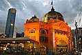
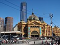
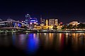
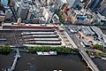
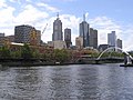
English: Flinders Street Station — the central railway station of the suburban rail network of Melbourne, Australia.
- It is on the corner of Flinders and Swanston Streets next to the Yarra River in the heart of the city.
- It was built after a competition for the design, in the Romanesque Revival Style, and completed in 1910.
Metropolitain railway station in Melbourne, Victoria, Australia  ,_Flinders_Street_Railway_Station_--_2019_--_202623.jpg)  .jpg) | |||||
| Upload media | |||||
| Instance of |
| ||||
|---|---|---|---|---|---|
| Named after | |||||
| Location | Melbourne central business district, City of Port Phillip, Melbourne, Victoria, AUS | ||||
| Street address |
| ||||
| Located on street |
| ||||
| Architectural style | |||||
| Transport network |
| ||||
| Connects with | |||||
| Owned by |
| ||||
| Operator | |||||
| Heritage designation |
| ||||
| Inception |
| ||||
| Date of official opening |
| ||||
| Connecting line |
| ||||
| Adjacent station |
| ||||
| Interchange station | |||||
| official website | |||||
 | |||||
Subcategories
This category has the following 6 subcategories, out of 6 total.
F
- Flinders Street Station (exterior) (153 F)
T
Media in category "Flinders Street Station"
The following 100 files are in this category, out of 100 total.
-
 2005-11-15 IR reform protests Melbourne 01.jpg 3,072 × 2,048; 2.72 MB
-
 3 V P3360618.jpg 3,968 × 2,232; 3.57 MB
-
 5-6 RVR ANZAC Day 2007.JPG 2,048 × 1,536; 523 KB
-
 5-6 RVR ANZAC Day 2008.JPG 2,048 × 1,536; 527 KB
-
 6 RVR ANZAC Day 2006.jpg 2,048 × 1,536; 515 KB
-
 69-1232 Melbourne, Australia 1969 (51214051132).jpg 1,800 × 1,177; 166 KB
-
 Coming into Flinders St Station.jpg 2,048 × 1,536; 1.04 MB
-
 Federation Square - Melbourne's Meeting Place (Tonemapped) (5430096989).jpg 4,770 × 3,177; 1.74 MB
-
 Flinders - panoramio.jpg 1,186 × 889; 473 KB
-
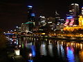
 Flinders St Station at night (cropped).jpg 5,952 × 3,719; 17.67 MB
-
 Flinders St Station at night.jpg 5,952 × 3,950; 18.15 MB
-
 Flinders St Station Melbourne. (47922779746).jpg 3,733 × 2,106; 4.18 MB
-
 Flinders St Station Side Entry Barriers.jpg 3,024 × 4,032; 3.65 MB
-
 Flinders St Stn Melbourne. (19575187118).jpg 2,532 × 1,460; 3.18 MB
-
 Flinders St. Viaduct & the River Yarra, Melbourne.jpg 7,188 × 5,364; 3.82 MB
-
 Flinders Street concourse interior OIC.jpg 1,600 × 1,200; 384 KB
-
 Flinders Street concourse signage 2011 OIC.jpg 1,600 × 1,200; 369 KB
-
 Flinders Street Railway Station, Melbourne, Australia (Unsplash -9UFPg3V6GI).jpg 2,968 × 3,957; 15.13 MB
-
 Flinders Street Station (47103670).jpeg 2,048 × 2,048; 984 KB
-
 Flinders Street Station - panoramio (1).jpg 3,499 × 2,332; 7.53 MB
-
 Flinders Street Station - panoramio (2).jpg 1,600 × 1,200; 887 KB
-
 Flinders Street station - panoramio.jpg 2,018 × 1,327; 687 KB
-
 Flinders Street Station 01.jpg 3,264 × 2,448; 1.6 MB
-
 Flinders Street Station 1908.jpg 1,163 × 518; 74 KB
-
 Flinders Street Station and Beyond (6410868645).jpg 2,687 × 1,792; 1.01 MB
-
 Flinders Street Station and Yarra River, Melbourne in 1914.jpg 902 × 730; 196 KB
-
 Flinders Street Station Competition winner 16 May 1883.jpg 1,388 × 490; 286 KB
-
 Flinders Street Station competition winning elevations.jpg 1,600 × 899; 248 KB
-
 Flinders Street Station Concourse 2017.jpg 2,112 × 1,408; 1.96 MB
-
 Flinders Street Station end of tunnel.jpg 3,264 × 2,448; 1.9 MB
-
 Flinders Street Station from Eureka Skydeck 01.jpg 3,072 × 2,304; 1.79 MB
-
 Flinders Street station from South Bank (Explored) (6634564383).jpg 4,752 × 3,168; 780 KB
-
 Flinders Street Station illuminated at night.jpg 3,248 × 2,020; 1.98 MB
-
 Flinders Street Station Roof (4520016663).jpg 1,800 × 1,200; 626 KB
-
 Flinders Street Station Ticket Office 1914-1918.jpg 1,600 × 1,211; 417 KB
-
 Flinders Street Station, Melbourne AUS.jpg 2,592 × 1,944; 1.47 MB
-
 Flinders Street stn end of underpass 2015.jpg 3,264 × 2,448; 1.71 MB
-
 Flindersstconcourse.jpg 500 × 375; 44 KB
-
 FlindersStreetA-SignalBox.jpg 550 × 349; 47 KB
-
 FlindersStreetStation-eastern entrance.jpg 3,008 × 2,000; 3.72 MB
-
 GJ-melbourne3.jpg 1,024 × 768; 213 KB
-
 Inside Flinders Street Station.jpg 614 × 461; 356 KB
-
 Jeroen Weimar 2018.png 486 × 753; 335 KB
-
 Laura MacFarlane Finders St Station 2014.jpg 340 × 508; 134 KB
-
 Melb CBD dotm banner 3.jpg 3,248 × 1,082; 1.45 MB
-
 Melbourne (17182298863).jpg 4,752 × 3,168; 12.23 MB
-
 Melbourne (17182419349).jpg 4,752 × 3,168; 328 KB
-
 Melbourne (2051641269).jpg 2,048 × 1,536; 1,003 KB
-
 Melbourne (2051641461).jpg 2,048 × 1,536; 725 KB
-
 Melbourne (2052428060).jpg 2,048 × 1,536; 931 KB
-
 Melbourne (2052428202).jpg 2,048 × 1,536; 1.03 MB
-
 Melbourne (26713920080).jpg 4,752 × 3,168; 21.15 MB
-
 Melbourne (27251052622).jpg 4,330 × 2,188; 10.39 MB
-
 Melbourne (27269393936).jpg 8,688 × 5,792; 68.68 MB
-
 Melbourne (27404996243).jpg 8,688 × 5,792; 68.26 MB
-
 Melbourne (6999149627).jpg 4,770 × 3,177; 7.92 MB
-
 Melbourne (AU), View from Eureka Tower, Flinders Street Railway Station -- 2019 -- 1462.jpg 6,720 × 4,480; 17.86 MB
-
 Melbourne (Flinders Street) (28230897351).jpg 6,000 × 4,000; 16.96 MB
-
 Melbourne (Flinders Street) (28309554995).jpg 6,000 × 4,000; 15.02 MB
-

-
 Melbourne and the Yarra.jpg 1,280 × 960; 637 KB
-
 Melbourne CBD including Flinders Street Station.jpg 4,032 × 3,024; 742 KB
-
 Melbourne Downtown 94.jpg 2,288 × 1,712; 781 KB
-
 Melbourne Flinders Street Railway Station D1000026.jpg 1,566 × 1,237; 1.43 MB
-
 Melbourne Flinders Street Railway Station D1000028.jpg 1,228 × 1,637; 1.28 MB
-
 Melbourne panorama.jpg 4,800 × 920; 2.59 MB
-
 Melbourne Skyline 3.jpg 3,186 × 2,343; 2.36 MB
-
 Melbourne south bank (27956269271).jpg 8,688 × 5,792; 65.87 MB
-
 Melbourne Towers (1543297109).jpg 1,800 × 1,350; 626 KB
-
 Melbourne VIC 3004, Australia - panoramio (135).jpg 5,284 × 3,198; 6.29 MB
-
 Melbourne VIC 3004, Australia - panoramio (136).jpg 12,662 × 2,936; 13.79 MB
-
 Melbourne VIC 3004, Australia - panoramio (137).jpg 10,896 × 3,128; 12.47 MB
-
 Melbourne VIC 3004, Australia - panoramio (41).jpg 1,800 × 2,700; 651 KB
-
 Melbourne VIC 3004, Australia - panoramio (91).jpg 2,700 × 1,800; 1.01 MB
-
 Melbourne, 1968 - Flickr - PhillipC.jpg 1,799 × 1,199; 746 KB
-
 Melbourne, Australia (Unsplash 09eoscPYdHU).jpg 4,646 × 3,077; 5.25 MB
-
 Melbourne, Australia - panoramio (121).jpg 5,184 × 3,456; 5.47 MB
-
 Melbourne, Australia - panoramio (131).jpg 5,132 × 3,378; 9.2 MB
-
 Melbourne, Australia - panoramio (136).jpg 5,184 × 3,026; 10.23 MB
-
 Melbourne, Australia - panoramio (137).jpg 5,184 × 3,456; 9.63 MB
-
 Melbourne, Australia - panoramio (91).jpg 5,092 × 3,314; 9.81 MB
-
 Melbourne, Australia - panoramio (92).jpg 5,184 × 3,456; 10.86 MB
-
 New Colour screen LCD PID used at Flinders Street Station.png 2,000 × 1,205; 214 KB
-
 New Metlink Signage.jpg 750 × 500; 109 KB
-
 Out About Melbourne Street Pic 48 (74564213).jpeg 800 × 343; 107 KB
-
 Pawłów Wielkopolski ~170623-16.jpg 2,560 × 1,920; 2.14 MB
-
 Police in 6th Lockdown Melbourne.jpg 4,000 × 2,250; 708 KB
-
 PRINCES BRIDGE MELBOURNE LOOKING EAST.tif 2,153 × 1,365; 8.42 MB
-
 Reflections (90135513).jpeg 2,048 × 1,365; 984 KB
-
 Southbank Bridge (1544162106).jpg 1,800 × 1,350; 726 KB
-
 Southgate.JPG 1,024 × 768; 304 KB
-
 Stasiun Kereta Api Flinders Street (2).jpg 4,608 × 2,240; 5.99 MB
-
 Stasiun Kereta Api Flinders Street.jpg 2,184 × 4,137; 4.52 MB
-
 Swanston Street Princes Bridge from Arts Centre 2010-11-22.jpg 3,648 × 2,736; 5.67 MB
-

-
 Two Aussie icons.jpg 1,280 × 960; 329 KB
-
 View of Melbourne, Australia, in February 1968.jpg 1,299 × 794; 712 KB
-
 What A Day In Melbourne Pic 01 (75005171).jpeg 800 × 533; 218 KB
-
 What A Day In Melbourne Pic 06 (75005177).jpeg 800 × 533; 173 KB
-
 Yarra river, Melbourne (26912317202).jpg 3,168 × 2,112; 996 KB


.jpg)

_(5430096989).jpg)

.jpg)

.jpg)

.jpg)


.jpg)
.jpeg)
.jpg)
.jpg)


.jpg)


_(6634564383).jpg)

.jpg)


.jpg)
.jpg)
.jpg)
.jpg)
.jpg)
.jpg)
.jpg)
.jpg)
.jpg)
.jpg)
.jpg)
,_View_from_Eureka_Tower,_Flinders_Street_Railway_Station_--_2019_--_1462.jpg)
_(28230897351).jpg)
_(28309554995).jpg)


.jpg)
.jpg)
.jpg)
.jpg)
.jpg)

.jpg)
.jpg)
.jpg)
.jpg)
.jpg)
.jpg)
.jpg)


.jpeg)


.jpeg)
.jpg)

.jpg)


.jpg)

.jpeg)
.jpeg)
.jpg)
.jpg)
.jpg)
Categories:
- Train stations in Melbourne
- Victorian Heritage Register
- Built in Australia in 1910
- Flinders Street, Melbourne
- Railway stations opened in 1910
- Frankston railway line
- Pakenham railway line
- Cranbourne railway line
- Sandringham railway line
- Lilydale railway line
- Belgrave railway line
- Alamein railway line
- Glen Waverley railway line
- Mernda railway line
- Hurstbridge railway line
- Flemington Racecourse railway line
- Craigieburn railway line
- Upfield railway line
- Sunbury railway line
- Werribee railway line
- Williamstown railway line
- Heritage buildings in Victoria, Australia
- Romanesque Revival architecture in Australia
- Buildings in Melbourne (suburb)
- Film locations in Melbourne
- Film locations in Victoria, Australia
- Art Nouveau train stations