Category:Flint, Wales
Jump to navigation
Jump to search
town in Wales, United Kingdom   | |||||
| Upload media | |||||
| Instance of | |||||
|---|---|---|---|---|---|
| Location |
| ||||
| Heritage designation |
| ||||
| Population |
| ||||
| Area |
| ||||
| official website | |||||
 | |||||
Български: 300px|мини|Сградата на кметството във Флинт
Cymraeg: Tref ar lannau Dyfrdwy yn Sir y Fflint yw Fflint. Mae gorsaf drenau'r dref ar Reilffordd Arfordir Gogledd Cymru. Rhed yr A548 a'r A5119 hefyd drwy'r dref. Y Fflint yw canolfan weinyddol y sir.
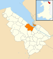
English: Flint is a town in Flintshire, North Wales, lying on the estuary of the River Dee. It was the county town of the historic county of Flintshire and today is the third largest town in Flintshire. According to the 2001 Census the population of the community of Flint was 12,804.
Français : Flint (en gallois : Y Fflint) est une ville du comté de Sir y Fflint, dans le nord du Pays de Galles, sur l'estuaire du fleuve Dee. Ses habitants (2001) en font la troisième ville du comté.
Lietuvių: Flintas miestas Didžiojoje Britanijoje, šiaurinėje Velso dalyje, ant Airijos jūros kranto, prie Dy upės estuarijos. 11,9 tūkst. gyventojų (2001 m.).
Nederlands: Flint is een plaats in Wales, in het bestuurlijke graafschap Flintshire en in het ceremoniële behouden graafschap Clwyd. De plaats telt 11.936 inwoners.
Norsk bokmål: Flint ( walisisk Y Fflint) er en by i Flintshire i det nordlige Wales. Den ligger ved elven Dee. Byen var tidligere administrasjonssenter i grevskapet, men disse funksjonene er flyttet til Mold.
Polski: Flint ( wal. Y Fflint) - miasto w północnej Walii (Wielka Brytania), hrabstwo Flintshire (wraz z Mold są największymi miastami hrabstwa). Graniczy od wschodu z Cheshire oraz okręgiem Wrexham na południu i Denbigshire na zachodzie. Według spisu powszechnego z 2001 roku miasto liczy 11 936 mieszkańców.
Subcategories
This category has the following 10 subcategories, out of 10 total.
C
- Cae-y-Castell (3 F)
F
- Flint Lifeboat Station (3 F)
- Flint railway station (36 F)
- Flint Town Hall (9 F)
- St Mary's Old Church, Flint (4 F)
- Flint, Wales, surrounding area (22 F)
J
S
Media in category "Flint, Wales"
The following 200 files are in this category, out of 557 total.
(previous page) (next page)-
 'The Big Flintshire Guardian' at Flint Point - geograph.org.uk - 5591066.jpg 1,024 × 769; 207 KB
-

-

-
 1813 Flint Lead Works Penny Token (FindID 785232).jpg 4,366 × 2,638; 3.93 MB
-
 2010 Wales Flintshire Community Flint map.svg 512 × 568; 494 KB
-
 2024 Wales Flintshire Community Flint map.svg 512 × 568; 394 KB
-
 A5119 Northop Road at Gulf filling station - geograph.org.uk - 6564679.jpg 1,024 × 752; 140 KB
-
 A548 - geograph.org.uk - 4493388.jpg 640 × 426; 100 KB
-
 A548 - geograph.org.uk - 4493397.jpg 640 × 399; 41 KB
-
 A548 and Holywell Street at Bagillt - geograph.org.uk - 6163369.jpg 800 × 494; 95 KB
-
 A548 at Rockliffe - geograph.org.uk - 3392850.jpg 640 × 480; 41 KB
-
 A548 at The Yacht public house - geograph.org.uk - 3392855.jpg 640 × 481; 61 KB
-
 A548 Chester Road at Oakenholt - geograph.org.uk - 6164877.jpg 800 × 471; 112 KB
-
 A548 Chester Road in Flint - geograph.org.uk - 6163307.jpg 800 × 475; 85 KB
-
 A548 Chester Road near Leadbrook Drive - geograph.org.uk - 6564234.jpg 1,024 × 706; 147 KB
-
 A548 Chester Street in Flint - geograph.org.uk - 6163332.jpg 800 × 545; 113 KB
-
 A548 heading north-west - geograph.org.uk - 3392863.jpg 640 × 481; 44 KB
-
 A548 heading towards Y Fflint - geograph.org.uk - 2995101.jpg 1,600 × 1,200; 495 KB
-
 A548 Holywell Road at Flint - geograph.org.uk - 6163344.jpg 800 × 509; 115 KB
-

-
 A548, Chester Street - geograph.org.uk - 3392860.jpg 640 × 480; 49 KB
-
 Aber Road pelican crossing, Flint - geograph.org.uk - 5258411.jpg 800 × 666; 123 KB
-
 Accommodation on a Flint corner - geograph.org.uk - 5266247.jpg 800 × 626; 99 KB
-
 Across fields towards Bryn Bach - geograph.org.uk - 3717282.jpg 3,264 × 2,448; 3.4 MB
-
 Across the Dee to Parkgate - geograph.org.uk - 2290543.jpg 1,200 × 803; 197 KB
-
 Afon Dyfrdwy saltings - geograph.org.uk - 2957343.jpg 1,600 × 1,200; 463 KB
-

-
 Albert Avenue, Flint - geograph.org.uk - 5257886.jpg 800 × 560; 87 KB
-
 Aldi supermarket, Flint - geograph.org.uk - 5256823.jpg 800 × 610; 78 KB
-
 Aldi, Flint - geograph.org.uk - 4493342.jpg 640 × 426; 73 KB
-
 All at the trough - geograph.org.uk - 3718554.jpg 3,264 × 2,448; 3.49 MB
-
 Alyn Veterinary Centre in Flint - geograph.org.uk - 5266337.jpg 800 × 588; 105 KB
-
 Anti motorcycle gateway - geograph.org.uk - 2957507.jpg 1,600 × 1,200; 405 KB
-

-
 Artwork along the Wales Coast Path - geograph.org.uk - 6164681.jpg 800 × 600; 157 KB
-
 Artwork overlooking Flint Castle - geograph.org.uk - 6126300.jpg 800 × 484; 92 KB
-

-

-
 Asda supermarket, Flint - geograph.org.uk - 5256555.jpg 800 × 553; 77 KB
-
 ASDA, Flint - geograph.org.uk - 4493369.jpg 640 × 426; 46 KB
-
 ATS Euromaster, Flint - geograph.org.uk - 5266263.jpg 800 × 719; 102 KB
-
 Barclays Bank, Flint - geograph.org.uk - 5258969.jpg 772 × 800; 120 KB
-
-
 Beacon, Flint Point - geograph.org.uk - 5317782.jpg 640 × 480; 52 KB
-

-
 Bella Boutique in Flint - geograph.org.uk - 5264040.jpg 575 × 800; 100 KB
-
 Bench mark on 71 Church Street, Flint - geograph.org.uk - 1736646.jpg 480 × 640; 184 KB
-
 Bench mark on Ann Moon's Cottage - geograph.org.uk - 1736396.jpg 480 × 640; 176 KB
-
 Bench Mark on Evans Street bridge - geograph.org.uk - 1737758.jpg 480 × 640; 169 KB
-
 Benkid77 A548 looking east, Flint 290609.JPG 1,280 × 1,024; 301 KB
-
 Benkid77 A548 looking west, Flint 290609.JPG 1,280 × 1,024; 372 KB
-
 Benkid77 Church Street, Flint 290609.JPG 1,280 × 1,024; 321 KB
-
 Benkid77 Flint TV Relay 290609.jpg 704 × 757; 123 KB
-
 Benkid77 Residential tower blocks, Flint 290609.JPG 1,024 × 1,280; 331 KB
-
 Benkid77 River Dee Community Church, Flint 290609.JPG 1,280 × 1,024; 310 KB
-
 Better Health Clinic, Flint - geograph.org.uk - 5255854.jpg 570 × 800; 98 KB
-
 Bevans, Flint - geograph.org.uk - 5255602.jpg 800 × 675; 127 KB
-

-

-
 Bolingbroke Heights - geograph.org.uk - 2962926.jpg 480 × 640; 77 KB
-
 Bolingbroke Heights sign - geograph.org.uk - 2962927.jpg 640 × 492; 94 KB
-
 Boots Pharmacy, Flint - geograph.org.uk - 5255392.jpg 800 × 536; 104 KB
-
 Borough Grove, Flint - geograph.org.uk - 5266255.jpg 800 × 538; 89 KB
-
 BT phonebox on a Flint corner - geograph.org.uk - 5257834.jpg 800 × 708; 130 KB
-
 Bungalow at Leadbrook Drive - geograph.org.uk - 2995141.jpg 1,600 × 1,200; 394 KB
-
 Burnshead Crotty - geograph.org.uk - 2995115.jpg 1,600 × 1,200; 552 KB
-

-
 Caesar Avenue, Flint - geograph.org.uk - 5255628.jpg 800 × 546; 89 KB
-
 Caesar Avenue, Flint - geograph.org.uk - 5255633.jpg 800 × 514; 84 KB
-
 Candid Cards in Flint - geograph.org.uk - 5264012.jpg 800 × 781; 164 KB
-
 Car park, Flint Station - geograph.org.uk - 4493354.jpg 640 × 543; 67 KB
-
 Car park, Flint Station - geograph.org.uk - 4493355.jpg 640 × 557; 65 KB
-
 Carewatch office, Flint - geograph.org.uk - 5258253.jpg 550 × 800; 103 KB
-
 Carved hand below the Big Flintshire Guardian - geograph.org.uk - 5591156.jpg 767 × 1,024; 242 KB
-
 Castell Fflint (1130957).jpg 1,229 × 844; 866 KB
-
 Castell y Fflint - Flint Castle - geograph.org.uk - 5204793.jpg 640 × 480; 80 KB
-

-

-
 Castle Dyke Street, Flint - geograph.org.uk - 5466862.jpg 800 × 525; 89 KB
-
 Castle Dyke Street, Flint - geograph.org.uk - 6147678.jpg 4,000 × 3,000; 2.69 MB
-

-
 Castle Heights, Flint - geograph.org.uk - 5372163.jpg 600 × 800; 103 KB
-
 Castle Park Flint information board - geograph.org.uk - 5466724.jpg 785 × 800; 162 KB
-
 Castle Road railway bridge - geograph.org.uk - 1739556.jpg 640 × 480; 138 KB
-
 Castle Road railway bridge - geograph.org.uk - 1739605.jpg 640 × 480; 96 KB
-
 Castle Road, Flint - geograph.org.uk - 5255876.jpg 800 × 614; 162 KB
-
 Castle Street, Flint - geograph.org.uk - 5466793.jpg 800 × 739; 119 KB
-
 Catholic Church in Flint - geograph.org.uk - 5257128.jpg 800 × 558; 97 KB
-
 Cattle grazing on the edge of town - geograph.org.uk - 2995190.jpg 1,600 × 1,200; 469 KB
-
 Centenary Square, Flint - geograph.org.uk - 5372111.jpg 800 × 600; 111 KB
-
-
 Chapel Street building site, Flint - geograph.org.uk - 5373091.jpg 800 × 581; 92 KB
-
 Chester Road at Oakenholt - geograph.org.uk - 5317228.jpg 640 × 480; 56 KB
-
 Chester Road at Pentre Ffwrndan - geograph.org.uk - 6162517.jpg 800 × 503; 85 KB
-
 Chester Road houses, Flint - geograph.org.uk - 5257748.jpg 800 × 567; 80 KB
-
 Chester Road houses, Flint - geograph.org.uk - 5257779.jpg 800 × 575; 87 KB
-
 Chester Road houses, Flint - geograph.org.uk - 5257804.jpg 800 × 607; 96 KB
-

-

-
 Chester Street - geograph.org.uk - 2962928.jpg 640 × 480; 85 KB
-
 Chiq in Flint - geograph.org.uk - 5258983.jpg 799 × 800; 148 KB
-

-
 Church Street - geograph.org.uk - 2962929.jpg 640 × 429; 62 KB
-
 Church Street bench and phonebox, Flint - geograph.org.uk - 5258301.jpg 800 × 658; 117 KB
-
 Church Street Dental Centre, Flint - geograph.org.uk - 5256994.jpg 800 × 667; 125 KB
-
 Church Street, Flint - geograph.org.uk - 1736647.jpg 640 × 480; 133 KB
-
-
 Cliff Tierney Funeral Directors, Flint - geograph.org.uk - 5266330.jpg 800 × 631; 103 KB
-

-
 Coed bedw - Birch trees - geograph.org.uk - 3816230.jpg 640 × 480; 64 KB
-
 Coleshill Street houses, Flint - geograph.org.uk - 5257148.jpg 800 × 636; 95 KB
-
 Concrete ruins dumped by the Dee Estuary - geograph.org.uk - 2716877.jpg 3,648 × 2,736; 4.72 MB
-
 Converted chapel at Oakenholt - geograph.org.uk - 5317246.jpg 640 × 480; 56 KB
-
 Corbett Bookmakers in Flint town centre - geograph.org.uk - 5280507.jpg 627 × 800; 130 KB
-

-

-

-

-
 Cornist Lane near Cornist Hall - geograph.org.uk - 6564676.jpg 1,024 × 768; 227 KB
-
 Corporation Street, Flint - geograph.org.uk - 5466784.jpg 800 × 531; 77 KB
-

-
 Cows grazing on pastureland near Sylfaen Farm - geograph.org.uk - 3434267.jpg 1,600 × 1,200; 304 KB
-

-
 Croes Atti Lane, Oakenholt - geograph.org.uk - 5255638.jpg 800 × 648; 135 KB
-
 Croes Atti Primary School, Flint - geograph.org.uk - 5317576.jpg 640 × 470; 104 KB
-
 Daisy Chains Nursery, Flint - geograph.org.uk - 5466726.jpg 800 × 596; 103 KB
-
-
 Dee Bridge - geograph.org.uk - 1827827.jpg 2,304 × 1,728; 513 KB
-
-
 Dee estuary panorama - geograph.org.uk - 5317974.jpg 640 × 172; 19 KB
-
 Dee Flowers, Flint - geograph.org.uk - 5257501.jpg 800 × 647; 122 KB
-
 Dee Inn, Flint - geograph.org.uk - 5264193.jpg 800 × 741; 173 KB
-

-

-
 Delyn Windows in Flint - geograph.org.uk - 5266212.jpg 771 × 800; 124 KB
-
 Departing Flint - geograph.org.uk - 3257131.jpg 640 × 413; 115 KB
-
 Diana Kebab Shop, Flint - geograph.org.uk - 3501016.jpg 1,024 × 682; 193 KB
-
 Donjon at Flint Castle - geograph.org.uk - 3490563.jpg 5,184 × 3,456; 3.57 MB
-
 Donjon, Flint Castle - geograph.org.uk - 3264519.jpg 1,478 × 986; 406 KB
-
 Drain beside the last house - geograph.org.uk - 2995175.jpg 1,600 × 1,200; 717 KB
-
 Drain Doctor, Flint - geograph.org.uk - 5256523.jpg 800 × 502; 90 KB
-
 Driver Hire Nationwide, Flint - geograph.org.uk - 5266219.jpg 800 × 470; 72 KB
-

-
 Earl Street, Flint - geograph.org.uk - 5257462.jpg 800 × 611; 138 KB
-
 Eglwys Fethodistaidd Flint - geograph.org.uk - 5280873.jpg 800 × 549; 99 KB
-

-

-
-
 Entrance to Sainsbury's Flint - geograph.org.uk - 5256623.jpg 800 × 573; 94 KB
-
 Entrance to Troes-Y-Mynydd - geograph.org.uk - 6564684.jpg 1,024 × 768; 190 KB
-

-
 Evans St - geograph.org.uk - 4556903.jpg 640 × 426; 62 KB
-
 Evans Street houses, Flint - geograph.org.uk - 5466711.jpg 800 × 570; 115 KB
-
 Evans Street railway bridge, Flint - geograph.org.uk - 1737778.jpg 640 × 480; 123 KB
-
 Evening at Flint Castle - geograph.org.uk - 6009167.jpg 5,184 × 2,920; 4.99 MB
-
 Evening at Flint Castle - geograph.org.uk - 6009172.jpg 5,184 × 2,920; 5.1 MB
-
 Farmland, Oakenholt - geograph.org.uk - 5317254.jpg 640 × 455; 44 KB
-
 Feathers Street eastwards - geograph.org.uk - 2962930.jpg 640 × 539; 75 KB
-
 Feathers Street westwards - geograph.org.uk - 2962931.jpg 640 × 516; 78 KB
-

-

-

-
-
 Field by the railway line - geograph.org.uk - 4493326.jpg 640 × 493; 65 KB
-
 Fire Station, Y Fflint - geograph.org.uk - 222651.jpg 640 × 480; 68 KB
-
 Flats in Flint - geograph.org.uk - 2962924.jpg 640 × 498; 78 KB
-
 Flint (1133880).jpg 1,709 × 1,012; 1.45 MB
-
 Flint (Y Fflint) Station - geograph.org.uk - 4493358.jpg 640 × 554; 73 KB
-
 Flint boundary sign on a lamppost - geograph.org.uk - 5255636.jpg 800 × 591; 96 KB
-
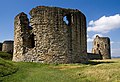
 Flint Castle (1) - geograph.org.uk - 3587697.jpg 640 × 337; 252 KB
-
 Flint Castle (Castell y Fflint) - geograph.org.uk - 6164684.jpg 800 × 559; 104 KB
-
 Flint Castle - east corner tower (3) - geograph.org.uk - 3587711.jpg 640 × 427; 361 KB
-
 Flint Castle - east corner tower (4) - geograph.org.uk - 3587724.jpg 640 × 483; 362 KB
-
 Flint Castle - east corner tower (5) - geograph.org.uk - 3587732.jpg 640 × 446; 349 KB
-
 Flint Castle - geograph.org.uk - 1808170.jpg 960 × 622; 226 KB
-
 Flint Castle - geograph.org.uk - 2278275.jpg 800 × 533; 53 KB
-
 Flint Castle - geograph.org.uk - 2278281.jpg 1,600 × 1,067; 570 KB
-
 Flint Castle - geograph.org.uk - 3315074.jpg 640 × 840; 99 KB
-
 Flint Castle - geograph.org.uk - 4161975.jpg 1,024 × 680; 256 KB
-
 Flint Castle - geograph.org.uk - 4161997.jpg 800 × 531; 122 KB
-
 Flint Castle - geograph.org.uk - 4162678.jpg 1,024 × 680; 242 KB
-
 Flint Castle - geograph.org.uk - 4162689.jpg 800 × 531; 128 KB
-
 Flint Castle - geograph.org.uk - 5240867.jpg 1,024 × 630; 69 KB
-
 Flint Castle - geograph.org.uk - 5317616.jpg 640 × 480; 60 KB
-
 Flint Castle - geograph.org.uk - 5317620.jpg 640 × 480; 53 KB
-
 Flint Castle - geograph.org.uk - 6017339.jpg 5,184 × 3,888; 4.15 MB
-
 Flint Castle - geograph.org.uk - 6147677.jpg 4,000 × 3,000; 2.47 MB
-
 Flint Castle - geograph.org.uk - 6365865.jpg 6,000 × 4,000; 4.28 MB
-
 Flint Castle - geograph.org.uk - 6365867.jpg 6,000 × 4,000; 2.76 MB
-
 Flint Castle - keep and corner tower (2) - geograph.org.uk - 3587702.jpg 640 × 439; 391 KB
-
 Flint Castle direction sign - geograph.org.uk - 5266447.jpg 640 × 622; 82 KB
-
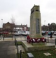 Flint Cenotaph - geograph.org.uk - 5372087.jpg 774 × 800; 119 KB
-
 Flint Church (1132465).jpg 1,000 × 776; 105 KB
-
 Flint Convenience Store, Flint - geograph.org.uk - 5255601.jpg 644 × 800; 105 KB
-

-
 Flint Dock tidal creek - geograph.org.uk - 6164476.jpg 800 × 579; 121 KB
-
 Flint Fire Station - geograph.org.uk - 4354327.jpg 4,308 × 2,872; 1.88 MB
-
 Flint Fire Station - geograph.org.uk - 4493341.jpg 640 × 426; 112 KB
-
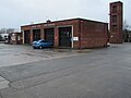
 Flint fire station - geograph.org.uk - 5266173.jpg 800 × 506; 62 KB
-
 Flint fire station and tower - geograph.org.uk - 5256876.jpg 800 × 597; 76 KB

.jpg)

.jpg)


.jpg)


.jpg)
_Station_-_geograph.org.uk_-_4493358.jpg)

_-_geograph.org.uk_-_3587697.jpg)
_-_geograph.org.uk_-_6164684.jpg)
_-_geograph.org.uk_-_3587711.jpg)
_-_geograph.org.uk_-_3587724.jpg)
_-_geograph.org.uk_-_3587732.jpg)


_-_geograph.org.uk_-_3587702.jpg)


.jpg)


