Category:Flood level signs in England
Jump to navigation
Jump to search
Subcategories
This category has the following 3 subcategories, out of 3 total.
F
L
O
Media in category "Flood level signs in England"
The following 44 files are in this category, out of 44 total.
-
 1894 flood marker.jpg 3,648 × 2,736; 2.38 MB
-
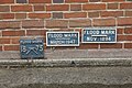
 1953 Flood Blue Plaque.jpg 432 × 425; 132 KB
-
 After the flood - geograph.org.uk - 122797.jpg 640 × 579; 138 KB
-
 After the flood - geograph.org.uk - 122798.jpg 640 × 480; 121 KB
-
 Archway Under Trent Bridge - geograph.org.uk - 608013.jpg 640 × 405; 79 KB
-
 Benchmark and Flood Mark, Delph - geograph.org.uk - 337323.jpg 640 × 478; 139 KB
-
 Benchmark and WD HWM at Magazines Promenade.jpg 4,280 × 3,032; 7.2 MB
-
 Burnham Overy Mill - geograph.org.uk - 175944.jpg 640 × 480; 114 KB
-
 Depth marker at Bulby ford - geograph.org.uk - 405508.jpg 640 × 427; 121 KB
-
 Flood gauge on the Cam at Hauxton - geograph.org.uk - 677361.jpg 480 × 640; 149 KB
-

-
 Flood history - geograph.org.uk - 1451558.jpg 640 × 426; 108 KB
-
 Flood Level 12.10.00 (3597640721).jpg 2,592 × 1,944; 2.11 MB
-

-
 Flood Level Mark, Guildford - geograph.org.uk - 646791.jpg 640 × 480; 81 KB
-
 Flood level marker, Bruton (geograph 2156859).jpg 640 × 480; 114 KB
-

-
 Flood level Patwell Street Bruton - geograph.org.uk - 1165658.jpg 468 × 640; 79 KB
-
 Flood Levels at Marsh Lock.jpg 5,184 × 3,456; 5.39 MB
-
 Flood mark on a garden wall, Brighouse - geograph.org.uk - 6360178.jpg 2,000 × 1,497; 1.2 MB
-
 Flood marker - geograph.org.uk - 1571076.jpg 426 × 640; 94 KB
-
 Flood marker - geograph.org.uk - 752141.jpg 640 × 480; 106 KB
-
 Flood Markers at Abingdon Lock - geograph.org.uk - 3104043.jpg 1,024 × 683; 245 KB
-

-
 Flood marks - geograph.org.uk - 1050156.jpg 480 × 640; 78 KB
-
 Flood marks - geograph.org.uk - 779865.jpg 427 × 640; 110 KB
-
 Flood marks - geograph.org.uk - 985399.jpg 640 × 480; 81 KB
-
 Flood marks across the lock - geograph.org.uk - 1431026.jpg 640 × 426; 112 KB
-
 Flood marks at the base - geograph.org.uk - 1571073.jpg 640 × 427; 111 KB
-
 Flood Marks at Wallingford - geograph.org.uk - 642081.jpg 640 × 480; 135 KB
-
 Flood marks on the boat house - geograph.org.uk - 1415576.jpg 455 × 640; 77 KB
-
 Flood marks on the wall - geograph.org.uk - 1178881.jpg 640 × 426; 92 KB
-
 Girton floodmarks - geograph.org.uk - 666010.jpg 640 × 427; 124 KB
-
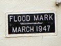 Henley-on-Thames 154 Flood mark March 1977 (8086265056).jpg 1,920 × 1,444; 1.03 MB
-
 Floodmark - geograph.org.uk - 381973.jpg 427 × 640; 104 KB
-
 How flooded are we^ - geograph.org.uk - 439018.jpg 640 × 477; 111 KB
-
 Lealholm floodmarks.jpg 480 × 722; 117 KB
-
 Markers on the wall - geograph.org.uk - 1275182.jpg 640 × 426; 84 KB
-
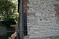
 River Derwent flood height marks - geograph.org.uk - 1288250.jpg 640 × 427; 105 KB
-
 The Fat Cat, Sheffield - geograph.org.uk - 539350.jpg 480 × 640; 117 KB
-
 The Harbour Inn, Southwold - geograph.org.uk - 1104190.jpg 640 × 427; 76 KB
-
 Up to this stone - geograph.org.uk - 1275253.jpg 400 × 600; 68 KB
-
 Water Levels at Rothschild's Bungalow - geograph.org.uk - 678482.jpg 640 × 640; 111 KB
-
 Water St Margarets Church King's Lynn.jpg 768 × 1,024; 602 KB


.jpg)


.jpg)


.jpg)


