Category:Flood protection in Austria
Jump to navigation
Jump to search
Countries of Europe: Austria · Belgium · Croatia · Czech Republic · Denmark · Estonia · Finland · France‡ · Germany · Hungary · Iceland · Italy · Latvia · Luxembourg · Netherlands‡ · Norway · Poland · Portugal‡ · Romania · Russia‡ · Slovakia · Slovenia · Spain‡ · Switzerland · Ukraine · United Kingdom
‡: partly located in Europe
‡: partly located in Europe
Subcategories
This category has the following 11 subcategories, out of 11 total.
C
- Check dams in Austria (46 F)
D
M
- Machlanddamm (7 F)
- Mobile flood protection Urfahr (19 F)
R
S
- Storm drains in Austria (15 F)
W
- Wildbachverbauung Hoferbergbach (16 F)
Media in category "Flood protection in Austria"
The following 40 files are in this category, out of 40 total.
-
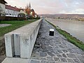
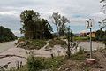
 2017-11-14 (545) Flood protection in Ybbs an der Donau.jpg 4,000 × 3,000; 4.05 MB
-
 2017-11-14 (554) Flood protection in Ybbs an der Donau.jpg 4,000 × 3,000; 3.19 MB
-
 2017-11-14 (555) Flood protection in Ybbs an der Donau.jpg 4,000 × 3,000; 3.32 MB
-
 2017-11-14 (567) Ybbs an der Donau.jpg 4,000 × 3,000; 2.94 MB
-
 20230806 110959 Rückhaltebecken Truppestraße.jpg 1,800 × 4,000; 4.7 MB
-
 20230806 111227 Rückhaltebecken Truppestraße.jpg 4,000 × 1,800; 5.14 MB
-
 20230806 123304 Viktring zwischen Bach und Wedenigstraße.jpg 4,000 × 1,800; 1.79 MB
-
 20230806 123323 Viktring zwischen Bach und Wedenigstraße.jpg 1,800 × 4,000; 2.46 MB
-
 Afritz, Tronitzerbach, Wildbach- und Lawinenverbauung, Kärnten.jpg 1,500 × 1,100; 800 KB
-
 Almbach Hochwasserschutz (2013).jpg 3,552 × 2,000; 2.63 MB
-
 Arnoldstein, künstlicher Wasserfall.jpg 997 × 1,500; 1.75 MB
-
 Bachregulierung im Ortszentrum von Obervellach (Kärnten).jpg 2,469 × 3,500; 7.24 MB
-
 BadenHelenentalHochwasserBefahrungsverbot20111113.JPG 3,648 × 2,736; 2.96 MB
-
 Bird feeder 02, Marbach an der Donau.jpg 3,152 × 4,800; 6.53 MB
-

-
 Dambach, Wildbachverbauung 1963.jpg 4,928 × 3,264; 8.86 MB
-
 Demo Hochwasserschutz 7462.JPG 2,928 × 4,392; 4.77 MB
-
 Demo Hochwasserschutz 7463.JPG 2,936 × 4,404; 3.54 MB
-
 Feuerwehr Baldramsdorf, Hochwasserschutz, Kärnten.jpg 4,826 × 2,593; 4.89 MB
-
 Firschnitzbach im Ortszentrum der Gemeinde Virgen, Osttirol.jpg 4,808 × 3,333; 8 MB
-
 Flood protection Dambach, Windischgarsten.jpg 4,928 × 3,264; 7.2 MB
-
 Flood protection, Marbach an der Donau.jpg 3,264 × 4,928; 8.28 MB
-
 Glanfluss Kärnten, Hochwasserschutz bei Karnburg.jpg 1,500 × 952; 1.7 MB
-
 Hochwasserschutz an der Drau, Oberdrauburg, Kärnten.jpg 1,500 × 1,193; 729 KB
-
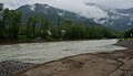
 Hochwasserschutz im Inn 2.jpg 3,872 × 2,047; 4.72 MB
-
 Hochwasserschutz im Inn.jpg 3,249 × 1,907; 3.6 MB
-
 Hochwasserschutzanlage, Ködnitzbach, Nationalpark Hohe Tauern.jpg 5,000 × 3,333; 9.65 MB
-
 Obere Drau, Europaschutzgebiet, Bereich Oberdrauburg, Kärnten.jpg 1,500 × 860; 731 KB
-
 Oberndorf - Leopold-Kohr-Promenade - Tafel - 2021 05 18-5.jpg 5,184 × 3,456; 5.18 MB
-
 Retention area for river Liesing near Willergasse.jpg 4,928 × 3,264; 9.74 MB
-
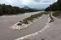 Saalachspitz 04.jpg 5,184 × 3,456; 1.62 MB
-
 Saalachspitz 06.jpg 5,104 × 3,402; 2.13 MB
-
 Saalachspitz 08.jpg 5,184 × 3,456; 1.82 MB
-
 Ship on Danube at Ybbs.jpg 4,760 × 2,896; 6.47 MB
-
 Sicherheitstag phillip prokesch 0003 (35293226280).jpg 2,469 × 1,648; 1.18 MB
-
 Urslau Ache Hochwasserschutz 1.JPG 3,611 × 2,411; 3.45 MB
-
 Urslau Ache Hochwasserschutz 2.JPG 4,110 × 2,744; 4.92 MB
-
 Urslau Ache Hochwasserschutz Infotafel.JPG 6,016 × 4,016; 7.65 MB
-
 Wachau 8430.JPG 5,184 × 3,456; 10.14 MB
-
 Wien12.SchildaHochwasserBetretungsverbot20111112.JPG 3,648 × 2,736; 5.77 MB
_Flood_protection_in_Ybbs_an_der_Donau.jpg)
_Flood_protection_in_Ybbs_an_der_Donau.jpg)
_Flood_protection_in_Ybbs_an_der_Donau.jpg)
_Ybbs_an_der_Donau.jpg)


.jpg)

.jpg)


.jpg)


