Category:Flower Ridge Trail
Jump to navigation
Jump to search
|
Flower Ridge Trail has an entry on OpenStreetMap (show). |
trail in Strathcona Regional District | |||||
| Upload media | |||||
| Instance of | |||||
|---|---|---|---|---|---|
| Location | Strathcona Regional District, British Columbia, Canada | ||||
| |||||
English: Flower Ridge Trail is located east of Strathcona-Westmin Provincial Park on Vancouver Island, British Columbia. (Note that there is another trail with this name in Sea to Sea Regional Park on the south end of the island.)
Media in category "Flower Ridge Trail"
The following 17 files are in this category, out of 17 total.
-
 Another frozen pond (48822704206).jpg 2,048 × 1,536; 1.08 MB
-
 Buttle Lake (48822340558).jpg 1,536 × 2,048; 765 KB
-
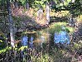
 Colorful pond! (48822346078).jpg 2,048 × 1,536; 1.04 MB
-
 Frozen pond - frozen grass (48822339578).jpg 2,048 × 1,536; 1.05 MB
-
 Glacier detail (48822865097).jpg 2,048 × 1,536; 268 KB
-
 Looking across... something - can't see the bottom! (48822702691).jpg 2,048 × 1,536; 762 KB
-
 Looking out across the lake - see the peaks? (48822345138).jpg 2,048 × 1,536; 665 KB
-
 Looking over Buttle Lake (48822859027).jpg 2,048 × 1,536; 941 KB
-
 Moss art (48822342958).jpg 2,048 × 1,536; 1.18 MB
-
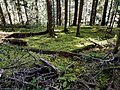
 Moss carpeting (48822707961).jpg 2,048 × 1,536; 1.12 MB
-
 Moss everywhere! (48822706671).jpg 2,048 × 1,536; 877 KB
-
 Moss walls (48822864052).jpg 2,048 × 1,536; 830 KB
-
 Peak detail (48822345438).jpg 2,048 × 1,536; 368 KB
-
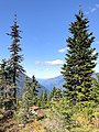
 Peaks across the lake (48822865452).jpg 2,048 × 1,536; 326 KB
-
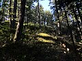
 Section of trail (48822708831).jpg 2,048 × 1,536; 1.13 MB
-
 Stairway to heaven? Yes! Flower Ridge! (48822706141).jpg 1,536 × 2,048; 1.01 MB
-
 The start of the Flower Ridge Trail (48822861347).jpg 1,536 × 2,048; 1.17 MB
.jpg)
.jpg)
.jpg)
.jpg)
.jpg)
.jpg)
.jpg)
.jpg)
.jpg)
.jpg)
.jpg)
.jpg)
.jpg)
.jpg)
.jpg)
.jpg)
.jpg)