Category:Fluchthorn
Jump to navigation
Jump to search
mountain in the Silvretta at the border Tyrol / Grisons  Fluchthorn, Piz Fenga | |||||
| Upload media | |||||
| Pronunciation audio | |||||
|---|---|---|---|---|---|
| Instance of | |||||
| Location | |||||
| Mountain range | |||||
| Topographic prominence |
| ||||
| Topographic isolation |
| ||||
| Elevation above sea level |
| ||||
| Parent peak | |||||
 | |||||
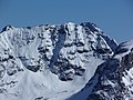
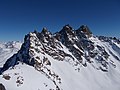
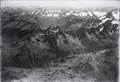
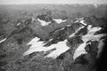
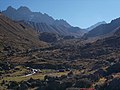
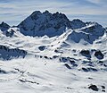
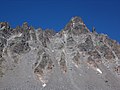
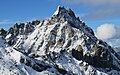
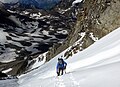
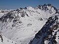
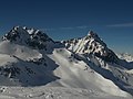
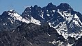
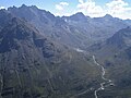
Das Fluchthorn (rätoromanisch Piz Fenga) ist ein Bergmassiv in der östlichen Silvretta an der Grenze zwischen Österreich und der Schweiz. Mit seit einem Bergsturz am 11. Juni 2023 3397 m Höhe ist das Fluchthorn nach wie vor der zweithöchste Berg der Silvretta.
Media in category "Fluchthorn"
The following 67 files are in this category, out of 67 total.
-
 05 Reste des Larainferners.jpg 2,272 × 1,704; 1.03 MB
-
 37 Tiroler Köpfe, Fluchthorn rechts dahinter.jpg 3,648 × 2,736; 1.57 MB
-
 Ausstieg aus Weilenmannrinne bei ca 3220 m.jpg 3,648 × 2,736; 2.42 MB
-
 Ausstiegsrinne vom Gipfel, Adamello links von Corno Baitone.jpg 4,608 × 3,456; 3.95 MB
-
 B 084 Schatten des Silvrettahorns zog über Wiesbadener.jpg 3,648 × 2,736; 4.6 MB
-
 Blick in die ausgeaperte Weilenmannrinne.jpg 3,264 × 2,448; 1.78 MB
-
 Blick in Weilenmannrinne.jpg 3,648 × 2,736; 2.45 MB
-
 Breites Wasser ist jetzt ein See.jpg 3,072 × 2,304; 1.08 MB
-
 Das Fluchthorn im Winter von der Schnapfenspitze (3219 m).jpg 4,608 × 3,456; 6.71 MB
-
 Diasalpe-See.jpg 2,472 × 1,390; 1.05 MB
-
 Die Weilenmannrinne ist eine Himmelsleiter.jpg 3,648 × 2,736; 2.42 MB
-
 DSCN8531 Fluchthorn halbrechts.jpg 1,600 × 1,200; 528 KB
-

-
 ETH-BIB-Ochsental, Fluchthorn, Jamtalferner v. O. aus 3300 m-Inlandflüge-LBS MH01-003899.tif 6,007 × 4,612; 79.34 MB
-
-
 ETH-BIB-Silvretta, Fluchthorn v. S. aus 3300 m-Inlandflüge-LBS MH01-007960.tif 4,731 × 5,468; 74.16 MB
-
 ETH-BIB-Teil der Alpen zwischen der Schweiz, Österreich und Italien-Weitere-LBS MH02-32-0022.tif 4,927 × 3,292; 46.54 MB
-
 ETH-BIB-Teil der Alpen zwischen der Schweiz, Österreich und Italien-Weitere-LBS MH02-32-0025.tif 4,960 × 3,292; 46.83 MB
-

-
 Fernaufnahme Fluchthorn wie ein abgebrochener Zahn.jpg 510 × 280; 36 KB
-
 Fluchthorn (links), Larainfernersp. (Mitte) und Heidelberger Sp. (rechts) von Nordwesten.jpg 3,264 × 2,448; 1.75 MB
-
 Fluchthorn 86.jpg 800 × 600; 94 KB
-
 Fluchthorn auf dem Weg zum Piz Davo Lais - 2023.jpg 3,648 × 2,736; 2.11 MB
-
 Fluchthorn aus dem hintersten Fimbertal.jpg 3,648 × 2,736; 2.58 MB
-
 Fluchthorn aus dem Laraintal mit Rest vom Larain-Hängegletscher.jpg 4,608 × 2,592; 2.86 MB
-
 Fluchthorn links, Bernina rechts hinter Seeköpfen.jpg 3,264 × 2,448; 1.32 MB
-
 Fluchthorn mit heller Abbruchflanke.jpg 3,072 × 2,304; 1.25 MB
-
 Fluchthorn mit Weilenmannrinne im Profil (von Süden).jpg 3,264 × 2,448; 1.83 MB
-
 Fluchthorn nach dem Bergsturz.jpg 3,072 × 2,304; 1.42 MB
-
 Fluchthorn Südgipfel Mittelgipfel Weilenmannrinne.jpg 3,722 × 2,516; 3.79 MB
-
 Fluchthorn südgipfel von süden nach bergsturz.jpg 4,036 × 2,586; 4.46 MB
-
 Fluchthorn und Krone vom Jamtalhaus.jpg 3,264 × 2,448; 1.93 MB
-
 Fluchthorn und Schnapfenspitze von Norden.jpg 3,264 × 2,448; 1.54 MB
-
 Fluchthorn vom Krone - Südwestgrat.jpg 3,264 × 2,448; 1.79 MB
-
 Fluchthorn von Madrisella P1288997b.jpg 3,421 × 2,280; 1.59 MB
-
 Fluchthorn von Nordosten, von der Velillalpe.jpg 2,592 × 1,944; 456 KB
-
-
 Fluchthorn von Osten, aus dem Fimbatal.jpg 3,648 × 2,736; 2.49 MB
-
 Fluchthorn von Süden mit Weilenmannrinne (Mitte).jpg 3,264 × 2,448; 1.73 MB
-
 Fluchthorn von südosten oktober 2023.jpg 5,177 × 3,256; 8.05 MB
-
 Fluchthorn vor und nach Bergsturz.jpg 1,875 × 2,862; 955 KB
-
 Fluchthorn, Larainfernerjoch (2853) und Schnapfenspitze (rechts hinten).jpg 3,264 × 2,448; 1.77 MB
-
 Fluchthorn, Silvrettasee und Augstenberg.jpg 4,608 × 3,456; 6.46 MB
-
 Fluchthorn, wie Weilenmann es sah.jpg 3,648 × 2,736; 3.93 MB
-
 Fluchthorn, Zahnjoch, Zugspitze hinten.jpg 3,264 × 2,448; 1.85 MB
-
 Fluchthorn-Südwestgrat aus dem oberem Bereich der Weilenmannrinne.jpg 3,648 × 2,736; 2.62 MB
-
 FluchthornWeilenmannrinne202007.jpg 3,800 × 2,750; 4.51 MB
-
 Gemeinde Ischgl, Austria - panoramio.jpg 2,592 × 1,944; 1.84 MB
-
 Gipfelkreuz auf dem Südlichem Fluchthorn, Mittelgipfel (3397 m) links dahinter.jpg 3,648 × 2,736; 2.41 MB
-
 Gipfelkreuztafel auf dem Fluchthorn.jpg 2,340 × 1,798; 614 KB
-
-
 HeidelbergerH-O.jpg 6,000 × 3,376; 7.28 MB
-
 Jamtalhaus und Fluchthörner vom Rauhen Kopf.jpg 3,264 × 2,448; 1.65 MB
-
 Krone (vorn) und Fluchthorn von Südosten.jpg 3,264 × 2,448; 1.93 MB
-
 Krone und Fluchthorn von Südosten.jpg 4,608 × 3,456; 3.65 MB
-
 Krone, Fluchthorn, Pflun, Kaltenberg, Lareinfernerspitze (Piz Larein).jpg 2,272 × 1,704; 987 KB
-
 Laraintal mit Fluchthorn, Tasna links hinten.jpg 4,608 × 2,592; 2.22 MB
-
 Oberes fimbatal mit curuna lada piz davo lais fluchthörner heidelberger hütte.jpg 9,650 × 2,573; 9.89 MB
-
 OberesLareintal.jpg 6,000 × 3,376; 4.71 MB
-
 Pass Futschöl Fluchthorn.jpg 4,000 × 3,000; 4.5 MB
-
 Pass Futschöl mit Fluchthorn.jpg 3,264 × 2,448; 3.78 MB
-
 Piz blaisch lunga grate grenzeckkopf futschöltal krone fluchthorn piz linard.jpg 8,858 × 2,876; 10.99 MB
-
Roh-vallader-Piz Fenga.ogg 1.6 s; 34 KB
-
 Schnapfenspitze und Fluchthorn.jpg 4,608 × 2,592; 5.25 MB
-
 Vesulspitze links, Watze Mitte, Wildspitze, Stammer, Muttler, Fluchthorn rechts.jpg 3,264 × 2,448; 1.82 MB
-
 Weißkugel, Fluchthorn und Andere beim Sonnenuntergang.jpg 3,264 × 2,448; 1.81 MB
-
 Übersicht über das Fluchthorn-Bergsturzgebiet.jpg 3,072 × 2,304; 1.33 MB


.jpg)


,_Larainfernersp._(Mitte)_und_Heidelberger_Sp._(rechts)_von_Nordwesten.jpg)


.jpg)


.jpg)


_und_Schnapfenspitze_(rechts_hinten).jpg)


_links_dahinter.jpg)


_und_Fluchthorn_von_S%C3%BCdosten.jpg)

.jpg)


