Category:Fluvial terraces
Jump to navigation
Jump to search
landform  | |||||
| Upload media | |||||
| Subclass of | |||||
|---|---|---|---|---|---|
| Facet of | |||||
| |||||
Subcategories
This category has the following 6 subcategories, out of 6 total.
Media in category "Fluvial terraces"
The following 51 files are in this category, out of 51 total.
-
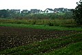
 04 Terrazas Gallego, en Villanueva de Gállego.jpg 400 × 369; 133 KB
-
 2008-05-16 09 17 07 Iceland-Síðumúli.jpg 2,048 × 1,536; 2.33 MB
-
 2008-05-22 12 Entering Dalsmynni on Road 835.jpg 5,056 × 1,974; 7.17 MB
-
 Aerial View of Dettifoss 21.05.2008 15-52-12.JPG 2,048 × 1,536; 1.63 MB
-
 Alluvial plain-2.JPG 2,304 × 1,728; 1.8 MB
-
 Ancient river valley in PaVi HaGiang Vietnam.jpg 2,592 × 1,944; 467 KB
-
 Aue-hochufer-niederterrasserp.jpg 1,062 × 706; 237 KB
-
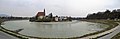 Blick auf Laufen von Oberndorf aus 2012.jpg 7,600 × 2,460; 7.97 MB
-
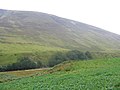
 Boulders, foot of Coire Dubh - geograph.org.uk - 554416.jpg 640 × 480; 82 KB
-
 Cerlan.jpg 708 × 474; 168 KB
-
 Chorna Tysa river nearby Chorna Tysa, Rakhiv Raion (5239-41).jpg 3,600 × 2,400; 4.06 MB
-

-
 Corp1000 - Flickr - NOAA Photo Library.jpg 1,716 × 1,140; 1.14 MB
-
 Crab-Creek-Drumheller.jpg 1,983 × 1,135; 585 KB
-
 Ecuador Andes Cayambe 2012.jpg 4,256 × 2,832; 12.63 MB
-
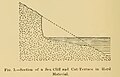 Fig 3 Section of a Sea Cliff and Cut-Terrace in Hard Material.jpg 562 × 360; 31 KB
-
 Fig 5 Section of a Cut and Built Terrace.jpg 510 × 328; 26 KB
-
 Flussterassen.gif 802 × 251; 17 KB
-
 Flussterrassesp.jpg 896 × 708; 280 KB
-

-
 Glen Roy and parallel roads - geograph.org.uk - 243022.jpg 640 × 480; 75 KB
-
 Hraundrangar.jpg 2,272 × 1,704; 971 KB
-
 Island Am Rande des Hochlands 04.JPG 3,444 × 2,586; 2.11 MB
-
 Island Ringstraße im Nordosten 02.JPG 3,444 × 2,586; 1.19 MB
-
 Island Ringstraße im Nordosten 03.JPG 3,444 × 2,586; 1.58 MB
-
 Island Schlucht Ásbyrgi 06.JPG 3,444 × 2,586; 3.41 MB
-

-
 Kurogawa Asakura City 20170708 2.png 461 × 258; 313 KB
-
 Manu riverbank.jpg 1,500 × 1,024; 627 KB
-
 Morphology of fluvial terrace.png 1,473 × 735; 51 KB
-
 NestedFluvialTerracesGeneral.jpg 2,708 × 1,015; 614 KB
-
 Niederterrassenschotter, Schertle-See IMGP7130.jpg 3,872 × 2,592; 4.85 MB
-
 Piz Traunter Ovas from Val Bever.jpg 2,592 × 1,944; 1.7 MB
-
 Rd4C & Valley in PaVi HaGiang Vietnam.jpg 2,592 × 1,944; 602 KB
-
 Rio lechos.png 604 × 169; 3 KB
-
 River terases.png 1,366 × 786; 50 KB
-
 Road in Jökulsá á Dal.jpg 5,184 × 3,456; 7.65 MB
-
 Step-like landform, Namibia (2017).jpg 4,928 × 3,264; 6.95 MB
-
 Tauglbach 2.JPG 5,152 × 3,864; 7.73 MB
-
 Terraces near Fish River Canyon, Namibia.jpg 4,633 × 3,017; 7.08 MB
-
 Terrasse Wimbachtal.jpg 1,280 × 960; 1.22 MB
-
 Terrazas Gallego.jpg 1,400 × 1,050; 1.17 MB
-
 Toshibetsu river Fluvial terraces Aerial photograph.1977.jpg 7,014 × 3,380; 14.84 MB
-
 Unpaired stream terraces.jpg 700 × 383; 194 KB
-
 Valle del Ri al centro del terrazzo Novara-Vespolate.jpg 4,032 × 3,024; 4.06 MB
-
 Vatnsdalur 09.jpg 3,264 × 2,448; 717 KB
-
 Wimbachtal Terrasse Felsdurchbruch.jpg 2,048 × 1,536; 3.04 MB
-
 Тераса в долині Інгульця.jpg 2,816 × 2,112; 1,011 KB
-
 ТерасаІнгулу.JPG 2,816 × 2,112; 1.16 MB
-
 ТерасаРічкиІнгул.JPG 2,816 × 2,112; 1.18 MB
-
 Устье Чуи.jpg 2,590 × 1,943; 2.91 MB


.jpg)
.jpg)


.jpg)


