Category:Fog in Devon
Jump to navigation
Jump to search
Media in category "Fog in Devon"
The following 69 files are in this category, out of 69 total.
-
 A379 under low cloud - geograph.org.uk - 1774893.jpg 640 × 377; 51 KB
-
 Barn near Uton - geograph.org.uk - 1736550.jpg 640 × 459; 53 KB
-
 Belstone Tor - geograph.org.uk - 1519676.jpg 640 × 427; 54 KB
-
 Bristol channel covered in fog, Near Lynton and Lynmouth (2545085053).jpg 2,518 × 2,750; 1.53 MB
-
 Bristol channel covered in fog, Near Lynton and Lynmouth (2545911334).jpg 2,412 × 2,503; 1.23 MB
-

-
 Cliffs near Flat Point - geograph.org.uk - 565178.jpg 640 × 480; 61 KB
-
 Culvery valley - geograph.org.uk - 1736781.jpg 640 × 429; 64 KB
-
 Dartmoor mist - geograph.org.uk - 23363.jpg 640 × 425; 48 KB
-
 Denbury Farm - geograph.org.uk - 1736439.jpg 640 × 378; 49 KB
-
 Duck's Marsh - geograph.org.uk - 266415.jpg 640 × 482; 36 KB
-
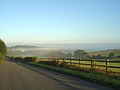
 Exe Valley from Holland Hall - geograph.org.uk - 1003472.jpg 640 × 455; 64 KB
-

-
 Farmland near Folly Farm - geograph.org.uk - 1736474.jpg 640 × 397; 54 KB
-
 Fremington, near Holmacott - geograph.org.uk - 535263.jpg 640 × 427; 137 KB
-
 Fremington, near Little Knightacott - geograph.org.uk - 535290.jpg 640 × 427; 99 KB
-
 Haytor Granite Tramway in the Fog (1).jpg 5,152 × 3,864; 7.17 MB
-
 Haytor Granite Tramway in the Fog (2).jpg 5,152 × 3,864; 7.31 MB
-
 Holne Moor in the fog.jpg 10,000 × 2,141; 9.45 MB
-
 If you can find it in the mist - geograph.org.uk - 264132.jpg 640 × 309; 42 KB
-
 Into the evening mist - geograph.org.uk - 278114.jpg 640 × 480; 52 KB
-

-
 Lane to Posbury - geograph.org.uk - 1736420.jpg 640 × 427; 64 KB
-
 Longmoor Wood - geograph.org.uk - 555572.jpg 640 × 480; 76 KB
-
 Looking towards Kingsnympton - geograph.org.uk - 992813.jpg 640 × 403; 52 KB
-
 Lynmouth with the fog coming in, Exmoor, Devon (2545089615).jpg 3,658 × 2,163; 2.93 MB
-
 Lynmouth with the fog coming in, Exmoor, Devon (2545919498).jpg 3,822 × 2,154; 4.69 MB
-
 Lynmouth with the fog coming in, Exmoor, Devon (2545924662).jpg 3,888 × 2,592; 5.06 MB
-
 Lynton sea front - geograph.org.uk - 514359.jpg 640 × 426; 71 KB
-
 Mist in the Culvery valley - geograph.org.uk - 1736430.jpg 640 × 402; 49 KB
-
 Mist in the Taw Valley - geograph.org.uk - 312939.jpg 640 × 480; 70 KB
-
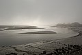
 Mist on the Avon estuary (2) - geograph.org.uk - 1509863.jpg 640 × 433; 17 KB
-
 Mist on the Avon estuary - geograph.org.uk - 1509841.jpg 640 × 480; 54 KB
-
 Mist on the Kennels Road - geograph.org.uk - 983588.jpg 640 × 458; 63 KB
-
 Mist over the Taw - geograph.org.uk - 555777.jpg 640 × 291; 43 KB
-
 Mists clearing at Great Mis Tor - geograph.org.uk - 1027578.jpg 640 × 480; 63 KB
-
 Misty hedge, Gallows Gate - geograph.org.uk - 686750.jpg 618 × 640; 38 KB
-
 Misty morning on the River Taw - geograph.org.uk - 336972.jpg 640 × 426; 100 KB
-
 Misty Tower - geograph.org.uk - 1650764.jpg 368 × 480; 36 KB
-
 Morning Glory - geograph.org.uk - 1061639.jpg 640 × 480; 37 KB
-

-

-
 Oak trees by Duck's Marsh - geograph.org.uk - 269402.jpg 640 × 480; 56 KB
-
 Plympton Hill - geograph.org.uk - 1619898.jpg 640 × 468; 42 KB
-

-

-
 River Exe in mist - geograph.org.uk - 266487.jpg 640 × 482; 43 KB
-
 River Exe in the mist - geograph.org.uk - 264156.jpg 480 × 640; 43 KB
-
 River Taw at Bridge Reeve - geograph.org.uk - 1732655.jpg 640 × 480; 105 KB
-
 Saunton Down - geograph.org.uk - 1633299.jpg 640 × 427; 33 KB
-
 Sea fog over Fort Picklecombe - geograph.org.uk - 437747.jpg 640 × 480; 46 KB
-
 Sea Mist - geograph.org.uk - 1656588.jpg 640 × 480; 238 KB
-
 Sea Mist - geograph.org.uk - 452031.jpg 640 × 426; 74 KB
-
 Sea Mist - left - geograph.org.uk - 452043.jpg 640 × 426; 87 KB
-
 Sea Mist - right - geograph.org.uk - 452054.jpg 640 × 426; 83 KB
-
 St Helena's church in a September sea mist - geograph.org.uk - 3113858.jpg 4,752 × 3,168; 1.86 MB
-

-
 Stoney Cross enshrouded in mist - geograph.org.uk - 727463.jpg 640 × 480; 42 KB
-
 Telecomms mast near Hemerdon Ball - geograph.org.uk - 270197.jpg 480 × 640; 45 KB
-

-
 The Exe in the mist - geograph.org.uk - 1120837.jpg 480 × 640; 41 KB
-
 Tick Lane, Doddiscombsleigh - geograph.org.uk - 688486.jpg 640 × 428; 87 KB
-
 Tower block, Exeter College - geograph.org.uk - 1164458.jpg 640 × 588; 31 KB
-

-
 Upcott, Bittadon - geograph.org.uk - 731534.jpg 640 × 370; 51 KB
-
 View from near South Hessary Tor.jpg 11,467 × 2,513; 9.39 MB
-
 View from Posbury - geograph.org.uk - 1737177.jpg 640 × 442; 55 KB
-
 Wear Farm Caravan Park - geograph.org.uk - 300301.jpg 640 × 480; 69 KB
-
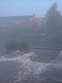 Weir in the mist - geograph.org.uk - 264139.jpg 480 × 640; 48 KB


.jpg)
.jpg)


.jpg)
.jpg)


.jpg)
.jpg)
.jpg)


_-_geograph.org.uk_-_1509863.jpg)


