Category:Footbridges in Pembrokeshire
Jump to navigation
Jump to search
Media in category "Footbridges in Pembrokeshire"
The following 47 files are in this category, out of 47 total.
-
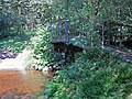
 Abandoned footbridge - geograph.org.uk - 1001661.jpg 640 × 480; 127 KB
-
 Across the Solfach - geograph.org.uk - 931756.jpg 640 × 480; 87 KB
-
 Bridge across a stream at Solva - geograph.org.uk - 622166.jpg 640 × 480; 164 KB
-
-
 Canol tref Hwlffordd Haverfordwest town center 03.JPG 4,272 × 2,848; 4.98 MB
-
 Canol tref Hwlffordd Haverfordwest town center 04.JPG 4,272 × 2,848; 5.23 MB
-
 Carew Cheriton Church - footpath and bridge - geograph.org.uk - 4740308.jpg 2,576 × 1,932; 1.17 MB
-

-

-

-
 Footbridge at Millin Cross - geograph.org.uk - 161101.jpg 640 × 480; 149 KB
-
 Footbridge at Rhyd-afallen - geograph.org.uk - 893573.jpg 640 × 480; 104 KB
-
 Footbridge by the Blue Lagoon - geograph.org.uk - 1503172.jpg 640 × 480; 96 KB
-

-
 Footbridge in Cwm Dyffryn - geograph.org.uk - 893620.jpg 480 × 640; 129 KB
-
 Footbridge in nature reserve - geograph.org.uk - 1542436.jpg 640 × 480; 309 KB
-
 Footbridge in October - geograph.org.uk - 1023749.jpg 640 × 480; 151 KB
-
 Footbridge near Fishguard ferry port - geograph.org.uk - 1525046.jpg 640 × 426; 102 KB
-
 Footbridge on coast path near Dale Fort - geograph.org.uk - 1526309.jpg 480 × 640; 308 KB
-
 Footbridge over Afon Gwaun - geograph.org.uk - 886675.jpg 640 × 480; 139 KB
-
 Footbridge over Nant Gafren - geograph.org.uk - 1473150.jpg 640 × 480; 152 KB
-
 Footbridge over the Afon Syfynwy (geograph 3619617).jpg 2,560 × 1,920; 2 MB
-

-
 Footpath to beach from car park, Amroth - geograph.org.uk - 1291312.jpg 640 × 480; 107 KB
-
 Footpath to beach from car park, Amroth - geograph.org.uk - 1291316.jpg 640 × 480; 101 KB
-
 Ford Carew Cheriton.jpg 1,200 × 900; 556 KB
-
 Forgotten foot bridge near Reynalton - geograph.org.uk - 1276663.jpg 527 × 640; 157 KB
-
 Gate and footbridge at Gwadn - geograph.org.uk - 2396492.jpg 640 × 480; 115 KB
-
 Gun Tower Museum and access pier - geograph.org.uk - 1286875.jpg 640 × 480; 70 KB
-
 Haverfordwest - geograph.org.uk - 13978.jpg 640 × 423; 83 KB
-

-
 Martello Tower, Pembroke Dock (4076).jpg 2,848 × 4,288; 5.51 MB
-
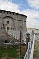
 Martello Tower, Pembroke Dock - geograph.org.uk - 13996.jpg 640 × 423; 71 KB
-

-
 Pedestrian bridge to Riverside Quay - geograph.org.uk - 1062040.jpg 640 × 480; 70 KB
-
 Pompren Pontnewydd - Pontnewydd footbridge (geograph 7027383).jpg 1,024 × 768; 312 KB
-
 Rhyd Afon Syfynwy - Afon Syfynwy ford (geograph 6919025).jpg 1,024 × 768; 388 KB
-
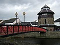
 Tenby railway station footbridge - geograph.org.uk - 3560093.jpg 800 × 513; 115 KB
-
 Tenby station 20190925 151100 (48793534852).jpg 4,032 × 3,024; 4.41 MB
-
 Vicar's Mill ford, Maenclochog - geograph.org.uk - 579957.jpg 640 × 475; 146 KB
-
 Western Cleddau in Haverfordwest (6075).jpg 4,288 × 2,848; 6.34 MB
-
 Ynys Meicel Footbridge - geograph.org.uk - 605999.jpg 640 × 409; 101 KB
-
 Footbridge near Cottesmore - geograph.org.uk - 410597.jpg 640 × 480; 169 KB
-
 Footbridge over a stream - geograph.org.uk - 525606.jpg 640 × 480; 156 KB
-
 Footbridge with sluice gate - geograph.org.uk - 572090.jpg 640 × 480; 112 KB
-
 Footbridge, Porthclais - geograph.org.uk - 461672.jpg 640 × 480; 147 KB
-
 Stone foot bridge - geograph.org.uk - 246099.jpg 640 × 480; 108 KB


_-_geograph.org.uk_-_1532862.jpg)


.jpg)


_-_geograph.org.uk_-_1524682.jpg)
.jpg)


.jpg)
.jpg)

.jpg)

.jpg)


