Category:Fords in Cornwall
Jump to navigation
Jump to search
Ceremonial counties of England: Bedfordshire · Berkshire · Buckinghamshire · Cambridgeshire · Cheshire · Cornwall · Cumbria · Derbyshire · Devon · Dorset · Durham · East Riding of Yorkshire · East Sussex · Essex · Gloucestershire · Greater Manchester · Hampshire · Herefordshire · Hertfordshire · Kent · Lancashire · Leicestershire · Lincolnshire · Norfolk · North Yorkshire · Northamptonshire · Northumberland · Nottinghamshire · Oxfordshire · Rutland · Shropshire · Somerset · South Yorkshire · Staffordshire · Suffolk · Surrey · Tyne and Wear · Warwickshire · West Midlands · West Sussex · West Yorkshire · Wiltshire · Worcestershire
City-counties:
Former historic counties:
Other former counties:
City-counties:
Former historic counties:
Other former counties:
Subcategories
This category has the following 26 subcategories, out of 26 total.
B
- Blowinghouse Ford (3 F)
- Bojorrow Ford (4 F)
- Bolingey Ford (3 F)
- Boskennal Ford (3 F)
C
- Coswarth Ford (3 F)
- Crift Ford (2 F)
- Crooksball Ford (3 F)
G
- Gooseford Lane Tidal Ford (7 F)
H
- Helford Ford (6 F)
- Hemmick Beach Ford (3 F)
- Higher Carnon Ford (4 F)
K
- Kea Ford (3 F)
L
- Lower Tregleath Ford (3 F)
- Lowertown Ford (5 F)
N
- New Mill Fords (4 F)
- Newbridge Ford (3 F)
P
- Ford near Palmersbridge (2 F)
- Penheale Ford (2 F)
- Pons Medda Ford (3 F)
- Ponsontuel Ford (4 F)
R
- Roseworthy Ford (2 F)
S
- St Lawrence Ford, Lezant (3 F)
T
- Tregair Ford (2 F)
- Trerice Mill Ford (2 F)
- Tresparrett Ford (3 F)
- Trevague Ford (3 F)
Media in category "Fords in Cornwall"
The following 45 files are in this category, out of 45 total.
-
 A Farmtrack ford - geograph.org.uk - 450091.jpg 640 × 427; 143 KB
-
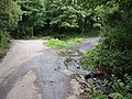
 A ford on a road through woodland - geograph.org.uk - 426925.jpg 640 × 427; 141 KB
-
 An unexpected ford - geograph.org.uk - 190490.jpg 640 × 480; 161 KB
-
 Charaton Ford - geograph.org.uk - 4679171.jpg 6,000 × 4,000; 6.45 MB
-
 Clapper footbridge and pack horse bridge, Bowithick - geograph.org.uk - 3961000.jpg 2,019 × 1,313; 1.11 MB
-
 Delford Bridge and ford - geograph.org.uk - 418805.jpg 640 × 342; 55 KB
-
 Dry ford, Hay Farm - geograph.org.uk - 184055.jpg 640 × 427; 325 KB
-
 DSCN1863StKewFordBridge.jpg 1,632 × 1,224; 910 KB
-
 Farm Track Ford - geograph.org.uk - 166226.jpg 640 × 427; 122 KB
-
 Ford across Bolesbridge Water - geograph.org.uk - 609038.jpg 640 × 480; 88 KB
-
 Ford across Country Lane. - geograph.org.uk - 533779.jpg 640 × 480; 155 KB
-
 Ford across Penpont Water - geograph.org.uk - 4440437.jpg 1,920 × 1,403; 788 KB
-
 Ford across Penpont Water - geograph.org.uk - 4701001.jpg 1,920 × 1,391; 873 KB
-
 Ford and bridges at Bowithick - geograph.org.uk - 2015731.jpg 640 × 480; 63 KB
-
 Ford and footbridge - geograph.org.uk - 748789.jpg 640 × 480; 142 KB
-
 Ford at Altarnun - geograph.org.uk - 4677172.jpg 6,000 × 4,000; 6.42 MB
-
 Ford at Bowithick - geograph.org.uk - 4677461.jpg 6,000 × 4,000; 6.4 MB
-
 Ford at Bowithick - geograph.org.uk - 4677484.jpg 6,000 × 4,000; 6.55 MB
-
 Ford at Coombe, Morwenstow - geograph.org.uk - 1369058.jpg 640 × 480; 183 KB
-
 Ford at Cusgarne, Cornwall - geograph-4682158.jpg 6,000 × 4,000; 6.51 MB
-
 Ford at Nineveh - geograph.org.uk - 36083.jpg 640 × 480; 147 KB
-
 Ford at Tregidden - geograph.org.uk - 369165.jpg 640 × 480; 141 KB
-
 Ford at Trekennick - geograph.org.uk - 2015665.jpg 640 × 480; 113 KB
-
 Ford at West Watergate - geograph.org.uk - 77822.jpg 640 × 480; 149 KB
-
 Ford at Wheal Bray - geograph.org.uk - 2015711.jpg 640 × 480; 87 KB
-
 Ford below Badharlick - geograph.org.uk - 718522.jpg 640 × 480; 135 KB
-
 Ford below Wortha - geograph.org.uk - 711828.jpg 640 × 480; 123 KB
-
 Ford by Kirthen Wood Haven - geograph.org.uk - 231732.jpg 640 × 480; 155 KB
-
 Ford in Marsland Wood (geograph 1910478).jpg 1,024 × 682; 299 KB
-
 Ford near Bealsmill - geograph.org.uk - 819833.jpg 640 × 480; 106 KB
-
 Ford near Ninniss Farm - geograph.org.uk - 89412.jpg 640 × 480; 125 KB
-
 Ford near Silverwell - geograph.org.uk - 1210392.jpg 640 × 427; 103 KB
-
 Ford on the road to Gwendra - geograph.org.uk - 1539095.jpg 640 × 427; 83 KB
-
 Ford, Badgall Downs - geograph.org.uk - 720139.jpg 640 × 480; 143 KB
-
 Ford, gates and meadow in forest - geograph.org.uk - 842580.jpg 640 × 480; 113 KB
-
 Nambol Ford - geograph.org.uk - 4684154.jpg 6,000 × 4,000; 6.46 MB
-
 North Cornwall , Ford - geograph.org.uk - 2493178.jpg 4,282 × 2,838; 5.69 MB
-
 Small Ford by Watergate Wood - geograph.org.uk - 426061.jpg 640 × 427; 125 KB
-
 St Kew Ford - geograph.org.uk - 4684196.jpg 6,000 × 4,000; 6.43 MB
-
 Trelill Ford - geograph.org.uk - 4684186.jpg 6,000 × 4,000; 6.41 MB
-
 Trengune - geograph.org.uk - 210786.jpg 640 × 480; 153 KB
-
 Trenilk Ford - geograph.org.uk - 4677067.jpg 6,000 × 4,000; 6.38 MB
-
 Trevaylor Stream ford.jpg 3,024 × 4,032; 6.01 MB
-
 West Carne Ford - geograph.org.uk - 4677438.jpg 6,000 × 4,000; 6.49 MB
-
 Wortha Ford - geograph.org.uk - 4679072.jpg 6,000 × 4,000; 6.45 MB


.jpg)


