Category:Fosse Notre Dame
Jump to navigation
Jump to search
| Object location | | View all coordinates using: OpenStreetMap |
|---|
| Geocoded outline |
Google Maps Fosse Notre-Dame |
|---|

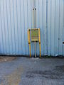
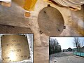
Français : La fosse Notre-Dame de la Compagnie des mines d'Aniche était un charbonnage constitué de deux puits situé à Waziers, Nord, Nord-Pas-de-Calais, France.
 | |||||
| Upload media | |||||
| Instance of | |||||
|---|---|---|---|---|---|
| Location | Waziers, canton of Douai-Nord | ||||
| Street address |
| ||||
| Operator | |||||
| Heritage designation |
| ||||
 | |||||
Subcategories
This category has the following 2 subcategories, out of 2 total.
C
Media in category "Fosse Notre Dame"
The following 56 files are in this category, out of 56 total.
-
 Fosse Notre Dame à Waziers en novembre 1977.jpg 1,114 × 667; 637 KB
-
 Fosse Notre Dame à Waziers vers 1955.jpg 1,114 × 702; 613 KB
-
 Waziers - Fosse Notre Dame des mines d'Aniche (01).JPG 2,736 × 3,648; 3.66 MB
-
 Waziers - Fosse Notre Dame des mines d'Aniche (02).JPG 3,648 × 2,736; 4.19 MB
-
 Waziers - Fosse Notre Dame des mines d'Aniche (03).JPG 3,648 × 2,736; 4.17 MB
-
 Waziers - Fosse Notre Dame des mines d'Aniche (04).JPG 3,648 × 2,736; 4.22 MB
-
 Waziers - Fosse Notre Dame des mines d'Aniche (05).JPG 3,648 × 2,736; 3.69 MB
-
 Waziers - Fosse Notre Dame des mines d'Aniche (06).JPG 3,648 × 2,736; 3.88 MB
-
 Waziers - Fosse Notre Dame des mines d'Aniche (07).JPG 3,648 × 2,736; 4.33 MB
-
 Waziers - Fosse Notre Dame des mines d'Aniche (08).JPG 3,648 × 2,736; 4.06 MB
-
 Waziers - Fosse Notre Dame des mines d'Aniche (09).JPG 3,648 × 2,736; 4.09 MB
-
 Waziers - Fosse Notre Dame des mines d'Aniche (10).JPG 3,648 × 2,736; 4.16 MB
-
 Waziers - Fosse Notre Dame des mines d'Aniche (11).JPG 3,648 × 2,736; 3.58 MB
-
 Waziers - Fosse Notre Dame des mines d'Aniche (12).JPG 3,648 × 2,736; 3.97 MB
-
 Waziers - Fosse Notre Dame des mines d'Aniche (13).JPG 2,736 × 3,648; 3.58 MB
-
 Waziers - Fosse Notre Dame des mines d'Aniche (14).JPG 3,648 × 2,736; 4.24 MB
-
 Waziers - Fosse Notre Dame des mines d'Aniche (15).JPG 2,736 × 3,648; 3.53 MB
-
 Waziers - Fosse Notre Dame des mines d'Aniche (16).JPG 3,648 × 2,736; 4.18 MB
-
 Waziers - Fosse Notre Dame des mines d'Aniche (17).JPG 3,648 × 2,736; 4.12 MB
-
 Waziers - Fosse Notre Dame des mines d'Aniche (18).JPG 3,648 × 2,736; 4.29 MB
-
 Waziers - Fosse Notre Dame des mines d'Aniche (19).JPG 3,648 × 2,736; 4.12 MB
-
 Waziers - Fosse Notre Dame des mines d'Aniche (20).JPG 3,648 × 2,736; 4.22 MB
-
 Waziers - Fosse Notre Dame des mines d'Aniche (21).JPG 3,648 × 2,736; 4.25 MB
-
 Waziers - Fosse Notre Dame des mines d'Aniche (22).JPG 3,648 × 2,736; 4.18 MB
-
 Waziers - Fosse Notre Dame des mines d'Aniche (23).JPG 3,648 × 2,736; 4.08 MB
-
 Waziers - Fosse Notre Dame des mines d'Aniche (24).JPG 3,648 × 2,736; 3.86 MB
-
 Waziers - Fosse Notre Dame des mines d'Aniche (25).JPG 3,648 × 2,736; 3.46 MB
-
 Waziers - Fosse Notre Dame des mines d'Aniche (26).JPG 3,648 × 2,736; 4.21 MB
-
 Waziers - Fosse Notre Dame des mines d'Aniche (27).JPG 3,648 × 2,736; 4.2 MB
-
 Waziers - Fosse Notre Dame des mines d'Aniche (28).JPG 3,648 × 2,736; 4.21 MB
-
 Waziers - Fosse Notre Dame des mines d'Aniche (29).JPG 3,648 × 2,736; 4.17 MB
-
 Waziers - Fosse Notre Dame des mines d'Aniche (30).JPG 2,736 × 3,648; 3.45 MB
-
 Waziers - Fosse Notre Dame des mines d'Aniche (31).JPG 3,648 × 2,736; 4.25 MB
-
 Waziers - Fosse Notre Dame des mines d'Aniche (32).JPG 3,648 × 2,736; 4.28 MB
-
 Waziers - Fosse Notre Dame des mines d'Aniche (33).JPG 3,648 × 2,736; 4.29 MB
-
 Waziers - Fosse Notre Dame des mines d'Aniche (34).JPG 3,648 × 2,736; 4.24 MB
-
 Waziers - Fosse Notre Dame des mines d'Aniche (35).JPG 3,648 × 2,736; 4.05 MB
-
 Waziers - Fosse Notre Dame des mines d'Aniche (36).JPG 3,648 × 2,736; 4.31 MB
-
 Waziers - Fosse Notre Dame des mines d'Aniche, puits n° 1 (A).JPG 3,648 × 2,736; 3.86 MB
-
 Waziers - Fosse Notre Dame des mines d'Aniche, puits n° 1 (B).JPG 3,648 × 2,736; 4.1 MB
-
 Waziers - Fosse Notre Dame des mines d'Aniche, puits n° 1 (C).JPG 2,736 × 3,648; 3.12 MB
-
 Waziers - Fosse Notre Dame des mines d'Aniche, puits n° 1 (D).JPG 2,736 × 3,648; 2.87 MB
-
 Waziers - Fosse Notre Dame des mines d'Aniche, puits n° 1 (E).JPG 3,648 × 2,736; 3.71 MB
-
 Waziers - Fosse Notre Dame des mines d'Aniche, puits n° 2 (A).JPG 3,648 × 2,736; 4.1 MB
-
 Waziers - Fosse Notre Dame des mines d'Aniche, puits n° 2 (B).JPG 2,736 × 3,648; 3.28 MB
-
 Waziers - Fosse Notre Dame des mines d'Aniche, puits n° 2 (C).JPG 3,648 × 2,736; 4.08 MB
-
 Waziers - Fosse Notre Dame des mines d'Aniche, puits n° 2 (D).JPG 2,736 × 3,648; 3.2 MB
-
 Waziers - Fosse Notre-Dame des mines d'Aniche (A).jpg 2,095 × 1,517; 1.51 MB
-
 Waziers - Fosse Notre-Dame des mines d'Aniche (B).jpg 2,299 × 1,369; 1.4 MB
-
 Waziers - Fosse Notre-Dame des mines d'Aniche (C).jpg 2,193 × 1,450; 1.29 MB
-
 Waziers - Fosse Notre-Dame des mines d'Aniche (D).jpg 2,126 × 1,291; 1.48 MB
-
 Waziers - Fosse Notre-Dame des mines d'Aniche (E).jpg 2,367 × 1,359; 1.08 MB
-
 Waziers - Fosse Notre-Dame des mines d'Aniche (F).jpg 2,163 × 1,256; 1.28 MB
-
 Waziers - Fosse Notre-Dame des mines d'Aniche (G).jpg 2,182 × 1,239; 1.15 MB
-
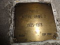
 Waziers - Puits Notre Dame n° 1 1856-1978.jpg 2,736 × 3,648; 5.08 MB
-
 Waziers - Puits Notre Dame n° 2 1905-1978.jpg 3,648 × 2,736; 5.02 MB

.JPG)
.JPG)
.JPG)
.JPG)
.JPG)
.JPG)
.JPG)
.JPG)
.JPG)
.JPG)
.JPG)
.JPG)
.JPG)
.JPG)
.JPG)
.JPG)
.JPG)
.JPG)
.JPG)
.JPG)
.JPG)
.JPG)
.JPG)
.JPG)
.JPG)
.JPG)
.JPG)
.JPG)
.JPG)
.JPG)
.JPG)
.JPG)
.JPG)
.JPG)
.JPG)
.JPG)
.JPG)
.JPG)
.JPG)
.JPG)
.JPG)
.JPG)
.JPG)
.JPG)
.JPG)
.jpg)
.jpg)
.jpg)
.jpg)
.jpg)
.jpg)
.jpg)

