Category:Fragile state index maps of the world
Jump to navigation
Jump to search
Media in category "Fragile state index maps of the world"
The following 25 files are in this category, out of 25 total.
-
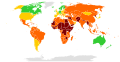
 Countries according to the Fragile States Index (2019).png 6,025 × 2,730; 1.85 MB
-
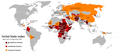
 Countries according to the Fragile States Index.svg 2,754 × 1,398; 1.19 MB
-
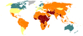
 Failed State Index 2.png 1,425 × 625; 47 KB
-
 Failed state index 2013.svg 863 × 443; 1.55 MB
-
 Failed State Index.png 1,425 × 625; 52 KB
-
 Failed States 2014.png 1,600 × 750; 511 KB
-
 Failed States Index Map 2007.png 1,350 × 625; 93 KB
-
 Failed States.PNG 1,427 × 628; 71 KB
-
 Failed-states-index-2005.png 1,425 × 625; 20 KB
-
 Failed-states-index-2006.png 1,425 × 625; 20 KB
-
 Failed-states-index-2007.png 1,425 × 625; 20 KB
-
 Failed-states-index-2008.png 1,425 × 625; 25 KB
-
 Failed-states-index-2009w.png 1,425 × 625; 25 KB
-
 Failed-states-index-2010.png 1,425 × 625; 51 KB
-
 Failed-states-index-2011.png 1,425 × 625; 51 KB
-
 Failed-states-index-2012.png 1,425 × 625; 33 KB
-
 Failed-states-index-2012.svg 863 × 443; 1.63 MB
-
 Failed-states-index-loop-2009.gif 1,425 × 625; 134 KB
-
 Failed-states-index-loop-2013b.gif 1,425 × 625; 202 KB
-
 Failed-states-index-loop.gif 1,425 × 625; 88 KB
-
 Fragile State Index 2015.svg 863 × 443; 2.41 MB
-
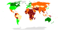
 Fragile State Index 2018.png 2,000 × 1,027; 334 KB
-
 Fragile States Index 2023.svg 2,754 × 1,398; 1.19 MB
-
 Fragilestates.tif 5,760 × 2,880; 5.49 MB
-

.png)


