Category:Fraisthorpe
Jump to navigation
Jump to search
English: Fraisthorpe is a village in the East Riding of Yorkshire, England. It is situated approximately 4 miles (6.4 km) south of Bridlington town centre. It lies to the east of the A165 road.
village in the United Kingdom  | |||||
| Upload media | |||||
| Instance of | |||||
|---|---|---|---|---|---|
| Location | Barmston, East Riding of Yorkshire, Yorkshire and the Humber, England | ||||
 | |||||
Subcategories
This category has the following 2 subcategories, out of 2 total.
E
F
- Fraisthorpe Sands (20 F)
Media in category "Fraisthorpe"
The following 41 files are in this category, out of 41 total.
-
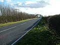
 A165 Direction Fraisthorpe - geograph.org.uk - 1223842.jpg 640 × 481; 133 KB
-
 A165 towards Fraisthorpe - geograph.org.uk - 1223601.jpg 640 × 481; 84 KB
-

-
 Bend in the Road - geograph.org.uk - 1223847.jpg 640 × 481; 99 KB
-
 Bridge over the Earls Dike Fraisthorpe.jpg 640 × 480; 90 KB
-
 Disused Farm Building - geograph.org.uk - 1251516.jpg 640 × 480; 88 KB
-
 East of Fraisthorpe - geograph.org.uk - 621536.jpg 455 × 640; 65 KB
-
 East of Fraisthorpe - geograph.org.uk - 813094.jpg 640 × 451; 64 KB
-
 Farm Buildings, Demming Farm - geograph.org.uk - 1223802.jpg 640 × 481; 73 KB
-
 Farm Buildings, Fraisthorpe - geograph.org.uk - 1223858.jpg 640 × 481; 55 KB
-
 Farm Gate and Track - geograph.org.uk - 1251501.jpg 640 × 480; 60 KB
-
 Farm road off the A165 - geograph.org.uk - 250586.jpg 640 × 480; 87 KB
-
 Farm road off the A165. - geograph.org.uk - 250582.jpg 640 × 409; 75 KB
-
 Farm Track From Demming Farm - geograph.org.uk - 1223831.jpg 640 × 481; 82 KB
-
 Farm Track Towards Fraisthorpe Sands - geograph.org.uk - 1251536.jpg 640 × 480; 55 KB
-
 Farm Track, Fraisthorpe - geograph.org.uk - 1251509.jpg 640 × 480; 54 KB
-
 Farmland near High Stonehills - geograph.org.uk - 1307335.jpg 640 × 480; 51 KB
-
 Farmland near Low Stonehills - geograph.org.uk - 1307321.jpg 640 × 480; 56 KB
-
 Fraisthorpe Cottage.jpg 640 × 487; 99 KB
-
 Hedgerow and Field - geograph.org.uk - 1251547.jpg 640 × 480; 60 KB
-
 High Stonehills Farm - geograph.org.uk - 1307328.jpg 640 × 480; 72 KB
-
 Low Stonehills - geograph.org.uk - 708070.jpg 640 × 482; 87 KB
-
 Minor Road Towards High Stonehills - geograph.org.uk - 1251491.jpg 640 × 480; 52 KB
-
 North Kingsfield Farm - geograph.org.uk - 1223627.jpg 640 × 481; 85 KB
-

-
 North Kingsfield, Barmston - geograph.org.uk - 708075.jpg 640 × 440; 61 KB
-
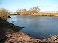 Pond Near Demming Farm - geograph.org.uk - 1223824.jpg 640 × 481; 81 KB
-
 Rose Cottage Fraisthorpe.jpg 640 × 463; 71 KB
-
 Sands Road, Fraisthorpe - geograph.org.uk - 621527.jpg 640 × 460; 86 KB
-
 Searchlight Cottage, Stone Hills - geograph.org.uk - 708069.jpg 640 × 457; 58 KB
-
 Sheep Walks, Fraisthorpe - geograph.org.uk - 621534.jpg 640 × 453; 66 KB
-
 South Kingsfield Farm - geograph.org.uk - 1223616.jpg 640 × 481; 73 KB
-
 South Kingsfield Farm - geograph.org.uk - 518043.jpg 640 × 480; 88 KB
-
 The A165 Hull to Bridlington road - geograph.org.uk - 250579.jpg 640 × 480; 74 KB
-
 The A165 Hull to Bridlington road. - geograph.org.uk - 250581.jpg 640 × 480; 118 KB
-
 The road to Auburn - geograph.org.uk - 621538.jpg 640 × 448; 67 KB
-
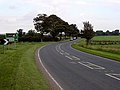
 The turning to Carnaby off the A165 - geograph.org.uk - 250591.jpg 640 × 449; 107 KB
-
 Track Towards Hamiltonhill Farm - geograph.org.uk - 1251579.jpg 640 × 480; 54 KB
-
 Track Towards South Kingsfield - geograph.org.uk - 1223608.jpg 640 × 481; 98 KB
-
 Wind Farm at Fraisthorpe 3.jpg 3,600 × 1,200; 1,008 KB
-
 Wind Farm at Fraisthorpe looking east.jpg 1,800 × 2,700; 851 KB


