Category:Framingham Earl
Jump to navigation
Jump to search
English: Framingham Earl is a small village situated south of Norwich, in the English county of Norfolk. It is next to Poringland and Framingham Pigot. It covers an area of and had a population of 834 in 354 households as of the 2001 census.
village in the United Kingdom   | |||||
| Upload media | |||||
| Instance of | |||||
|---|---|---|---|---|---|
| Location | South Norfolk, Norfolk, East of England, England | ||||
| Population |
| ||||
| Area |
| ||||
 | |||||
Subcategories
This category has only the following subcategory.
A
Media in category "Framingham Earl"
The following 200 files are in this category, out of 230 total.
(previous page) (next page)-

-

-
 23 Long Road - geograph.org.uk - 5920127.jpg 800 × 431; 99 KB
-
 23 Long Road - geograph.org.uk - 5920128.jpg 800 × 448; 119 KB
-
 23 Long Road - geograph.org.uk - 5920130.jpg 800 × 444; 110 KB
-
 A heap of soil and rubble - geograph.org.uk - 4832059.jpg 640 × 360; 384 KB
-
 A heap of trees - geograph.org.uk - 5306077.jpg 640 × 360; 329 KB
-
 A new type of speed camera - geograph.org.uk - 4745277.jpg 640 × 633; 565 KB
-

-
 A path through the Dell - geograph.org.uk - 1541884.jpg 640 × 480; 157 KB
-
 A very pink house - geograph.org.uk - 1541848.jpg 640 × 489; 85 KB
-
 A wintry day in The Ramblers - geograph.org.uk - 1655377.jpg 640 × 480; 77 KB
-
 Air raid shelter ventilation hatch cover - geograph.org.uk - 4476681.jpg 640 × 562; 625 KB
-
 Air raid shelter ventilation hatches - geograph.org.uk - 4476670.jpg 640 × 480; 281 KB
-
 B1332 Norwich Road ^ Gatso Speed Camera - geograph.org.uk - 3489417.jpg 3,072 × 2,304; 1.33 MB
-
 B1332 Norwich Road, Framingham Earl - geograph.org.uk - 3489409.jpg 3,072 × 2,253; 1.2 MB
-
 B1332 Norwich Road, Framingham Earl - geograph.org.uk - 3489421.jpg 3,072 × 2,304; 1.32 MB
-
 B1332 Norwich Road, Framingham Earl - geograph.org.uk - 3681548.jpg 3,072 × 2,304; 1.57 MB
-

-

-
 Birches beside a drainage ditch - geograph.org.uk - 5306066.jpg 640 × 360; 355 KB
-
 Birches growing beside a drainage ditch - geograph.org.uk - 5306063.jpg 640 × 360; 364 KB
-
 Bits of concrete - geograph.org.uk - 4832046.jpg 640 × 431; 337 KB
-

-
 Bridge over a drainage ditch - geograph.org.uk - 5306064.jpg 640 × 360; 365 KB
-

-

-

-
-

-
-
 Building on the old Long Road RAF Camp - geograph.org.uk - 4476699.jpg 640 × 480; 540 KB
-
 Burgate Lane, Framingham - geograph.org.uk - 5998709.jpg 3,456 × 2,592; 3.87 MB
-
 Caistor Lane, Framingham Earl - geograph.org.uk - 3681256.jpg 2,888 × 2,170; 2.6 MB
-
-
 Church Plantation - geograph.org.uk - 1724008.jpg 640 × 480; 186 KB
-
 Clearing the way for new housing - geograph.org.uk - 4832051.jpg 640 × 458; 327 KB
-
 Concreted hut platform - geograph.org.uk - 4476646.jpg 640 × 480; 481 KB
-

-

-

-
-

-

-

-
 Cottage by Osier Carr - geograph.org.uk - 1724069.jpg 640 × 468; 111 KB
-
 Cottage in Pigot Lane - geograph.org.uk - 1541842.jpg 640 × 460; 94 KB
-
 Digger on the former Poringland Camp - geograph.org.uk - 4832055.jpg 640 × 434; 375 KB
-
 Drainage ditch at Forty Acre Plantation - geograph.org.uk - 5306067.jpg 640 × 360; 357 KB
-
 Drainage ditches south of Pigot Lane - geograph.org.uk - 5306070.jpg 640 × 360; 339 KB
-
 Earlsmead - now selling - geograph.org.uk - 5306015.jpg 640 × 360; 316 KB
-
 Emptying the bins - geograph.org.uk - 1655385.jpg 640 × 533; 118 KB
-
 Entrance into a construction site - geograph.org.uk - 5920161.jpg 800 × 448; 87 KB
-
 Entrance into Long Road Camp - geograph.org.uk - 4476599.jpg 640 × 480; 534 KB
-
 Entrance into Long Road Camp - geograph.org.uk - 4476605.jpg 640 × 480; 500 KB
-
 Entrance to The Nook - geograph.org.uk - 6282067.jpg 800 × 561; 106 KB
-
 Field adjoining Poringland Wood - geograph.org.uk - 1371361.jpg 640 × 480; 90 KB
-

-

-
 Flowering rhododendron - geograph.org.uk - 4476535.jpg 640 × 556; 615 KB
-
 Forget-me-Nots on Long Road Camp - geograph.org.uk - 4476626.jpg 640 × 545; 668 KB
-
 Foundations of an old RAF building - geograph.org.uk - 4476634.jpg 640 × 480; 549 KB
-
 Foundations of an old RAF building - geograph.org.uk - 4476643.jpg 640 × 480; 594 KB
-
 Framingham and Poringland water tower from Burgate Lane - geograph.org.uk - 5998708.jpg 3,456 × 2,592; 3.94 MB
-
 Framingham Earl Church - geograph.org.uk - 3419142.jpg 3,072 × 2,304; 1.38 MB
-
 Framingham Earl High School entrance - geograph.org.uk - 5956326.jpg 3,323 × 2,492; 5.42 MB
-
 Framingham Earl High School entrance - geograph.org.uk - 5956327.jpg 3,456 × 2,592; 3.82 MB
-
 Framingham Earl Methodist Church - geograph.org.uk - 3419388.jpg 2,948 × 2,198; 1,004 KB
-
 Framingham Earl Methodist Church sign - geograph.org.uk - 3419405.jpg 2,162 × 2,886; 1.3 MB
-
 Framingham Earl Village Sign - geograph.org.uk - 2365496.jpg 2,304 × 3,072; 1.43 MB
-
 Framingham Earl village sign - geograph.org.uk - 6631986.jpg 4,608 × 3,072; 4.36 MB
-
 Framingham Earl village sign - geograph.org.uk - 6631992.jpg 4,608 × 3,072; 4.88 MB
-
 Framingham Earl Water Tower - geograph.org.uk - 3419098.jpg 2,304 × 3,072; 1.67 MB
-
 Framingham Earl Water Tower - geograph.org.uk - 3419371.jpg 2,304 × 3,072; 1.69 MB
-
 Framingham Earl WW1 War Memorial - geograph.org.uk - 6580824.jpg 640 × 593; 256 KB
-
 Framingham Earl, looking towards Primrose Grove woods - geograph.org.uk - 4300100.jpg 2,718 × 1,536; 1.4 MB
-
 Gate into a meadow - geograph.org.uk - 5306059.jpg 640 × 360; 307 KB
-
 Gull Lane - geograph.org.uk - 1723994.jpg 640 × 444; 137 KB
-
 Hall Road, Framingham Earl - geograph.org.uk - 3419141.jpg 3,072 × 2,304; 1.52 MB
-
 Hall Road, Framingham Earl - geograph.org.uk - 3419206.jpg 3,072 × 2,304; 1.63 MB
-
 House in the trees - geograph.org.uk - 1284598.jpg 640 × 480; 114 KB
-
 Houses at the end of The Ramblers - geograph.org.uk - 1655367.jpg 640 × 480; 87 KB
-
 Hut platform exposed - geograph.org.uk - 4832025.jpg 640 × 360; 357 KB
-
 Long Road, Framingham Earl - geograph.org.uk - 3419112.jpg 3,072 × 2,304; 1.5 MB
-
 Long Road, Framingham Earl - geograph.org.uk - 3419128.jpg 3,072 × 2,304; 1.51 MB
-
 Long Road, Framingham Earl - geograph.org.uk - 3419131.jpg 3,072 × 2,304; 1.39 MB
-
 Long Road, Framingham Earl - geograph.org.uk - 3419373.jpg 3,072 × 2,304; 1.53 MB
-
 Long Road, Framingham Earl - geograph.org.uk - 3419553.jpg 3,072 × 2,304; 1.23 MB
-
 Long Road, Poringland - geograph.org.uk - 3419079.jpg 3,072 × 2,304; 1.4 MB
-

-

-

-
 Luxury homes under construction - geograph.org.uk - 5920132.jpg 800 × 450; 119 KB
-
 Luxury homes under construction - geograph.org.uk - 5920137.jpg 800 × 450; 115 KB
-

-

-
 Meadow beside Pigot Lane - geograph.org.uk - 5306072.jpg 640 × 360; 301 KB
-
 Meadow by Forty Acre Plantation - geograph.org.uk - 4476523.jpg 640 × 480; 397 KB
-
 Meadow by Forty Acre Plantation - geograph.org.uk - 4476524.jpg 640 × 480; 365 KB
-
 Methodist Church in Pigot Lane - geograph.org.uk - 1541852.jpg 640 × 455; 74 KB
-
 Muddy tracks - geograph.org.uk - 5306071.jpg 640 × 360; 356 KB
-
 Muddy tracks - geograph.org.uk - 5306073.jpg 640 × 360; 340 KB
-
 New Bungalows in The Ramblers - geograph.org.uk - 1655359.jpg 640 × 458; 83 KB
-
 New houses in The Ramblers - geograph.org.uk - 1655340.jpg 640 × 520; 117 KB
-
 New houses in The Ramblers - geograph.org.uk - 1655350.jpg 640 × 480; 85 KB
-
 New houses in Walnut Tree Drive - geograph.org.uk - 5306017.jpg 640 × 360; 269 KB
-
 New housing at Earlsmead - geograph.org.uk - 5306004.jpg 640 × 360; 215 KB
-
 New housing estate in Pigot Lane - geograph.org.uk - 5306007.jpg 640 × 360; 269 KB
-
 New housing in Pigot Lane - geograph.org.uk - 5306001.jpg 640 × 360; 288 KB
-
 New housing in Pigot Lane - geograph.org.uk - 5306008.jpg 640 × 360; 274 KB
-
 New housing in Walnut Tree Drive - geograph.org.uk - 5306021.jpg 640 × 360; 253 KB
-
 New housing on the Earlsmead estate - geograph.org.uk - 5306020.jpg 640 × 360; 229 KB
-

-
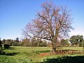
 Oak tree in 'The Dell', Framingham Earl - geograph.org.uk - 123983.jpg 480 × 640; 165 KB
-
 Oaklands, Poringland - geograph.org.uk - 6401830.jpg 1,600 × 1,064; 270 KB
-
 Path skirting Church Plantation - geograph.org.uk - 1724006.jpg 640 × 480; 212 KB
-
 Pigot Lane, Framingham Earl - geograph.org.uk - 3419406.jpg 3,072 × 2,304; 1.43 MB
-
 Pigot Lane, Framingham Earl - geograph.org.uk - 3419548.jpg 3,072 × 2,304; 1.34 MB
-
 Pigot Lane-Walnut Tree Drive junction - geograph.org.uk - 5306013.jpg 640 × 360; 281 KB
-
 Pink-flowering ornamental shrub - geograph.org.uk - 4476537.jpg 640 × 480; 391 KB
-
 Poringland Camp, now a construction site - geograph.org.uk - 4832031.jpg 640 × 360; 290 KB
-
 Poringland water towers - geograph.org.uk - 4475204.jpg 640 × 480; 435 KB
-
 Preparing the ground - geograph.org.uk - 5306061.jpg 640 × 360; 367 KB
-
 Preparing the ground for new housing - geograph.org.uk - 4832039.jpg 640 × 360; 347 KB
-

-

-
 Public footpath to Burgate Lane - geograph.org.uk - 1451505.jpg 640 × 480; 112 KB
-
 Public footpath to Poringland - geograph.org.uk - 1451503.jpg 640 × 480; 108 KB
-

-
 Remains of a hut platform - geograph.org.uk - 4832053.jpg 640 × 393; 350 KB
-
 Roadsigns on the B1332 Norwich Road - geograph.org.uk - 3681477.jpg 2,215 × 2,956; 2.91 MB
-
 Skirting a field's edge - geograph.org.uk - 1451497.jpg 640 × 480; 110 KB
-
 Small pond beside Pigot Lane - geograph.org.uk - 5306024.jpg 640 × 360; 379 KB
-
 Small pond beside Pigot Lane - geograph.org.uk - 5306025.jpg 640 × 360; 390 KB
-

-
 Snow-covered The Ramblers - geograph.org.uk - 1655373.jpg 640 × 480; 90 KB
-
 South Lodge in Spur Lane - geograph.org.uk - 5920120.jpg 800 × 450; 122 KB
-

-

-
-
 Steps descending into the Dell - geograph.org.uk - 1541865.jpg 480 × 640; 132 KB
-
 Steps to Pigot Lane - geograph.org.uk - 1541871.jpg 640 × 457; 134 KB
-
 Steps to the Dell car park - geograph.org.uk - 1541879.jpg 640 × 461; 122 KB
-

-
 The Dell - geograph.org.uk - 1541874.jpg 640 × 496; 171 KB
-
 The Dell - information board - geograph.org.uk - 1541861.jpg 640 × 480; 108 KB
-
 The Framingham Arboretum - geograph.org.uk - 5949612.jpg 800 × 580; 175 KB
-
 The Framingham Arboretum - geograph.org.uk - 5949621.jpg 800 × 561; 197 KB
-
 The Framingham Arboretum - geograph.org.uk - 5949622.jpg 800 × 600; 211 KB
-
 The Framingham Arboretum - geograph.org.uk - 5949624.jpg 800 × 600; 217 KB
-
 The Framingham Arboretum - geograph.org.uk - 5949627.jpg 800 × 595; 187 KB
-
 The Framingham Arboretum - geograph.org.uk - 5949630.jpg 800 × 571; 148 KB
-
 The Framingham Arboretum - geograph.org.uk - 5949633.jpg 800 × 602; 169 KB
-
 The Framingham Arboretum - geograph.org.uk - 5949639.jpg 800 × 577; 163 KB
-
 The Framingham Arboretum - geograph.org.uk - 5949642.jpg 800 × 590; 195 KB
-
 The Framingham Arboretum - geograph.org.uk - 5949645.jpg 800 × 595; 198 KB
-
 The Framingham Arboretum - geograph.org.uk - 5949657.jpg 800 × 534; 156 KB
-
 The Framingham Arboretum - geograph.org.uk - 5949658.jpg 800 × 600; 197 KB
-
 The Framingham Arboretum - geograph.org.uk - 5949660.jpg 800 × 596; 173 KB
-
 The Framingham Arboretum - geograph.org.uk - 5949742.jpg 800 × 588; 134 KB
-
 The Framingham Arboretum - geograph.org.uk - 5949746.jpg 800 × 583; 178 KB
-
 The Framingham Arboretum - geograph.org.uk - 5949750.jpg 800 × 600; 167 KB
-
 The Framingham Arboretum - geograph.org.uk - 5949755.jpg 800 × 564; 168 KB
-
 The Framingham Arboretum - geograph.org.uk - 5949759.jpg 800 × 593; 154 KB
-
 The Framingham Arboretum - geograph.org.uk - 5949763.jpg 600 × 800; 163 KB
-
 The Framingham Arboretum - geograph.org.uk - 5949767.jpg 800 × 600; 169 KB
-
 The Framingham Arboretum - geograph.org.uk - 5949769.jpg 800 × 599; 207 KB
-
 The Framingham Arboretum - geograph.org.uk - 5949772.jpg 800 × 596; 199 KB
-
 The Framingham Arboretum - geograph.org.uk - 5949775.jpg 800 × 597; 150 KB
-
 The Framingham Arboretum - geograph.org.uk - 5949779.jpg 800 × 587; 156 KB
-
 The Framingham Arboretum - geograph.org.uk - 5949786.jpg 800 × 599; 178 KB
-
 The Framingham Arboretum - geograph.org.uk - 5949787.jpg 800 × 600; 212 KB
-
 The Framingham Arboretum - geograph.org.uk - 5949791.jpg 800 × 592; 161 KB
-
 The Framingham Arboretum - geograph.org.uk - 5949793.jpg 800 × 584; 199 KB
-
 The Framingham Arboretum - geograph.org.uk - 5949794.jpg 800 × 584; 195 KB
-
 The Framingham Arboretum - geograph.org.uk - 5949797.jpg 800 × 600; 178 KB
-
 The Framingham Arboretum - geograph.org.uk - 5949799.jpg 800 × 592; 133 KB
-
 The Framingham Arboretum - geograph.org.uk - 5949800.jpg 800 × 567; 170 KB
-
 The Framingham Arboretum - geograph.org.uk - 5949801.jpg 800 × 600; 158 KB
-
 The Framingham Arboretum - geograph.org.uk - 5949806.jpg 800 × 600; 162 KB
-
 The Framingham Arboretum - geograph.org.uk - 5949817.jpg 800 × 600; 220 KB
-
 The Framingham Arboretum - geograph.org.uk - 5949822.jpg 800 × 600; 200 KB
-
 The Framingham Arboretum - geograph.org.uk - 5949823.jpg 800 × 600; 224 KB
-
 The Framingham Arboretum - geograph.org.uk - 5949825.jpg 800 × 550; 249 KB
-
 The Framingham Arboretum - Old Hall - geograph.org.uk - 5949812.jpg 800 × 592; 148 KB
-
 The Framingham Arboretum - Old Hall - geograph.org.uk - 5949814.jpg 800 × 600; 151 KB
-
 The Framingham Arboretum - Old Hall - geograph.org.uk - 5949816.jpg 800 × 600; 200 KB
-
 The Nook Appeal - geograph.org.uk - 5920163.jpg 800 × 450; 88 KB
-
 The Nook children's hospice - geograph.org.uk - 6282069.jpg 800 × 582; 98 KB
-
 The Nook children's hospice - geograph.org.uk - 6282070.jpg 800 × 591; 98 KB
-
 The Nook children's hospice - geograph.org.uk - 6282071.jpg 800 × 587; 110 KB
-
 The Nook children's hospice - geograph.org.uk - 6282074.jpg 800 × 584; 111 KB
-
 The Nook children's hospice - geograph.org.uk - 6282075.jpg 800 × 588; 115 KB
-
 The old camp road - geograph.org.uk - 4476629.jpg 640 × 480; 498 KB
-
 The old camp road - geograph.org.uk - 4832035.jpg 640 × 360; 315 KB
-
 The old camp road - geograph.org.uk - 4832061.jpg 640 × 360; 327 KB
-

-
 The Railway Tavern - geograph.org.uk - 1541834.jpg 640 × 465; 89 KB
-
 The Ramblers - geograph.org.uk - 1655324.jpg 640 × 480; 97 KB
-


_-_geograph.org.uk_-_4476709.jpg)
_-_geograph.org.uk_-_4476712.jpg)
_-_geograph.org.uk_-_4476717.jpg)
_-_geograph.org.uk_-_4476721.jpg)
_-_geograph.org.uk_-_4476724.jpg)
_-_geograph.org.uk_-_4476727.jpg)


_social_distancing_notice_-_geograph.org.uk_-_6452248.jpg)
_social_distancing_notice_-_geograph.org.uk_-_6452250.jpg)
_social_distancing_notice_-_geograph.org.uk_-_6452255.jpg)


_-_geograph.org.uk_-_1428181.jpg)


