Category:French-language SVG maps showing history
Jump to navigation
Jump to search
Formerly Category:Historical maps in French, which is outside the naming scheme as ambiguous terminology
Media in category "French-language SVG maps showing history"
The following 200 files are in this category, out of 568 total.
(previous page) (next page)-
1799 Anglo-Russian invasion of Holland map-fr.svg 960 × 1,450; 156 KB
-
1914 albania-fr.svg 1,071 × 2,000; 162 KB
-
Barents 1942.svg 964 × 1,088; 130 KB
-
2023 Belgorod Oblast attacks.svg 1,545 × 1,215; 450 KB
-
323 Accords de Babylone.svg 2,647 × 1,411; 6.48 MB
-
450 roman-hunnic-empire-fr.svg 1,648 × 1,049; 1.69 MB
-
500 fall-roman-empire-fr.svg 1,648 × 1,049; 1.83 MB
-
555 justinian conquests-fr.svg 1,648 × 1,049; 1.93 MB
-
650 byzantium-fr.svg 1,648 × 1,049; 1.94 MB
-
8 provinces de Corée.svg 1,000 × 1,556; 102 KB
-
Actividad militar de Guerrero (1812-1817)-fr.svg 798 × 482; 404 KB
-
Agilulf's Italy-fr.svg 588 × 702; 25 KB
-
Al-Andalus732 fr.svg 863 × 717; 712 KB
-
Alemannic language location map in 1950-fr.svg 1,400 × 1,000; 245 KB
-
Alexander III conquest from Babylon to Indus and back-fr.svg 1,243 × 673; 1.17 MB
-
Alexander III conquest from Halicarnasse to Issos-fr.svg 1,243 × 673; 1.03 MB
-
Alexander III conquest from Issos to Babylon-fr.svg 1,243 × 673; 1.04 MB
-
Alexander III conquest from Pella to Halicarnasse-fr.svg 1,243 × 673; 1.03 MB
-
Alexander III empire map-fr.svg 1,243 × 673; 1.03 MB
-
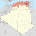
Alger department 1934-1955 map-fr.svg 1,287 × 1,278; 1.79 MB
-
Alliances militaires en Europe 1914-1918-fr.svg 998 × 593; 97 KB
-
Alsace Lorraine departments evolution map-fr.svg 600 × 450; 98 KB
-
Anaximander world map-fr.svg 1,063 × 1,063; 14 KB
-
Ancient Egypt map-fr.svg 1,577 × 3,219; 417 KB
-
Ancient greek dialects (-400)-fr.svg 660 × 555; 574 KB
-
Ancient greek dialects-fr.svg 660 × 555; 507 KB
-
Ancient Regions Mainland Greece-fr.svg 502 × 567; 2.78 MB
-
AncientGreekDialects (Woodard) fr.svg 660 × 555; 851 KB
-
Anjouan invasion-map-fr.svg 841 × 687; 836 KB
-
Antique jew diaspora map fr.svg 855 × 549; 496 KB
-
Antique jew diaspora map with Acts of the Apostles mention highlight.svg 855 × 549; 500 KB
-
Aquitani tribes map-fr.svg 878 × 750; 1.26 MB
-
Archeological sites - wine and oil.svg 2,472 × 1,215; 304 KB
-
Arshakuni Armenia 150-fr.svg 2,717 × 1,595; 763 KB
-
Artaxiad Armenia 80BC-fr.svg 2,960 × 2,140; 11.09 MB
-
Artemis Orthia location.svg 991 × 784; 96 KB
-
Attila in Gaul 451CE-fr.svg 1,280 × 977; 420 KB
-
Aurignacian culture map-fr.svg 720 × 540; 99 KB
-
Aurora's drift map-fr.svg 1,560 × 1,264; 415 KB
-
Avantage comparatif & commerce britannique.svg 1,200 × 400; 74 KB
-
Aztec Empire 1519 map-fr.svg 1,898 × 1,462; 303 KB
-
Aztec empire 1519-fr.svg 1,225 × 924; 27 KB
-
Aïn Sefra territory 1934-1955 map-fr.svg 1,287 × 1,278; 1.84 MB
-
Bagdad XVIIe century-fr.svg 660 × 550; 79 KB
-
Baltic Tribes c 1200-fr.svg 988 × 1,088; 526 KB
-
Basin of Mexico 1519 map-fr.svg 1,412 × 1,883; 528 KB
-
Bataille de Fougères (1793) - parcours armée vendéenne.svg 184 × 129; 1.72 MB
-
Bataille de Koursk.svg 810 × 1,080; 185 KB
-
Bataille de la RC4.svg 1,376 × 1,736; 710 KB
-
Bataille de Muret 1213.svg 1,312 × 1,080; 1.5 MB
-
Batalla Tajo(220aC)-Fases batalla 1-2-3-fr.svg 1,631 × 564; 153 KB
-
Batalla Tajo(220aC)-Movimientos previos 1-2-3-fr.svg 1,608 × 787; 151 KB
-
Battle Granicus-fr.svg 1,052 × 744; 76 KB
-
Battle of Actium-fr.svg 716 × 533; 269 KB
-
Battle of Bantry Bay,11 May 1689-fr.svg 974 × 640; 48 KB
-
Battle of Beachy Head (1690)-fr.svg 1,036 × 711; 34 KB
-
Battle of Delium detail map-fr.svg 1,200 × 900; 486 KB
-
Battle of Delium general map-fr.svg 1,300 × 1,100; 479 KB
-
Battle of Greece WWII 1941 map-fr.svg 1,848 × 2,500; 1.68 MB
-
Battle of Hastings-fr.svg 1,052 × 744; 91 KB
-
Battle of Poitiers 1356 map-fr.svg 1,704 × 1,467; 1.63 MB
-
Battle of Quiberon Bay - 1759-11-20 - map-fr.svg 1,820 × 1,265; 790 KB
-
Battle of Santa Cruz map-fr.svg 1,345 × 1,343; 146 KB
-
Battle of Tolbiac map-fr.svg 787 × 607; 123 KB
-
Battle Philippine sea map-fr.svg 732 × 671; 158 KB
-
Battle Trebia-fr.svg 999 × 755; 94 KB
-
BelgianCongoProvinces-1933-60.svg 640 × 647; 180 KB
-
Bissy 1921 map.svg 968 × 726; 108 KB
-
Bosporan Kingdom growth map-fr.svg 675 × 575; 1.13 MB
-
Bretagne-Pays de la Loire - Empire romain - Capitale de cités et cités.svg 3,479 × 1,869; 130 KB
-
BritishMandatePalestine1920-fr.svg 675 × 542; 19 KB
-
Bulgaria Samuil (997-1014) es fr.svg 728 × 594; 208 KB
-
Bulgaria-Theodore Svetoslav-fr.svg 3,280 × 2,473; 527 KB
-
Bulgarian acquisitions, treaty IX 1915-fr.svg 1,414 × 1,583; 115 KB
-
Map Bulgaria Simeon-fr.svg 503 × 681; 85 KB
-
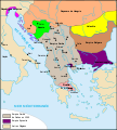
Byzantine Empire Themata-750-fr.svg 743 × 457; 211 KB
-
ByzantineEmpire1265.svg 1,708 × 816; 479 KB
-
Byzantium1204.svg 512 × 357; 312 KB
-
Byzantium1230-it.svg 512 × 357; 71 KB
-
Byzantium1230.svg 512 × 357; 278 KB
-
Caesar campaigns from Rome to Munda-fr.svg 2,050 × 1,213; 1.2 MB
-
Caesar campaigns from Rome to Thapsus-fr.svg 2,050 × 1,213; 1.2 MB
-
Caesar campaigns from Rome to Zela-fr.svg 2,050 × 1,213; 1.21 MB
-
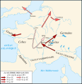
Caesar campaigns gaul-fr.svg 755 × 784; 468 KB
-
Calaisis 1360 map-fr.svg 1,424 × 892; 773 KB
-
Campagne avant la bataille de Poitiers 1356.svg 450 × 550; 40 KB
-
Campagnes-de-Constantin.svg 1,649 × 962; 2.07 MB
-
Campañas Meseta Anibal (221-220 aC)-fr.svg 924 × 762; 578 KB
-
Carte de l'Afrique en 1914.svg 1,525 × 1,440; 1.73 MB
-
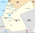
Carte de la Palestine et de la Transjordanie sous mandat britannique-fr.svg 3,368 × 3,177; 449 KB
-
Carte des attaques du Monstre du Valais-fr.svg 1,719 × 1,290; 538 KB
-
Carte des villages de La Boissière du Doré et la Remaudière en 1857.svg 1,600 × 1,084; 503 KB
-
Carte du maquis de Saint-Mards-en-Othe.svg 3,495 × 2,452; 60 KB
-
Carte empire Romain 271.svg 2,050 × 1,213; 385 KB
-
Carte Qibya.svg 330 × 715; 61 KB
-
Carte vambery-armin.svg 1,243 × 673; 7.05 MB
-
Carte vierge F-All.svg 682 × 600; 114 KB
-
Carte élections régionales france 2004.svg 900 × 900; 96 KB
-
Carthage archaeological sites map-fr.svg 1,030 × 880; 123 KB
-
Cempoala location map-fr.svg 1,171 × 416; 583 KB
-
CG16-2008.svg 536 × 508; 77 KB
-
CG16-2011.svg 536 × 508; 61 KB
-
CG17-2011.svg 623 × 724; 88 KB
-
CG22-2011.svg 711 × 545; 122 KB
-
CG26-2011.svg 1,727 × 2,507; 369 KB
-
Champs-Catalauniques.svg 1,076 × 1,362; 174 KB
-
Chevauchée de Lancastre 1356.svg 2,835 × 1,772; 266 KB
-
Christopher Colombus first voyage 1492-1493 map-fr.svg 1,922 × 1,256; 399 KB
-
Christopher Colombus second voyage 1493-1496 map-fr.svg 1,922 × 1,256; 399 KB
-
Christopher Colombus third voyage 1498-1500 map-fr.svg 1,922 × 1,256; 399 KB
-
Christopher Columbus fourth voyage 1502-1504 map-fr.svg 1,922 × 1,256; 399 KB
-
Christopher Columbus voyages map-fr.svg 1,922 × 1,256; 399 KB
-
Chéronée-338.svg 949 × 744; 136 KB
-
Cilician Armenia-fr.svg 1,458 × 991; 374 KB
-
Colinas Cartagena-fr.svg 1,124 × 802; 21 KB
-
Conceptions Colomb map-fr.svg 1,022 × 635; 1.01 MB
-
Conquest of Mexico 1519-1521.svg 1,171 × 416; 587 KB
-
Conquête de l'Islam à la chute des Omeyyades.svg 1,146 × 588; 531 KB
-
Constantine department 1934-1955 map-fr.svg 1,287 × 1,278; 1.79 MB
-
Convoy PQ-17 map 1942 (noms des navires)-fr.svg 970 × 1,095; 186 KB
-
Convoy PQ-17 map 1942-fr.svg 970 × 1,095; 239 KB
-
Coral Sea battle.svg 868 × 717; 497 KB
-
Curzon line-fr.svg 516 × 508; 41 KB
-
Première République tchécoslovaque.SVG 1,001 × 472; 68 KB
-
DariusScythes fr.svg 1,771 × 1,254; 2.94 MB
-
DavidianCumbria-fr.svg 539 × 465; 57 KB
-
Delos location.svg 991 × 784; 87 KB
-
Delphi location.svg 991 × 784; 86 KB
-
Departements of French Empire 1811-fr.svg 1,120 × 840; 844 KB
-
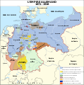
Deutsches Reich (1871-1918)-fr.svg 778 × 783; 453 KB
-
Deutsches Reich (1871-1918)-tr.svg 778 × 783; 887 KB
-
Diadochi-fr.svg 3,170 × 1,675; 6.64 MB
-
Diadoques-303-fr.svg 3,170 × 1,675; 6.7 MB
-
Diderot's travel from Paris to Saint Petersburg in 1773-1774 map-fr.svg 1,240 × 860; 146 KB
-
Diorren an hañvlec'hioù e Breizh.svg 1,052 × 744; 1.49 MB
-
Dodona location-es.svg 992 × 794; 3.49 MB
-
Dodona location.svg 991 × 784; 517 KB
-
Domaine ducal de Bretagne sous le règne de Jean V-es.svg 1,668 × 1,452; 388 KB
-
Domaine ducal de Bretagne sous le règne de Jean V-fr.svg 1,668 × 1,452; 236 KB
-
Dougga map-fr.svg 1,120 × 920; 171 KB
-
Dynasties du Nord et du Sud.svg 2,000 × 2,187; 1.37 MB
-
Départements français d'Algérie 1934-1955 map-fr.svg 1,287 × 1,278; 1.79 MB
-
Désintégration du califat abbasside.svg 795 × 423; 1.66 MB
-
Développement des stations balnéaires de Bretagne map-fr.svg 1,052 × 744; 1.49 MB
-
Emperor Taizong's campaign against Xiyu states-fr.svg 1,026 × 674; 629 KB
-
Empire angevin.svg 956 × 658; 1.61 MB
-
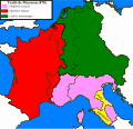
Empire carolingien 814-fr.svg 1,091 × 1,053; 579 KB
-
Empire carolingien 828-fr.svg 1,091 × 1,053; 816 KB
-
Empire carolingien 855-fr.svg 1,091 × 1,053; 594 KB
-
Empire carolingien 870.svg 1,091 × 1,053; 1.31 MB
-
Empire carolingien en 880.svg 603 × 615; 368 KB
-
Empire de Dušan.svg 994 × 1,104; 293 KB
-
Empire-byzantin-1180.svg 1,913 × 1,169; 1.08 MB
-
Empire-byzantin-1265.svg 1,913 × 1,169; 1.49 MB
-
Empire-byzantin-1355.svg 1,913 × 1,169; 1.61 MB
-
Empire-byzantin-1450.svg 1,913 × 1,169; 1.51 MB
-
Emploi touristique en Bretagne map-fr.svg 1,031 × 770; 4.61 MB
-
Epirus across Greece Albania4-fr.svg 744 × 1,052; 161 KB
-
Escadre allemande d'Extrême-Orient 1914 1915-fr.svg 3,100 × 1,600; 1.07 MB
-
España bizantina 5-fr.svg 798 × 444; 299 KB
-
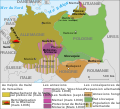
Extension of Germany (1935-1939)-fr.svg 741 × 674; 116 KB
-
Fidènes VIe et IVe siècles avant JC.svg 882 × 786; 1.97 MB
-
First Punic War (264 BC)-fr.svg 1,112 × 712; 397 KB
-
First Russian Antarctic Expedition route - fr.svg 1,451 × 2,098; 1.65 MB
-
Fortifications after Raid on Lorient 1746 map-fr.svg 1,190 × 793; 823 KB
-
Jublains archaeological site map-fr.svg 1,550 × 1,345; 194 KB
-
France 1154-fr.svg 1,405 × 1,675; 529 KB
-
France 1330.svg 423 × 518; 76 KB
-
France 1814 map-blank.svg 2,000 × 1,898; 303 KB
-
France 1940-Plan de bataille.svg 682 × 600; 210 KB
-
France location map-1477-blank.svg 2,000 × 1,922; 820 KB
-
France location map-Departements 1790.svg 2,000 × 1,922; 581 KB
-
France location map-Departements 1791.svg 2,000 × 1,922; 568 KB
-
France location map-Departements 1793.svg 2,000 × 1,922; 565 KB
-
France location map-Departements 1795.svg 2,000 × 1,922; 640 KB
-
France location map-Departements 1797.svg 2,000 × 1,922; 603 KB
-
France location map-Departements 1798.svg 2,000 × 1,922; 890 KB
-
France location map-Departements 1800.svg 2,000 × 1,922; 886 KB
-
France location map-Departements 1801.svg 2,000 × 1,922; 883 KB
-
France location map-Departements 1802.svg 2,000 × 1,922; 869 KB
-
France location map-Departements 1805.svg 2,000 × 1,922; 869 KB
-
France location map-Departements 1808.svg 2,000 × 1,922; 868 KB
-
France location map-Departements 1810.svg 2,000 × 1,922; 890 KB
-
France location map-Departements 1811.svg 2,000 × 1,922; 913 KB
-
France location map-Departements 1812.svg 2,000 × 1,922; 890 KB
-
France location map-Departements 1813.svg 2,000 × 1,922; 885 KB
-
France location map-Departements 1814.svg 2,000 × 1,922; 808 KB
-
France location map-Departements 1815.svg 2,000 × 1,922; 588 KB
-
France location map-Departements 1848.svg 2,000 × 1,922; 587 KB
-
France location map-Departements 1852.svg 2,000 × 1,922; 580 KB
-
France location map-Departements 1860.svg 2,000 × 1,922; 567 KB
-
France location map-Departements 1919.svg 2,000 × 1,922; 575 KB
-
France location map-Departements 1947.svg 2,000 × 1,922; 573 KB
-
France location map-Departements 1964.svg 2,000 × 1,922; 577 KB
-
France location map-Departements 1967.svg 2,000 × 1,922; 598 KB
-
France location map-Departements 1970.svg 2,000 × 1,922; 578 KB
-
France location map-Departements 1971-1972.svg 2,000 × 1,922; 620 KB


